
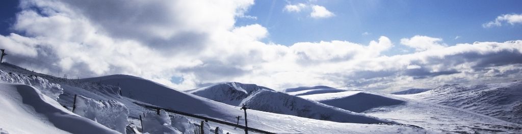
Mountain weather
South Grampian and Southeast Highlands Mountain weather forecast table
Confidence
High confidence for settled conditions through Saturday, and for turning unsettled from Sunday onwards, but lower confidence for the exact details from Sunday onwards.
Mountain weather hazards
Hazards apply at or above 300m, reflecting the more severe conditions which can occur at altitude.
 Strong Sunlight
Harmful UV levels from sunlight increase with altitude giving a greater risk of sunburn and eye damage, even on some overcast days. On breezy days, the cooling effect of wind on exposed skin may disguise any feeling of sunburn until it is too late. If there is snow cover, glare increases the effect of UV rays especially on the eyes. It is advisable to wear sun block, protective clothing such as a long-sleeved top and hat and have good quality eye protection.
Mountain weather forecast
Dry and bright with some spells of hazy sunshine.
| 06:00 | 09:00 | 12:00 | 15:00 | 18:00 | 21:00 | |
|---|---|---|---|---|---|---|
Weather (at 800m) |
|
|
|
|
|
|
Chance of precipitation (at 800m) |
00% | 00% | 00% | 00% | 00% | 00% |
Wind direction and speed (mph)
Altitude above mean sea level
| 06:00 | 09:00 | 12:00 | 15:00 | 18:00 | 21:00 | |
|---|---|---|---|---|---|---|
| 1100m |
SW
16
|
SW
18
|
SW
18
|
SW
20
|
SW
20
|
SW
19
|
| 900m |
SW
14
|
SW
14
|
SW
16
|
SW
16
|
SW
16
|
SW
14
|
| 600m |
W
3
|
W
5
|
SW
11
|
SW
12
|
SW
11
|
SW
10
|
| 300m |
SW
2
|
W
3
|
SW
8
|
SW
10
|
SW
8
|
W
4
|
| Glen |
W
2
|
SW
4
|
S
5
|
SW
9
|
SW
8
|
W
4
|
Wind gust (mph)
Altitude above mean sea level
| 06:00 | 09:00 | 12:00 | 15:00 | 18:00 | 21:00 | |
|---|---|---|---|---|---|---|
| 1100m | 20 | 22 | 24 | 26 | 25 | 25 |
| 900m | 18 | 18 | 22 | 22 | 22 | 20 |
| 600m | 6 | 10 | 18 | 20 | 20 | 20 |
| 300m | 7 | 7 | 15 | 19 | 16 | 10 |
| Glen | 8 | 7 | 10 | 17 | 17 | 8 |
Altitude above mean sea level
| 06:00 | 09:00 | 12:00 | 15:00 | 18:00 | 21:00 | |
|---|---|---|---|---|---|---|
| 1100m |
9°
|
8°
|
10°
|
11°
|
10°
|
8°
|
| 900m |
10°
|
10°
|
12°
|
13°
|
12°
|
10°
|
| 600m |
11°
|
13°
|
15°
|
16°
|
15°
|
12°
|
| 300m |
11°
|
15°
|
18°
|
19°
|
18°
|
12°
|
| Glen |
11°
|
15°
|
18°
|
20°
|
18°
|
13°
|
| Freezing Level |
2,200m
|
2,200m
|
2,200m
|
2,200m
|
2,000m
|
2,000m
|
Altitude above mean sea level
| 06:00 | 09:00 | 12:00 | 15:00 | 18:00 | 21:00 | |
|---|---|---|---|---|---|---|
| 1100m |
6°
|
4°
|
6°
|
7°
|
6°
|
5°
|
| 900m |
8°
|
7°
|
9°
|
10°
|
9°
|
7°
|
| 600m |
10°
|
12°
|
13°
|
14°
|
13°
|
10°
|
| 300m |
11°
|
15°
|
16°
|
17°
|
16°
|
12°
|
| Glen |
11°
|
15°
|
18°
|
18°
|
17°
|
12°
|
Additional weather information
Met Office Aberdeen meteorologist's view
Nothing to add
Weather
A dry and bright day, with some high cloud providing hazy sunshine at first, before sunnier spells break out more widely in the afternoon. A few mist or fog patches at first should clear soon after dawn.
Chance of cloud-free hill tops
90% or more
Low cloud and visibility
Early mist or fog patches will soon clear to leave excellent visibilities and any cloud well above the summits.
Mountain weather information
Weather
A mainly dry and bright day with good sunny spells, but a small chance of a few showers developing through the afternoon.
Chance of cloud-free hill tops
90% or higher
Maximum wind speed expected
South to southwesterly mean 15-20mph, gusting 25-30mph.
Temperature
- At 800m Plus 6 rising to plus 14 Celsius.
- Glen Plus 8 rising to plus 20 Celsius.
- Freezing level Well above summits.
Low cloud and visibility
Cloud bases will generally be above all summits with excellent visibilities, but they may drop to some of the highest peaks with visibilities suddenly dropping should any showers pass through.
Mountain weather information
Sun 12 May
Sunrise:
Sunset:
A dry start, but some heavy, thundery showers developing through the day.
Mon 13 May
Sunrise:
Sunset:
Scattered heavy showers, forming longer spells of rain later.
Tue 14 May
Sunrise:
Sunset:
Showers or longer spells of rain.
Updated at:
Summit specific forecast
Mountain summit forecast map
Loading map…
Key
Including South and East Cairngorms National Park, Aberdeenshire and Angus Hills, Ben Vrackie, Ben Lawers, Loch Tay and Ochils
For snow and avalanche hazard forecasts please visit Scottish Avalanche Information Service