
Mountain weather
Bannau Brycheiniog / Brecon Beacons Mountain weather forecast table
Confidence
High for settled weather. Moderate for extent and distribution of cloud and fog overnight.
This evening forecast
Staying dry this evening with clear spells.
Mountain weather hazards
Hazards apply at or above 300m, reflecting the more severe conditions which can occur at altitude.
 Strong Sunlight
Harmful UV levels from sunlight increase with altitude giving a greater risk of sunburn and eye damage, even on some overcast days. On breezy days, the cooling effect of wind on exposed skin may disguise any feeling of sunburn until it is too late. If there is snow cover, glare increases the effect of UV rays especially on the eyes. It is advisable to wear sun block, protective clothing such as a long-sleeved top and hat and have good quality eye protection.
Mountain weather forecast
Dry with warm sunny spells.
| 00:00 | 03:00 | 06:00 | 09:00 | 12:00 | 15:00 | 18:00 | 21:00 | |
|---|---|---|---|---|---|---|---|---|
Weather (at 600m) |
|
|
|
|
|
|
|
|
Chance of precipitation (at 600m) |
<05% | <05% | <05% | <05% | <05% | <05% | <05% | <05% |
Wind direction and speed (mph)
Altitude above mean sea level
| 00:00 | 03:00 | 06:00 | 09:00 | 12:00 | 15:00 | 18:00 | 21:00 | |
|---|---|---|---|---|---|---|---|---|
| 600m |
SW
8
|
SW
8
|
SW
6
|
SW
6
|
W
5
|
NW
5
|
W
3
|
N
5
|
| 300m |
SW
3
|
SW
3
|
SW
3
|
SW
3
|
W
4
|
NW
4
|
W
2
|
NW
2
|
| Valley |
SW
2
|
S
1
|
SW
2
|
E
2
|
W
4
|
W
4
|
W
3
|
E
2
|
Wind gust (mph)
Altitude above mean sea level
| 00:00 | 03:00 | 06:00 | 09:00 | 12:00 | 15:00 | 18:00 | 21:00 | |
|---|---|---|---|---|---|---|---|---|
| 600m | 12 | 10 | 9 | 8 | 8 | 9 | 5 | 7 |
| 300m | 5 | 6 | 7 | 6 | 8 | 8 | 5 | 5 |
| Valley | 5 | 3 | 5 | 5 | 9 | 8 | 5 | 4 |
Altitude above mean sea level
| 00:00 | 03:00 | 06:00 | 09:00 | 12:00 | 15:00 | 18:00 | 21:00 | |
|---|---|---|---|---|---|---|---|---|
| 600m |
10°
|
10°
|
10°
|
12°
|
15°
|
16°
|
15°
|
12°
|
| 300m |
10°
|
9°
|
11°
|
15°
|
18°
|
19°
|
18°
|
13°
|
| Valley |
10°
|
9°
|
11°
|
16°
|
19°
|
19°
|
18°
|
13°
|
| Freezing Level |
2,300m
|
2,200m
|
2,200m
|
2,300m
|
2,300m
|
2,400m
|
2,400m
|
2,300m
|
Altitude above mean sea level
| 00:00 | 03:00 | 06:00 | 09:00 | 12:00 | 15:00 | 18:00 | 21:00 | |
|---|---|---|---|---|---|---|---|---|
| 600m |
8°
|
8°
|
9°
|
12°
|
14°
|
15°
|
15°
|
12°
|
| 300m |
10°
|
8°
|
10°
|
15°
|
18°
|
18°
|
18°
|
13°
|
| Valley |
10°
|
8°
|
11°
|
16°
|
18°
|
19°
|
18°
|
13°
|
Additional weather information
Meteorologist's view
High UV levels with sunscreen advised.
Weather
Some mist and fog patches in the valleys to start, though this dissipating quickly. Then a fine, dry and warm day ahead with plenty of bright or sunny spells.
Chance of cloud-free hill tops
95%
Low cloud and visibility
Some mist and fog across valleys to start, otherwise high level cloud and excellent visibility.
Recent rainfall
Location: Neuadd (Near Pontsticill)
Altitude: 353m
| Last 24 hours | Last 48 hours | Last 72 hours |
|---|---|---|
| 1.6mm | 9mm | 9mm |
Measurement date:
Rainfall data provided by Natural Resources Wales. The Met Office is not responsible for content provided by third parties and may remove this data without warning.
Mountain weather information
Weather
Some mist and fog to start, otherwise another dry with plenty of warm sunshine and light winds.
Chance of cloud-free hill tops
Greater than 95%
Maximum wind speed expected
Southeasterly 10-15 mph.
Temperature
- At 600m Plus 10 Celsius rising to plus 15 Celsius.
- Valley Plus 13 Celsius rising to plus 21 Celsius.
- Freezing level Above summits.
Low cloud and visibility
Some mist and fog across valleys to start, otherwise any fair weather cloud above summits with excellent visibility.
Mountain weather information
Sat 11 May
Sunrise:
Sunset:
Similar to Friday. Warm, fine and dry with light winds. A low risk of the odd shower by the afternoon.
Sun 12 May
Sunrise:
Sunset:
Remaining settled to start with sunny spells and light winds. A chance of cloudier conditions during the afternoon with a risk of thundery showers, however confidence low for this aspect of the forecast.
Mon 13 May
Sunrise:
Sunset:
Turning unsettled with outbreaks of rain and stronger winds, though detail remains rather uncertain.
Updated at:
Summit specific forecast
Mountain summit forecast map
Loading map…
Key
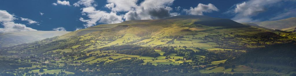
The Bannau Brycheiniog / Brecon Beacons is a mountain range in South Wales comprising six main peaks, with the highest peak, Pen y Fan, standing at 886 metres.