
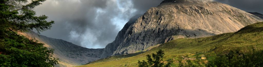
Mountain weather
North Grampian Mountain weather forecast table
Confidence
High confidence for a period of rain focussed over western high ground Wednesday to Thursday otherwise mainly dry conditions for the rest of this period. Becoming brighter towards the end of the week.
Mountain weather hazards
Hazards apply at or above 300m, reflecting the more severe conditions which can occur at altitude.
 Strong Sunlight
Harmful UV levels from sunlight increase with altitude giving a greater risk of sunburn and eye damage, even on some overcast days. On breezy days, the cooling effect of wind on exposed skin may disguise any feeling of sunburn until it is too late. If there is snow cover, glare increases the effect of UV rays especially on the eyes. It is advisable to wear sun block, protective clothing such as a long-sleeved top and hat and have good quality eye protection.
Severe Chill Effect
Wind significantly lowers the ‘feels-like’ temperature relative to the actual temperature, with even moderate winds significantly adding to the chilling effect. Strong winds can result in a severe and debilitating wind chill many degrees below the actual temperature. This effect will be enhanced in rain or wet snow. Without protection, prolonged exposure could result in frost nip or frostbite on exposed parts of the body and/or hypothermia.
Poor Visibility
Poor visibility presents challenging route finding conditions. Visibility could be significantly less than 50 metres in all directions with few or no visual references, especially on featureless moors or plateaux. Distances become hard to judge and cliff or cornice edges can be difficult to recognise. These conditions require good navigational skills. There is a risk of white-out conditions when mist or fog is combined with extensive snow cover.
Mountain weather forecast
Mainly dry with rain spreading east during the evening. Strong summit winds.
| 06:00 | 09:00 | 12:00 | 15:00 | 18:00 | 21:00 | |
|---|---|---|---|---|---|---|
Weather (at 800m) |
|
|
|
|
|
|
Chance of precipitation (at 800m) |
00% | 00% | 20% | 30% | 30% | 60% |
Wind direction and speed (mph)
Altitude above mean sea level
| 06:00 | 09:00 | 12:00 | 15:00 | 18:00 | 21:00 | |
|---|---|---|---|---|---|---|
| 1300m |
S
23
|
S
24
|
SW
25
|
SW
25
|
SW
28
|
SW
34
|
| 900m |
S
24
|
SW
24
|
SW
24
|
SW
24
|
SW
25
|
SW
30
|
| 600m |
SW
14
|
SW
17
|
SW
18
|
SW
17
|
SW
17
|
SW
17
|
| 300m |
SW
4
|
SW
9
|
SW
11
|
SW
10
|
SW
8
|
SW
8
|
| Glen |
SW
6
|
SW
8
|
SW
9
|
SW
7
|
SW
7
|
SW
7
|
Wind gust (mph)
Altitude above mean sea level
| 06:00 | 09:00 | 12:00 | 15:00 | 18:00 | 21:00 | |
|---|---|---|---|---|---|---|
| 1300m | 31 | 32 | 34 | 34 | 37 | 47 |
| 900m | 30 | 30 | 31 | 32 | 32 | 38 |
| 600m | 21 | 23 | 25 | 24 | 24 | 25 |
| 300m | 11 | 20 | 23 | 21 | 19 | 20 |
| Glen | 20 | 20 | 23 | 22 | 22 | 25 |
Altitude above mean sea level
| 06:00 | 09:00 | 12:00 | 15:00 | 18:00 | 21:00 | |
|---|---|---|---|---|---|---|
| 1300m |
3°
|
5°
|
6°
|
6°
|
5°
|
4°
|
| 900m |
7°
|
8°
|
9°
|
9°
|
8°
|
7°
|
| 600m |
10°
|
10°
|
12°
|
12°
|
10°
|
9°
|
| 300m |
9°
|
13°
|
15°
|
14°
|
12°
|
11°
|
| Glen |
10°
|
14°
|
16°
|
15°
|
13°
|
12°
|
| Freezing Level |
2,000m
|
2,000m
|
2,200m
|
2,500m
|
2,700m
|
2,700m
|
Altitude above mean sea level
| 06:00 | 09:00 | 12:00 | 15:00 | 18:00 | 21:00 | |
|---|---|---|---|---|---|---|
| 1300m |
-3°
|
-1°
|
1°
|
1°
|
-1°
|
-3°
|
| 900m |
3°
|
3°
|
5°
|
5°
|
3°
|
2°
|
| 600m |
7°
|
7°
|
9°
|
9°
|
7°
|
6°
|
| 300m |
8°
|
11°
|
13°
|
12°
|
11°
|
9°
|
| Glen |
7°
|
12°
|
13°
|
13°
|
11°
|
9°
|
Additional weather information
Met Office Aberdeen meteorologist's view
After a dry and bright start, rain spreads east from the evening. It will feel cold in strong winds at height.
Weather
Dry but cloudy with clears spells overnight. The morning will stay dry with some hazy sunshine. Cloud will thicken and lower from the west in the afternoon with rain spreading east from the evening.
Chance of cloud-free hill tops
60% lowering to 30% from the afternoon.
Low cloud and visibility
Broken cloud around 1000m will increase and lower to 600-800m by the afternoon. The visibility will fall poor in rain later.
Mountain weather information
Weather
Overcast with patchy rain in the early morning, soon becoming dry and brighter. Increasing sunny spells in the afternoon will be accompanied by the odd shower.
Chance of cloud-free hill tops
30% increasing 60% in the afternoon.
Maximum wind speed expected
Southwest 25-30mph gust 45mph.
Temperature
- At 800m Plus 8 Celsius.
- Glen Plus 9 Celsius rising plus 17 Celsius.
- Freezing level Above the summits.
Low cloud and visibility
Broken cloud 500-700m in the morning will rise 700-900m during the afternoon when becoming patchy over eastern ranges.
Mountain weather information
Fri 10 May
Sunrise:
Sunset:
Mainly dry with sunny spells, the odd afternoon shower. Moderate southwest summit winds.
Sat 11 May
Sunrise:
Sunset:
Dry with sunny periods. Moderate southwest summit winds.
Sun 12 May
Sunrise:
Sunset:
Continuing dry with sunny periods. Fresh southerly summit winds.
Updated at:
Summit specific forecast
Mountain summit forecast map
Loading map…
Key
Includes the northern and western Cairngorms National Park, Monadhliath, Ben Alder, Creag Meagaidh, Loch Ericht and Loch Rannoch.
For snow and avalanche hazard forecasts please visit Scottish Avalanche Information Service