
Mountain weather
Southwest Highlands Mountain weather forecast table
Confidence
High confidence for rain late Wednesday into Thursday then mostly dry until Saturday. Low confidence for detail Sunday when showers possible.
This evening forecast
Dry with sunny spells south at first. Overcast with outbreaks of rain, some heavy, north spreading south from late evening. Fresh summit winds.
Mountain weather hazards
Hazards apply at or above 300m, reflecting the more severe conditions which can occur at altitude.
 Poor Visibility
Poor visibility presents challenging route finding conditions. Visibility could be significantly less than 50 metres in all directions with few or no visual references, especially on featureless moors or plateaux. Distances become hard to judge and cliff or cornice edges can be difficult to recognise. These conditions require good navigational skills. There is a risk of white-out conditions when mist or fog is combined with extensive snow cover.
Strong Sunlight
Harmful UV levels from sunlight increase with altitude giving a greater risk of sunburn and eye damage, even on some overcast days. On breezy days, the cooling effect of wind on exposed skin may disguise any feeling of sunburn until it is too late. If there is snow cover, glare increases the effect of UV rays especially on the eyes. It is advisable to wear sun block, protective clothing such as a long-sleeved top and hat and have good quality eye protection.
Mountain weather forecast
Outbreaks of rain clear as sunny spells increase from mid-morning. Strong summit winds ease steadily through the day.
| 00:00 | 03:00 | 06:00 | 09:00 | 12:00 | 15:00 | 18:00 | 21:00 | |
|---|---|---|---|---|---|---|---|---|
Weather (at 800m) |
|
|
|
|
|
|
|
|
Chance of precipitation (at 800m) |
60% | 40% | 40% | 30% | 20% | 20% | 20% | 10% |
Wind direction and speed (mph)
Altitude above mean sea level
| 00:00 | 03:00 | 06:00 | 09:00 | 12:00 | 15:00 | 18:00 | 21:00 | |
|---|---|---|---|---|---|---|---|---|
| 1300m |
SW
28
|
SW
27
|
SW
20
|
SW
18
|
SW
16
|
SW
14
|
SW
13
|
S
12
|
| 900m |
SW
19
|
SW
17
|
SW
15
|
SW
14
|
SW
14
|
SW
11
|
SW
10
|
SW
9
|
| 600m |
SW
25
|
SW
21
|
SW
19
|
SW
17
|
SW
14
|
SW
12
|
SW
11
|
SW
6
|
| 300m |
SW
14
|
SW
13
|
S
9
|
SW
10
|
SW
8
|
SW
8
|
SW
7
|
S
3
|
| Glen |
SW
11
|
SW
12
|
SW
10
|
SW
9
|
SW
8
|
SW
7
|
SW
6
|
S
3
|
Wind gust (mph)
Altitude above mean sea level
| 00:00 | 03:00 | 06:00 | 09:00 | 12:00 | 15:00 | 18:00 | 21:00 | |
|---|---|---|---|---|---|---|---|---|
| 1300m | 36 | 34 | 27 | 24 | 23 | 20 | 18 | 15 |
| 900m | 27 | 23 | 21 | 20 | 20 | 17 | 15 | 11 |
| 600m | 32 | 28 | 25 | 23 | 21 | 17 | 16 | 9 |
| 300m | 23 | 20 | 15 | 16 | 14 | 13 | 11 | 5 |
| Glen | 22 | 22 | 20 | 17 | 15 | 13 | 11 | 5 |
Altitude above mean sea level
| 00:00 | 03:00 | 06:00 | 09:00 | 12:00 | 15:00 | 18:00 | 21:00 | |
|---|---|---|---|---|---|---|---|---|
| 1300m |
4°
|
4°
|
4°
|
5°
|
5°
|
6°
|
5°
|
5°
|
| 900m |
6°
|
6°
|
6°
|
7°
|
8°
|
9°
|
8°
|
7°
|
| 600m |
8°
|
8°
|
8°
|
8°
|
10°
|
10°
|
10°
|
10°
|
| 300m |
10°
|
10°
|
10°
|
10°
|
11°
|
12°
|
12°
|
12°
|
| Glen |
11°
|
11°
|
11°
|
11°
|
13°
|
14°
|
14°
|
13°
|
| Freezing Level |
2,600m
|
2,600m
|
2,600m
|
2,600m
|
2,600m
|
2,600m
|
2,500m
|
2,200m
|
Altitude above mean sea level
| 00:00 | 03:00 | 06:00 | 09:00 | 12:00 | 15:00 | 18:00 | 21:00 | |
|---|---|---|---|---|---|---|---|---|
| 1300m |
-2°
|
-2°
|
-1°
|
0°
|
1°
|
2°
|
2°
|
2°
|
| 900m |
2°
|
2°
|
2°
|
3°
|
5°
|
6°
|
6°
|
5°
|
| 600m |
4°
|
4°
|
4°
|
5°
|
6°
|
8°
|
8°
|
8°
|
| 300m |
7°
|
7°
|
8°
|
8°
|
10°
|
11°
|
11°
|
11°
|
| Glen |
9°
|
9°
|
9°
|
9°
|
11°
|
13°
|
13°
|
12°
|
Additional weather information
Met Office Aberdeen meteorologist's view
Most summits will remain in cloud through the early morning with brighter conditions increasing from the morning. Low cloud and rain will reduce visibility in the early morning.
Weather
Outbreaks of rain, heavy at times over Lochaber, continue overnight. The rain over Arran and Jura will clear by morning with dry conditions spreading north to Lochaber by the afternoon. Sunny spells will increase through the afternoon.
Chance of cloud-free hill tops
20% or lower in the morning, increasing 40%
Low cloud and visibility
Cloud will be extensive 300-500m at first in the morning before lifting 700-900m through the afternoon. The visibility will be poor or very poor in cloud and rain becoming good in the afternoon.
Mountain weather information
Weather
A dry day with hazy sunshine and a thin, high layer of cloud.
Chance of cloud-free hill tops
95%
Maximum wind speed expected
South 20-25mph gust 35mph.
Temperature
- At 800m Plus 10 Celsius.
- Glen plus 10 Celsius rising to plus 19 Celsius.
- Freezing level Above the summits.
Low cloud and visibility
Cloud will be extensive but thin and mostly well above the summits. The visibility will be good.
Mountain weather information
Sat 11 May
Sunrise:
Sunset:
Dry and warm with sunny periods. Moderate southerly summit winds.
Sun 12 May
Sunrise:
Sunset:
Warm with sunny spells and the odd shower. Fresh southerly summit winds
Mon 13 May
Sunrise:
Sunset:
Cloudy with bright spells and frequent showers. Moderate southeast summit winds
Updated at:
Summit specific forecast
Mountain summit forecast map
Loading map…
Key
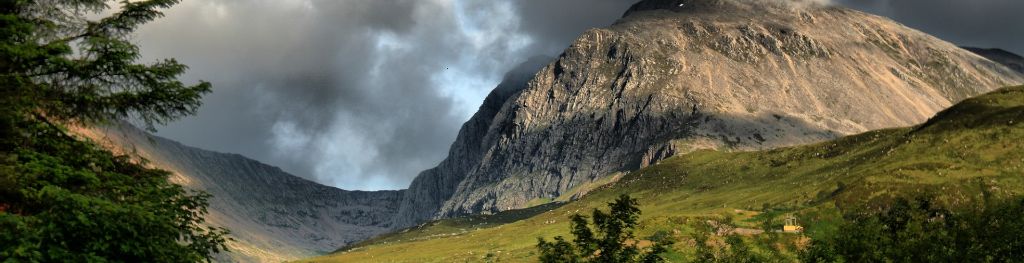
Including Ben Nevis, Glen Coe and the rest of Lochaber, Argyll including the Isles, Loch Lomond, Trossachs and Arran
For snow and avalanche hazard forecasts please visit Scottish Avalanche Information Service