Weather fronts
Weather fronts mark the boundary or transition zone between two air masses and have an important impact upon the weather.
The air around the globe has different properties. For example, air from the north is usually colder, and there is usually a sharp boundary where this meets the warmer air from the south (rather than a gradual increase in temperature). There is also the added complication that air is often dry if it has come from a large continent, or holds a lot of moisture if it has come across an ocean.
Weather fronts mark the boundary between two different air masses, which often have contrasting properties. For example, one air mass may be cold and dry and the other air mass may be relatively warm and moist. These differences produce a reaction (often a band of rain) in a zone known as a front.
What is a weather front?
A weather front is a boundary between two air masses. It can be thought of like the frontline in a battle, where the warm air represents one side and its 'enemy,' the cold air, the other side.
Across a front, there can be large variations in temperature, as warm air comes into contact with cooler air. The difference in temperature can indicate the 'strength' of a front. If very cold air comes into contact with warm tropical air, for example, the front can be 'strong' or 'intense'. However, if there is little difference in temperature between the two air masses, the front may be 'weak.'
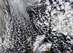
Weather fronts and the UK weather
The UK has unique weather because we are an island nation, with a large ocean to the west of us, a large landmass to the east of us and because of our position north of the equator. These factors mean that we experience a large number of frontal systems and their associated weather.
Most of the frontal systems that affect the UK are formed out over the Atlantic Ocean and move in a west to east direction. Met Office surface pressure charts show forecast pressure and weather fronts, out to five days ahead, for Europe and the northwest Atlantic. Three of the most common weather fronts displayed on these maps are explained below.
Cold fronts
A cold front is symbolised on a weather map as a line with triangles. The triangles can be thought of as icicles. Cold fronts are often coloured blue.
The presence of a cold front means that cold air is advancing and pushing underneath warmer air. This is because the cold air is 'heavier,' or denser, than the warm air. Cold air is thus replacing warm air at the surface. The tips of the 'icicles' indicate the direction of movement of the cold air.
Warm fronts
A warm front is symbolised on a weather map as a line with semicircles. The semicircles can be thought of as half suns. Warm fronts are often coloured red.
The presence of a warm front means that warm air is advancing and rising over cold air. This is because warm air is 'lighter,' or less dense than cold air. Warm air is replacing cooler air at the surface. The edges of the 'suns' indicate the direction of movement of the warm air.
Occluded fronts
An occluded front is symbolised on a weather map as a line with both semicircles and triangles. They are often coloured purple.
These are slightly more complex than cold or warm fronts. The word occluded means 'hidden' and an occlusion occurs when the cold front 'catches up' with the warm front. The warm air is then lifted from the surface, and therefore hidden. An occlusion can be thought of as having the characteristics of both warm and cold fronts.