
Mountain weather
Mourne Mountains Mountain weather forecast table
Confidence
High over the weekend and on Monday. Some uncertainty in cloud amounts on Tuesday and Wednesday.
This evening forecast
Clear skies this evening and to start the night. Moderate north or northwest winds across the tops, but light at low levels.
Mountain weather hazards
Hazards apply at or above 300m, reflecting the more severe conditions which can occur at altitude.
 Strong Sunlight
Harmful UV levels from sunlight increase with altitude giving a greater risk of sunburn and eye damage, even on some overcast days. On breezy days, the cooling effect of wind on exposed skin may disguise any feeling of sunburn until it is too late. If there is snow cover, glare increases the effect of UV rays especially on the eyes. It is advisable to wear sun block, protective clothing such as a long-sleeved top and hat and have good quality eye protection.
Mountain weather forecast
Dry and sunny with light winds.
| 00:00 | 03:00 | 06:00 | 09:00 | 12:00 | 15:00 | 18:00 | 21:00 | |
|---|---|---|---|---|---|---|---|---|
Weather (at 700m) |
|
|
|
|
|
|
|
|
Chance of precipitation (at 700m) |
00% | 00% | 00% | 00% | 00% | 00% | 00% | 00% |
Wind direction and speed (mph)
Altitude above mean sea level
| 00:00 | 03:00 | 06:00 | 09:00 | 12:00 | 15:00 | 18:00 | 21:00 | |
|---|---|---|---|---|---|---|---|---|
| 600m |
N
15
|
N
10
|
N
8
|
N
5
|
SW
5
|
SW
6
|
SW
7
|
S
6
|
| 300m |
N
9
|
N
7
|
N
6
|
N
4
|
SE
4
|
S
6
|
S
5
|
SW
4
|
| Valley |
N
8
|
N
6
|
N
5
|
N
3
|
E
4
|
S
4
|
S
4
|
S
2
|
Wind gust (mph)
Altitude above mean sea level
| 00:00 | 03:00 | 06:00 | 09:00 | 12:00 | 15:00 | 18:00 | 21:00 | |
|---|---|---|---|---|---|---|---|---|
| 600m | 19 | 13 | 10 | 8 | 8 | 10 | 9 | 7 |
| 300m | 15 | 11 | 9 | 7 | 7 | 9 | 8 | 5 |
| Valley | 14 | 10 | 8 | 7 | 8 | 8 | 6 | 4 |
Altitude above mean sea level
| 00:00 | 03:00 | 06:00 | 09:00 | 12:00 | 15:00 | 18:00 | 21:00 | |
|---|---|---|---|---|---|---|---|---|
| 600m |
3°
|
3°
|
3°
|
5°
|
7°
|
8°
|
7°
|
6°
|
| 300m |
4°
|
4°
|
4°
|
8°
|
9°
|
10°
|
8°
|
6°
|
| Valley |
2°
|
0°
|
2°
|
9°
|
12°
|
14°
|
10°
|
6°
|
| Freezing Level |
800m
|
800m
|
800m
|
900m
|
1,200m
|
1,500m
|
2,000m
|
2,100m
|
Altitude above mean sea level
| 00:00 | 03:00 | 06:00 | 09:00 | 12:00 | 15:00 | 18:00 | 21:00 | |
|---|---|---|---|---|---|---|---|---|
| 600m |
-2°
|
-1°
|
0°
|
3°
|
5°
|
6°
|
5°
|
4°
|
| 300m |
1°
|
1°
|
2°
|
7°
|
8°
|
9°
|
7°
|
5°
|
| Valley |
1°
|
-1°
|
2°
|
8°
|
12°
|
14°
|
9°
|
6°
|
Additional weather information
Meteorologist's view
Moderate UV levels, sun protection recommended. Feeling pleasantly warm in valleys on the south side of the main ridge.
Weather
Dry with clear spells through the early hours, a chance of some shallow patchy mist or fog and frost in the valleys towards dawn. Then a dry largely sunny day. Lengthy clear spells for the coming night.
Chance of cloud-free hill tops
100%
Low cloud and visibility
Very good or excellent visibility with any mist or fog patches in the valleys dispersing around dawn. No cloud expected on the hills.
Mountain weather information
Weather
Dry with clear spells through the early hours. Then a dry day with sunny spells Cloud increasing at times in the evening and start of the night.
Chance of cloud-free hill tops
90%
Maximum wind speed expected
Variable, 5 mph
Temperature
- At 700m Plus 6 Celsius rising to 9 Celsius.
- Valley Plus 4 Celsius rising to 15 Celsius.
- Freezing level Above the summits.
Low cloud and visibility
Very good or excellent visibility with no cloud on the hills during the day. Cloud lowering to 600m in the evening at times, perhaps to lower slopes towards midnight.
Mountain weather information
Mon 22 Apr
Sunrise:
Sunset:
Low cloud overnight lifting and breaking in the morning to give another dry day with sunny spells. Cloud lowering again in the evening, perhaps a few spots of drizzle. Moderate north or northwest winds.
Tue 23 Apr
Sunrise:
Sunset:
Any early cloud soon breaking up to give another dry day with good sunny spells. Light to moderate northerly winds.
Wed 24 Apr
Sunrise:
Sunset:
Likely to be another dry bright day with sunny spells and light to moderate northerly winds. A small chance of showers.
Updated at:
Summit specific forecast
Mountain summit forecast map
Loading map…
Key
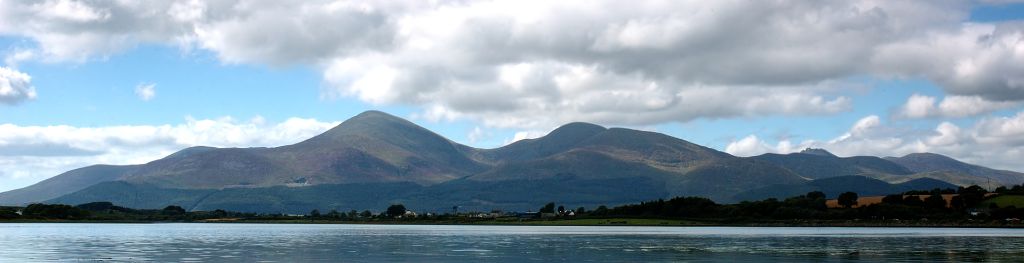
The Mourne Mountains are a granite mountain range in County Down in the southeast of Northern Ireland, is an area of outstanding natural beauty, and has been proposed as the first National Park in Northern Ireland.