
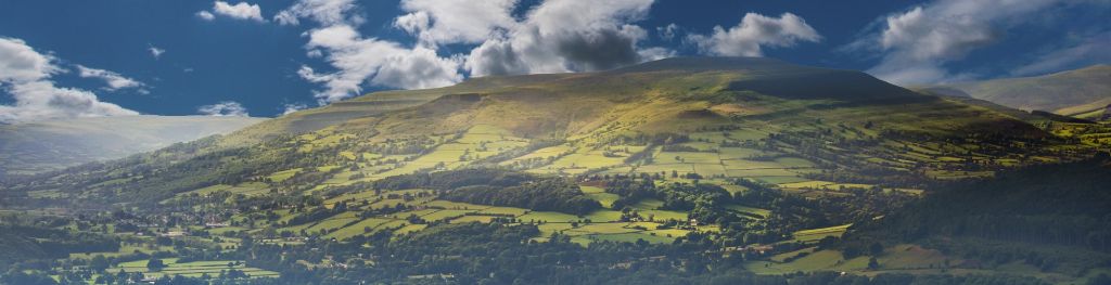
Mountain weather
Bannau Brycheiniog / Brecon Beacons Mountain weather forecast table
Confidence
High for a mostly dry and sunny day on Wednesday after a cloudy start. Lower confidence for shower detail later in the week and change to unsettled conditions into the weekend.
This evening forecast
Staying mostly dry through the evening and overnight with clear spells, though the odd light shower still possible.
Mountain weather hazards
Hazards apply at or above 300m, reflecting the more severe conditions which can occur at altitude.
 Strong Sunlight
Harmful UV levels from sunlight increase with altitude giving a greater risk of sunburn and eye damage, even on some overcast days. On breezy days, the cooling effect of wind on exposed skin may disguise any feeling of sunburn until it is too late. If there is snow cover, glare increases the effect of UV rays especially on the eyes. It is advisable to wear sun block, protective clothing such as a long-sleeved top and hat and have good quality eye protection.
Severe Chill Effect
Wind significantly lowers the ‘feels-like’ temperature relative to the actual temperature, with even moderate winds significantly adding to the chilling effect. Strong winds can result in a severe and debilitating wind chill many degrees below the actual temperature. This effect will be enhanced in rain or wet snow. Without protection, prolonged exposure could result in frost nip or frostbite on exposed parts of the body and/or hypothermia.
Poor Visibility
Poor visibility presents challenging route finding conditions. Visibility could be significantly less than 50 metres in all directions with few or no visual references, especially on featureless moors or plateaux. Distances become hard to judge and cliff or cornice edges can be difficult to recognise. These conditions require good navigational skills. There is a risk of white-out conditions when mist or fog is combined with extensive snow cover.
Mountain weather forecast
Dry with sunny spells after a cloudy start.
| 00:00 | 03:00 | 06:00 | 09:00 | 12:00 | 15:00 | 18:00 | 21:00 | |
|---|---|---|---|---|---|---|---|---|
Weather (at 600m) |
|
|
|
|
|
|
|
|
Chance of precipitation (at 600m) |
10% | 20% | 30% | 30% | 20% | 00% | 00% | 00% |
Wind direction and speed (mph)
Altitude above mean sea level
| 00:00 | 03:00 | 06:00 | 09:00 | 12:00 | 15:00 | 18:00 | 21:00 | |
|---|---|---|---|---|---|---|---|---|
| 600m |
N
6
|
W
7
|
NW
9
|
N
11
|
N
11
|
N
9
|
N
9
|
NW
5
|
| 300m |
S
2
|
W
4
|
W
4
|
N
7
|
N
7
|
N
6
|
NW
7
|
W
4
|
| Valley |
W
2
|
W
5
|
W
5
|
N
7
|
N
7
|
N
6
|
N
5
|
NW
4
|
Wind gust (mph)
Altitude above mean sea level
| 00:00 | 03:00 | 06:00 | 09:00 | 12:00 | 15:00 | 18:00 | 21:00 | |
|---|---|---|---|---|---|---|---|---|
| 600m | 9 | 9 | 12 | 16 | 16 | 13 | 12 | 8 |
| 300m | 4 | 9 | 11 | 13 | 13 | 11 | 13 | 6 |
| Valley | 4 | 10 | 11 | 13 | 13 | 12 | 11 | 7 |
Altitude above mean sea level
| 00:00 | 03:00 | 06:00 | 09:00 | 12:00 | 15:00 | 18:00 | 21:00 | |
|---|---|---|---|---|---|---|---|---|
| 600m |
3°
|
2°
|
2°
|
4°
|
6°
|
8°
|
7°
|
3°
|
| 300m |
4°
|
4°
|
5°
|
7°
|
10°
|
11°
|
9°
|
4°
|
| Valley |
5°
|
5°
|
5°
|
8°
|
11°
|
12°
|
10°
|
4°
|
| Freezing Level |
1,000m
|
1,000m
|
1,000m
|
1,000m
|
1,000m
|
1,000m
|
1,000m
|
800m
|
Altitude above mean sea level
| 00:00 | 03:00 | 06:00 | 09:00 | 12:00 | 15:00 | 18:00 | 21:00 | |
|---|---|---|---|---|---|---|---|---|
| 600m |
0°
|
-1°
|
-1°
|
0°
|
3°
|
5°
|
4°
|
1°
|
| 300m |
4°
|
2°
|
3°
|
5°
|
8°
|
10°
|
8°
|
2°
|
| Valley |
4°
|
3°
|
4°
|
6°
|
10°
|
10°
|
9°
|
3°
|
Additional weather information
Meteorologist's view
Poor visibilities to start with some low cloud. Adequate layers required with conditions improving through the morning but remaining chilly in northerly winds. Moderate UV levels with sun protection advised.
Weather
A cloudy start with a few scattered light showers through the morning. Turning drier into the afternoon with lengthy sunny intervals. Feeling chilly in the northerly winds.
Chance of cloud-free hill tops
40% during the early morning, improving to 90% or better by the afternoon.
Low cloud and visibility
Cloud may cover the slopes and summits for a time but will lift and break during the morning, although briefly lowering to cover summits in any showers. Very little cloud above all summits through the afternoon. Very good visibility, although briefly dropping to moderate in any showers or early low cloud.
Recent rainfall
Location: Neuadd (Near Pontsticill)
Altitude: 353m
| Last 24 hours | Last 48 hours | Last 72 hours |
|---|---|---|
| 0.4mm | 0.4mm | 0.4mm |
Measurement date:
Rainfall data provided by Natural Resources Wales. The Met Office is not responsible for content provided by third parties and may remove this data without warning.
Mountain weather information
Weather
A bright start, then turning a little cloudier than Wednesday with occasional sunny spells during the afternoon and the odd shower possible.
Chance of cloud-free hill tops
90% or above, lowering to 70% during the afternoon and evening.
Maximum wind speed expected
West to northwesterly, 10-15 mph with gusts of 20-25 mph.
Temperature
- At 600m Plus 0 Celsius rising to Plus 7 Celsius.
- Valley Plus 3 Celsius rising to Plus 12 Celsius.
- Freezing level Above all summits.
Low cloud and visibility
Very little cloud above all summits during the morning, but scattered cloud with bases around 700m through the afternoon and evening. Generally very good visibility, but moderate in any showers.
Mountain weather information
Fri 26 Apr
Sunrise:
Sunset:
A mixture of sunny spells and more frequent showers, heavy at times. Light to moderate winds, mainly southeasterly. Freezing level above summits.
Sat 27 Apr
Sunrise:
Sunset:
Low confidence but generally unsettled with showers or longer spells of rain. Light to moderate winds to start, variable mainly northeasterly. Freezing level above summits.
Sun 28 Apr
Sunrise:
Sunset:
Remaining unsettled with outbreaks of rain. Light to moderate winds to start, variable mainly north or northwesterly. Freezing level above summits.
Updated at:
Summit specific forecast
Mountain summit forecast map
Loading map…
Key
The Bannau Brycheiniog / Brecon Beacons is a mountain range in South Wales comprising six main peaks, with the highest peak, Pen y Fan, standing at 886 metres.