
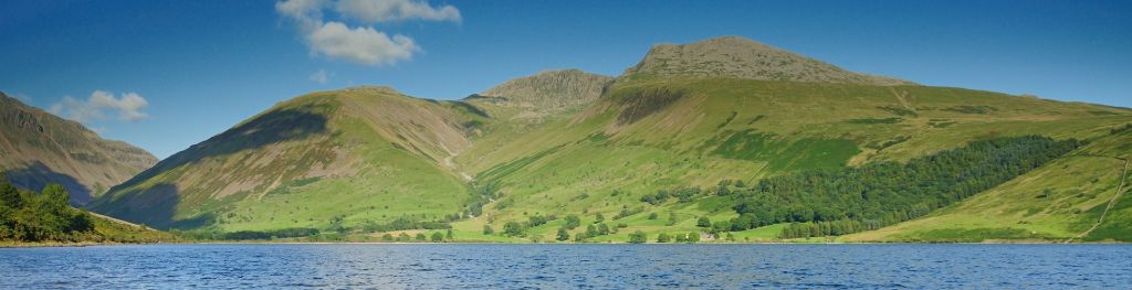
Mountain weather
Lake District Mountain weather forecast table
Confidence
High for Saturday. Moderate for chance of rain on Sunday and Monday. Low for chance of rain and cloud amounts on Tuesday and Wednesday.
Mountain weather hazards
Hazards apply at or above 300m, reflecting the more severe conditions which can occur at altitude.
 Strong Sunlight
Harmful UV levels from sunlight increase with altitude giving a greater risk of sunburn and eye damage, even on some overcast days. On breezy days, the cooling effect of wind on exposed skin may disguise any feeling of sunburn until it is too late. If there is snow cover, glare increases the effect of UV rays especially on the eyes. It is advisable to wear sun block, protective clothing such as a long-sleeved top and hat and have good quality eye protection.
Mountain weather forecast
Dry with sunny spells and light winds.
| 06:00 | 09:00 | 12:00 | 15:00 | 18:00 | 21:00 | |
|---|---|---|---|---|---|---|
Weather (at 800m) |
|
|
|
|
|
|
Chance of precipitation (at 800m) |
00% | 00% | 00% | 00% | 00% | 00% |
Wind direction and speed (mph)
Altitude above mean sea level
| 06:00 | 09:00 | 12:00 | 15:00 | 18:00 | 21:00 | |
|---|---|---|---|---|---|---|
| 900m |
NE
13
|
N
9
|
NW
7
|
NW
10
|
N
8
|
N
7
|
| 600m |
E
8
|
NE
6
|
N
7
|
NW
9
|
NW
7
|
N
4
|
| 300m |
NE
2
|
N
2
|
N
5
|
N
6
|
NW
4
|
N
2
|
| Valley |
NE
4
|
NE
2
|
W
4
|
NW
5
|
NW
5
|
N
3
|
Wind gust (mph)
Altitude above mean sea level
| 06:00 | 09:00 | 12:00 | 15:00 | 18:00 | 21:00 | |
|---|---|---|---|---|---|---|
| 900m | 15 | 13 | 11 | 15 | 11 | 9 |
| 600m | 11 | 10 | 11 | 14 | 10 | 6 |
| 300m | 11 | 8 | 11 | 12 | 9 | 6 |
| Valley | 10 | 7 | 9 | 10 | 9 | 6 |
Altitude above mean sea level
| 06:00 | 09:00 | 12:00 | 15:00 | 18:00 | 21:00 | |
|---|---|---|---|---|---|---|
| 900m |
0°
|
0°
|
2°
|
3°
|
3°
|
2°
|
| 600m |
1°
|
3°
|
5°
|
6°
|
5°
|
4°
|
| 300m |
3°
|
6°
|
8°
|
9°
|
8°
|
5°
|
| Valley |
5°
|
8°
|
9°
|
10°
|
10°
|
8°
|
| Freezing Level |
500m
|
600m
|
900m
|
1,000m
|
1,100m
|
1,100m
|
Altitude above mean sea level
| 06:00 | 09:00 | 12:00 | 15:00 | 18:00 | 21:00 | |
|---|---|---|---|---|---|---|
| 900m |
-5°
|
-4°
|
-1°
|
-1°
|
0°
|
-1°
|
| 600m |
-3°
|
0°
|
2°
|
3°
|
3°
|
2°
|
| 300m |
2°
|
5°
|
7°
|
8°
|
6°
|
5°
|
| Valley |
4°
|
7°
|
8°
|
9°
|
8°
|
7°
|
Additional weather information
Meteorologist's view
Moderate UV levels, sun protection recommended. A cooling breeze on the tops.
Weather
A dry, bright day. Good sunny spells in the morning. High cloud increases in the afternoon. A dry but cloudy evening and start to the night.
Chance of cloud-free hill tops
90%
Low cloud and visibility
Very good or excellent visibility. No cloud expected on the hills.
Ground conditions
No recent ground conditions report available.
Mountain weather information
Weather
Cloudy through the early hours with a chance of rain across the northern and eastern Fells, mainly towards dawn. Then a dull day with low cloud and rain or drizzle at times. The rain heaviest and most persistent across northern and eastern Fells. Best chance of longer dry spells across the western Fells. Little change after dark.
Chance of cloud-free hill tops
30-40%, best chance in the west. Falling to 10% or less in the evening.
Maximum wind speed expected
Mainly north, 5-10 mph, becoming variable in the evening.
Temperature
- At 800m Plus 2 Celsius rising to 5 Celsius.
- Valley Plus 6 Celsius rising to 10 Celsius.
- Freezing level Above the summits.
Low cloud and visibility
Visibility good early morning across western Fells, but often poor through the day. Variable cloud bases, occasionally just above the summits, but mostly 700-800m, falling to 500m in any heavier rain or drizzle. Cloud down to lower slopes in the evening.
Mountain weather information
Mon 22 Apr
Sunrise:
Sunset:
Low cloud and drizzle to start. Some drier spells may develop, most likely in the west, but further patchy rain is likely. Light winds.
Tue 23 Apr
Sunrise:
Sunset:
Cloudy with light rain in the morning, but expected to turn dry with some sunny spells. Moderate northerly winds. Freezing level 900m early morning and late evening, but above the tops by day.
Wed 24 Apr
Sunrise:
Sunset:
Likely to be bright with sunny spells, perhaps a few light wintry showers. Moderate northerly winds. Freezing level 600-800m.
Updated at:
Summit specific forecast
Mountain summit forecast map
Loading map…
Key
The Lake District covers an area of 885 square miles with its highest point, Scafell Pike, standing at 978 metres.