
Mountain weather
Mourne Mountains Mountain weather forecast table
Confidence
High confidence for unsettled weather Thursday until Friday morning, then for dry and settled weather with sunny spells until Monday.
This evening forecast
Patchy cloud at first, soon clearing to leave a dry evening with clear spells, but feeling chilly in northwesterly winds.
Mountain weather hazards
Hazards apply at or above 300m, reflecting the more severe conditions which can occur at altitude.
 Poor Visibility
Poor visibility presents challenging route finding conditions. Visibility could be significantly less than 50 metres in all directions with few or no visual references, especially on featureless moors or plateaux. Distances become hard to judge and cliff or cornice edges can be difficult to recognise. These conditions require good navigational skills. There is a risk of white-out conditions when mist or fog is combined with extensive snow cover.
Gales
Gale force winds (gusts over 50mph) make walking difficult and strenuous with a potential to be blown over by gusts. There is often a marked increase in winds through cols or on exposed ridges and summits. Distances can take longer to cover and compass bearings become harder to follow accurately.
Mountain weather forecast
Dry before dawn. Low cloud and patchy outbreaks of rain thereafter. Strengthening westerly winds with a chance of summit gales evening.
| 00:00 | 03:00 | 06:00 | 09:00 | 12:00 | 15:00 | 18:00 | 21:00 | |
|---|---|---|---|---|---|---|---|---|
Weather (at 700m) |
|
|
|
|
|
|
|
|
Chance of precipitation (at 700m) |
00% | 00% | <05% | 40% | 30% | 10% | 20% | 20% |
Wind direction and speed (mph)
Altitude above mean sea level
| 00:00 | 03:00 | 06:00 | 09:00 | 12:00 | 15:00 | 18:00 | 21:00 | |
|---|---|---|---|---|---|---|---|---|
| 600m |
NW
8
|
W
7
|
W
16
|
W
18
|
W
21
|
W
27
|
W
27
|
W
29
|
| 300m |
NW
8
|
NW
4
|
W
8
|
W
10
|
W
14
|
W
16
|
W
17
|
W
18
|
| Valley |
NW
7
|
W
4
|
W
7
|
W
9
|
W
12
|
W
14
|
W
14
|
W
15
|
Wind gust (mph)
Altitude above mean sea level
| 00:00 | 03:00 | 06:00 | 09:00 | 12:00 | 15:00 | 18:00 | 21:00 | |
|---|---|---|---|---|---|---|---|---|
| 600m | 11 | 9 | 23 | 26 | 32 | 40 | 40 | 43 |
| 300m | 11 | 7 | 16 | 18 | 24 | 30 | 30 | 32 |
| Valley | 11 | 6 | 15 | 18 | 23 | 28 | 28 | 30 |
Altitude above mean sea level
| 00:00 | 03:00 | 06:00 | 09:00 | 12:00 | 15:00 | 18:00 | 21:00 | |
|---|---|---|---|---|---|---|---|---|
| 600m |
2°
|
2°
|
2°
|
4°
|
5°
|
7°
|
6°
|
5°
|
| 300m |
3°
|
2°
|
4°
|
6°
|
8°
|
10°
|
8°
|
7°
|
| Valley |
4°
|
4°
|
4°
|
8°
|
9°
|
11°
|
10°
|
8°
|
| Freezing Level |
800m
|
800m
|
1,000m
|
1,100m
|
1,600m
|
1,600m
|
1,900m
|
1,700m
|
Altitude above mean sea level
| 00:00 | 03:00 | 06:00 | 09:00 | 12:00 | 15:00 | 18:00 | 21:00 | |
|---|---|---|---|---|---|---|---|---|
| 600m |
-2°
|
-1°
|
-3°
|
-1°
|
0°
|
2°
|
0°
|
-1°
|
| 300m |
0°
|
1°
|
0°
|
3°
|
4°
|
6°
|
4°
|
3°
|
| Valley |
1°
|
2°
|
2°
|
5°
|
6°
|
8°
|
6°
|
5°
|
Additional weather information
Meteorologist's view
Strengthening westerly winds in the afternoon with a chance of summit gales later will make for fairly arduous walking on exposed terrain.
Weather
Dry with clear spells before dawn, some fog forming in valleys. Cloud builds from the northwest through the morning with outbreaks of patchy light rain at times and strengthening westerly winds. Some cloud breaks possible through the middle of the day, before cloud thickens again in the evening.
Chance of cloud-free hill tops
80% before dawn, falling to 30% through the morning. Rising to 60% for a time around the middle of the day.
Low cloud and visibility
Mainly clear skies and cloud well above summits before dawn. Low cloud to 300-400m arriving through the morning, but lifting and breaking for a time through the middle of the day. Poor visibility at times in hill fog and outbreaks of rain or drizzle.
Mountain weather information
Weather
A few showers in the morning, clearing in the afternoon to allow for some bright, sunny spells. Strong northwesterly winds with a chance of summit gales at first, will gradually ease through the afternoon.
Chance of cloud-free hill tops
60% rising to more than 80% by the late afternoon.
Maximum wind speed expected
Northwesterly average 30-35mph, gusting 45-50mph in the morning will ease to 20mph, gusting 30-35mph in the evening.
Temperature
- At 700m Plus 2 to plus 5 Celsius.
- Valley Plus 9 to plus 12 Celsius.
- Freezing level 1100m falling to 800m.
Low cloud and visibility
A few patchy areas of cloud down to 400m in any early showers, but bases soon rising above summits and cloud becoming more sparse, with excellent visibilities.
Mountain weather information
Sat 20 Apr
Sunrise:
Sunset:
Dry with light winds and lengthy sunny spells. Some patchy cloud at times.
Sun 21 Apr
Sunrise:
Sunset:
Dry with light winds and lengthy sunny spells. Some patchy cloud at times. Feeling a touch milder.
Mon 22 Apr
Sunrise:
Sunset:
Dry but somewhat cloudy. Perhaps a few clearer spells at times.
Updated at:
Summit specific forecast
Mountain summit forecast map
Loading map…
Key
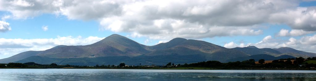
The Mourne Mountains are a granite mountain range in County Down in the southeast of Northern Ireland, is an area of outstanding natural beauty, and has been proposed as the first National Park in Northern Ireland.