
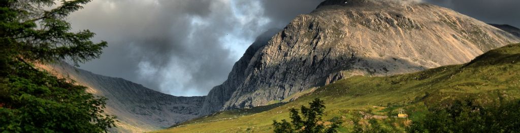
Mountain weather
North Grampian Mountain weather forecast table
Confidence
High for Saturday. Moderate for details of cloud and rain amounts from Sunday.
Mountain weather hazards
Hazards apply at or above 300m, reflecting the more severe conditions which can occur at altitude.
 Severe Chill Effect
Wind significantly lowers the ‘feels-like’ temperature relative to the actual temperature, with even moderate winds significantly adding to the chilling effect. Strong winds can result in a severe and debilitating wind chill many degrees below the actual temperature. This effect will be enhanced in rain or wet snow. Without protection, prolonged exposure could result in frost nip or frostbite on exposed parts of the body and/or hypothermia.
Poor Visibility
Poor visibility presents challenging route finding conditions. Visibility could be significantly less than 50 metres in all directions with few or no visual references, especially on featureless moors or plateaux. Distances become hard to judge and cliff or cornice edges can be difficult to recognise. These conditions require good navigational skills. There is a risk of white-out conditions when mist or fog is combined with extensive snow cover.

Mountain weather forecast
A dry cloudy day. Rain and low cloud in the evening.
| 06:00 | 09:00 | 12:00 | 15:00 | 18:00 | 21:00 | |
|---|---|---|---|---|---|---|
Weather (at 800m) |
|
|
|
|
|
|
Chance of precipitation (at 800m) |
00% | 00% | 00% | 10% | 10% | 70% |
Wind direction and speed (mph)
Altitude above mean sea level
| 06:00 | 09:00 | 12:00 | 15:00 | 18:00 | 21:00 | |
|---|---|---|---|---|---|---|
| 1300m |
NW
17
|
NW
14
|
N
11
|
NW
9
|
N
9
|
NW
9
|
| 900m |
N
8
|
NW
7
|
N
8
|
N
6
|
N
6
|
W
4
|
| 600m |
NE
4
|
NW
5
|
N
6
|
N
5
|
NE
5
|
W
3
|
| 300m |
SE
2
|
NW
2
|
N
4
|
NE
3
|
NE
3
|
NE
2
|
| Glen |
S
1
|
S
2
|
NE
4
|
NE
3
|
NE
3
|
W
2
|
Wind gust (mph)
Altitude above mean sea level
| 06:00 | 09:00 | 12:00 | 15:00 | 18:00 | 21:00 | |
|---|---|---|---|---|---|---|
| 1300m | 22 | 18 | 15 | 12 | 12 | 12 |
| 900m | 9 | 10 | 13 | 10 | 9 | 6 |
| 600m | 5 | 8 | 10 | 8 | 8 | 5 |
| 300m | 2 | 5 | 8 | 6 | 6 | 3 |
| Glen | 3 | 6 | 8 | 7 | 6 | 6 |
Altitude above mean sea level
| 06:00 | 09:00 | 12:00 | 15:00 | 18:00 | 21:00 | |
|---|---|---|---|---|---|---|
| 1300m |
-4°
|
-3°
|
-2°
|
-1°
|
-1°
|
-1°
|
| 900m |
-1°
|
0°
|
2°
|
3°
|
3°
|
2°
|
| 600m |
0°
|
2°
|
4°
|
6°
|
5°
|
4°
|
| 300m |
2°
|
5°
|
7°
|
8°
|
7°
|
6°
|
| Glen |
2°
|
5°
|
8°
|
9°
|
8°
|
6°
|
| Freezing Level |
400m
|
600m
|
900m
|
1,100m
|
1,200m
|
1,300m
|
Altitude above mean sea level
| 06:00 | 09:00 | 12:00 | 15:00 | 18:00 | 21:00 | |
|---|---|---|---|---|---|---|
| 1300m |
-12°
|
-10°
|
-7°
|
-5°
|
-5°
|
-5°
|
| 900m |
-6°
|
-4°
|
-2°
|
0°
|
0°
|
0°
|
| 600m |
-2°
|
0°
|
2°
|
4°
|
3°
|
3°
|
| 300m |
0°
|
4°
|
6°
|
7°
|
6°
|
5°
|
| Glen |
0°
|
4°
|
8°
|
9°
|
8°
|
5°
|
Additional weather information
Met Office Aberdeen meteorologist's view
Freezing level will be around 200m higher in the west of the area.
Weather
Dry with patchy high cloud through the morning. Cloud thickening and lowering through the afternoon with patchy light rain in the evening.
Chance of cloud-free hill tops
80%, falling to 20% in the evening.
Low cloud and visibility
Generally very good visibility with cloud expected to be above the summits for much of the day, perhaps briefly affecting the higher summits of the Cairngorms at times. Cloud lowering onto the higher summits around dusk, then 700m towards midnight.
Mountain weather information
Weather
Low cloud in the early hours, rain across the Cairngorms clearing east through the morning. Then a largely dry day. Bright or sunny spells developing across western hills in the afternoon, but remaining cloudy across the Cairngorms. More extensive low cloud and patchy drizzle spreads in the evening.
Chance of cloud-free hill tops
60% in the west, 40% in the east.
Maximum wind speed expected
West or northwest, 5-10 mph.
Temperature
- At 800m Plus 4 Celsius, rising to 8 Celsius.
- Glen Plus 6 Celsius rising to 12 Celsius.
- Freezing level Above the summits.
Low cloud and visibility
Good visibility in the west later with cloud breaking in places. Poor visibility early morning across the Cairngorms with cloud around 500-600m, lifting to 800m by afternoon. More extensive cloud down to 500-600m late evening.
Mountain weather information
Mon 22 Apr
Sunrise:
Sunset:
Low cloud and patchy drizzle. More persistent rain for a couple of hours in the afternoon. Clearer skies spreading south in the evening, although patchy cloud may persist across the Cairngorms. Moderate northwest winds. Freezing level above the summits, falling to 1000m, then 800m in the evening.
Tue 23 Apr
Sunrise:
Sunset:
Dry with sunny spells, these best in the west. Moderate northerly winds. Freezing level 700-800m early morning and in the evening, rising to 1000-1200m during the day.
Wed 24 Apr
Sunrise:
Sunset:
Rather cloudy with a few showers possible, best chance of sunny spells in the west. Light to moderate northerly winds. Freezing level 600-800m.
Updated at:
Summit specific forecast
Mountain summit forecast map
Loading map…
Key
Includes the northern and western Cairngorms National Park, Monadhliath, Ben Alder, Creag Meagaidh, Loch Ericht and Loch Rannoch.
For snow and avalanche hazard forecasts please visit Scottish Avalanche Information Service