
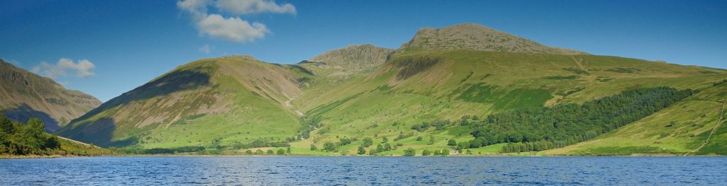
Mountain weather
Lake District Mountain weather forecast table
Confidence
High confidence for a spell of unsettled weather Thursday and early Friday, before turning clearer and drier until Sunday. Lower confidence for details of cloud and any rain Sunday.
Mountain weather hazards
Hazards apply at or above 300m, reflecting the more severe conditions which can occur at altitude.
 Poor Visibility
Poor visibility presents challenging route finding conditions. Visibility could be significantly less than 50 metres in all directions with few or no visual references, especially on featureless moors or plateaux. Distances become hard to judge and cliff or cornice edges can be difficult to recognise. These conditions require good navigational skills. There is a risk of white-out conditions when mist or fog is combined with extensive snow cover.
Severe Chill Effect
Wind significantly lowers the ‘feels-like’ temperature relative to the actual temperature, with even moderate winds significantly adding to the chilling effect. Strong winds can result in a severe and debilitating wind chill many degrees below the actual temperature. This effect will be enhanced in rain or wet snow. Without protection, prolonged exposure could result in frost nip or frostbite on exposed parts of the body and/or hypothermia.
Heavy Persistent Rain
Heavy and persistent rain can lead to drenched clothing and footwear with waterproofs often becoming soaked through, especially if accompanied by strong winds. This can lead to significant loss of body heat and an increased likelihood of hypothermia. Terrain may turn increasingly boggy underfoot while streams can flood and become impassable. There may also be a risk of flooding in valleys or glens. If there is snow cover, a heightened avalanche hazard is possible and avalanche reports should be consulted where available.
Gales
Gale force winds (gusts over 50mph) make walking difficult and strenuous with a potential to be blown over by gusts. There is often a marked increase in winds through cols or on exposed ridges and summits. Distances can take longer to cover and compass bearings become harder to follow accurately.
Mountain weather forecast
Dry start with clear spells. Strengthening westerly winds, cloud and outbreaks of rain arrive around midday, persisting until midnight.
| 06:00 | 09:00 | 12:00 | 15:00 | 18:00 | 21:00 | |
|---|---|---|---|---|---|---|
Weather (at 800m) |
|
|
|
|
|
|
Chance of precipitation (at 800m) |
00% | 20% | 70% | 90% | 80% | 60% |
Wind direction and speed (mph)
Altitude above mean sea level
| 06:00 | 09:00 | 12:00 | 15:00 | 18:00 | 21:00 | |
|---|---|---|---|---|---|---|
| 900m |
SW
15
|
SW
21
|
SW
23
|
SW
28
|
W
34
|
W
36
|
| 600m |
SW
14
|
SW
18
|
SW
20
|
SW
23
|
W
27
|
W
27
|
| 300m |
SW
4
|
SW
8
|
SW
9
|
SW
10
|
W
12
|
W
14
|
| Valley |
SW
1
|
SW
9
|
SW
10
|
SW
12
|
W
12
|
W
13
|
Wind gust (mph)
Altitude above mean sea level
| 06:00 | 09:00 | 12:00 | 15:00 | 18:00 | 21:00 | |
|---|---|---|---|---|---|---|
| 900m | 17 | 28 | 30 | 36 | 44 | 46 |
| 600m | 18 | 24 | 26 | 32 | 38 | 39 |
| 300m | 13 | 20 | 22 | 26 | 31 | 34 |
| Valley | 8 | 18 | 22 | 27 | 28 | 30 |
Altitude above mean sea level
| 06:00 | 09:00 | 12:00 | 15:00 | 18:00 | 21:00 | |
|---|---|---|---|---|---|---|
| 900m |
0°
|
1°
|
1°
|
2°
|
3°
|
3°
|
| 600m |
1°
|
3°
|
3°
|
4°
|
5°
|
5°
|
| 300m |
3°
|
6°
|
5°
|
6°
|
7°
|
7°
|
| Valley |
5°
|
8°
|
7°
|
8°
|
9°
|
9°
|
| Freezing Level |
700m
|
900m
|
1,000m
|
1,400m
|
1,500m
|
1,600m
|
Altitude above mean sea level
| 06:00 | 09:00 | 12:00 | 15:00 | 18:00 | 21:00 | |
|---|---|---|---|---|---|---|
| 900m |
-5°
|
-6°
|
-6°
|
-4°
|
-4°
|
-4°
|
| 600m |
-4°
|
-2°
|
-3°
|
-2°
|
-1°
|
-1°
|
| 300m |
1°
|
4°
|
2°
|
3°
|
3°
|
3°
|
| Valley |
4°
|
6°
|
5°
|
5°
|
6°
|
6°
|
Additional weather information
Meteorologist's view
The best of the conditions in the morning. Visibilities poor and drenching conditions in persistent rain later. Windy conditions from the afternoon will make for fairly arduous walking on exposed terrain.
Weather
Dry but cold at first with some clear skies and light winds. Cloud builds from the north through the morning, with outbreaks of sleet arriving around midday, soon turning to rain with heavier bursts at times. Rain gradually easing off in the evening, with low cloud and drizzle persisting until midnight. Light winds at first will strengthen with a chance of summit gales in the evening.
Chance of cloud-free hill tops
More than 80% at first, falling to 20% or less from mid to late-morning, the best chance then towards the Southeastern Fells.
Low cloud and visibility
Predominantly clear skies and excellent visibility to start, but extensive persistent low cloud arriving from mid to late-morning with bases down to 300-400m and poor visibilities in hill fog or outbreaks of heavy rain.
Ground conditions
No recent ground conditions report available.
Mountain weather information
Weather
A few showers possible before dawn, otherwise dry with sunny spells developing at times through the day. Strong north to northwesterly winds will maintain a cold feeling to the day, and ease somewhat into the evening.
Chance of cloud-free hill tops
50% before dawn rising to more than 90%.
Maximum wind speed expected
Average 25-35mph, with gusts in excess of 45-50mph in the morning, easing to 20-25mph, gusting 30-35mph later.
Temperature
- At 800m Plus 1 to plus 3 Celsius.
- Valley Plus 7 to plus 10 Celsius.
- Freezing level 1000m falling to 700m.
Low cloud and visibility
Some patchy cloud around 600m in the early hours but rising well above summits after that with excellent visibilities.
Mountain weather information
Sat 20 Apr
Sunrise:
Sunset:
Dry with good sunny spells and light northerly winds.
Sun 21 Apr
Sunrise:
Sunset:
Mainly dry but cloudy with a few outbreaks of rain possible. Feeling milder.
Mon 22 Apr
Sunrise:
Sunset:
High pressure remains in charge so generally dry weather, but with variable amounts of cloud.
Updated at:
Summit specific forecast
Mountain summit forecast map
Loading map…
Key
The Lake District covers an area of 885 square miles with its highest point, Scafell Pike, standing at 978 metres.