
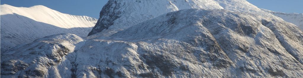
Mountain weather
Northwest Highlands Mountain weather forecast table
Confidence
High for showery conditions, snow on the hills until Thursday when rain spreads east, becoming drier again Saturday.
Mountain weather hazards
Hazards apply at or above 300m, reflecting the more severe conditions which can occur at altitude.
 Severe Chill Effect
Wind significantly lowers the ‘feels-like’ temperature relative to the actual temperature, with even moderate winds significantly adding to the chilling effect. Strong winds can result in a severe and debilitating wind chill many degrees below the actual temperature. This effect will be enhanced in rain or wet snow. Without protection, prolonged exposure could result in frost nip or frostbite on exposed parts of the body and/or hypothermia.
Poor Visibility
Poor visibility presents challenging route finding conditions. Visibility could be significantly less than 50 metres in all directions with few or no visual references, especially on featureless moors or plateaux. Distances become hard to judge and cliff or cornice edges can be difficult to recognise. These conditions require good navigational skills. There is a risk of white-out conditions when mist or fog is combined with extensive snow cover.
Thunderstorms
Lightning is a significant mountain hazard which can result in serious injury or death. Mountain terrain often leaves one highly exposed to lightning strikes. Hail may give unpleasant conditions with torrential rain and localised flash flooding also possible, mainly in Summer months.
Strong Sunlight
Harmful UV levels from sunlight increase with altitude giving a greater risk of sunburn and eye damage, even on some overcast days. On breezy days, the cooling effect of wind on exposed skin may disguise any feeling of sunburn until it is too late. If there is snow cover, glare increases the effect of UV rays especially on the eyes. It is advisable to wear sun block, protective clothing such as a long-sleeved top and hat and have good quality eye protection.

Mountain weather forecast
Mainly dry and bright at first becoming cloudy with scattered showers. Summit winds will be near gale force northwest.
| 06:00 | 09:00 | 12:00 | 15:00 | 18:00 | 21:00 | |
|---|---|---|---|---|---|---|
Weather (at 800m) |
|
|
|
|
|
|
Chance of precipitation (at 800m) |
20% | 20% | 40% | 60% | 40% | 40% |
Wind direction and speed (mph)
Altitude above mean sea level
| 06:00 | 09:00 | 12:00 | 15:00 | 18:00 | 21:00 | |
|---|---|---|---|---|---|---|
| 1000m |
NW
33
|
NW
25
|
NW
23
|
NW
30
|
NW
32
|
NW
32
|
| 900m |
NW
32
|
NW
25
|
NW
22
|
NW
28
|
NW
30
|
NW
30
|
| 600m |
N
20
|
NW
19
|
NW
18
|
NW
21
|
NW
22
|
NW
20
|
| 300m |
NW
6
|
NW
7
|
NW
7
|
NW
10
|
NW
9
|
NW
7
|
| Glen |
N
8
|
NW
10
|
W
13
|
NW
13
|
NW
14
|
NW
11
|
Wind gust (mph)
Altitude above mean sea level
| 06:00 | 09:00 | 12:00 | 15:00 | 18:00 | 21:00 | |
|---|---|---|---|---|---|---|
| 1000m | 38 | 32 | 31 | 39 | 41 | 40 |
| 900m | 38 | 31 | 30 | 37 | 39 | 38 |
| 600m | 27 | 25 | 25 | 30 | 30 | 29 |
| 300m | 28 | 25 | 25 | 31 | 32 | 30 |
| Glen | 21 | 21 | 22 | 26 | 28 | 24 |
Altitude above mean sea level
| 06:00 | 09:00 | 12:00 | 15:00 | 18:00 | 21:00 | |
|---|---|---|---|---|---|---|
| 1000m |
-3°
|
-3°
|
-2°
|
-3°
|
-4°
|
-4°
|
| 900m |
-2°
|
-2°
|
-1°
|
-2°
|
-3°
|
-3°
|
| 600m |
0°
|
1°
|
2°
|
1°
|
0°
|
0°
|
| 300m |
2°
|
4°
|
5°
|
3°
|
3°
|
2°
|
| Glen |
5°
|
7°
|
8°
|
6°
|
6°
|
5°
|
| Freezing Level |
500m
|
500m
|
600m
|
500m
|
400m
|
500m
|
Altitude above mean sea level
| 06:00 | 09:00 | 12:00 | 15:00 | 18:00 | 21:00 | |
|---|---|---|---|---|---|---|
| 1000m |
-13°
|
-11°
|
-10°
|
-11°
|
-13°
|
-13°
|
| 900m |
-11°
|
-10°
|
-8°
|
-10°
|
-12°
|
-11°
|
| 600m |
-6°
|
-5°
|
-4°
|
-6°
|
-7°
|
-7°
|
| 300m |
0°
|
1°
|
3°
|
-1°
|
-1°
|
-1°
|
| Glen |
2°
|
4°
|
5°
|
3°
|
1°
|
2°
|
Additional weather information
Met Office Aberdeen meteorologist's view
It will feel very cold at height with clouds mainly near or above the peaks, lowering at times in showers, falling as snow above 400m.
Weather
The morning will begin mainly dry and bright with the chance of an odd shower. Cloud will increase through the morning with snow showers, becoming scattered by the afternoon with a low risk of thunder at times.
Chance of cloud-free hill tops
90% falling 60%
Low cloud and visibility
Scattered cloud 500-700m in association with showers. The visibility will be mainly good, falling poor in showers but very poor in heavier falls and snow.
Mountain weather information
Weather
Cloudy with scattered showers, snow above 400m, and the occasional bright spell. The showers die with the afternoon becoming mainly dry with increasing bright spells.
Chance of cloud-free hill tops
40% increasing 60% in the afternoon.
Maximum wind speed expected
Northwest 20-25mph gust 35mph
Temperature
- At 800m Zero Celsius
- Glen Plus 1 Celsius rising to plus 9 Celsius
- Freezing level 700m
Low cloud and visibility
Extensive morning cloud 500-700m will lift and break 1000-1200m during the afternoon. The visibility will fall moderate or poor in showers.
Mountain weather information
Thu 18 Apr
Sunrise:
Sunset:
Overcast with widespread rain, preceded by snow. Strong southwest summit wind with 1200m freezing level.
Fri 19 Apr
Sunrise:
Sunset:
Overcast with patchy light rain, clearing by the afternoon. Strong northwest summit wind with 1000m freezing level.
Sat 20 Apr
Sunrise:
Sunset:
Cloudy, mainly dry, patchy light rain north. Moderate westerly summit wind with 1200m freezing level.
Updated at:
Summit specific forecast
Mountain summit forecast map
Loading map…
Key
Separated from the Grampians by the Great Glen the weather forecast area includes Wester Ross, Assynt, Sutherland, Knoydart, Torridon, Glen Affric and the Cuillin Hills on the Isle of Skye.
For snow and avalanche hazard forecasts please visit Scottish Avalanche Information Service