
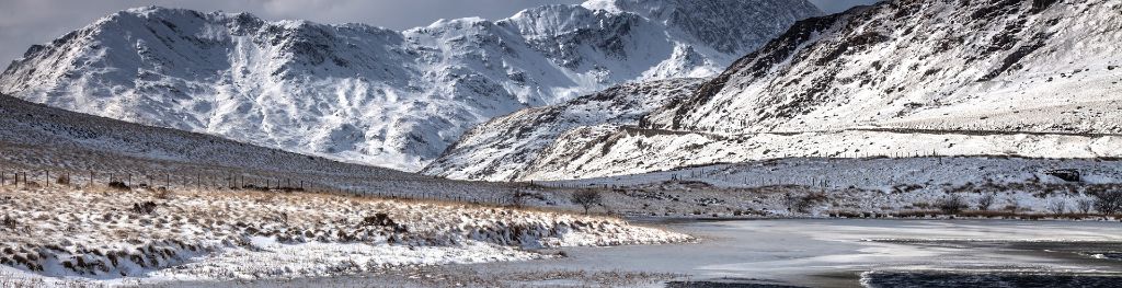
Mountain weather
Eryri / Snowdonia Mountain weather forecast table
Confidence
High for increasingly settled theme, although lower for cloud detail and for extent of morning valley fog.
Mountain weather hazards
Hazards apply at or above 300m, reflecting the more severe conditions which can occur at altitude.
 Strong Sunlight
Harmful UV levels from sunlight increase with altitude giving a greater risk of sunburn and eye damage, even on some overcast days. On breezy days, the cooling effect of wind on exposed skin may disguise any feeling of sunburn until it is too late. If there is snow cover, glare increases the effect of UV rays especially on the eyes. It is advisable to wear sun block, protective clothing such as a long-sleeved top and hat and have good quality eye protection.
Gales
Gale force winds (gusts over 50mph) make walking difficult and strenuous with a potential to be blown over by gusts. There is often a marked increase in winds through cols or on exposed ridges and summits. Distances can take longer to cover and compass bearings become harder to follow accurately.
Severe Chill Effect
Wind significantly lowers the ‘feels-like’ temperature relative to the actual temperature, with even moderate winds significantly adding to the chilling effect. Strong winds can result in a severe and debilitating wind chill many degrees below the actual temperature. This effect will be enhanced in rain or wet snow. Without protection, prolonged exposure could result in frost nip or frostbite on exposed parts of the body and/or hypothermia.
Poor Visibility
Poor visibility presents challenging route finding conditions. Visibility could be significantly less than 50 metres in all directions with few or no visual references, especially on featureless moors or plateaux. Distances become hard to judge and cliff or cornice edges can be difficult to recognise. These conditions require good navigational skills. There is a risk of white-out conditions when mist or fog is combined with extensive snow cover.
Mountain weather forecast
On the cloudy side with rain then showers at first, becoming brighter later. Strong winds easing.
| 06:00 | 09:00 | 12:00 | 15:00 | 18:00 | 21:00 | |
|---|---|---|---|---|---|---|
Weather (at 800m) |
|
|
|
|
|
|
Chance of precipitation (at 800m) |
40% | 40% | 20% | 10% | <05% | 00% |
Wind direction and speed (mph)
Altitude above mean sea level
| 06:00 | 09:00 | 12:00 | 15:00 | 18:00 | 21:00 | |
|---|---|---|---|---|---|---|
| 900m |
NW
34
|
NW
33
|
NW
33
|
N
32
|
N
24
|
N
22
|
| 600m |
NW
24
|
NW
24
|
N
26
|
N
26
|
N
17
|
NE
10
|
| 300m |
NW
16
|
NW
17
|
NW
18
|
N
19
|
N
12
|
NE
5
|
| Valley |
NW
17
|
NW
17
|
NW
18
|
N
19
|
N
13
|
NE
6
|
Wind gust (mph)
Altitude above mean sea level
| 06:00 | 09:00 | 12:00 | 15:00 | 18:00 | 21:00 | |
|---|---|---|---|---|---|---|
| 900m | 42 | 42 | 43 | 41 | 30 | 26 |
| 600m | 32 | 32 | 34 | 35 | 23 | 15 |
| 300m | 27 | 27 | 30 | 32 | 21 | 13 |
| Valley | 28 | 28 | 30 | 32 | 22 | 14 |
Altitude above mean sea level
| 06:00 | 09:00 | 12:00 | 15:00 | 18:00 | 21:00 | |
|---|---|---|---|---|---|---|
| 900m |
3°
|
2°
|
2°
|
3°
|
2°
|
1°
|
| 600m |
5°
|
5°
|
5°
|
6°
|
5°
|
3°
|
| 300m |
7°
|
7°
|
8°
|
8°
|
8°
|
5°
|
| Valley |
8°
|
8°
|
9°
|
10°
|
9°
|
7°
|
| Freezing Level |
1,300m
|
1,200m
|
1,100m
|
1,000m
|
1,000m
|
900m
|
Altitude above mean sea level
| 06:00 | 09:00 | 12:00 | 15:00 | 18:00 | 21:00 | |
|---|---|---|---|---|---|---|
| 900m |
-4°
|
-5°
|
-5°
|
-5°
|
-5°
|
-5°
|
| 600m |
-1°
|
-1°
|
-1°
|
0°
|
0°
|
-1°
|
| 300m |
3°
|
3°
|
4°
|
5°
|
4°
|
4°
|
| Valley |
4°
|
5°
|
6°
|
6°
|
6°
|
5°
|
Additional weather information
Meteorologist's view
There will be a marked difference between conditions early and late, with layers advisable to react to the changes. Note however there will still be a wind chill at height, even after the sun comes out later. Gusts up to 50 mph on highest ground at first will soon ease.
Weather
Windy and on the cloudy side at first. Early rain turning to scattered showers will ease by lunchtime, as cloud gradually lifts with more breaks developing. The afternoon should see clearer skies with plenty of sunny spells. Winds will be slower to drop, however by the evening should have appreciably lowered, with temperatures dipping sharply during the evening as a result.
Chance of cloud-free hill tops
20%, increasing 80% by lunchtime.
Low cloud and visibility
Areas of cloud down to 400-500 metres at first, giving very poor visibility in cloud, with moderate visibility in showers. Cloud lifting and breaking around lunchtime, but perhaps with patches lingering on higher summits. Visibility subsequently very good.
Ground conditions
Please see - https://yrwyddfa.live/
Mountain weather information
Weather
A chilly start, with some valley frost as well as possible shallow mist and fog. Some hazy sunshine is then expected, but cloud perhaps thickening a little around the middle of the day, although this should lie clear of the highest ground throughout. Feeling chilly.
Chance of cloud-free hill tops
90%
Maximum wind speed expected
Variable, mainly northerly, 10mph.
Temperature
- At 800m Plus 3 Celsius.
- Valley Minus 1 becoming plus 11 Celsius.
- Freezing level Around 1000 metres and rising.
Low cloud and visibility
Risk of fog in valleys early and late, else little impediment to very good visibility.
Mountain weather information
Sun 21 Apr
Sunrise:
Sunset:
Relatively low confidence in cloud detail especially through this three-day period. Probably rather cloudy, perhaps with the odd spot of rain at times, although western parts perhaps more reliably dry with the best sunny spells. Light northerly or northeasterly winds. Freezing level above summits.
Mon 22 Apr
Sunrise:
Sunset:
Probably rather cloudy with a little light rain or drizzle, perhaps clearing westwards later. Light winds, perhaps upslope by day and downslope by night. Freezing level above summits.
Tue 23 Apr
Sunrise:
Sunset:
Perhaps a brighter day with some sunshine and light northerly or northeasterly winds. Freezing level descending to lie near higher summits.
Updated at:
Summit specific forecast
Mountain summit forecast map
Loading map…
Key
The Eryri (Snowdonia) mountains are made up of 90 mountain peaks including the tallest mountain in Wales, Yr Wyddfa (Snowdon), standing at 1,085 metres.