
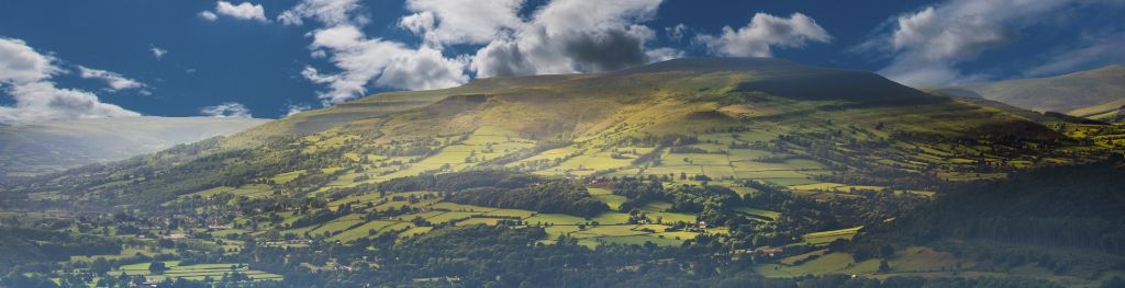
Mountain weather
Bannau Brycheiniog / Brecon Beacons Mountain weather forecast table
Confidence
High overall for bright but showery theme, though lower for location and intensity of heavy and thundery showers and extent of overnight low cloud.
Mountain weather hazards
Hazards apply at or above 300m, reflecting the more severe conditions which can occur at altitude.
 Poor Visibility
Poor visibility presents challenging route finding conditions. Visibility could be significantly less than 50 metres in all directions with few or no visual references, especially on featureless moors or plateaux. Distances become hard to judge and cliff or cornice edges can be difficult to recognise. These conditions require good navigational skills. There is a risk of white-out conditions when mist or fog is combined with extensive snow cover.
Thunderstorms
Lightning is a significant mountain hazard which can result in serious injury or death. Mountain terrain often leaves one highly exposed to lightning strikes. Hail may give unpleasant conditions with torrential rain and localised flash flooding also possible, mainly in Summer months.
Strong Sunlight
Harmful UV levels from sunlight increase with altitude giving a greater risk of sunburn and eye damage, even on some overcast days. On breezy days, the cooling effect of wind on exposed skin may disguise any feeling of sunburn until it is too late. If there is snow cover, glare increases the effect of UV rays especially on the eyes. It is advisable to wear sun block, protective clothing such as a long-sleeved top and hat and have good quality eye protection.
Heavy Persistent Rain
Heavy and persistent rain can lead to drenched clothing and footwear with waterproofs often becoming soaked through, especially if accompanied by strong winds. This can lead to significant loss of body heat and an increased likelihood of hypothermia. Terrain may turn increasingly boggy underfoot while streams can flood and become impassable. There may also be a risk of flooding in valleys or glens. If there is snow cover, a heightened avalanche hazard is possible and avalanche reports should be consulted where available.
Mountain weather forecast
Brightening up, but heavy, thundery showers possible by the afternoon.
| 06:00 | 09:00 | 12:00 | 15:00 | 18:00 | 21:00 | |
|---|---|---|---|---|---|---|
Weather (at 600m) |
|
|
|
|
|
|
Chance of precipitation (at 600m) |
10% | 20% | 60% | 60% | 40% | 30% |
Wind direction and speed (mph)
Altitude above mean sea level
| 06:00 | 09:00 | 12:00 | 15:00 | 18:00 | 21:00 | |
|---|---|---|---|---|---|---|
| 600m |
NE
8
|
NE
9
|
NE
10
|
NE
9
|
NE
8
|
NE
9
|
| 300m |
E
1
|
NE
4
|
NE
6
|
NE
5
|
NE
4
|
NE
4
|
| Valley |
W
1
|
E
3
|
E
4
|
NE
4
|
N
4
|
NE
4
|
Wind gust (mph)
Altitude above mean sea level
| 06:00 | 09:00 | 12:00 | 15:00 | 18:00 | 21:00 | |
|---|---|---|---|---|---|---|
| 600m | 11 | 12 | 15 | 14 | 11 | 13 |
| 300m | 6 | 8 | 11 | 11 | 10 | 10 |
| Valley | 4 | 6 | 9 | 10 | 11 | 10 |
Altitude above mean sea level
| 06:00 | 09:00 | 12:00 | 15:00 | 18:00 | 21:00 | |
|---|---|---|---|---|---|---|
| 600m |
11°
|
12°
|
14°
|
15°
|
14°
|
12°
|
| 300m |
12°
|
15°
|
17°
|
18°
|
16°
|
13°
|
| Valley |
12°
|
16°
|
18°
|
18°
|
17°
|
14°
|
| Freezing Level |
2,300m
|
2,300m
|
2,400m
|
2,500m
|
2,600m
|
2,500m
|
Altitude above mean sea level
| 06:00 | 09:00 | 12:00 | 15:00 | 18:00 | 21:00 | |
|---|---|---|---|---|---|---|
| 600m |
9°
|
11°
|
13°
|
14°
|
13°
|
11°
|
| 300m |
12°
|
15°
|
16°
|
17°
|
16°
|
13°
|
| Valley |
12°
|
16°
|
18°
|
18°
|
17°
|
14°
|
Additional weather information
Meteorologist's view
Sudden deteriorations in heavy, thundery showers leading to surface runoff. Strong sunshine at this time of the year so ensure you have sun protection with high UV levels expected.
Weather
Early low cloud clearing to leave a day of sunny spells and showers. Perhaps fewer sunny intervals than on Friday with a higher risk of heavy showers. These could be slow-moving and locally thundery with hail possible before gradually easing through the evening.
Chance of cloud-free hill tops
60% becoming 90% by mid-morning. Falling to 60% during showers.
Low cloud and visibility
Areas of low cloud above 500m at first, mainly in the east, and some mist or fog also possible in the valleys. Cloud and fog lifting and clearing most summits by mid-morning. Generally good visibility thereafter but deteriorating to poor or very poor in any afternoon heavy showers or thunderstorms.
Recent rainfall
Location: Neuadd (Near Pontsticill)
Altitude: 353m
| Last 24 hours | Last 48 hours | Last 72 hours |
|---|---|---|
| 0mm | 5mm | 5mm |
Measurement date:
Rainfall data provided by Natural Resources Wales. The Met Office is not responsible for content provided by third parties and may remove this data without warning.
Mountain weather information
Weather
Dry start with low cloud affecting the east of the park, lifting and breaking to leave plenty of warm sunshine. The chance of an isolated heavy shower during the afternoon but mostly dry.
Chance of cloud-free hill tops
60% in the east at first, otherwise 95%
Maximum wind speed expected
Northeasterly 20 mph.
Temperature
- At 600m Plus 08 Celsius rising to plus 15 Celsius.
- Valley Plus 13 Celsius rising to plus 20 Celsius.
- Freezing level Above summits.
Low cloud and visibility
Areas of low cloud around 400-500 m at first in the east with some mist or fog also possible in the valleys. Cloud and fog lifting and breaking most summits by mid-morning. Generally very good visibility with clear views of distant hills.
Mountain weather information
Mon 20 May
Sunrise:
Sunset:
Morning mist and fog quickly clearing, then dry with sunny spells. Light northeasterly winds. High UV levels.
Tue 21 May
Sunrise:
Sunset:
Turning more changeable but some uncertainty in the details. Showers developing with a chance of longer spells of rain later. Winds remaining light from variable directions.
Wed 22 May
Sunrise:
Sunset:
Largely dry with bright or sunny spells and the chance of showers though detail remains uncertain. Light to moderate northwesterly.
Updated at:
Summit specific forecast
Mountain summit forecast map
Loading map…
Key
The Bannau Brycheiniog / Brecon Beacons is a mountain range in South Wales comprising six main peaks, with the highest peak, Pen y Fan, standing at 886 metres.