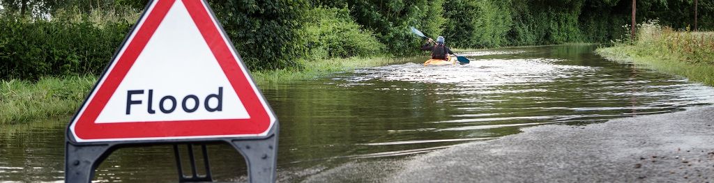
Floods and flooding
Floods can be devastating — costing the lives of people and animals, as well as destroying crops, homes and businesses.
The east coast of England and the Netherlands have always been prone to flooding as storms track off the North Sea, bringing water surges and huge waves with them.
The devastation floods can cause
About 10,000 people died in a single flood in the Netherlands in 1421. Water from the North Sea flooded inland and swept through 72 villages, leaving a trail of destruction.
Further severe floods struck the region in 1570, 1825, 1894, 1916 and 1953. All of them occurred despite the area having extensive flood defence systems - sometimes nature's power is just too strong. These defences are vital for the Netherlands, where 40% of the country is below sea level.
Along the coast of eastern England there have also been many failures of coastal defences. Even London has seen disastrous flooding. In January 1928 a northerly gale raised water levels in the Thames Estuary. Water overtopped embankments and low-lying riverside districts were flooded in the city, drowning 14 people.
Flooding caused by surges
Tides affect sea levels, but sometimes the weather will also play its part in raising or lowering water height. This is called a surge and is measured by how much higher or lower the sea is than expected on any given tide. A surge is positive if the water level is higher than the expected tide, and negative if lower. Positive surges happen when water is driven towards a coast by wind and negative when it is driven away.
While wind is the main cause of surges, barometric pressure - the pressure in the air - also plays its part. When pressure decreases by one millibar, sea level rises by one centimetre. Therefore, a deep depression with a central pressure of about 960 mb causes sea level to rise half a metre above the level it would have been had pressure been about average (1013 mb). When pressure is above average, sea level correspondingly falls.
When strong winds combine with very low pressure they can raise the sea level in eastern England by more than two metres. Fortunately such surges normally occur at mid-tide levels - so do not cause as much damage. If they were to coincide with high tide it could be a very different story.
Surges travel counter-clockwise around the North Sea - first southwards down the western half of the sea, then northwards up the western side. They take about 24 hours to progress most of the way around.
Waves, generated by strong winds, are another flooding factor. While coastal defences are designed to deal with high tides, these defences can be badly damaged by a pounding from large and powerful waves. Some waves are so large that they simply break over coastal defences, sending water flooding in and undermining sea-wall foundations until they collapse.
The surge of 1953
More than 2,000 people drowned at the end of January 1953 when the greatest surge on record, happened in the North Sea. The surge measured nearly three metres in Norfolk and even more in the Netherlands. About 160,000 hectares of eastern England were flooded and 307 people died. A further 200,000 hectares were flooded in the Netherlands, and 1,800 people drowned.
The storm that caused this disastrous surge was among the worst the UK had experienced.
- Hurricane force winds blew down more trees in Scotland than were normally felled in a year.
- A car ferry, the Princess Victoria, sank with the loss of 133 lives - but 41 of the passengers and crew survived.
- From Yorkshire to the Thames Estuary, coastal defences were pounded by the sea and gave way under the onslaught.
As darkness fell on 31 January, coastal areas of Lincolnshire bore the brunt of the storm.
- Sand was scoured from beaches and sand hills
- Timber-piled dunes were breached
- Concrete sea walls crumbled
- The promenades of Mablethorpe and Sutton-on-Sea were wrecked
- Salt water from the North Sea flooded agricultural land
Later that evening, embankments around The Wash were overtopped and people drowned in northern Norfolk. At Wells-next-the-Sea, a 160-ton vessel was left washed up on the quay after waves pounded it ashore.
In 1953, because many telephone lines in Lincolnshire and Norfolk were brought down by the wind, virtually no warnings of the storm's severity were passed to counties farther south until it was too late. Suffolk and Essex suffered most.
By midnight, Felixstowe, Harwich and Maldon had been flooded, with much loss of life. Soon after midnight, the sea walls on Canvey Island collapsed and 58 people died. At Jaywick in Clacton, the sea rose a metre in 15 minutes and 35 people drowned.
The surge travelled on. From Tilbury to London's docklands, oil refineries, factories, cement works, gasworks and electricity generating stations were flooded and brought to a standstill.
In London's East End, 100 metres of sea wall collapsed, causing more than 1,000 houses to be inundated and 640,000 cubic metres of Thames water to flow into the streets of West Ham. The BP oil refinery on the Isle of Grain was flooded, and so was the Naval Dockyard at Sheerness.
Download the weather summary for 31 January 1953 (PDF, 98 kB)
Storm tide warnings
The disastrous surge of 1953 was predicted successfully by the Met Office and the Dutch Surge Warning Service. Forecasts of dangerously high water levels were issued several hours before they happened. An inquiry into the disaster recommended, however, that a flood warning organisation should be set up. This led to the setting up of the Storm Tide Warning Service.
After weather and surge models were developed, the Met Office was then able to provide national forecasts and warnings. In 1996, the Environment Agency took over the role of issuing flood warnings to the general public. In January 2005, responsibility for the Storm Tide Warning Service passed from Defra to the Environment Agency as the principal operational user. From 1 April 2009, the service was renamed ‘UK Coastal Monitoring and Forecasting’ (UKCMF) to more accurately reflect the service carried out and in 2018 it was again renamed to become the current ‘UK Coastal Flood Forecasting’ (UKCFF) Service. The science and observations network behind this service are now provided by; Met Office, Environment Agency, Natural Resources Wales, Proudman Oceanographic Laboratory, Centre for Environment, Fisheries and Aquaculture Science, and the British Oceanographic Data Centre. This unique collaboration of professional expertise combines to provide a comprehensive United Kingdom wide service for coastal surge and wave forecasting.
The Flood Forecasting Centre currently provides surge and offshore wave forecasts to the Environment Agency and Natural Resources Wales, whilst the Scottish Flood Forecasting Service provide the same for the Scottish Environment Protection Agency and the Northern Ireland Rivers Agency. Observations, tide forecasts and Met Office weather forecasts are used to drive surge and wave models which are the basis for this service. Once potential impacts from the coastal conditions are agreed by the above partners, through discussions both locally and nationally, the impact forecasts are also shared at government levels and with Category 1 and 2 Responders to help plan for, prepare and respond to any large-scale events, such as in 1953. Staff in the devolved bodies also use the broader scale forecast information to derive forecasts of coastal conditions at a more local level and to provide local advice, alerts and warnings.
What happened to cause this storm?
In the early hours of 30 January 1953, the storm that was to cause the havoc was a normal looking depression with a central pressure of 996 mb, located a little to the south of Iceland. While it looked normal, during the day the pressure rapidly deepened and headed eastwards.
By 6 p.m. on 30 January, it was near the Faeroes, its central pressure 980 mb. By 12p.m. (midday) on 31 January, it was centred over the North Sea between Aberdeenshire and southern Norway and its central pressure was 968 mb.
Meanwhile, a strong ridge of high pressure had built up over the Atlantic Ocean south of Iceland, the pressure within being more than 1030 mb. In the steep pressure gradient that now existed on the western flanks of the depression, there was a very strong flow from a northerly point. Winds of Force 10 were reported from exposed parts of Scotland and northern England. The depression turned south-east and deepened to 966 mb before filling. By midday on 1 February, it lay over northern Germany, its central pressure 984 mb.
All day on 31 January, Force 10/11 winds blew from the north over western parts of the North Sea. They drove water south, and generated waves more than eight metres high. The surge originated in the waters off the north-east coast of Scotland and was amplified as it travelled first southwards along the eastern coasts of Scotland and England, and then north-east along the coast of the Netherlands. It reached Ijmuiden in the Netherlands around 4 a.m. on 1 February.
Surges still causing damage
Since 1953, there have been other large surges in the North Sea. Among them one, on 12 January 1978, caused extensive flooding and damage along the east coast of England from Humberside to Kent. London came close to disaster, escaping flooding by only 0.5 m, and the enormous steel and rubber floodgates designed to protect the major London docks were closed for the first time since their completion in 1972.
Another large surge event occurred in the North Sea on the 5 and 6 December 2013 which brought the highest tides since the 1953 event (and highest ever recorded in some places). Spring tides coincided with northerly gales bringing large waves (from 3 to 5m) on many east and west coasts of the UK along with a large surge (generally around 2m higher than astronomical tide levels) down the North Sea coast.
The possibility of this 2013 event was first indicated by the Flood Forecasting Centre to emergency responders more than five days ahead, with more certain forecasts of a flood given with three days lead time (compared to a few hours’ notice in 1953). This enabled mitigating actions to be taken, emergency services to be readied, flood gates to be closed, Environment Agency and Natural Resources Wales staff to be ready and flood warnings to be issued. Although around 1,400 properties were still flooded on the east coast of England and around 160 in Wales there were no flood related deaths and hundreds of thousands of properties were successfully protected, a great improvement in national capability when compared with the 307 deaths and around 24,000 properties flooded in 1953.
Flood defences
Concern over rising sea levels, and the potential catastrophe if London were to be flooded, led the Government to build the Thames Flood Barrier. Based at Woolwich and finished in 1982, it is the world's second largest movable flood barrier. It is designed to allow ships to pass in normal times, but flood gates come down to stop storm surges in times of need. The barriers are closed about four times a year, on average.
Over the years, coastal defences in the Netherlands and eastern England have been raised and strengthened continually to protect against storm surges. Our coasts and estuaries are safer now than they have ever been. Nevertheless, surges remain a threat, as complete protection against the most extreme can never be guaranteed.
The likelihood of being taken by surprise is now much lower, because weather and surge forecasting systems have improved greatly in recent years, and the UK Coastal Flood Forecasting Service has established clear and effective procedures for alerting the authorities when danger threatens.