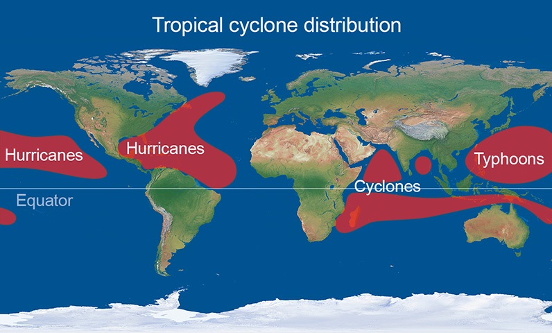
Location of tropical cyclones
Tropical cyclones occur around the equator at 5 ° - 30 °, but also have varying names depending upon where in the world they form.
Tropical cyclones initially move westward (owing to easterly winds) and slightly towards the poles. Many tropical cyclones eventually drift far enough from the equator to move into areas dominated by westerly winds (found in the middle latitudes). These winds tend to reverse the direction of the tropical cyclone to an eastward path. As the tropical cyclone moves polewards it picks up forward speed and may reach 30 mph or more. An average tropical cyclone can travel about 300 to 400 miles a day, or about 3,000 miles before it dies out.
In the northern hemisphere, tropical cyclones occur between June and November peaking in September. In the southern hemisphere, the season lasts from November to April but storms remain less common here than in the northern hemisphere. More than one tropical storm can occur in the same ocean and region at once. Due to the coriolis effect, the storm's surface wind will be deflected to the right in the northern hemisphere to rotate counter-clockwise, and to the left to rotate clockwise in the southern hemisphere.
Tropical cyclones which occur in the Atlantic region and affect the Caribbean and USA usually comprise less than 15% of global tropical cyclone activity. Tropical cyclones also occur in various parts of the Pacific Ocean, and can affect coastal regions of Mexico, southeast Asia, northeast Australia and the south Pacific islands. Those that form in the Indian Ocean can affect India, Bangladesh, northwest Australia, some parts of east Africa and Indian Ocean islands such as Mauritius and Madagascar.
When the average wind speed of the storm reaches 74 mph, the tropical cyclone is classified by various different names globally despite resulting from the same process:
- Hurricanes - Atlantic and North-East Pacific Oceans
- Typhoon/Super typhoon - North-West Pacific Ocean
- Severe tropical cyclone - South-West Pacific and South- East Indian Ocean
- Severe cyclonic storm - North Indian Ocean
- Tropical cyclone - South-West Indian Ocean
Tropical cyclones are most frequently seen to make landfall and impact in the USA and Asia. There are seven basins in which tropical storms are seen to form regularly at different times throughout the year, these are sometimes referred to as seasons.
- Atlantic basin: June - November
- North- East Pacific basin: Late May/early June - Late October/early November
- North- West Pacific basin: Occur all year round. Main season - July- November
- North Indian basin: April - December
- South- West Indian basin: Late October/early November - May
- South- East Indian/Australian basin: Late October/early November - May
- Australian/South- West Pacific basin: Late October/early November - May
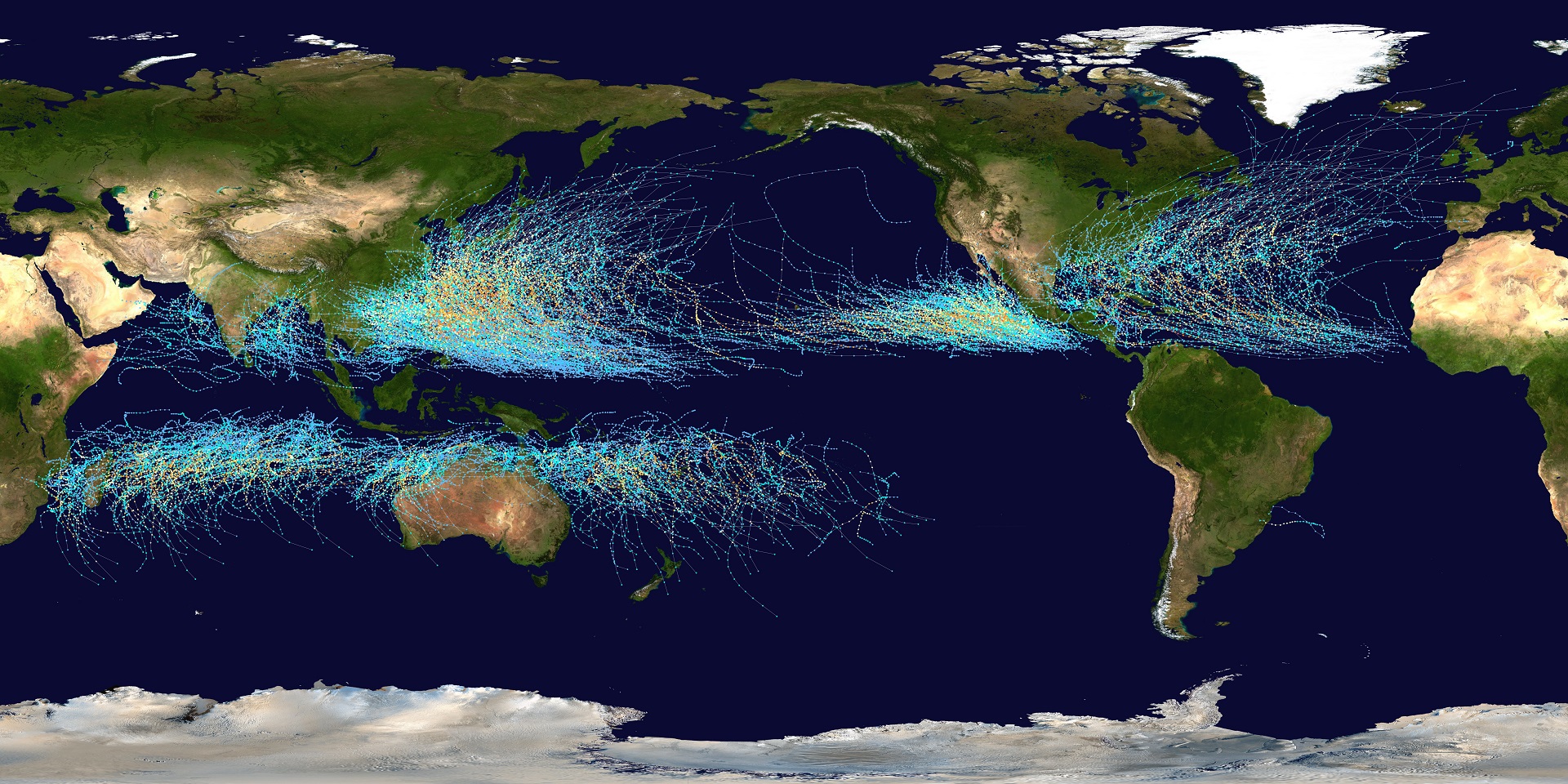
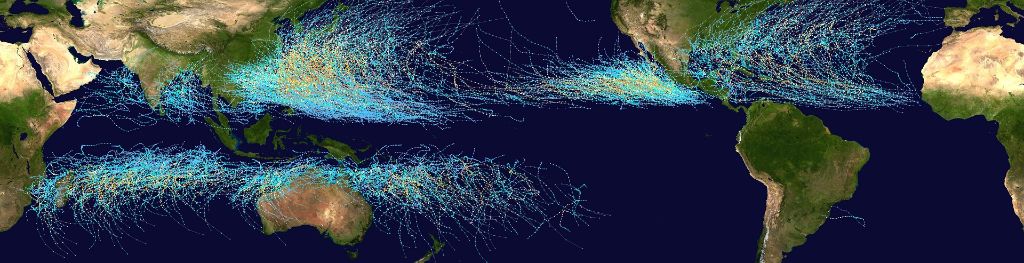
Observing tropical cyclone tracks
The image below, produced by Nasa, shows the actual observed tracks of tropical cyclones over 20 years from 1985 to 2005 and clearly shows their formation in the zones displayed in the previous diagram: