Sudden Stratospheric Warming
Sudden stratospheric warming describes an event when rapid warming occurs high up in the stratosphere. However, it can lead to changes in our weather at the surface.
What is a Sudden Stratospheric Warming?
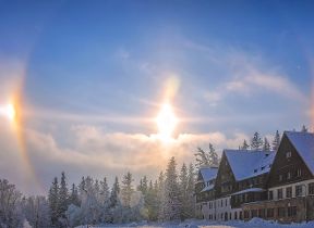
In recent years some extreme cold, winter snow events have all been connected to the surface effects of sudden stratospheric warmings, such as those in 2009-10, 2013, and ‘the beast from the east’ in 2018. You may be asking why it is called a warming then, if it lead to cold conditions?
The term sudden stratospheric warming refers to what is observed in the stratosphere:- a rapid warming (up to about 50 °C in just a couple of days), between 10 km and 50 km above the earth’s surface. This is so high up that we don’t feel the ‘warming’ ourselves. However, usually a few weeks later, we can start to see knock-on effects on the jet stream, which in turn effects our weather lower down (in the troposphere).
However, the stratospheric sudden warming doesn’t happen every year, and it doesn’t always affect our weather when it does.
How does a sudden stratospheric warming occur?
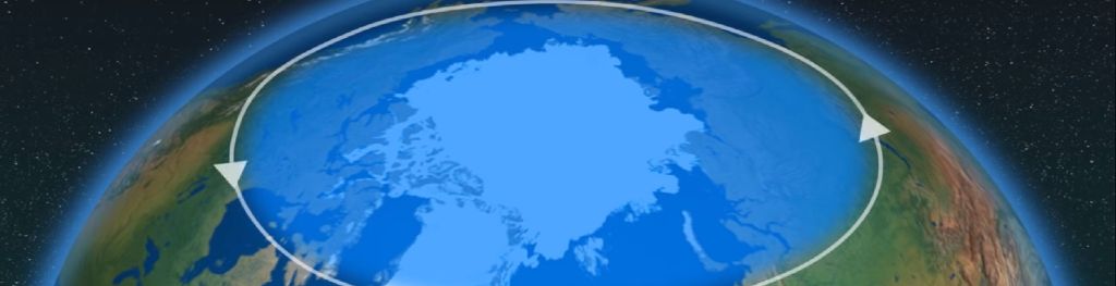
Every year in winter, strong westerly winds circle around the pole high up in the stratosphere. This is called the stratospheric polar vortex and it circulates around cold air high over the Arctic.
In some years, the winds in the polar vortex temporarily weaken, or even reverse to flow from east to west. The cold air then descends very rapidly in the polar vortex and this causes the temperature in the stratosphere to rise very rapidly, as much as 50°C over only a few days; hence the term sudden stratospheric warming.
As the cold air from high up in the stratosphere disperses, it can affect the shape of the jet stream as the cold air sinks from the stratosphere into the troposphere. It is this change in the jet stream that causes our weather to change.
How does a Sudden Stratospheric Warming affect our weather?
The stratospheric sudden warming can sometimes cause the jet stream to ‘snake’ more, and this tends to create a large area of blocking high pressure. Typically this will form over the North Atlantic and Scandinavia. This means that northern Europe, including the UK is likely to get a long spell of dry, cold weather, whereas southern Europe will tend to be more mild, wet and windy. On the boundary of these areas, cold easterly winds develop and in some cases the drop in temperatures leads to snow, which is what happened in early 2018.
Can we predict these events in advance?
Currently we can reliably predict individual sudden stratospheric warmings about a week in advance, and we can detect them early on with satellite and other observations. This means we have some time to see how they develop and may impact our future weather. The sudden stratospheric warming usually takes a few weeks to influence our weather at the surface, or into the next month.
Jet streams high up in our atmosphere, in both the northern and southern hemisphere, circumnavigate the Earth from west to east. One of these, the Polar Night Jet, circles the Arctic.
Sometimes the usual westerly flow can be disrupted by natural weather patterns or disturbances in the lower part of the atmosphere, such as a large area of high pressure in the northern hemisphere. This causes the Polar Jet to wobble and these wobbles, or waves, break just like waves on the beach. When they break they can be strong enough to weaken or even reverse the westerly winds and swing them to easterlies. As this happens, air in the stratosphere starts to collapse in to the polar cap and compress. As it compresses it warms, hence the stratospheric warming.
How does it move down through the atmosphere?
As it turns out, waves can only move around the Earth's atmosphere in westerly winds. Fluctuations in our weather send waves up through the atmosphere to the easterly winds in the stratosphere, where they travel no further, and instead break and reinforce the easterly winds, bringing the easterlies lower. This pattern continues until the easterlies have moved down to the troposphere - the lowest part of the atmosphere where our weather is.