
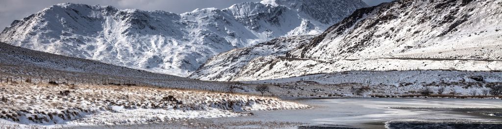
Mountain weather
Eryri / Snowdonia Mountain weather forecast table
Confidence
High for the generally fine conditions Saturday, but cloudier with drizzle Sunday and Monday. Low confidence on westward extent of precipitation however.
Mountain weather hazards
Hazards apply at or above 300m, reflecting the more severe conditions which can occur at altitude.
 Strong Sunlight
Harmful UV levels from sunlight increase with altitude giving a greater risk of sunburn and eye damage, even on some overcast days. On breezy days, the cooling effect of wind on exposed skin may disguise any feeling of sunburn until it is too late. If there is snow cover, glare increases the effect of UV rays especially on the eyes. It is advisable to wear sun block, protective clothing such as a long-sleeved top and hat and have good quality eye protection.
Severe Chill Effect
Wind significantly lowers the ‘feels-like’ temperature relative to the actual temperature, with even moderate winds significantly adding to the chilling effect. Strong winds can result in a severe and debilitating wind chill many degrees below the actual temperature. This effect will be enhanced in rain or wet snow. Without protection, prolonged exposure could result in frost nip or frostbite on exposed parts of the body and/or hypothermia.
Mountain weather forecast
Fine, with long spells of sunshine and light winds.
| 06:00 | 09:00 | 12:00 | 15:00 | 18:00 | 21:00 | |
|---|---|---|---|---|---|---|
Weather (at 800m) |
|
|
|
|
|
|
Chance of precipitation (at 800m) |
<05% | 00% | 00% | <05% | <05% | 00% |
Wind direction and speed (mph)
Altitude above mean sea level
| 06:00 | 09:00 | 12:00 | 15:00 | 18:00 | 21:00 | |
|---|---|---|---|---|---|---|
| 900m |
NE
10
|
NW
8
|
N
10
|
N
11
|
N
10
|
NE
12
|
| 600m |
E
7
|
NW
7
|
N
9
|
N
10
|
N
9
|
NE
7
|
| 300m |
E
4
|
NW
4
|
N
8
|
N
9
|
N
6
|
N
3
|
| Valley |
SE
4
|
N
5
|
N
8
|
N
9
|
N
6
|
N
2
|
Wind gust (mph)
Altitude above mean sea level
| 06:00 | 09:00 | 12:00 | 15:00 | 18:00 | 21:00 | |
|---|---|---|---|---|---|---|
| 900m | 12 | 11 | 15 | 16 | 14 | 15 |
| 600m | 9 | 10 | 14 | 16 | 13 | 10 |
| 300m | 6 | 8 | 13 | 15 | 11 | 7 |
| Valley | 7 | 8 | 13 | 15 | 10 | 6 |
Altitude above mean sea level
| 06:00 | 09:00 | 12:00 | 15:00 | 18:00 | 21:00 | |
|---|---|---|---|---|---|---|
| 900m |
1°
|
2°
|
4°
|
4°
|
3°
|
2°
|
| 600m |
3°
|
5°
|
6°
|
6°
|
6°
|
4°
|
| 300m |
5°
|
8°
|
9°
|
9°
|
8°
|
5°
|
| Valley |
6°
|
9°
|
10°
|
10°
|
9°
|
7°
|
| Freezing Level |
800m
|
900m
|
1,000m
|
1,000m
|
1,000m
|
1,100m
|
Altitude above mean sea level
| 06:00 | 09:00 | 12:00 | 15:00 | 18:00 | 21:00 | |
|---|---|---|---|---|---|---|
| 900m |
-3°
|
-1°
|
0°
|
0°
|
-1°
|
-2°
|
| 600m |
0°
|
2°
|
3°
|
3°
|
2°
|
1°
|
| 300m |
3°
|
6°
|
7°
|
7°
|
6°
|
4°
|
| Valley |
4°
|
8°
|
8°
|
8°
|
8°
|
6°
|
Additional weather information
Meteorologist's view
Cold start in valleys and staying rather chilly on the tops, although this reduced somewhat by the long sunny periods. Warm layers recommended, especially for those stopping to enjoy the widespread views from the tops. Appropriate sun protection will be needed.
Weather
Dry, with any early cloud easing away to leave long sunny periods with light winds. Patchy cloud will develop this afternoon, but staying well above summit level. Feeling chilly, especially on the tops.
Chance of cloud-free hill tops
90% this morning, otherwise near 100%
Low cloud and visibility
The odd patch of cloud on hills above 600m at first, but otherwise any cloud remaining above summit level. Good to Very Good visibility today, with wide-ranging views of distant summits.
Ground conditions
Please see - https://yrwyddfa.live/
Mountain weather information
Weather
A cloudier day on Sunday, although cloud remaining above the tops until late afternoon. Also dry until this time, but then an increasing chance of light rain or drizzle arriving.
Chance of cloud-free hill tops
Near 100% until late afternoon, then falling to be 40% by midnight.
Maximum wind speed expected
Northeast 10mph gusting 20-25mph
Temperature
- At 800m Plus 1 Celsius rising to Plus 7 Celsius
- Valley Plus 5 Celsius rising to Plus 13 Celsius
- Freezing level Above summits
Low cloud and visibility
Cloud above summits until late afternoon, then gradually descending and obscuring some tops above 600m by dusk. Good visibility for much of the day outside of this cloud, but falling to Moderate or Poor in any light rain or drizzle later.
Mountain weather information
Mon 22 Apr
Sunrise:
Sunset:
Dull start with further outbreaks of rain or drizzle, mostly light and focused across eastern hills, clearing to brighter spells later. Freezing level above summits.
Tue 23 Apr
Sunrise:
Sunset:
Rather cloudy, with summits often obscured and a chance of showers. Best chances of clearer hills and routes in the west. Freezing level above summits.
Wed 24 Apr
Sunrise:
Sunset:
Likely dry, with variable cloud and some brighter spells. Feeling rather cool in the brisk breeze however, with freezing level falling to around 800m for a time.
Updated at:
Summit specific forecast
Mountain summit forecast map
Loading map…
Key
The Eryri (Snowdonia) mountains are made up of 90 mountain peaks including the tallest mountain in Wales, Yr Wyddfa (Snowdon), standing at 1,085 metres.