
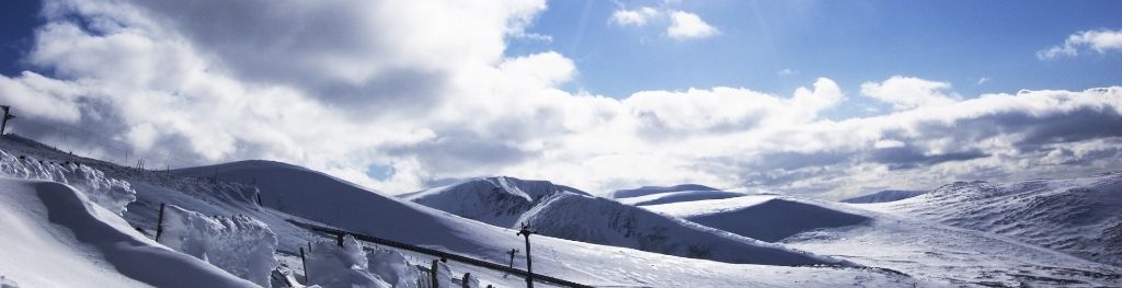
Mountain weather
South Grampian and Southeast Highlands Mountain weather forecast table
Confidence
High confidence for mainly settled conditions with a few showers until Saturday. High confidence for a transition to unsettled weather over the weekend, but low confidence in the day to day details.
This evening forecast
Predominantly dry but cloudy. Perhaps a few light showers in the east, falling as snow above 400m. Feeling very cold in fresh northerly winds.
Mountain weather hazards
Hazards apply at or above 300m, reflecting the more severe conditions which can occur at altitude.
 Severe Chill Effect
Wind significantly lowers the ‘feels-like’ temperature relative to the actual temperature, with even moderate winds significantly adding to the chilling effect. Strong winds can result in a severe and debilitating wind chill many degrees below the actual temperature. This effect will be enhanced in rain or wet snow. Without protection, prolonged exposure could result in frost nip or frostbite on exposed parts of the body and/or hypothermia.
Strong Sunlight
Harmful UV levels from sunlight increase with altitude giving a greater risk of sunburn and eye damage, even on some overcast days. On breezy days, the cooling effect of wind on exposed skin may disguise any feeling of sunburn until it is too late. If there is snow cover, glare increases the effect of UV rays especially on the eyes. It is advisable to wear sun block, protective clothing such as a long-sleeved top and hat and have good quality eye protection.
Poor Visibility
Poor visibility presents challenging route finding conditions. Visibility could be significantly less than 50 metres in all directions with few or no visual references, especially on featureless moors or plateaux. Distances become hard to judge and cliff or cornice edges can be difficult to recognise. These conditions require good navigational skills. There is a risk of white-out conditions when mist or fog is combined with extensive snow cover.

Mountain weather forecast
Dry but somewhat cloudy through the day, some sunny spells in the afternoon. Heavier showers possible overnight. Feeling cold in fresh northerly winds.
| 00:00 | 03:00 | 06:00 | 09:00 | 12:00 | 15:00 | 18:00 | 21:00 | |
|---|---|---|---|---|---|---|---|---|
Weather (at 800m) |
|
|
|
|
|
|
|
|
Chance of precipitation (at 800m) |
10% | <05% | <05% | 00% | 00% | 00% | 00% | <05% |
Wind direction and speed (mph)
Altitude above mean sea level
| 00:00 | 03:00 | 06:00 | 09:00 | 12:00 | 15:00 | 18:00 | 21:00 | |
|---|---|---|---|---|---|---|---|---|
| 1100m |
N
23
|
N
22
|
N
22
|
N
15
|
N
12
|
NW
15
|
NW
16
|
NW
19
|
| 900m |
N
17
|
N
15
|
N
15
|
N
15
|
N
11
|
NW
13
|
NW
14
|
NW
14
|
| 600m |
N
8
|
N
7
|
N
8
|
N
10
|
N
9
|
NW
10
|
NW
10
|
NW
9
|
| 300m |
N
7
|
N
6
|
N
5
|
N
9
|
N
8
|
NW
9
|
N
7
|
NW
5
|
| Glen |
N
4
|
NW
4
|
NW
4
|
N
9
|
N
8
|
N
8
|
N
7
|
NW
4
|
Wind gust (mph)
Altitude above mean sea level
| 00:00 | 03:00 | 06:00 | 09:00 | 12:00 | 15:00 | 18:00 | 21:00 | |
|---|---|---|---|---|---|---|---|---|
| 1100m | 30 | 28 | 28 | 21 | 18 | 21 | 23 | 25 |
| 900m | 24 | 21 | 21 | 21 | 17 | 20 | 20 | 20 |
| 600m | 16 | 15 | 15 | 17 | 15 | 18 | 18 | 16 |
| 300m | 17 | 16 | 14 | 18 | 16 | 18 | 15 | 13 |
| Glen | 13 | 11 | 11 | 17 | 16 | 17 | 15 | 10 |
Altitude above mean sea level
| 00:00 | 03:00 | 06:00 | 09:00 | 12:00 | 15:00 | 18:00 | 21:00 | |
|---|---|---|---|---|---|---|---|---|
| 1100m |
-5°
|
-6°
|
-6°
|
-4°
|
-2°
|
0°
|
0°
|
-2°
|
| 900m |
-3°
|
-4°
|
-4°
|
-2°
|
1°
|
3°
|
2°
|
0°
|
| 600m |
0°
|
-1°
|
-1°
|
1°
|
4°
|
6°
|
5°
|
2°
|
| 300m |
2°
|
1°
|
1°
|
5°
|
8°
|
9°
|
7°
|
4°
|
| Glen |
2°
|
2°
|
2°
|
6°
|
8°
|
10°
|
8°
|
5°
|
| Freezing Level |
400m
|
300m
|
300m
|
400m
|
600m
|
700m
|
800m
|
700m
|
Altitude above mean sea level
| 00:00 | 03:00 | 06:00 | 09:00 | 12:00 | 15:00 | 18:00 | 21:00 | |
|---|---|---|---|---|---|---|---|---|
| 1100m |
-14°
|
-15°
|
-14°
|
-11°
|
-7°
|
-5°
|
-6°
|
-9°
|
| 900m |
-10°
|
-11°
|
-10°
|
-8°
|
-4°
|
-2°
|
-2°
|
-5°
|
| 600m |
-4°
|
-5°
|
-5°
|
-3°
|
0°
|
2°
|
2°
|
-1°
|
| 300m |
-1°
|
-2°
|
-1°
|
2°
|
5°
|
7°
|
5°
|
2°
|
| Glen |
0°
|
0°
|
1°
|
3°
|
6°
|
8°
|
6°
|
3°
|
Additional weather information
Met Office Aberdeen meteorologist's view
Feeling very cold in brisk northerly winds. A chance of strong lee gusts in the morning, gradually easing off through the day as inversion lifts and weakens. Sunny spells, particularly in the afternoon will warrant suitable protection.
Weather
Cloudy start with perhaps a few patchy outbreaks of light rain in the Aberdeenshire Hills, falling as snow above 400m. Turning clearer and brighter through the morning, with some sunny spells developing in the afternoon, especially over Perthshire. Turning cloudier again after sunset, with perhaps a few heavier showers overnight.
Chance of cloud-free hill tops
Generally 90%, but falling to 70% before sunrise and after sunset.
Low cloud and visibility
Somewhat cloudy in the north but bases generally above 900-1000m in the morning. Cloud generally lifting and breaking through the day with some excellent visibilities. Bases falling to 700m in the north again in the evening with reduced visibility in any showers.
Mountain weather information
Weather
Sunny spells and a few scattered showers through the day, falling as snow above 400m. Feeling very cold in fresh northerly winds.
Chance of cloud-free hill tops
60%
Maximum wind speed expected
North or northwesterly 25-30mph, gusting 35-40mph, easing easterly through the afternoon to 15mph.
Temperature
- At 800m Minus 2 to plus 1 Celsius.
- Glen Plus 3 Celsius to plus 7 Celsius.
- Freezing level 600-800m.
Low cloud and visibility
Cloud bases generally above 900-1000m, but occasionally falling to 600m in showers with associated moderate to poor visibility.
Mountain weather information
Fri 26 Apr
Sunrise:
Sunset:
Mostly dry but cloudy with a few showers. Freezing level 600-800m.
Sat 27 Apr
Sunrise:
Sunset:
Band of rain preceded by summit snow pushes north through the morning. Freezing levels steadily rise to 1200-1400m.
Sun 28 Apr
Sunrise:
Sunset:
Showers or longer spells of rain push north. Freezing levels rise above summits. Strengthening easterly winds.
Updated at:
Summit specific forecast
Mountain summit forecast map
Loading map…
Key
Including South and East Cairngorms National Park, Aberdeenshire and Angus Hills, Ben Vrackie, Ben Lawers, Loch Tay and Ochils
For snow and avalanche hazard forecasts please visit Scottish Avalanche Information Service