
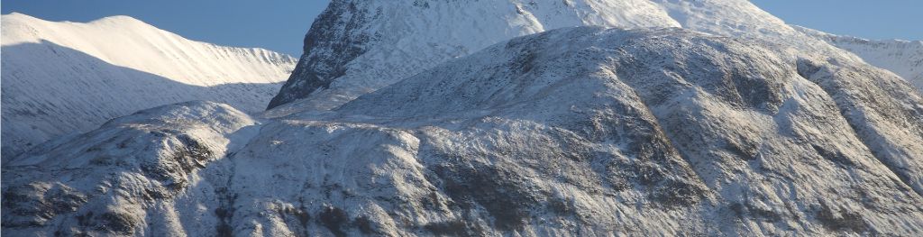
Mountain weather
Northwest Highlands Mountain weather forecast table
Confidence
High for Saturday. Moderate for details of cloud and rain amounts from Sunday.
This evening forecast
Dry with mostly clear skies. Moderate northerly winds across the tops. Freezing level 700m, lowering to 400m in the far north.
Mountain weather hazards
Hazards apply at or above 300m, reflecting the more severe conditions which can occur at altitude.
 Poor Visibility
Poor visibility presents challenging route finding conditions. Visibility could be significantly less than 50 metres in all directions with few or no visual references, especially on featureless moors or plateaux. Distances become hard to judge and cliff or cornice edges can be difficult to recognise. These conditions require good navigational skills. There is a risk of white-out conditions when mist or fog is combined with extensive snow cover.

Mountain weather forecast
A dry increasingly cloudy morning. Rain spreading east in the afternoon.
| 00:00 | 03:00 | 06:00 | 09:00 | 12:00 | 15:00 | 18:00 | 21:00 | |
|---|---|---|---|---|---|---|---|---|
Weather (at 800m) |
|
|
|
|
|
|
|
|
Chance of precipitation (at 800m) |
00% | 00% | 00% | 00% | 00% | 10% | 40% | 60% |
Wind direction and speed (mph)
Altitude above mean sea level
| 00:00 | 03:00 | 06:00 | 09:00 | 12:00 | 15:00 | 18:00 | 21:00 | |
|---|---|---|---|---|---|---|---|---|
| 1000m |
NW
9
|
NW
9
|
SW
9
|
W
8
|
W
8
|
W
10
|
W
11
|
SW
10
|
| 900m |
NW
7
|
NW
8
|
SW
8
|
W
8
|
W
8
|
W
10
|
W
11
|
SW
9
|
| 600m |
S
4
|
NW
5
|
SW
5
|
W
6
|
W
7
|
W
8
|
W
7
|
SW
6
|
| 300m |
NW
1
|
NW
1
|
SW
1
|
W
2
|
W
3
|
W
4
|
W
4
|
W
2
|
| Glen |
NW
1
|
NW
1
|
NW
1
|
SW
1
|
W
2
|
W
4
|
W
3
|
W
2
|
Wind gust (mph)
Altitude above mean sea level
| 00:00 | 03:00 | 06:00 | 09:00 | 12:00 | 15:00 | 18:00 | 21:00 | |
|---|---|---|---|---|---|---|---|---|
| 1000m | 11 | 11 | 12 | 12 | 12 | 14 | 15 | 12 |
| 900m | 9 | 10 | 10 | 11 | 12 | 14 | 14 | 12 |
| 600m | 6 | 7 | 8 | 10 | 10 | 12 | 11 | 9 |
| 300m | 7 | 7 | 7 | 9 | 10 | 11 | 11 | 9 |
| Glen | 3 | 3 | 3 | 4 | 5 | 7 | 6 | 5 |
Altitude above mean sea level
| 00:00 | 03:00 | 06:00 | 09:00 | 12:00 | 15:00 | 18:00 | 21:00 | |
|---|---|---|---|---|---|---|---|---|
| 1000m |
-2°
|
-1°
|
-1°
|
0°
|
1°
|
2°
|
2°
|
2°
|
| 900m |
-1°
|
0°
|
0°
|
1°
|
2°
|
3°
|
3°
|
3°
|
| 600m |
2°
|
2°
|
2°
|
4°
|
5°
|
5°
|
5°
|
5°
|
| 300m |
3°
|
3°
|
4°
|
6°
|
8°
|
8°
|
8°
|
6°
|
| Glen |
6°
|
6°
|
6°
|
8°
|
10°
|
10°
|
10°
|
9°
|
| Freezing Level |
700m
|
700m
|
800m
|
900m
|
1,100m
|
1,500m
|
1,800m
|
2,100m
|
Altitude above mean sea level
| 00:00 | 03:00 | 06:00 | 09:00 | 12:00 | 15:00 | 18:00 | 21:00 | |
|---|---|---|---|---|---|---|---|---|
| 1000m |
-6°
|
-6°
|
-5°
|
-4°
|
-2°
|
-2°
|
-2°
|
-2°
|
| 900m |
-5°
|
-4°
|
-4°
|
-3°
|
-1°
|
-1°
|
0°
|
-1°
|
| 600m |
0°
|
0°
|
0°
|
1°
|
2°
|
3°
|
3°
|
3°
|
| 300m |
2°
|
2°
|
2°
|
5°
|
7°
|
7°
|
6°
|
6°
|
| Glen |
5°
|
5°
|
6°
|
8°
|
10°
|
10°
|
10°
|
8°
|
Additional weather information
Met Office Aberdeen meteorologist's view
Freezing level 1000m on the west coast, 400m in the east around dawn, then gradually rising across all of the area.
Weather
Dry with patchy high cloud through the early hours and the morning. Cloud thickening and lowering in the afternoon with patchy light rain in the far north. More persistent occasionally heavy rain spreads east late afternoon and evening, although Skye and Knoydart stay dry.
Chance of cloud-free hill tops
80%, falling to 20% in the north from late afternoon.
Low cloud and visibility
Generally very good visibility with cloud expected to be above the summits for much of the day, perhaps briefly affecting the higher summits near the west coast. Cloud lowering to 700m in the north from late afternoon, but likely to remain just above the summits in the south of the area.
Mountain weather information
Weather
Dry with some clear spells in the early hours. Low cloud spreads into the north soon after dawn with a little drizzle near the coast, but dry with sunny spells in the south. Cloud increases across most ranges in the afternoon, but still some sunny spells. More extensive low cloud spreads east in the evening.
Chance of cloud-free hill tops
80% through daylight hours. Falling to 60% in the evening.
Maximum wind speed expected
West, 10 mph gusting 15-20 mph.
Temperature
- At 800m Plus 3 Celsius, rising to 6 Celsius in the south.
- Glen Plus 6 Celsius rising to 12 Celsius.
- Freezing level Above the summits.
Low cloud and visibility
Very good visibility in the south with cloud generally above the summits. Poor visibility early morning across the north with cloud around 400m, but cloud gradually lifting to 700m with increasing breaks. More extensive cloud down to lower slopes in the west during the evening, but tops above 1100m likely to be above the cloud.
Mountain weather information
Mon 22 Apr
Sunrise:
Sunset:
Low cloud and patchy drizzle, most extensive in the north. More persistent rain for a couple of hours in the afternoon. Clearing skies spreading south in the evening. Moderate northwest winds. Freezing level above the summits, falling to 1000m, then 800m in the evening.
Tue 23 Apr
Sunrise:
Sunset:
Dry with sunny spells, these best in the south. Light to moderate north or northwest winds. Freezing level 700-800m early morning and in the evening, rising to 1000-1200m during the day.
Wed 24 Apr
Sunrise:
Sunset:
Likely to be bright with sunny spells, perhaps a few showers. Light to moderate northerly winds. Freezing level 600-800m.
Updated at:
Summit specific forecast
Mountain summit forecast map
Loading map…
Key
Separated from the Grampians by the Great Glen the weather forecast area includes Wester Ross, Assynt, Sutherland, Knoydart, Torridon, Glen Affric and the Cuillin Hills on the Isle of Skye.
For snow and avalanche hazard forecasts please visit Scottish Avalanche Information Service