
Mountain weather
Bannau Brycheiniog / Brecon Beacons Mountain weather forecast table
Confidence
Moderate to high confidence in largely dry conditions on Thursday and Friday and then for a chance to much more unsettled, wetter and windier weather this weekend. Low confidence in the details over the weekend, particularly regarding the timings and intensities of any rainfall.
This evening forecast
A fine evening with clearing skies.
Mountain weather hazards
Hazards apply at or above 300m, reflecting the more severe conditions which can occur at altitude.
 Strong Sunlight
Harmful UV levels from sunlight increase with altitude giving a greater risk of sunburn and eye damage, even on some overcast days. On breezy days, the cooling effect of wind on exposed skin may disguise any feeling of sunburn until it is too late. If there is snow cover, glare increases the effect of UV rays especially on the eyes. It is advisable to wear sun block, protective clothing such as a long-sleeved top and hat and have good quality eye protection.
Mountain weather forecast
Showers at first clearing then mainly dry with cloud and sunny intervals.
| 00:00 | 03:00 | 06:00 | 09:00 | 12:00 | 15:00 | 18:00 | 21:00 | |
|---|---|---|---|---|---|---|---|---|
Weather (at 600m) |
|
|
|
|
|
|
|
|
Chance of precipitation (at 600m) |
<05% | 10% | 40% | 30% | 20% | 20% | 10% | 10% |
Wind direction and speed (mph)
Altitude above mean sea level
| 00:00 | 03:00 | 06:00 | 09:00 | 12:00 | 15:00 | 18:00 | 21:00 | |
|---|---|---|---|---|---|---|---|---|
| 600m |
NW
8
|
W
9
|
W
11
|
NW
13
|
NW
14
|
NW
13
|
NW
11
|
NW
5
|
| 300m |
W
5
|
W
5
|
SW
6
|
NW
8
|
NW
9
|
NW
9
|
NW
8
|
NW
3
|
| Valley |
W
6
|
W
5
|
W
5
|
W
7
|
NW
9
|
NW
9
|
NW
7
|
NW
4
|
Wind gust (mph)
Altitude above mean sea level
| 00:00 | 03:00 | 06:00 | 09:00 | 12:00 | 15:00 | 18:00 | 21:00 | |
|---|---|---|---|---|---|---|---|---|
| 600m | 11 | 14 | 16 | 18 | 19 | 19 | 15 | 9 |
| 300m | 9 | 10 | 14 | 14 | 17 | 17 | 14 | 7 |
| Valley | 11 | 11 | 14 | 13 | 17 | 18 | 15 | 7 |
Altitude above mean sea level
| 00:00 | 03:00 | 06:00 | 09:00 | 12:00 | 15:00 | 18:00 | 21:00 | |
|---|---|---|---|---|---|---|---|---|
| 600m |
2°
|
1°
|
2°
|
4°
|
5°
|
6°
|
5°
|
3°
|
| 300m |
2°
|
2°
|
4°
|
7°
|
8°
|
9°
|
8°
|
4°
|
| Valley |
3°
|
3°
|
5°
|
8°
|
9°
|
10°
|
8°
|
5°
|
| Freezing Level |
700m
|
800m
|
1,000m
|
900m
|
900m
|
1,000m
|
900m
|
900m
|
Altitude above mean sea level
| 00:00 | 03:00 | 06:00 | 09:00 | 12:00 | 15:00 | 18:00 | 21:00 | |
|---|---|---|---|---|---|---|---|---|
| 600m |
-2°
|
-3°
|
-2°
|
-1°
|
1°
|
2°
|
1°
|
0°
|
| 300m |
0°
|
0°
|
2°
|
4°
|
5°
|
7°
|
5°
|
3°
|
| Valley |
1°
|
0°
|
3°
|
6°
|
6°
|
8°
|
6°
|
3°
|
Additional weather information
Meteorologist's view
You'll need extra layers if you're heading up high due to a brisk north-westerly breeze making it feel sub-zero on the summits.
Weather
Mostly clear skies during the early hours but probably turning cloudier by dawn with the chance of showers, these possibly briefly heavy early in the morning. A diminishing chance of showers through the day with a mixture of cloudy periods and sunny spells.
Chance of cloud-free hill tops
70%.
Low cloud and visibility
Periods of cloud above 550-600m first thing and then patchy cloud above 700-800m thereafter with poor or very poor visibility in the cloud. Otherwise very good visibility with distant hills clearly visible.
Recent rainfall
Location: Neuadd (Near Pontsticill)
Altitude: 353m
| Last 24 hours | Last 48 hours | Last 72 hours |
|---|---|---|
| 0.8mm | 1.2mm | 1.2mm |
Measurement date:
Rainfall data provided by Natural Resources Wales. The Met Office is not responsible for content provided by third parties and may remove this data without warning.
Mountain weather information
Weather
Mainly dry during the early hours with clear spells allowing the chance of a frost in valleys as well as a few isolated fog patches. Mainly dry during the morning with broken cloud and sunny intervals. Staying similar through the afternoon with cloudy skies, bright periods and the low chance of a shower.
Chance of cloud-free hill tops
80%
Maximum wind speed expected
Easterly 10-15 mph.
Temperature
- At 600m Minus 1 Celsius rising to plus 6 Celsius.
- Valley Zero Celsius rising to plus 12 Celsius.
- Freezing level 800-900 metres.
Low cloud and visibility
Scraps of cloud are possible between 400m and 600m first thing but otherwise very good visibility is expected in general. Locally very poor in any early morning fog patches.
Mountain weather information
Sat 27 Apr
Sunrise:
Sunset:
Low confidence in the details. Probably mainly dry and cloudy for much of the day but an increasing chance of showery outbreaks of rain later, this perhaps turning heavy and persistent by the evening. Light to moderate northeasterly winds. Freezing level 800m rising above the summits.
Sun 28 Apr
Sunrise:
Sunset:
Rain overnight with perhaps some snow over the summits. Further outbreaks of rain and (at first) summit snow through the day, perhaps drier later. Light to moderate northerly winds. Low confidence in the details. Freezing levels lifting to above the summits.
Mon 29 Apr
Sunrise:
Sunset:
Mostly dry with largely cloudy skies, bright or sunny intervals and the chance of isolated light showers. Feeling a bit warmer with light south-westerly winds. Freezing levels above the summits.
Updated at:
Summit specific forecast
Mountain summit forecast map
Loading map…
Key
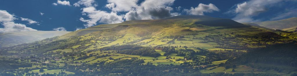
The Bannau Brycheiniog / Brecon Beacons is a mountain range in South Wales comprising six main peaks, with the highest peak, Pen y Fan, standing at 886 metres.