

Climate projection science
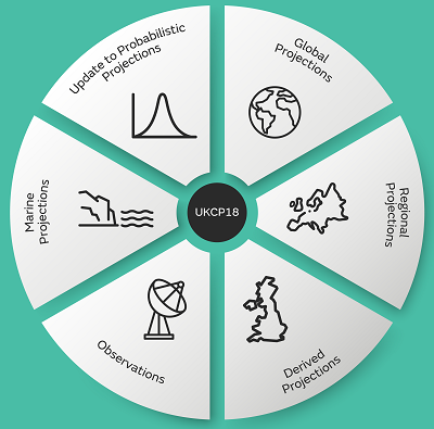
There are six sets of climate data that comprise the projections. These are described in more detail below covering what has been generated, how it has been done and how it might be useful to your applications.
It is not possible to give a precise prediction of how weather and climate will change years into the future so UKCP provides ranges that aim to capture a spread of climate response based on our current knowledge. You can explore the types and magnitudes of climate change that are projected for the future. Depending on the purpose and your level of risk aversion, you may choose to focus on the full range of outcomes or pay particular attention to parts of the distribution such as the largest projected changes.
See how the projections over land are connected to each other in this schematic [378KB] and also UKCP18 Guidance: How to use the land projections [1.8MB]. You may also find this schematic [68KB] helpful to understand which sets of information to use.
Probabilistic Projections
The probabilistic projections combine information from several collections of computer models with observations using advanced statistical methods.
Global (60km) Projections
The new set of simulations using global climate models enable users to analyse changes in future climate that are coherent in space and time on a horizontal spatial scale of around 60km.
Regional (12km) and Local (2.2km) Projections
If you are investigating local climate effects, the regional projections are downscaled versions of the global projections at 12km. The local projections are downscaled versions of the regional projections at 2.2 km. Both these sets of projections have greater spatial detail than the 25km regional climate model used in UKCP09 and benefit from a range of model improvements..
Marine Projections
UKCP18 provides new projections of time mean sea-level rise and extreme water levels for the UK coastline.
Observations
UKCP18 includes a comprehensive set of observations of weather and climate covering the UK, with some the records extending back more than 150 years. Examining observations enables us to place the model simulated climate into context.