

Aviation Data Services
Aviation Data Services supplies high resolution weather data for integration into visualisation systems.
Aviation Data Services will supply relevant, accurate, detailed, and consistent high resolution weather data for integration into decision-making and visualisation systems, which can be uplinked into on-board flight management systems and integrated with ground-based decision support tools.
Providing a global dataset with substantial amounts of data is unviable in terms of file size and transmission costs. The solution, which Aviation Data Services provides, is to make relevant and useable chunks of high-resolution data available and easily accessible as SWIM compliant services.
The first of these Aviation Data Services 4D-Trajectory (4DT) is available. Further services are currently in development.
4D-Trajectory 4DT
The Met Office 4D-Trajectory API provides high resolution meteorological data tailored to unique flight trajectory requests. This enables access, via an API, to high resolution weather data which would otherwise be too large and slow to ingest.
Taking a slice of the data via an API trajectory is much quicker to transfer and can be used in a more agile way to suit users.
Met Office high-resolution weather forecast data, as provided by 4DT, reduces flying time to under a minute between each forecast point (10km). Compared to the current World Area Forecast System (WAFS) dataset which has approximately 9 minutes of flying time (140km) between each point. 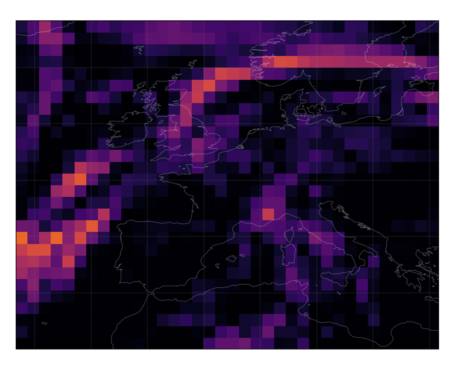 WAFS Resolution 140k
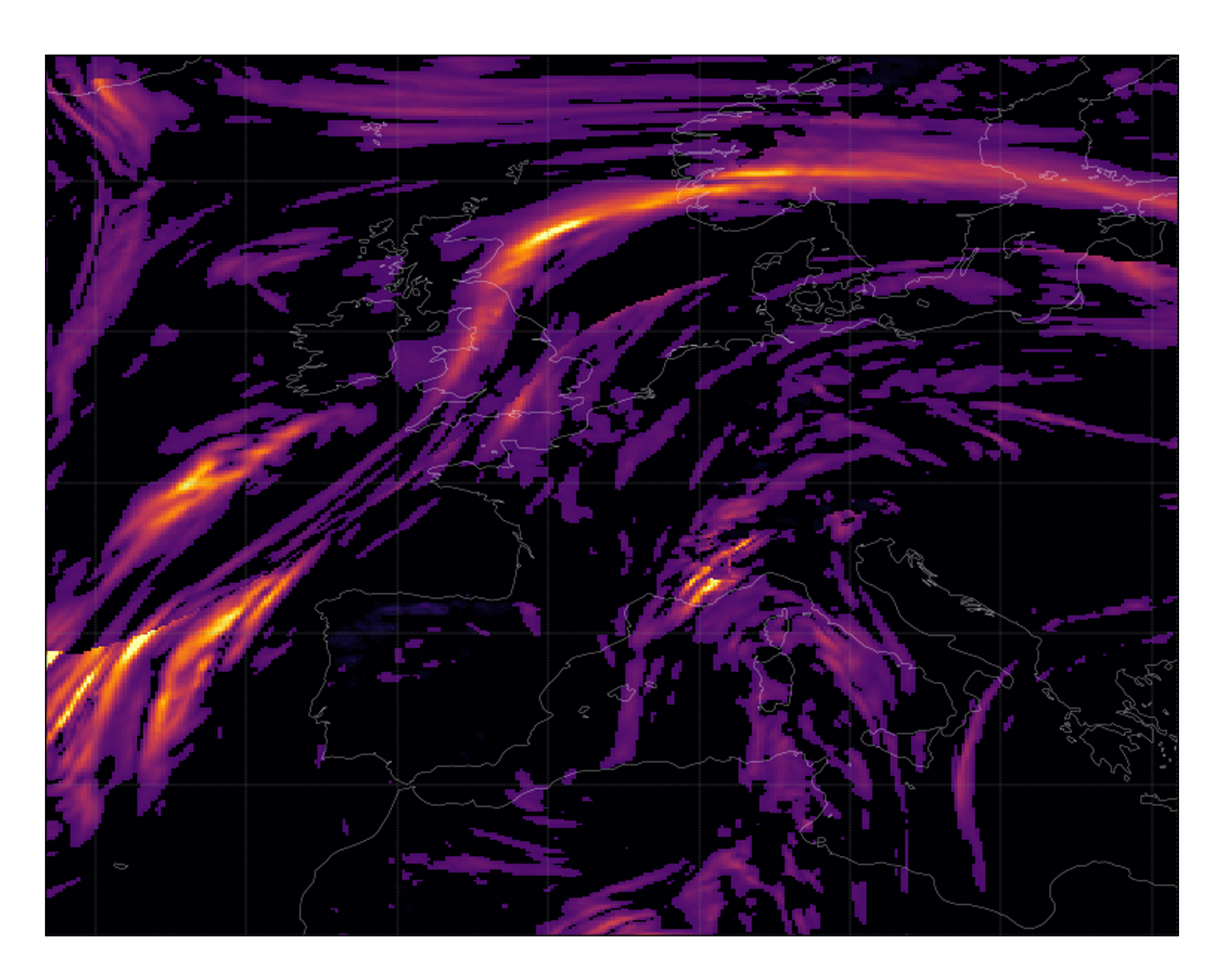 4DT High Resolution Data
Data Available via 4DT
The data available comes from the Met Office Global Model, which has a horizontal resolution of ~10km, 1 hourly timesteps, and covers the whole globe. Data is valid between T=0 and T=+36hrs. It is available in CovJSON format.
The following data is available:
· Wind U
· Wind V
· Temperature
· Turbulence
· Relative Humidity
Benefits
Increase in flight efficiency as high resolution wind data will enable choice of more favourable winds, resulting in fuel cost saving.
Increase in environmentally sustainability of aviation operations due to CO2 reduction.
Ability to plan an optimum flight path and make better fuel load calculations.
Data Requests
Users submit a data request, to include latitude, longitude, atmospheric height (in ICAO Pressure Level), date/time and weather parameter specification, to tailor meteorological data to a unique flight profile. This data can be combined with other flight parameters to calculate optimum flight profiles.
Intended users
4DT is intended for use by:
Airlines
Airports
ATM
ANSP
Flight Planners
Pilots
Pricing
4DT is a pay-per-request service.
All potential users can sign up for a free 30-day trial. This enables access to high resolution weather data and testing to ascertain potential efficiencies, including fuel cost savings.
How to access 4DT
To express interest in using the service or to learn more, you can email: [email protected]
Terms of Reference - 4DT
Read and understand our Terms of Reference
Stay updated
You can stay up to date with all our aviation services including NWR by following our Aviation Services LinkedIn page.
Get in touch
Call us
We are available 24/7.
0370 900 0100Email us
Fill out this short form and we'll get back to you.
Contact Us formFollow us
Linkedin TwitterGet in touch
Call us
We are available 24/7.
0370 900 0100Email us
Fill out this short form and we'll get back to you.
Contact Us form