Numerical weather prediction models
The Met Office uses the Unified Model as part of several operational Numerical Weather Prediction (NWP) systems to support the production of its weather forecasts.
Global and UK NWP configurations
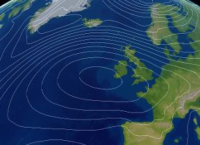
Global configurations of the Unified Model provide global medium-range weather forecasts and support the nested higher resolution regional models with boundary data. Both deterministic and ensemble global NWP systems include interactive coupling between the ocean and the atmosphere. More detailed short to medium-range forecasts are provided by nested high-resolution models which can represent certain atmospheric processes more accurately, as well as having a more detailed representation of surface features such as coastlines and orography.
The deterministic UK forecast uses a variable resolution model which has a high resolution inner domain (1.5 km grid boxes) over the UK and Republic of Ireland, surrounded by a coarser grid (4 km) outer domain with a variable resolution transition zone in between.
The UK ensemble provides information on the uncertainty of forecasts up to five days ahead using the same variable resolution approach, but with a slightly lower-resolution inner domain. The solution spread is obtained by perturbing both the initial conditions and some aspects of the physical processes within the model.
|
NWP system |
Grid length and integration time step |
Vertical levels |
Forecast length |
Run times (UTC) |
Initial/boundary conditions |
|---|---|---|---|---|---|
|
Deterministic Global atmosphere fully coupled to 1/4 degree ocean |
10 km in mid latitudes (2560 x 1920 grid points) with a 4 minute time step. |
70 |
6 days |
00, 12 |
Hybrid Incremental 4D-Var with flow-dependent background errors from 44-member global ensemble (3D-Var for ocean initialisation, simplified Extended Kalman Filter for land). |
| 2½ days | 06, 18 | ||||
|
Ensemble Global atmosphere fully coupled to 1/4 degree ocean |
20 km in mid latitudes (1280 x 960 grid points) with a 5 minute time step. | 70 (lid ~80 km) |
Control member + 17 perturbed members to 10 days. 36 member ensemble generated by time-lagging over the latest 2 cycles. |
00, 06, 12, 18 |
44-member ensemble of 4D-ensemble-Var. Model perturbations from Additive Inflation from historical analysis increments, Stochastic Kinetic Energy Backscatter (SKEB), Stochastic Perturbation of physics Tendencies (SPT), sea surface temperature (SST) and soil-moisture perturbations. |
|
Deterministic UK atmosphere (UKV) |
1.5 km inner domain (622 x 810 grid points); 4 km outer domain (950 x 1025 grid points) with a 60 second time step. |
70 |
120 hours |
03,15 |
Hourly 4D-Var. Lateral boundary conditions from deterministic Global model. AMM15 shelf seas model supplies hourly sea surface temperatures for the lower boundary condition on sea points. Simplified Extended Kalman Filter for land surface assimilation. |
|
54 hours |
00, 06, 09, 12, 18, 21 |
||||
|
12 hours |
All other hours |
||||
|
Ensemble UK atmosphere |
2.2 km inner domain; 4km outer domain (740 x 752 grid points) with a 100 second time step. |
70 |
Control member + 2 perturbed members to 5 days |
05, 11, 17, 23 |
UKV analysis + perturbations interpolated from global ensemble. Lateral boundary conditions from corresponding global ensemble member. AMM15 shelf seas model supplies hourly sea surface temperatures for the lower boundary condition on sea points |
|
3 perturbed members to 5 days |
All other hours |
||||
|
18 member ensemble generated by time-lagging over the latest 6 cycles. |
Every hour |
The current operational NWP systems are all part of Operational Suite cycle 47 (OS47) which was implemented in January 2026. Global NWP systems use the “Global Coupled 5” science configuration (GC5) whilst UK NWP systems use the “Regional Atmosphere/Land 3” science configuration (RAL3, Bush et al. (2025)).
Other regional NWP models
The Met Office also runs regional models in other areas of interest. These include Defence Regional Models using the same science configurations as UK NWP and Crisis Area Models that can be relocated rapidly when required to support military operations and disaster relief efforts.
Differences compared to climate configurations
Numerical Weather Prediction configurations of the Unified Model differ from the Met Office seasonal and climate models in a number of respects:
- Data assimilation - In weather forecasting an accurate representation of the initial state of the atmosphere is vital and so assimilation of the latest observations is required.
- Resolution - The shorter forecast length allows the model to be run at higher resolution allowing more accurate representation of atmospheric dynamics and surface features.
- Complexity - Processes which are thought not to have a significant impact on weather prediction timescales such as atmospheric chemistry and the carbon cycle are not currently modelled.
Operational contact point
For any enquiries about our operational NWP systems and their output, please contact us using the details on the Contact the Met Office webpage.