
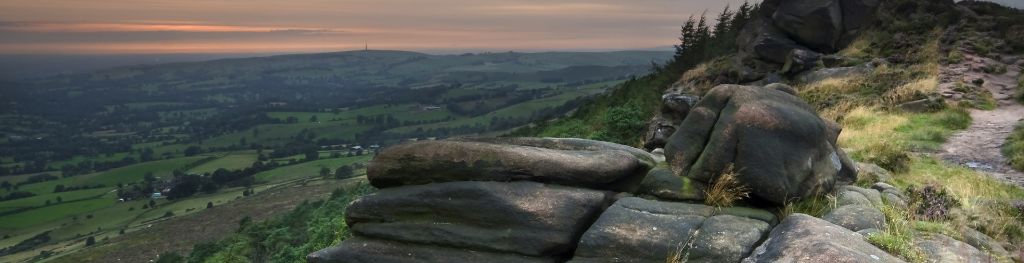
Mountain weather
Peak District Mountain weather forecast table
Confidence
Generally high confidence though moderate for rainfall timings today, and low confidence for forecast detail from Sunday
Mountain weather hazards
Hazards apply at or above 300m, reflecting the more severe conditions which can occur at altitude.
 Poor Visibility
Poor visibility presents challenging route finding conditions. Visibility could be significantly less than 50 metres in all directions with few or no visual references, especially on featureless moors or plateaux. Distances become hard to judge and cliff or cornice edges can be difficult to recognise. These conditions require good navigational skills. There is a risk of white-out conditions when mist or fog is combined with extensive snow cover.
Heavy Persistent Rain
Heavy and persistent rain can lead to drenched clothing and footwear with waterproofs often becoming soaked through, especially if accompanied by strong winds. This can lead to significant loss of body heat and an increased likelihood of hypothermia. Terrain may turn increasingly boggy underfoot while streams can flood and become impassable. There may also be a risk of flooding in valleys or glens. If there is snow cover, a heightened avalanche hazard is possible and avalanche reports should be consulted where available.
Thunderstorms
Lightning is a significant mountain hazard which can result in serious injury or death. Mountain terrain often leaves one highly exposed to lightning strikes. Hail may give unpleasant conditions with torrential rain and localised flash flooding also possible, mainly in Summer months.
Mountain weather forecast
Low cloud and outbreaks of rain and drizzle throughout.
| 06:00 | 09:00 | 12:00 | 15:00 | 18:00 | 21:00 | |
|---|---|---|---|---|---|---|
Weather (at 600m) |
|
|
|
|
|
|
Chance of precipitation (at 600m) |
20% | 20% | 60% | 80% | 80% | 70% |
Wind direction and speed (mph)
Altitude above mean sea level
| 06:00 | 09:00 | 12:00 | 15:00 | 18:00 | 21:00 | |
|---|---|---|---|---|---|---|
| 600m |
N
6
|
NW
7
|
W
9
|
W
10
|
W
12
|
W
14
|
| 300m |
NW
3
|
W
5
|
W
7
|
W
9
|
W
9
|
W
10
|
| Valley |
N
3
|
W
4
|
W
6
|
W
8
|
W
7
|
W
7
|
Wind gust (mph)
Altitude above mean sea level
| 06:00 | 09:00 | 12:00 | 15:00 | 18:00 | 21:00 | |
|---|---|---|---|---|---|---|
| 600m | 10 | 10 | 12 | 15 | 17 | 19 |
| 300m | 4 | 7 | 11 | 14 | 13 | 16 |
| Valley | 4 | 6 | 10 | 14 | 13 | 14 |
Altitude above mean sea level
| 06:00 | 09:00 | 12:00 | 15:00 | 18:00 | 21:00 | |
|---|---|---|---|---|---|---|
| 600m |
7°
|
8°
|
9°
|
9°
|
9°
|
8°
|
| 300m |
9°
|
10°
|
11°
|
11°
|
11°
|
9°
|
| Valley |
10°
|
11°
|
12°
|
12°
|
11°
|
10°
|
| Freezing Level |
2,300m
|
2,400m
|
2,600m
|
2,500m
|
2,500m
|
2,500m
|
Altitude above mean sea level
| 06:00 | 09:00 | 12:00 | 15:00 | 18:00 | 21:00 | |
|---|---|---|---|---|---|---|
| 600m |
5°
|
6°
|
7°
|
7°
|
6°
|
4°
|
| 300m |
8°
|
9°
|
10°
|
10°
|
9°
|
7°
|
| Valley |
10°
|
11°
|
11°
|
11°
|
10°
|
8°
|
Additional weather information
Meteorologist's view
Waterproofs required along the tops with risk of outbreaks of rain and drizzle expected throughout. Navigation skills essential as visibility likely poor on the hills.
Weather
Friday will likely grow more unsettled, it will be cloudy with patchy rain and drizzle. During the afternoon, this will transition into widespread showery rain, which could be persistent, thundery and heavy at times. Rainfall is expected continue into the evening.
Chance of cloud-free hill tops
70% becoming 10% during the afternoon.
Low cloud and visibility
Low cloud cover will likely extend down to 500-600m at first falling to around 400m in the afternoon. Visibility moderate, poor or very poor in rain and drizzle.
Recent rainfall
Location: Cat & Fiddle (Midway between Buxton and Macclesfield)
Altitude: 511m
| Last 24 hours | Last 48 hours | Last 72 hours |
|---|---|---|
| 0mm | 0.1mm | 0.3mm |
Measurement date:
Rainfall data provided by the Environment Agency. The Met Office is not responsible for content provided by third parties and may remove this data without warning.
Mountain weather information
Weather
Low cloud continuing to shroud the hills and outbreaks of showery rain. Cloud slowly lifting and moving northwards in the afternoon with brighter conditions developing behind.
Chance of cloud-free hill tops
10% rising to 60% by afternoon and 90% during the evening.
Maximum wind speed expected
Southwest 10-15 mph with gusts of 25 mph.
Temperature
- At 600m Plus 6 Celsius rising to Plus 9 Celsius
- Valley Plus 10 Celsius rising to Plus 13 Celsius
- Freezing level Above all Summits
Low cloud and visibility
Low cloud around 400 metres likely at first, slowly lifting throughout the day to be clear of the tops by the evening. Visibility moderate becoming good in the evening, poor or very poor in rain and drizzle.
Mountain weather information
Sun 5 May
Sunrise:
Sunset:
Low confidence in forecast detail though generally staying unsettled with variable cloud and the potential for heavy showers and thunderstorms. Warm in any sunshine and light winds. Freezing levels above summits.
Mon 6 May
Sunrise:
Sunset:
Low confidence in forecast detail. Cloudy with the risk of spells of rain or showers with the risk of heavy showers. Light winds. Freezing levels above summits.
Tue 7 May
Sunrise:
Sunset:
Showers remain possible, but expected to be drier than Monday with perhaps some good sunny periods. Feeling warm in the sunshine with light, variable winds. Freezing levels above summits.
Updated at:
Summit specific forecast
Mountain summit forecast map
Loading map…
Key
The Peak District is home to a wide variety of magnificent hills, moors, outcrops and gritstone edges.