
Mountain weather
Peak District Mountain weather forecast table
Confidence
High for unsettled main theme and rising temperatures, but notably low for detail given very weak progression of inbound weather systems.
This evening forecast
Temperatures falling sharply during the evening as skies clear from the north, with potentially icy surfaces developing after daytime rain. Valley fog also developing in places may hamper late descents.
Mountain weather hazards
Hazards apply at or above 300m, reflecting the more severe conditions which can occur at altitude.
 Severe Chill Effect
Wind significantly lowers the ‘feels-like’ temperature relative to the actual temperature, with even moderate winds significantly adding to the chilling effect. Strong winds can result in a severe and debilitating wind chill many degrees below the actual temperature. This effect will be enhanced in rain or wet snow. Without protection, prolonged exposure could result in frost nip or frostbite on exposed parts of the body and/or hypothermia.
Poor Visibility
Poor visibility presents challenging route finding conditions. Visibility could be significantly less than 50 metres in all directions with few or no visual references, especially on featureless moors or plateaux. Distances become hard to judge and cliff or cornice edges can be difficult to recognise. These conditions require good navigational skills. There is a risk of white-out conditions when mist or fog is combined with extensive snow cover.
Thunderstorms
Lightning is a significant mountain hazard which can result in serious injury or death. Mountain terrain often leaves one highly exposed to lightning strikes. Hail may give unpleasant conditions with torrential rain and localised flash flooding also possible, mainly in Summer months.
Heavy Persistent Rain
Heavy and persistent rain can lead to drenched clothing and footwear with waterproofs often becoming soaked through, especially if accompanied by strong winds. This can lead to significant loss of body heat and an increased likelihood of hypothermia. Terrain may turn increasingly boggy underfoot while streams can flood and become impassable. There may also be a risk of flooding in valleys or glens. If there is snow cover, a heightened avalanche hazard is possible and avalanche reports should be consulted where available.
Strong Sunlight
Harmful UV levels from sunlight increase with altitude giving a greater risk of sunburn and eye damage, even on some overcast days. On breezy days, the cooling effect of wind on exposed skin may disguise any feeling of sunburn until it is too late. If there is snow cover, glare increases the effect of UV rays especially on the eyes. It is advisable to wear sun block, protective clothing such as a long-sleeved top and hat and have good quality eye protection.
Mountain weather forecast
Friday fine at frosty at first, scattered heavy, wintry showers possible later.
| 00:00 | 03:00 | 06:00 | 09:00 | 12:00 | 15:00 | 18:00 | 21:00 | |
|---|---|---|---|---|---|---|---|---|
Weather (at 600m) |
|
|
|
|
|
|
|
|
Chance of precipitation (at 600m) |
10% | 10% | 20% | 20% | 40% | 60% | 30% | 20% |
Wind direction and speed (mph)
Altitude above mean sea level
| 00:00 | 03:00 | 06:00 | 09:00 | 12:00 | 15:00 | 18:00 | 21:00 | |
|---|---|---|---|---|---|---|---|---|
| 600m |
NE
9
|
NE
9
|
NE
11
|
NE
13
|
NE
12
|
E
11
|
E
12
|
E
12
|
| 300m |
NE
4
|
NE
5
|
NE
6
|
NE
10
|
NE
11
|
NE
8
|
E
11
|
NE
9
|
| Valley |
NE
3
|
NE
3
|
NE
4
|
NE
8
|
E
9
|
NE
7
|
E
7
|
E
9
|
Wind gust (mph)
Altitude above mean sea level
| 00:00 | 03:00 | 06:00 | 09:00 | 12:00 | 15:00 | 18:00 | 21:00 | |
|---|---|---|---|---|---|---|---|---|
| 600m | 15 | 15 | 15 | 18 | 16 | 16 | 16 | 18 |
| 300m | 9 | 8 | 9 | 15 | 17 | 13 | 16 | 16 |
| Valley | 13 | 10 | 11 | 16 | 17 | 13 | 13 | 20 |
Altitude above mean sea level
| 00:00 | 03:00 | 06:00 | 09:00 | 12:00 | 15:00 | 18:00 | 21:00 | |
|---|---|---|---|---|---|---|---|---|
| 600m |
-1°
|
-1°
|
0°
|
1°
|
3°
|
3°
|
2°
|
1°
|
| 300m |
2°
|
1°
|
2°
|
4°
|
6°
|
7°
|
5°
|
4°
|
| Valley |
2°
|
1°
|
2°
|
6°
|
8°
|
7°
|
6°
|
4°
|
| Freezing Level |
400m
|
400m
|
500m
|
600m
|
700m
|
800m
|
800m
|
700m
|
Altitude above mean sea level
| 00:00 | 03:00 | 06:00 | 09:00 | 12:00 | 15:00 | 18:00 | 21:00 | |
|---|---|---|---|---|---|---|---|---|
| 600m |
-5°
|
-6°
|
-5°
|
-4°
|
-2°
|
-1°
|
-2°
|
-3°
|
| 300m |
0°
|
-2°
|
-1°
|
1°
|
3°
|
4°
|
2°
|
0°
|
| Valley |
0°
|
-1°
|
1°
|
3°
|
6°
|
5°
|
4°
|
1°
|
Additional weather information
Meteorologist's view
The UV index will be moderate, and lower than average temperatures coupled with the breeze may render the Sun's stregth deceptive.
Weather
Cold with clear periods during the early hours, with a hard frost in valleys and some freezing fog patches developing locally. Fine into daybreak, with local fog dispersing and some sunny spells developing for a time. Fair weather cloud will build by lunchtime to allow isolated light showers to become heavier and more numerous, falling as snow over higher escarpments and carrying an outside chance of thunder. Becoming drier but cloudier into the evening, with temperatures again falling sharply.
Chance of cloud-free hill tops
90%, falling 60% by evening.
Low cloud and visibility
Visibility generally very good, but notable deteriorations in snow showers and some locally poor visibility in valleys first thing.
Recent rainfall
Location: Cat & Fiddle (Midway between Buxton and Macclesfield)
Altitude: 511m
| Last 24 hours | Last 48 hours | Last 72 hours |
|---|---|---|
| 0.9mm | 3.9mm | 5.1mm |
Measurement date:
Rainfall data provided by the Environment Agency. The Met Office is not responsible for content provided by third parties and may remove this data without warning.
Mountain weather information
Weather
Low confidence relative to the period. Probably a fine start with the best of any limited hazy sunshine in the north as cloud and rain then gradually edge in from the south towards lunchtime, probably seeing out the day once established.
Chance of cloud-free hill tops
30%
Maximum wind speed expected
Northeasterly 20mph.
Temperature
- At 600m Plus 2 Celsius.
- Valley Minus 2 becoming plus 11 Celsius.
- Freezing level Sub-zero in valleys at first, else above the highest ground.
Low cloud and visibility
Good visibility in the main, but broken cloud probably persisting over the highest ground.
Mountain weather information
Sun 28 Apr
Sunrise:
Sunset:
Note relatively low confidence in details through this three-day period. Sunday potentially a very wet day with persistent and occasionally heavy rain, although the track of this weather system carries high uncertainty. Moderate northerly becoming southwesterly winds. Freezing level clear of all summits.
Mon 29 Apr
Sunrise:
Sunset:
Probably a brighter day with some sunshine, but with strengthening south, later southeasterly winds. There is a chance of some rain making inroads from the west later. Freezing level clear of all summits.
Tue 30 Apr
Sunrise:
Sunset:
Becoming more unsettled again, with showers or longer spells of rain arriving on a moderate southeasterly wind. Freezing level clear of all summits.
Updated at:
Summit specific forecast
Mountain summit forecast map
Loading map…
Key
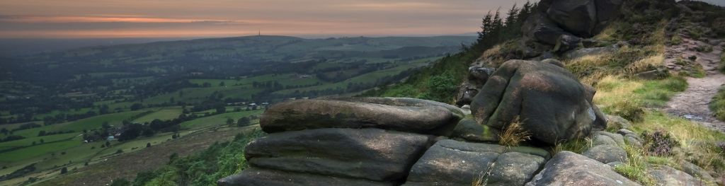
The Peak District is home to a wide variety of magnificent hills, moors, outcrops and gritstone edges.