
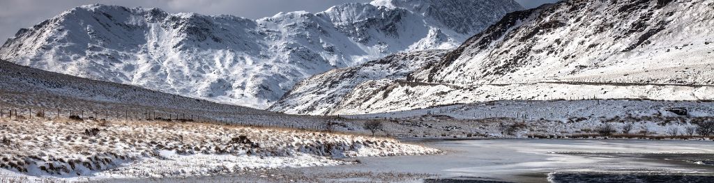
Mountain weather
Eryri / Snowdonia Mountain weather forecast table
Confidence
High for a generally unsettled and changeable spell with showers and sunny spells. Low for detail.
This evening forecast
Any lingering showers clearing with skies beginning to clear away from summits. Cloud will continue to cover highest peaks.
Mountain weather hazards
Hazards apply at or above 300m, reflecting the more severe conditions which can occur at altitude.
 Thunderstorms
Lightning is a significant mountain hazard which can result in serious injury or death. Mountain terrain often leaves one highly exposed to lightning strikes. Hail may give unpleasant conditions with torrential rain and localised flash flooding also possible, mainly in Summer months.
Strong Sunlight
Harmful UV levels from sunlight increase with altitude giving a greater risk of sunburn and eye damage, even on some overcast days. On breezy days, the cooling effect of wind on exposed skin may disguise any feeling of sunburn until it is too late. If there is snow cover, glare increases the effect of UV rays especially on the eyes. It is advisable to wear sun block, protective clothing such as a long-sleeved top and hat and have good quality eye protection.
Mountain weather forecast
A chance of some light rain early and showers late, otherwise bright with sunny spells.
| 00:00 | 03:00 | 06:00 | 09:00 | 12:00 | 15:00 | 18:00 | 21:00 | |
|---|---|---|---|---|---|---|---|---|
Weather (at 800m) |
|
|
|
|
|
|
|
|
Chance of precipitation (at 800m) |
<05% | 10% | 30% | 30% | 20% | 30% | 10% | <05% |
Wind direction and speed (mph)
Altitude above mean sea level
| 00:00 | 03:00 | 06:00 | 09:00 | 12:00 | 15:00 | 18:00 | 21:00 | |
|---|---|---|---|---|---|---|---|---|
| 900m |
E
26
|
E
25
|
E
24
|
SE
20
|
SE
17
|
SE
13
|
E
13
|
E
13
|
| 600m |
SE
17
|
SE
18
|
E
18
|
SE
17
|
SE
14
|
SE
10
|
E
10
|
E
9
|
| 300m |
SE
11
|
E
11
|
E
12
|
SE
11
|
SE
11
|
SE
7
|
E
8
|
E
7
|
| Valley |
SE
12
|
SE
11
|
SE
12
|
SE
11
|
SE
10
|
SE
7
|
E
8
|
SE
7
|
Wind gust (mph)
Altitude above mean sea level
| 00:00 | 03:00 | 06:00 | 09:00 | 12:00 | 15:00 | 18:00 | 21:00 | |
|---|---|---|---|---|---|---|---|---|
| 900m | 32 | 31 | 31 | 28 | 24 | 19 | 18 | 17 |
| 600m | 23 | 24 | 25 | 24 | 20 | 16 | 14 | 15 |
| 300m | 22 | 22 | 22 | 21 | 19 | 13 | 14 | 14 |
| Valley | 22 | 21 | 21 | 20 | 18 | 13 | 13 | 14 |
Altitude above mean sea level
| 00:00 | 03:00 | 06:00 | 09:00 | 12:00 | 15:00 | 18:00 | 21:00 | |
|---|---|---|---|---|---|---|---|---|
| 900m |
7°
|
7°
|
7°
|
8°
|
10°
|
11°
|
10°
|
8°
|
| 600m |
9°
|
9°
|
9°
|
11°
|
13°
|
13°
|
13°
|
10°
|
| 300m |
11°
|
11°
|
12°
|
14°
|
16°
|
16°
|
15°
|
12°
|
| Valley |
12°
|
12°
|
13°
|
15°
|
17°
|
17°
|
17°
|
14°
|
| Freezing Level |
2,000m
|
2,000m
|
2,000m
|
1,900m
|
2,100m
|
2,200m
|
2,200m
|
2,200m
|
Altitude above mean sea level
| 00:00 | 03:00 | 06:00 | 09:00 | 12:00 | 15:00 | 18:00 | 21:00 | |
|---|---|---|---|---|---|---|---|---|
| 900m |
2°
|
2°
|
3°
|
4°
|
7°
|
8°
|
8°
|
5°
|
| 600m |
6°
|
6°
|
6°
|
8°
|
10°
|
12°
|
11°
|
9°
|
| 300m |
9°
|
9°
|
9°
|
12°
|
14°
|
15°
|
14°
|
11°
|
| Valley |
10°
|
10°
|
11°
|
13°
|
15°
|
16°
|
16°
|
13°
|
Additional weather information
Meteorologist's view
Conditions becoming more favourable from late morning, with a small chance of a thundery downpour in the afternoon. Packable waterproofs and sun protection recommended.
Weather
Dry, with cloud covering summits during the early hours. Some patchy light rain possible first thing on Wednesday morning, followed by light showers. Sunny spells and patchy cloud for much of the range through the middle of the day and afternoon, with a chance of isolated showers, some of which may be heavy and thundery. Becoming dry again in the evening.
Chance of cloud-free hill tops
40% initially, becoming 95% by late morning.
Low cloud and visibility
Scattered amounts of cloud across the range through the day with cloud developing most extensively down to 600m across summits and southeastern facing slopes in the morning. Cloud generally lifting above summits by late morning. Visibility generally very good with clear views of distant hills, but moderate in rainfall, a chance of poor in thundery downpours or over summits early.
Ground conditions
Please see - https://yrwyddfa.live/
Mountain weather information
Weather
Generally dry to start but cloudy on southern and eastern facing slopes initially and across summits. Cloud soon lifting above summits, with some good sunny intervals through the day and isolated potentially heavy and thundery showers.
Chance of cloud-free hill tops
30% initially, rising to 100% by mid-morning.
Maximum wind speed expected
Northerly 15 mph.
Temperature
- At 800m Plus 8 Celsius becoming 13 Celsius.
- Valley Plus 10 Celsius becoming 20 Celsius.
- Freezing level Above summits.
Low cloud and visibility
Cloud developing most extensively down to 600m across summits and southern/eastern facing slopes in the morning. Cloud generally lifting above summits by late morning. Visibility generally very good with clear views of distant hills, but poor in cloud over summits early, perhaps poor in heavy thundery showers later.
Mountain weather information
Fri 17 May
Sunrise:
Sunset:
Mostly cloudy with a chance of heavy rain of thundery showers. Freezing level above summits.
Sat 18 May
Sunrise:
Sunset:
A brighter day but once again with a chance of heavy thundery showers. Freezing level above summits.
Sun 19 May
Sunrise:
Sunset:
Partly cloudy with an outside chance of rain or showers, but mostly dry. Freezing level above summits.
Updated at:
Summit specific forecast
Mountain summit forecast map
Loading map…
Key
The Eryri (Snowdonia) mountains are made up of 90 mountain peaks including the tallest mountain in Wales, Yr Wyddfa (Snowdon), standing at 1,085 metres.