
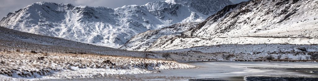
Mountain weather
Eryri / Snowdonia Mountain weather forecast table
Confidence
High for unsettled conditions and spells of rain. Moderate for timing of rain and thunderstorm risk Wednesday and Thursday. Low for details of low cloud, rain and thunderstorms otherwise.
Mountain weather hazards
Hazards apply at or above 300m, reflecting the more severe conditions which can occur at altitude.
 Strong Sunlight
Harmful UV levels from sunlight increase with altitude giving a greater risk of sunburn and eye damage, even on some overcast days. On breezy days, the cooling effect of wind on exposed skin may disguise any feeling of sunburn until it is too late. If there is snow cover, glare increases the effect of UV rays especially on the eyes. It is advisable to wear sun block, protective clothing such as a long-sleeved top and hat and have good quality eye protection.
Poor Visibility
Poor visibility presents challenging route finding conditions. Visibility could be significantly less than 50 metres in all directions with few or no visual references, especially on featureless moors or plateaux. Distances become hard to judge and cliff or cornice edges can be difficult to recognise. These conditions require good navigational skills. There is a risk of white-out conditions when mist or fog is combined with extensive snow cover.
Thunderstorms
Lightning is a significant mountain hazard which can result in serious injury or death. Mountain terrain often leaves one highly exposed to lightning strikes. Hail may give unpleasant conditions with torrential rain and localised flash flooding also possible, mainly in Summer months.
Heavy Persistent Rain
Heavy and persistent rain can lead to drenched clothing and footwear with waterproofs often becoming soaked through, especially if accompanied by strong winds. This can lead to significant loss of body heat and an increased likelihood of hypothermia. Terrain may turn increasingly boggy underfoot while streams can flood and become impassable. There may also be a risk of flooding in valleys or glens. If there is snow cover, a heightened avalanche hazard is possible and avalanche reports should be consulted where available.
Mountain weather forecast
Patchy rain and low cloud clearing to sunny spells. Heavy rain later.
| 06:00 | 09:00 | 12:00 | 15:00 | 18:00 | 21:00 | |
|---|---|---|---|---|---|---|
Weather (at 800m) |
|
|
|
|
|
|
Chance of precipitation (at 800m) |
30% | 20% | 20% | 20% | 60% | 80% |
Wind direction and speed (mph)
Altitude above mean sea level
| 06:00 | 09:00 | 12:00 | 15:00 | 18:00 | 21:00 | |
|---|---|---|---|---|---|---|
| 900m |
SE
15
|
SE
13
|
SE
9
|
N
8
|
NE
12
|
N
12
|
| 600m |
SE
11
|
S
10
|
SE
6
|
NW
8
|
N
9
|
NW
7
|
| 300m |
SE
4
|
S
6
|
SE
5
|
N
5
|
N
6
|
N
5
|
| Valley |
SE
4
|
S
6
|
E
5
|
N
6
|
N
6
|
NW
4
|
Wind gust (mph)
Altitude above mean sea level
| 06:00 | 09:00 | 12:00 | 15:00 | 18:00 | 21:00 | |
|---|---|---|---|---|---|---|
| 900m | 18 | 16 | 13 | 11 | 16 | 16 |
| 600m | 13 | 12 | 10 | 11 | 13 | 10 |
| 300m | 9 | 9 | 9 | 9 | 10 | 10 |
| Valley | 9 | 9 | 8 | 9 | 9 | 9 |
Altitude above mean sea level
| 06:00 | 09:00 | 12:00 | 15:00 | 18:00 | 21:00 | |
|---|---|---|---|---|---|---|
| 900m |
3°
|
4°
|
7°
|
7°
|
7°
|
6°
|
| 600m |
5°
|
7°
|
10°
|
9°
|
8°
|
8°
|
| 300m |
7°
|
10°
|
12°
|
11°
|
11°
|
10°
|
| Valley |
8°
|
11°
|
13°
|
12°
|
11°
|
10°
|
| Freezing Level |
1,400m
|
1,400m
|
1,600m
|
1,800m
|
2,000m
|
2,200m
|
Altitude above mean sea level
| 06:00 | 09:00 | 12:00 | 15:00 | 18:00 | 21:00 | |
|---|---|---|---|---|---|---|
| 900m |
-2°
|
0°
|
5°
|
4°
|
4°
|
3°
|
| 600m |
2°
|
4°
|
8°
|
7°
|
6°
|
6°
|
| 300m |
6°
|
8°
|
11°
|
10°
|
9°
|
9°
|
| Valley |
8°
|
10°
|
12°
|
11°
|
10°
|
10°
|
Additional weather information
Meteorologist's view
Chance of spells of strong sunlight this afternoon with elevated UV levels. Waterproofs may become soaked late on.
Weather
Cloudy with any patchy light rain soon clearing. Elsewhere, any overnight valley mist and fog patches will be short-lived and low cloud covering mainly eastern slopes will lift and dissipate. Some sunny spells developing by afternoon, although with a chance of isolated showers. Cloud increasing from the southeast ahead of a band of, locally heavy, rain which could produce some thundery downpours.
Chance of cloud-free hill tops
40% in the east at first, soon becoming 80% or more. Lowering to 60% from the southeast during the evening.
Low cloud and visibility
Cloud with bases of around 400-500m at first, perhaps covering some lower slopes in the east. Bases above summits by mid-morning. Bases may lower to around 600m in heavy rain during the evening. Visibility generally very good but moderate in early light rain and poor or very poor in any mist or fog. Poor in heavy evening rain.
Ground conditions
Please see - https://yrwyddfa.live/
Mountain weather information
Weather
Cloudy, with heavy rain and thundery downpours affecting the southern half of the Park. Rain making uncertain northward progress through the day and becoming lighter more drizzly with extensive hill fog. The best of any brightness towards Conwy during the day. Breezy across higher routes.
Chance of cloud-free hill tops
30% becoming 70% by afternoon, but 90% in the north. Lowering to 10% through the evening.
Maximum wind speed expected
Northeast 20-25 mph with gusts 30-40 mph easing east 10-15 mph with gusts to 20 mph.
Temperature
- At 800m Plus 7 Celsius becoming 12 Celsius.
- Valley Plus 9 Celsius becoming 17 Celsius.
- Freezing level Above summits.
Low cloud and visibility
Cloud bases of around 500-600m to start with summits clear in the northwest. Bases mostly above summits by late morning. Cloud lowering from the south during the evening with bases of 400-500m, lowering further in persistent drizzle. Visibility generally good outside of cloud, but poor in heavy rain and very poor in drizzle.
Mountain weather information
Fri 3 May
Sunrise:
Sunset:
High uncertainty. Cloudy start with outbreaks of patchy rain. Then unsettled with showers or longer spells of rain and a risk of heavy, possibly thundery downpours. Hill fog may persist on highest tops. Brighter in the north. Gentle southwesterly winds. Drier Friday evening. Freezing level above summits
Sat 4 May
Sunrise:
Sunset:
Low confidence. Area of rain will soon clear northwards leaving a dry day of sunny spells. Low cloud or hill fog to start and returning later. Freezing level above summits. Light or gentle southerly winds.
Sun 5 May
Sunrise:
Sunset:
Low confidence. Cloudy morning with patchy light rain. Showers arriving or developing by the afternoon. Band of showery rain may push north late on. Freezing level above summits. Gentle southerly winds
Updated at:
Summit specific forecast
Mountain summit forecast map
Loading map…
Key
The Eryri (Snowdonia) mountains are made up of 90 mountain peaks including the tallest mountain in Wales, Yr Wyddfa (Snowdon), standing at 1,085 metres.