
Mountain weather
Peak District Mountain weather forecast table
Confidence
High for unsettled themes, moderate for rain and low cloud detail this weekend.
Mountain weather hazards
Hazards apply at or above 300m, reflecting the more severe conditions which can occur at altitude.
 Severe Chill Effect
Wind significantly lowers the ‘feels-like’ temperature relative to the actual temperature, with even moderate winds significantly adding to the chilling effect. Strong winds can result in a severe and debilitating wind chill many degrees below the actual temperature. This effect will be enhanced in rain or wet snow. Without protection, prolonged exposure could result in frost nip or frostbite on exposed parts of the body and/or hypothermia.
Poor Visibility
Poor visibility presents challenging route finding conditions. Visibility could be significantly less than 50 metres in all directions with few or no visual references, especially on featureless moors or plateaux. Distances become hard to judge and cliff or cornice edges can be difficult to recognise. These conditions require good navigational skills. There is a risk of white-out conditions when mist or fog is combined with extensive snow cover.
Mountain weather forecast
A cold start to the day with bright spells, becoming cloudy with a chance of patchy light rain.
| 06:00 | 09:00 | 12:00 | 15:00 | 18:00 | 21:00 | |
|---|---|---|---|---|---|---|
Weather (at 600m) |
|
|
|
|
|
|
Chance of precipitation (at 600m) |
10% | 10% | 30% | 60% | 20% | 20% |
Wind direction and speed (mph)
Altitude above mean sea level
| 06:00 | 09:00 | 12:00 | 15:00 | 18:00 | 21:00 | |
|---|---|---|---|---|---|---|
| 600m |
E
17
|
E
20
|
E
18
|
E
18
|
E
20
|
NE
22
|
| 300m |
NE
13
|
E
16
|
E
15
|
E
15
|
E
16
|
NE
17
|
| Valley |
E
10
|
E
12
|
E
11
|
E
12
|
E
11
|
NE
13
|
Wind gust (mph)
Altitude above mean sea level
| 06:00 | 09:00 | 12:00 | 15:00 | 18:00 | 21:00 | |
|---|---|---|---|---|---|---|
| 600m | 22 | 25 | 24 | 25 | 28 | 30 |
| 300m | 19 | 22 | 21 | 22 | 24 | 26 |
| Valley | 22 | 22 | 21 | 22 | 24 | 28 |
Altitude above mean sea level
| 06:00 | 09:00 | 12:00 | 15:00 | 18:00 | 21:00 | |
|---|---|---|---|---|---|---|
| 600m |
1°
|
2°
|
4°
|
4°
|
3°
|
2°
|
| 300m |
3°
|
5°
|
7°
|
7°
|
6°
|
5°
|
| Valley |
4°
|
7°
|
9°
|
9°
|
7°
|
6°
|
| Freezing Level |
700m
|
800m
|
900m
|
900m
|
900m
|
800m
|
Altitude above mean sea level
| 06:00 | 09:00 | 12:00 | 15:00 | 18:00 | 21:00 | |
|---|---|---|---|---|---|---|
| 600m |
-5°
|
-4°
|
-1°
|
-1°
|
-2°
|
-4°
|
| 300m |
-1°
|
1°
|
3°
|
4°
|
2°
|
0°
|
| Valley |
0°
|
4°
|
6°
|
6°
|
4°
|
2°
|
Additional weather information
Meteorologist's view
Suitable winter layers should be worn to ensure a comfortable day in the Park.
Weather
A cold start today with perhaps some isolated fog patches in the valleys. Some early bright or sunny spells but then becoming increasingly cloudy this morning, bringing a chance of patchy light rain or drizzle this afternoon. Remaining largely cloudy this evening, but becoming mostly dry.
Chance of cloud-free hill tops
80%, decreasing 40% across southern and eastern areas at times.
Low cloud and visibility
Generally good or very good visibility, but decreasing moderate in rain and very poor with hill fog. Cloud bases largely above summits, but probably becoming broken around 600m across southern and eastern areas at times this morning and afternoon.
Recent rainfall
Location: Cat & Fiddle (Midway between Buxton and Macclesfield)
Altitude: 511m
| Last 24 hours | Last 48 hours | Last 72 hours |
|---|---|---|
| 0mm | 1.8mm | 1.8mm |
Measurement date:
Rainfall data provided by the Environment Agency. The Met Office is not responsible for content provided by third parties and may remove this data without warning.
Mountain weather information
Weather
Overnight heavy rain will spread north, falling as sleet over highest peaks, and then persisting until mid to late afternoon. Significant rainfall accumulations are likely, especially on northwesterly slopes. Later in the afternoon dry and clearer conditions arrive from the west.
Chance of cloud-free hill tops
Less than 10% becoming 80% by the end of the day.
Maximum wind speed expected
North-northeasterly 20-25mph gusting 30-35mph becoming westerly 15mph gusting 25mph.
Temperature
- At 600m Plus 1 Celsius becoming plus 4 Celsius.
- Valley Plus 5 Celsius becoming plus 9 Celsius.
- Freezing level Above summits.
Low cloud and visibility
Poor or very poor in rain, sleet and low cloud. Extensive cloud bases above 300-400m developing, then lifting above summits and clearing east by the end of the day and visibilities improving to very good.
Mountain weather information
Mon 29 Apr
Sunrise:
Sunset:
Generally a fine and dry day with a good deal of sunshine, some isolated showers possible. Fresh to Strong southerly winds. Freezing level about summits.
Tue 30 Apr
Sunrise:
Sunset:
Mist and fog around in the morning, slowly burning away then scattered showers developing. Fresh to Strong southeasterly winds. Freezing level above summits.
Wed 1 May
Sunrise:
Sunset:
Cloudy with perhaps some sun at times, but scattered heavy and possibly thundery showers developing. Moderate easterly winds. Freezing level above summits.
Updated at:
Summit specific forecast
Mountain summit forecast map
Loading map…
Key
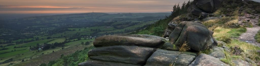
The Peak District is home to a wide variety of magnificent hills, moors, outcrops and gritstone edges.