

Another low-pressure area to bring wind and rain
Author: Press Office
15:27 (UTC+1) on Mon 8 Apr 2024
Another area of low pressure is following closely on the heels of Storm Kathleen which brought challenging conditions to parts of the UK over the weekend.
Another area of low pressure is following closely on the heels of Storm Kathleen which brought challenging conditions to parts of the UK over the weekend.
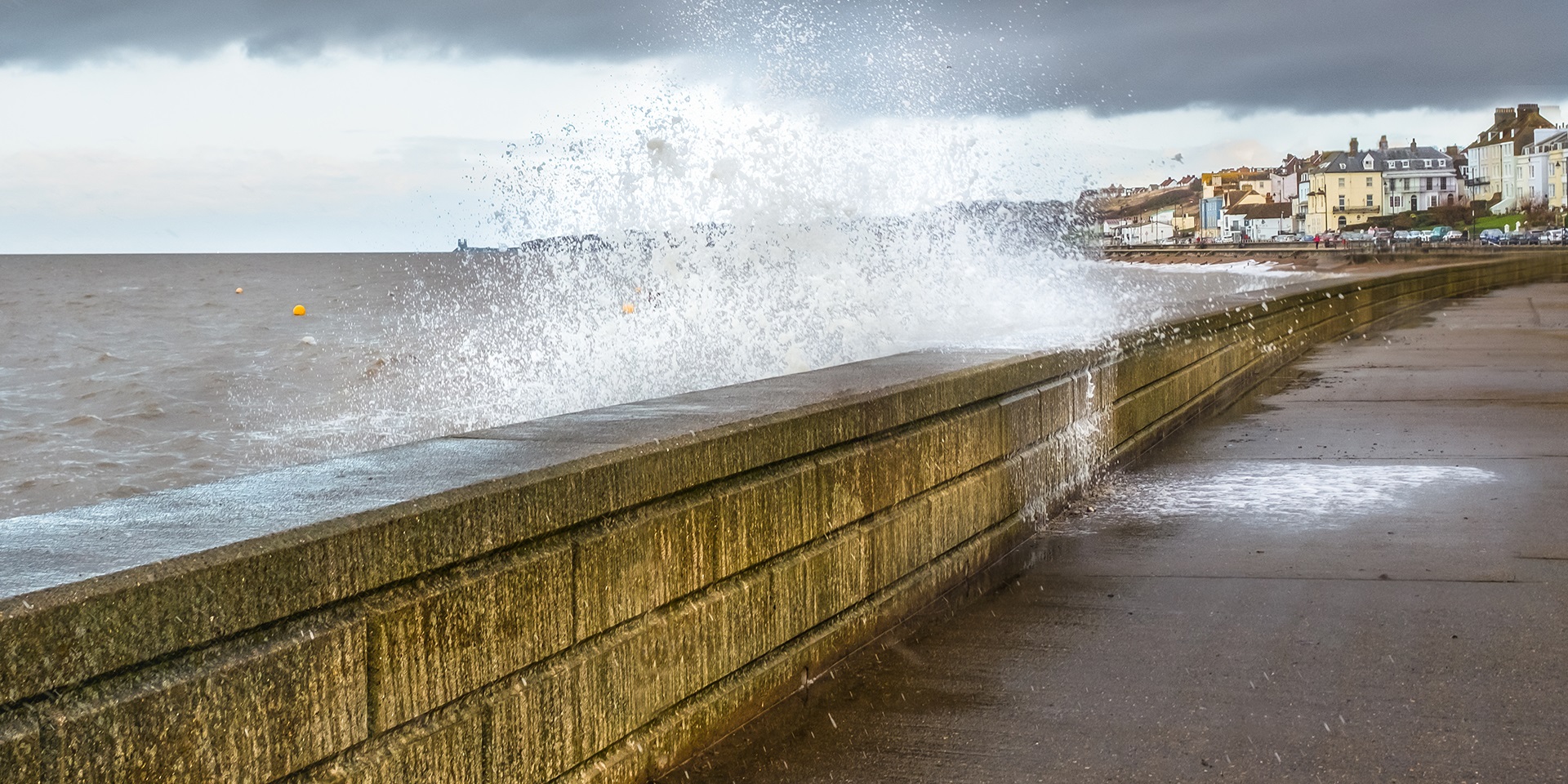
The low-pressure system will bring the strongest winds to Cornwall and coastal parts of Devon and Somerset later today [Monday 8 April] and overnight, then as the system continues to track across the UK the strong winds will extend along many English Channel coasts, all the way to Kent, and north along the coasts of the Celtic and Irish Seas to Lancashire. These strong winds come in combination with large waves and one of the highest tides of the year, highlighting coastal areas for impacts. A warning of heavy rain has also been issued for parts of southern and eastern Scotland.
Frank Saunders is a Met Office Chief meteorologist. He said: “This system is in its deepening phase at present and will bring the strongest gusts to areas on its western and southern flanks. As the system develops it will bring warmer air back into some southeastern areas of England today, but with the potential for some isolated thunder and lightning this evening.”
Coastal impacts
Harry Walton, Flood Duty Manager at the Environment Agency, said: “Due to a combination of spring tides and strong winds generating storm surge and large waves, minor coastal flooding impacts are probable for parts of England on Monday and Tuesday.
"Environment Agency teams are out on the ground, taking action to reduce the impact of flooding and support those communities affected. We urge people to stay safe on the coast, take extreme care on coastal paths and promenades, and we advise people not to drive through flood water as just 30cm of flowing water is enough to move your car.”
Helen Caughey is a Met Office Deputy Chief meteorologist. Looking at the prospects for later this week, she said: “The forecast contains a brief, quieter interlude thanks to a ridge of high pressure which becomes established across the country later on Tuesday. This will bring dry conditions for most areas for a time, but also a chance of some overnight frosts for prone locations.
“However, through Wednesday another band of rain pushes in from the west bringing some heavy and persistent rain, especially for higher ground in the west and north, with warnings already issued for parts of western Scotland. This system is accompanied by some strong and gusty winds, especially for coastal locations and across high ground, in the northern half of the country. The best of any drier and brighter conditions are likely across the south and east of the country.”
People should check their flood risk, sign up for free flood warnings and keep up to date with the latest situation at https://www.gov.uk/check-flood-risk, call Floodline on 0345 988 1188 or follow @EnvAgency on Twitter for the latest flood updates.
You can keep up to date with the latest forecast on our website, by following us on Twitter and Facebook, as well as on our mobile app which is available for iPhone from the App store and for Android from the Google Play store.