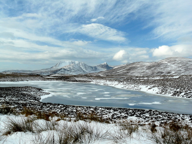
Very cold week
Author: Press Office
13:24 (UTC) on Mon 15 Jan 2024
The UK is now in the grip of a cold plunge of Arctic air which has moved in from the north across the whole of the country.
The northerly airflow is also bringing very cold conditions for all, with snow showers for some areas at times. A number of National Severe Weather Warnings have been issued for potentially disruptive snow and ice over the coming days.
What are the prospects of seeing any snow where you live this week? ☃️
— Met Office (@metoffice) January 14, 2024
Here's a look at the current forecast for the week ahead 👇 pic.twitter.com/F3yusbxDTa
Met Office Chief Meteorologist, Andy Page, said: “Where and how much snow we will get will vary throughout the week and weather warnings could change quickly, you will need to keep an eye on the forecast for your region for the latest information.
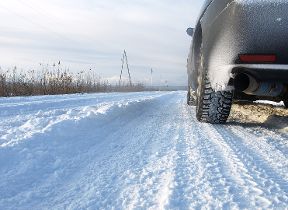
“There will be widespread frost this week and we could see some fairly deep laying snow in parts of northern UK and strong winds could result in drifting or blizzard conditions at times. The snow and ice will be disruptive and could potentially impact travel plans, make driving dangerous and pavements slippery.
“It will feel bitterly cold with daytime temperatures in the low single figures for many, and overnight temperatures will fall to -3 or -4 in many towns and cities, and it will be even colder in many rural areas.”
The UK Health Security Agency has a Cold-Health Alert in force for England, which highlights the possibility of significant impacts for the health and the social care sector.
Dr Agostinho Sousa, Head of Extreme Events and Health Protection at UKHSA, said: “The temperatures we will see can rapidly have a serious impact on the health of those over the age of 65 and those with pre-existing health conditions as it increases the risk of heart attacks, strokes and chest infections. It is therefore vital to check in on friends, family and neighbours to ensure they are well prepared for the cold weather thisweek.”
Stein Connelly, Head of Transport Resilience (Operations) at Transport Scotland said:
“We’re working closely with our colleagues at the Met Office to understand the extent of the anticipated snow and ice impacts across Scotland.
"This cold snap is already causing difficult driving conditions in the current warning areas, with further severe impacts anticipated on Tuesday. It’s important that anyone that has to travel during the warning period plans their journey in advance and allows extra time. Police Scotland’s official travel advice is likely to change at short notice, so it’s important people check the news and follow social media accounts for the latest advice.
“If you have to travel, please drive to the conditions. Consider what kit you might need to keep in your car in the event of difficult conditions. There may be disruption on other modes of transport, so please check with your transport operator before setting off if you’re planning to travel by rail, ferry or air.
“Motorists can check with Traffic Scotland to make sure that their route is available. The new Traffic Scotland website gives people access to the latest travel information and the Traffic Scotland twitter page is also updated regularly.
“Pedestrians should also be aware that pavements will be affected by snow and ice, so make sure you use the appropriate clothing and footwear if you have to go out.”
Further Ahead
As we move into mid-week a low-pressure system will move across the northern France bringing some snowfall on its northern edge. Met Office Deputy Chief Meteorologist, Nick Silkstone, said: “The track of this system still has some small but all-important uncertainties tied to its northern extent, and it has the potential to bring some snow to southern England.
"However, our preferred solution suggests minimal snowfall (a couple of cm at most) across parts of the extreme south of England in association with this system, but we are keeping an eye on how things develop and will update the forecast as needed.”
You can keep up to date with the latest forecast on our website, by following us on Twitter and Facebook, as well as on our mobile app which is available for iPhone from the App store and for Android from the Google Play store.