Storm Claudia brings intense rain to England and Wales
Further heavy rainfall will continue through the evening and overnight.
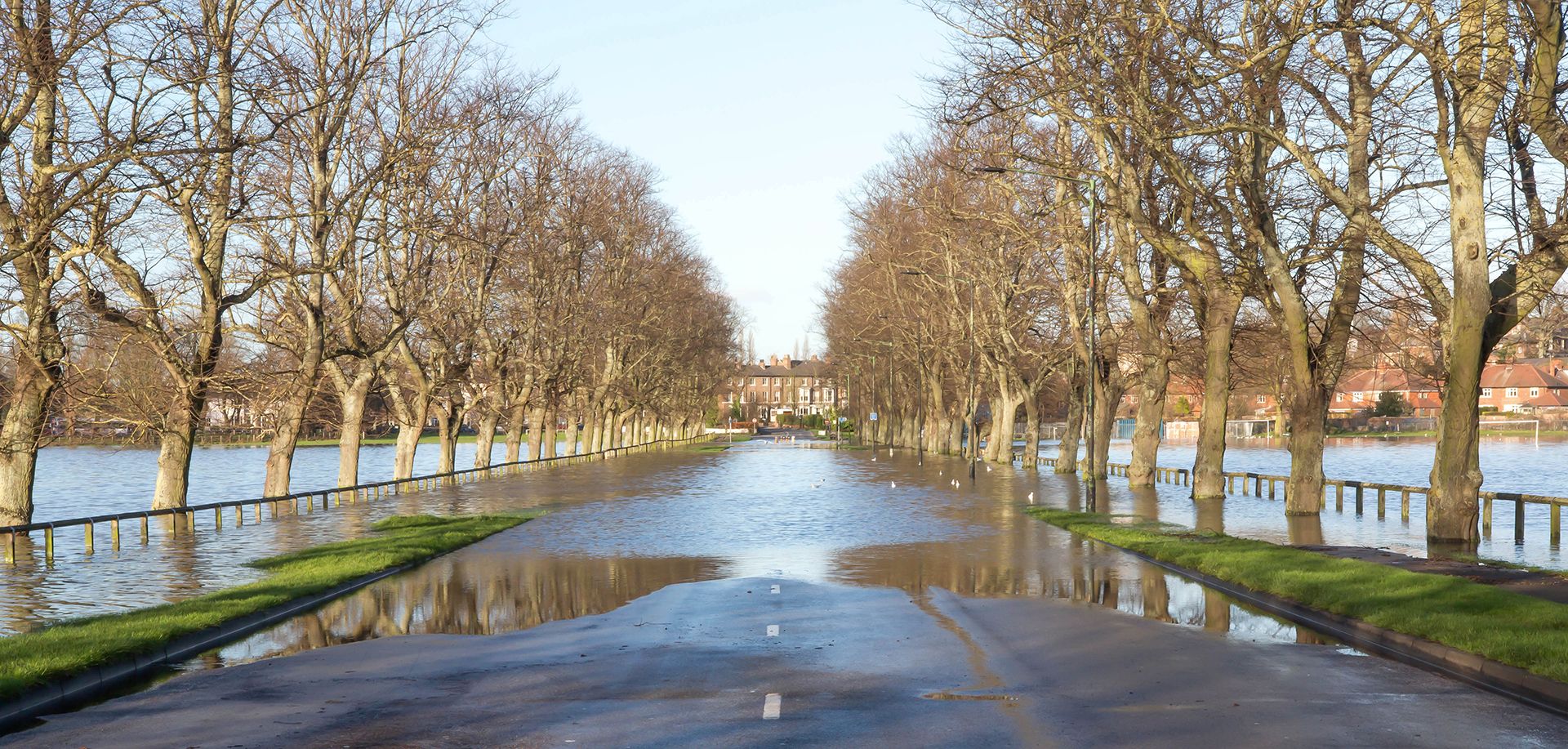
Storm Claudia is bringing heavy and persistent rain to England and Wales with 81.8mm already recorded between 1800 Thursday and 1600 Friday at a Natural Resources Wales rain gauge at Tafalog in Gwent.
The heavy rain will continue to fall and increase accumulations into the evening and overnight, with impacts expected to continue into the weekend. The 81.8mm recorded at Tafalog is already 60% of the monthly November average (1991-2020) for the region.
Weather warnings remain in force, with Amber warnings active until midnight as the heavy rain continues into the night. Even after the Amber warnings expire, conditions will be hazardous with Yellow warnings for rain continuing through the night until 0600 in England and Wales, and through to midday in Northern Ireland.
Met Office Chief Forecaster Rebekah Hicks, said: “Storm Claudia is currently bringing intense rainfall across parts of England and Wales. We’ve recorded 81.8mm of rainfall already and the intense downpours will continue into the evening before weakening in the early hours. Impacted areas will continue to see increasingly lighter rainfall through Saturday morning before eventually turning drier through the afternoon and into Sunday. There remains a risk of flooding so people should keep up to date with local flood warnings and take action where necessary.”
There have also been strong gusty winds in northern parts of Wales and northwest England where 61mph has been recorded at Warcop Range in Cumbria and 58mph at Aberdaron in Gwynedd.
Disruption and flooding expected across England and Wales today from heavy rain associated with Storm Claudia ⚠️
— Met Office (@metoffice) November 14, 2025
Strong, gusty winds will also affect parts of northwest Wales and northwest England
A drier and brighter afternoon for Northern Ireland and Scotland pic.twitter.com/Wy96SIf18w
Risk of flooding
Given the recent unsettled weather, the combination of saturated ground and further heavy rain means that flooding is probable in some areas.
Sally Davies, Duty Tactical Manager Wales at NRW, said: “Storm Claudia is expected to bring persistent and slow-moving rainfall across all of Wales, but will be extremely heavy in parts of South East Wales and Powys. This could lead to severe flooding in these areas, and we want people in these areas to prepare for that possibility.
“We’re expecting the heaviest rain to fall lower down in catchments across these areas. This means smaller streams and watercourses in these parts are at the greatest immediate risk of flooding today and overnight.
“There is also the risk of flooding from rivers slower to respond to rain falling higher up in the catchment. As such, we could continue to see impacts over the coming days, and we urge everyone to take these warnings extremely seriously.
“We have been, and continue to work hard with our partners and emergency responders to make sure communities are as prepared as possible. We need people to take care and make arrangements to be safe.
“Driving conditions during people’s commute home from work today will be particularly treacherous. If you are out, take extreme caution and never drive or walk through flood waters.
“Keep an eye on the forecast and visit our website for the latest information on flood warnings. You can find practical advice on flooding on our website too.”
Turning colder through the weekend
As the intense rainfall weakens, high pressure northwest of the UK will begin to push the area of low pressure that is Storm Claudia back to the south, allowing colder air to spread southwards across the UK. This will bring a marked change to conditions with drier and eventually brighter weather for many. This colder air will bring overnight frosts for many across the UK, with lows of -5°C possible in rural Scotland by Monday night.
While the cold air has been in place over Scotland for a couple of days already, with some snowfall in places like Inverness, this continued cold pool of air brings a further the risk of wintry showers in parts of Scotland as well as overnight ice.
Keep up to date with the latest forecast for your area using our forecast pages. You can also follow us on Twitter and Facebook. Use our mobile app which is available for iPhone from the App store and for Android from the Google Play store.