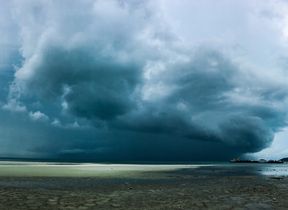
Turning more unsettled for the bank holiday weekend and into half-term week
The bank holiday weekend sees a marked change in weather type, with many areas seeing rain or showers and more unsettled conditions, which remain into next week.
We’ve already seen an end to the prolonged dry spell, with rain over the south of the UK today (Wednesday), with 10-15mm in an hour possible in some areas. This rain will clear during the afternoon, leaving a few heavy showers and the possibility of the odd rumble of thunder. To the north of this, there’s plenty of sunshine though, feeling warm, with top temperatures of 22/23°C possible.
Scattered showers in the south may be heavy at times this afternoon, even bringing the odd rumble of thunder ⛈️
— Met Office (@metoffice) May 21, 2025
Brighter and sunnier elsewhere, and feeling warm away from the North Sea coast where a cool onshore northerly breeze will persist 🌬️ pic.twitter.com/KDYyZfgFbA
Tonight, any showers will gradually fade to leave a dry night, with clear spells. Rural spots could see some mist and fog patches.
Thursday, we’ll see a brief return to high pressure, leaving a drier day in general. There may be patchy fog in the west early on, but this will clear to leave sunny spells. There’s also some thick cloud and isolated rain in the northeast of England, with a few showers possible in the afternoon in the far south too. Temperatures will turn cooler from the north, with warmer conditions confined to the far southwest.
A chilly night on Thursday into Friday, with some frost likely in rural areas and a chilly start to the day. Friday starts dry and sunny for many, but then a system arrives from the west in the afternoon, reaching Northern Ireland first and bringing outbreaks of rain extending eastwards during the afternoon and evening, then reaching all of the west coast of the UK into Saturday. This sets us up for an unsettled bank holiday weekend.
Rain and wind for the bank holiday weekend
The high pressure that has been dominant for much of the last few weeks is expected to finally move away eastwards this weekend, as Deputy Chief meteorologist David Oliver explains: “We’ll see a change in conditions this weekend as weather systems move in from the Atlantic. These will bring rain and windier conditions from the west later Friday, which will spread across the whole of the UK on Saturday. Some heavy rain is expected, especially in the northwest later on Saturday when winds will also strengthen, bringing a risk of coastal gales in the north.
“These strong winds will continue on Sunday as an area of low pressure passes the northwest of the UK. Blustery showers are expected on Sunday, which will be heaviest and most frequent in the northwest. Conversely, the south and southeast may well see a good deal of dry weather.
“Wind will be a watchpoint for Sunday, especially across Scotland where there is some uncertainty on the exact track of the low and its associated wind speeds, so keep up-to-date with the forecast as it evolves over the coming days.”
Bank holiday Monday and beyond
This unsettled regime continues on Monday, with a mixture of bright spells and blustery showers. The showers could be heavy and thundery in places, especially in parts of the northwest. Temperatures look to be near or a little below average, feeling rather cool compared to recent weeks.
The half-term week looks set to be a more unsettled period than of late, with further frontal systems running into the UK, bringing rain to many areas at times, but also some drier spells in between. Temperatures will probably be close to average, perhaps slightly above at times, but will feel fairly cool in the often strong winds.
Keep up to date with weather warnings, and you can find the latest forecast on our website, on YouTube, by following us on X and Facebook, as well as on our mobile app which is available for iPhone from the App store and for Android from the Google Play store.


