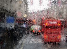
Yellow Warning for rain issued for unsettled midweek ahead
Unsettled conditions are set to continue across the UK this week, with a spell of heavy rain and strong winds impacting southern areas through today and into Wednesday.
Today (Tuesday), rain will move eastwards across southern counties of England and Wales, bringing blustery conditions and heavy downpours in places. Elsewhere, a mix of sunny spells and scattered showers is likely, with lighter winds. Highs of 20-22°C are expected in the south and southeast, with temperatures widely in the high teens further north.
A yellow warning for Wednesday
A yellow warning for rain is in place from midnight until 2pm on Wednesday, covering parts of southwest England and south Wales.
⚠️ Yellow weather warning issued ⚠️
— Met Office (@metoffice) September 2, 2025
Heavy rain across parts of South Wales and southwest England
Wednesday 0000 – 1400
Latest info 👉 https://t.co/QwDLMfRBfs
Stay #WeatherAware⚠️ pic.twitter.com/sdQjWtYRZu
Rebekah Hicks, Chief Meteorologist at the Met Office said: “We’re expecting a band of heavy rain and strong winds to move northeast through the first part of Wednesday, followed by heavy showers and the risk of thunderstorms. Some of these could bring hail and gusty winds, particularly in southern areas.
“Of course, the warning coincides with the first school run after the summer holidays for some, meaning a wet and potentially disruptive start to the day for many.”
Rainfall totals are expected to reach 20-30mm widely, with 40-60mm possible in some areas over a 6-to-9-hour period. Conditions will gradually improve from the southwest through Wednesday afternoon as showers become more isolated.
Thursday to Friday outlook
Thursday looks to be unsettled, with widespread showers and occasional thunderstorms. Some sunny spells are expected, but rain may become more persistent in parts of western Scotland. Winds will stay brisk, especially near coasts, and temperatures will be around average for the time of year, in the high teens to low 20s.
By Friday, southern areas will begin to see more settled conditions, with increasing sunshine and fewer showers. However, the northwest will remain wet and windy, with a small chance of coastal gales.
Potential aurora sightings ahead
Heightened solar activity brought an opportunity to see the aurora borealis across parts of the UK. A fast-moving coronal mass ejection (CME) left the Sun late on Saturday, and sightings were reported as far south as Dorset last night.
Did you manage to see the aurora last night? There were reports of sightings as far south as Dorset! Send us some photos if you did 📸
— Met Office (@metoffice) September 2, 2025
Here's a great shot from @Stevo_SnakeDR in Hopeman, Moray 🌃 pic.twitter.com/leKdQoJWqH
While there is a chance of further viewings tonight, this is more restricted to northern parts of Scotland as the intensity wanes.
Keep up to date with weather warnings, and you can find the latest forecast on our website, on YouTube, by following us on X and Facebook, as well as on our mobile app which is available for iPhone from the App store and for Android from the Google Play store


