Cold spell continues with further snow and ice warnings
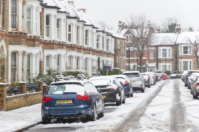
An Arctic airmass continues to cover the UK, bringing cold conditions with snow, sleet and hail showers.
While a number of severe weather warnings expired through Monday, numerous warnings remain in place for Tuesday. The whole of Scotland, Northern Ireland and northern England remain under Yellow warnings for snow and ice, and an Amber warning is in place for snow in central Scotland.
Further warnings cover the east of England and west of Wales as well as Devon and Cornwall. UKHSA Amber cold weather health alerts for all regions of England are in place until Friday 9 January.
Temperatures dropped to -10.9°C at Shap in Cumbria on Sunday night, with numerous Met Office stations well below freezing. Lying snow has been recorded at a large number of Met Office stations, with the greatest accumulations being 52cm at Tomintoul in Banffshire, 35cm at Durris in Kincardineshire and 34cm at Loch Glascarnoch in Ross & Cromarty as of 10:00 Monday morning.
How long will the cold weather last?
— Met Office (@metoffice) January 4, 2026
Here are all the weather details for the week ahead ⤵️ pic.twitter.com/VUBvmiEQtT
While many inland areas will remain dry with long sunny spells, snow showers will continue in northern and eastern areas although these will become lighter and less frequent through the day on Monday. It will be another cold day, with temperatures widely struggling to get much above freezing. Overnight into Tuesday temperatures will once again fall below freezing for much of the country, with the lowest temperatures over lying snow possibly dipping to -12°C.
Tuesday will see a continuation of wintry showers at first across parts of Wales and southwest England. A mix of rain, sleet and snow will move south-eastwards across Scotland and Northern Ireland, then later into parts of Wales and England. There is a chance that a further spell of disruptive snow could affect central and northern Scotland later Tuesday morning until early evening.
Met Office Chief Meteorologist, Matthew Lehnert, said: “The UK will continue to experience a range of winter weather hazards through this week, with low temperatures as well as snow showers and the risk of ice for many. A number of severe weather warnings have been issued and these are likely to be updated through the week so do keep up to date with the forecast.”
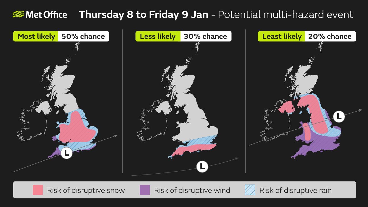
Potential for strong winds, further snow accumulations and heavy rain
Further into the week there are signs that strong winds and heavy rain may bring additional hazards to the impactful weather across the UK. There is some uncertainty over the position of a low pressure system which is important in understanding the potential weather hazards it may bring.
Deputy Chief Meteorologist, Mike Silverstone, explains: “While we’re confident an area of low pressure will move in from the west on Thursday and into Friday, the exact position of that low pressure is uncertain at this stage. The position is important as it will determine the type of severe weather different locations may experience.
“The most likely scenario at this stage is for low pressure to track near the south coast. Near and south of the low, heavy rain and strong winds are more likely, whilst snow could accumulate to the north as it encounters cold air. As confidence increases in the track of the low pressure, so will the detail of the weather impacts so it is important to stay up to date with the weather forecast through the week.”
Advice on staying safe in cold weather
With freezing temperatures as well as snow and ice impacting many areas of the UK, the Met Office’s WeatherReady campaign offers practical advice to help you prepare your home, garden, and daily routines for winter weather. For the latest warnings and forecasts, visit: Met Office warnings and advice.
Age Scotland’s policy director, Adam Stachura, said: “With such cold temperatures and icy conditions ahead, try and make sure you have enough food and any important medications at home to reduce the need for unnecessary and potentially risky trips. This is particularly important if you have mobility challenges or are unsteady on your feet by avoiding slips, falls and the need for medical attention.
"If heating your home is a challenge, try and stay warm in the room or place you will spend most of your time by wearing layered clothing, taking warm drinks and food with some regular movement to help with circulation and keeping your muscles active. And if you are out clearing paths and your drive of snow an ice, please think about also doing so for your older neighbours to help make it easier for them to leave the house if they need to. That act of kindness will go a long way.”
You can find the latest forecast on our website, on YouTube, by following us on X and Facebook, as well as on our mobile app which is available for iPhone from the App store and for Android from the Google Play store.