Weather for the Coronation
Author: Press Office
12:00 (UTC+1) on Thu 4 May 2023
The weather forecast for the Coronation of Their Majesties King Charles III and Queen Camilla.
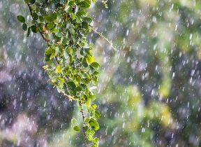
The weather across the UK looks unsettled today, with showers or longer spells of rain for many. Some heavy, thundery downpours are expected on Friday and Sunday.
An area of low pressure will move north eastwards across the UK heralding a move to more changeable conditions from the southwest. It will remain mainly dry in the north and east whilst outbreaks of rain will affect the southwest. Temperatures will struggle under the cloud and cool onshore breeze in the northeast, but further south 21 °C is possible under more prolonged sunshine.
Friday will be a day of sunshine and showers, some of the showers could be heavy and slow moving at times with some thunder, lightning and hail. The showers will affect most parts of the UK, including London, with some more persistent rain affecting parts of eastern Scotland. Highs of 18-20°C are expected across much of England and Wales.
Will your plans over the #CoronationWeekend be affected by the weather?
— Met Office (@metoffice) May 4, 2023
Take a look at the latest day-by-day forecast to find out 👇 pic.twitter.com/R6kVyngCm7
Weather by the weekend
Currently Saturday is forecast to be another cloudy, wet day for many. Showers are likely to develop in central, eastern, and northern areas, as well as across Northern Ireland, but not expected to be as intense or as heavy as those on Friday.
Met Office Deputy Chief Forecaster, Steven Keates, said: “A further area of rain is expected to move into southwest England early on Saturday, moving east and north through the day with some heavy bursts at times. This is likely to bring some rain to London by around lunchtime. Further north in Scotland, northern England and Northern Ireland it will be a day of sunshine and showers before the more persistent rain moves northwards overnight. It will feel humid, especially in the south, with highs of 17°C possible in London.”
Further ahead
With celebrations continuing through the Bank Holiday, Sunday will see areas of rain and drizzle at first. Heavy, possibly thundery showers may possibly develop across parts of central, eastern and southern England, with parts of northeast England and eastern Scotland looking fairly grey and wet. Western parts of the UK, Northern Ireland, Wales, western Scotland and southwest England are expected to see the driest and brightest weather.
Eastern areas will start out mostly dry on Monday but a band of rain in the west will sweep eastwards throughout the day bringing rain to many places. This rain will be followed by sunshine and scattered showers. Winds are expected to be fresh to strong with temperatures near average.
If you want more in depth information about the forecast over the coronation weekend, watch our latest presented forecast.
With the #Coronation weekend fast approaching, here is a snippet of the 10 day trend, focusing on London
— Met Office (@metoffice) May 3, 2023
Find the full forecast for the whole of the UK here https://t.co/YGj31orEzG pic.twitter.com/l4PAJ9UPsa
Weather over past Coronations
Data from the Met Office archive shows that past coronations back to Edward VII have been mixed when it comes to the weather. The Coronation of HM Queen Elizabeth II saw temperature highs of just 11.8°C on 2 June 1953 with some light rain through the day. The Coronation of HM King George V was the mildest of the last four monarch’s Coronation, with daytime highs of 17°C on 22 June 1911.
|
Coronation |
Date |
Daily max temp (°C) |
Daily min temp (°C) |
Daily rain (mm) |
Daily sunshine (hours) |
|
Edward VII |
09/08/1902 |
16 |
9.1 |
0.5 |
- |
|
George V |
22/06/1911 |
17 |
12.8 |
0.3 |
0 |
|
George VI |
12/05/1937 |
14.2 |
6.2 |
8.2 |
0 |
|
Elizabeth II |
02/06/1953 |
11.8 |
6.8 |
2.6 |
1.2 |
We will continue to update the forecast here on our website and on our mobile app, which is available for iPhone from the App store and for Android from the Google Play store. Keep up with the latest on our social media accounts on Twitter and Facebook. Any weather warnings will be posted on the weather warning page.