Wet and windy weather to continue
Author: Press Office
11:41 (UTC) on Wed 21 Feb 2024
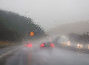
Met Office warnings have been issued with wet and windy weather continuing for many through much of this week.
Unsettled conditions will continue in the coming days, with potential impacts from wind and rain on Thursday and further rain and wind likely for some through the weekend.
Met Office Chief Meteorologist Paul Gundersen said: “After what has been a wet February so far, further rain is on the way on Thursday, accompanied by some gusty winds and potential impacts for those within the warning areas which cover much of southern, central and eastern England.”
“There’s a small chance that wind gusts could reach 60-70mph, mostly likely on exposed coasts, though more widely we're likely to see a shorter spell of heavy, squally rain with hail and thunder in a few places and gusts to around 50mph. Most places within the warning areas are likely to see 10-15mm of rain, with a chance of 30-40mm in a few places. This is falling on saturated ground, which elevates the chances of flooding and disruption.”
Weekend ahead
Friday will be a breezy day for many, with showers feeding into many areas, though these will generally be more frequent in the west. Temperatures are returning more towards average for the time of year compared to the recent mild weather.
Showers should reduce through Saturday, giving most areas a drier spell of weather.
Further persistent rain and locally strong winds are likely to move into some southern areas on Sunday, though those further north are likely to see drier conditions.

Updated at 08:29 (UTC) on Fri 23 Feb 2024