
Briefing on the Arctic sea ice minimum – September 2022
Alex West and Ed Blockley
Arctic sea ice minimum
On 18th September Arctic sea ice reached its minimum extent for the year, at 4.67 million sq km (Figure 1). This is the joint-10th lowest minimum recorded in the satellite era, equal with 2017 and 2018 and slightly below last year’s minimum of 4.75 million sq km. It is 1.55 million sq km below the 1981-2010 average minimum extent, but 0.59 million sq km above the long-term linear trend (Figure 2).
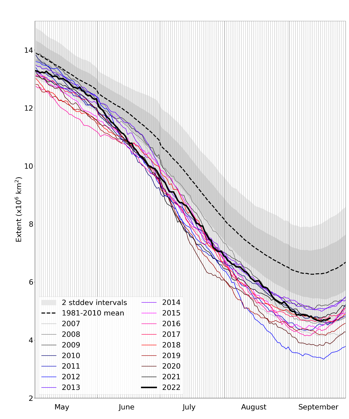
Figure 1. Daily Arctic sea ice extent for 2022, compared with recent years and the 1981-2010 average, with +/- 1 and 2 standard deviation intervals indicated by the shaded areas. Data are from the National Snow and Ice Data Center (NSIDC).
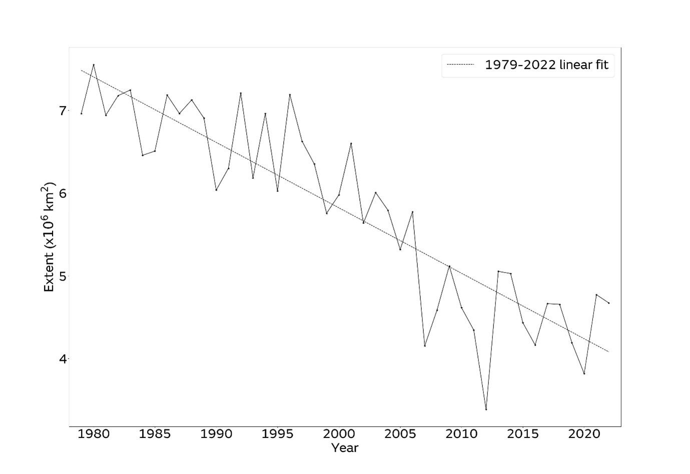
Figure 2. Arctic sea ice minima from 1979 to 2022 according to the NSIDC Sea Ice Index. The minimum sea ice extent is taken to be the lowest 5-day average.
Regional conditions
Extent at minimum was near-average in the Atlantic sector of the Arctic, but well below average in all other regions (Figure 3). In the Beaufort and East Siberian Seas, long, partially dispersed ‘arms’ of sea ice extended from the main pack, with nearby separated patches of ice also visible.
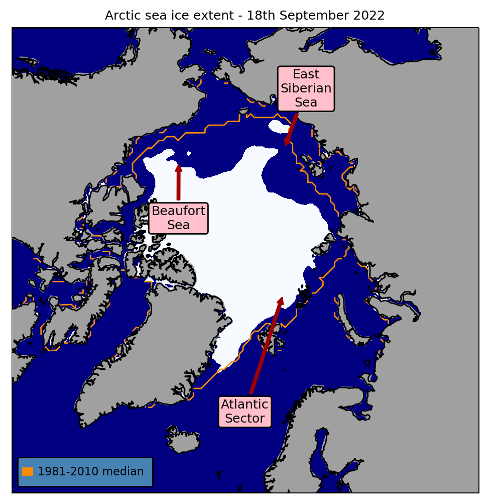
Figure 3. Minimum sea ice extent (18th September 2022), with 1981-2010 average extent for this date indicated in orange. Data are from EUMETSAT OSI-SAF (Tonboe et al., 2017).
References
Tonboe, R., Lavelle, J., Pfeiffer, R.-H. and Howe, E. (2017) OSI SAF Global Sea Ice Concentration. Product OSI-401-b. Version 1.6. September 2017, Available at: https://osi-saf.eumetsat.int/products/osi-401-b