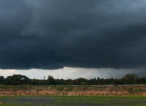
Met Office daily weather: A mix of fog, rain, and occasional brighter spells.
A changeable end to the week is expected across the UK, with a mix of fog, rain, and occasional brighter spells.
Friday morning will begin with freezing fog patches, particularly across southeast England. These are expected to lift by mid-morning, giving way to a more organised area of cloud and rain in the northeast. This rain will gradually become more showery as it clears into the Northern Isles.
Elsewhere, cloud and wind will increase from the west and southwest, bringing a spell of rain that will move north-eastwards through the day. Some of this rain may turn heavy at times, especially in western areas. Temperatures will be close to the seasonal average, though it will become milder in the southwest later in the day.
As we head into Friday night, a band of rain, heavy at times, will continue to move northeast, becoming slow-moving across central and eastern Scotland later in the night. Either side of this rain, clear spells and showers are likely, with some showers turning heavy and a chance of hail or even the odd rumble of thunder in the southwest. Winds will be strong, with coastal gales at first, though these will become confined to the far southwest and northeast later. A patchy frost is possible in parts of western Scotland where skies clear, but it will be milder elsewhere.
Outlook for Saturday
Saturday will see persistent rain affecting parts of eastern Scotland during the morning, slowly pulling northwards through the day. For most other areas, a mix of clear or sunny spells and showers is expected, with some showers heavy and possibly thundery. Showers should ease from the west later, ahead of another band of rain arriving into the southwest late on. Winds will remain blustery for many, with temperatures near average for the time of year.
Met Office presenter and meteorologist, Aidan McGivern, said: “Some freezing fog patches forming early Friday morning, especially across southeast England. These will take until mid to late morning to clear, but away from the fog, there’ll be some sunny spells for the Midlands, eastern England, and the southeast.
“Elsewhere, we’ve got strengthening winds, building cloud, and the next area of rain moving into western parts, especially Northern Ireland, Wales, and the southwest, which will be persistent and heavy as we end the day. Tricky conditions for the Friday afternoon rush hour. Clear spells, some sunshine continuing in the east. Still some showers for Orkney and Shetland, along with a stronger breeze here.
“But, it’s going to be turning a bit milder in the southwest. Not feeling particularly mild, however, with that wet and windy weather moving in as we end Friday. So, a soggy evening to come on Friday as that rain band moves its way eastwards. It will clear, but only to the next area of showers and gusty winds. It’s going to be a wet night for many as that rain clears its way through. Low pressure still in charge, followed by another low, followed by another low, etc., etc., during the weekend and into the start of next week. So, very changeable weather. It won’t be raining all the time, but there’ll be plenty of rain around.”


