Amber warnings issued as Storm Amy approaches
Met Office Amber warnings for wind have been issued as Storm Amy will bring very strong winds and heavy rain for many in the north of the UK in the coming days.
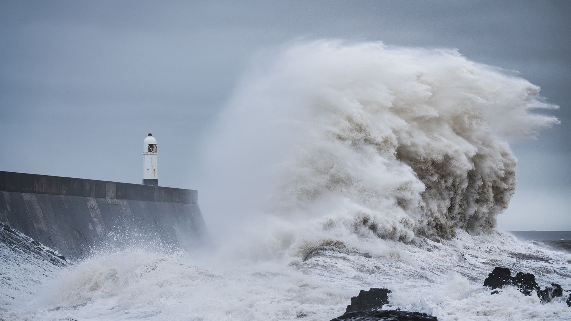
Storm Amy is currently developing in the Atlantic and will bring disruptive wet and windy weather for much of Scotland, Northern Ireland, northwest England and northwest Wales from Friday afternoon and into Saturday.
An Amber warning for wind has been issued for northern and western parts of Scotland which comes into force from 1700 on Friday and will be active until 0900 on Saturday. A separate Amber warning has been issued for the western half of Northern Ireland, valid from 1500-2000 on Friday. The warnings highlight a danger to life, the possibility of power cuts, travel disruption and particularly dangerous conditions near coasts.
Met Office Chief Forecaster Neil Armstrong said: “Within the Scotland amber warning area, gusts in excess of 95mph are possible from Friday evening and into Saturday morning as Stormy Amy brings a risk of power cuts and damage to buildings and trees. Gusts up to 80 mph are possible within the Northern Ireland warning area, more widely 60-70 mph gusts are expected in the Amber warning areas, in what will be an impactful autumn storm for many in Scotland and Northern Ireland.
“Rainfall is an additional hazard, in particular over western Scotland, where totals could exceed 30-50mm in 6-9 hours, increasing the risk of flooding for some. Warnings will continue to be tweaked and amended in the coming days as confidence increases so stay up to date with the latest Met Office forecast and warnings.”
⚠️⚠️ Amber weather warning issued ⚠️⚠️
— Met Office (@metoffice) October 2, 2025
Strong, damaging winds due to #StormAmy across parts of northern and western Scotland
Friday 1700 – Saturday 0900
Latest info 👉 https://t.co/QwDLMfS950
Stay #WeatherAware ⚠️ pic.twitter.com/XDLZYastw6
⚠️⚠️ Amber weather warning issued ⚠️⚠️
— Met Office (@metoffice) October 2, 2025
Wind across northern and western parts of Northern Ireland in association with #StormAmy
Friday 1500 – 2000
Latest info 👉 https://t.co/QwDLMfS950
Stay #WeatherAware ⚠️ pic.twitter.com/QBFuhcryZR
Accumulating rainfall is a particular risk for western Scotland, with a rain warning already in force and further rain to come in the coming days.
Wider Yellow warnings for wind and rain have also been issued in response to the approach of Storm Amy, with gusty winds around 60-70mph possible, even for some inland areas.
Martin Thomson from Transport Scotland said: “Storm Amy is set to bring heavy rain and strong winds to parts of Scotland and we expect to see disruption to the transport network in the warning areas.
“The rain and wind will bring difficult driving conditions, such as reduced visibility and surface water, and are also likely to affect the ferry and rail networks, so it’s important to plan your journey ahead of time.
“Motorists should use the Traffic Scotland website before they set off to make sure that their route is available, and you should check with your operator if you are planning to travel on trains, ferries and flights.”
Claire Dashwood, Engineering Geohazards Geologist at the British Geological Survey, said: “BGS records show that landslides have been triggered in western Scotland by similar amounts of rainfall to that being forecast this week. Both natural and infrastructure slopes are likely to be affected with potential for disruption to roads and railway within the warning area, this could be particularly impactful in this area due to the presence of isolated communities and long diversion routes.”
Sarah Cook, Flood Duty Manager at the Environment Agency, said: “Storm Amy is expected to bring heavy rainfall that may lead to minor surface flooding across parts of the north of England and Midlands this Friday and Saturday.
“Environment Agency teams will be out on the ground, taking action to reduce the impact of flooding and supporting local authorities in responding to surface water flooding. We advise people to stay away from swollen rivers and coastal paths, and not to drive through flood water as just 30cm of flowing water is enough to move your car.
“People should search ‘check my flood risk’ online, sign up for free flood warnings, and keep up to date with the latest situation with @EnvAgency on X.”
Storm naming
Storm Amy has been named in line with the Met Office’s storm naming protocol, which aims to improve public awareness and readiness for impactful weather.
The storm’s evolution is being closely monitored, with its development influenced by the remnants of Hurricanes Humberto and Imelda over the tropical Atlantic. These systems have accelerated the jet stream, contributing to the formation and intensification of Storm Amy.
Keep up to date with the latest forecast for your area using our forecast pages. You can also follow us on Twitter and Facebook. Use our mobile app which is available for iPhone from the App store and for Android from the Google Play store.