Snow and ice warnings remain before a change this weekend
Snow and ice warnings remain in force before the weather pattern shifts this weekend.
The UK continues to experience wintry hazards today and into early Friday, as a cold northerly airstream brings snow showers and icy patches to parts of the country.
Snow and ice warnings remain in place, with new ice warnings issued for some areas overnight into Friday morning.
Feeling the chill? 🥶
— Met Office (@metoffice) November 20, 2025
A cold and crisp afternoon ahead!
Northern Scotland and some coastal spots will see more sleet and snow showers ❄️⚠️
Elsewhere, it’s dry with sunny spells ☀️ pic.twitter.com/xvf8jNIZD8
Chief Forecaster Steve Willington said: “We’re still in the grip of a cold, Arctic air mass today and into Friday, and that means further wintry showers for some, and ice, particularly overnight.
“Multiple warnings are currently in place, with new warnings for the overnight period issued.
“Temperatures will fall sharply again tonight, with lows potentially reaching -12°C in rural parts of Scotland and widely below freezing elsewhere. As temperatures fall overnight, ice will form on untreated surfaces and may cause some travel disruption tonight and into Friday morning.”
Last night saw the coldest night of the season so far for Northern Ireland, England and Wales, with widespread sharp frosts under clear skies.
Brrrr, it was a cold night for many with Northern Ireland, England and Wales all recording their coldest night of the season so far ❄️ pic.twitter.com/zlq3tnDAy9
— Met Office (@metoffice) November 20, 2025
An Amber Cold Health Alert issued by the UK Health Security Agency (UKHSA) also remains in force, focusing on impacts for health and social care in England.
Things will be drier for many by Friday, with temperatures gradually turning milder and rain reaching the west later in the day.
WeatherReady tips for colder conditions
With freezing temperatures and the potential for snow and ice in places, there are a number of simple steps you can take to prepare your home, garden, or business for the winter weather.
Our WeatherReady pages provide expert seasonal advice from carefully selected organisations to help keep you and your property safe, from steps to prevent sub-zero temperatures bursting pipes, to preparing your vehicle for the change in conditions.
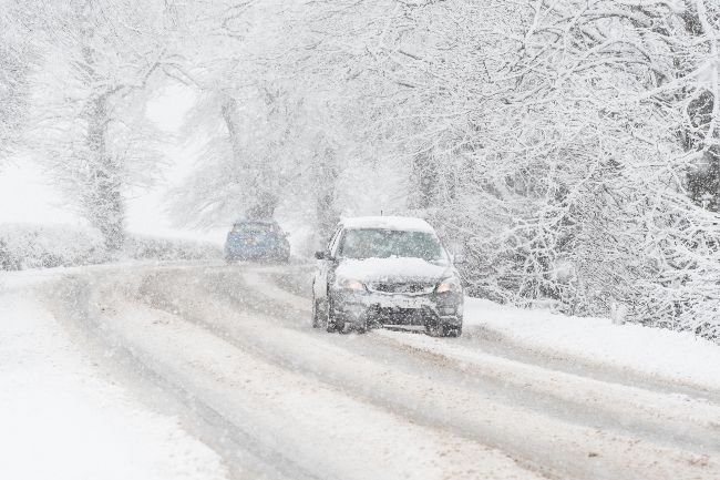
Take extra care on the roads during icy weather.
— Met Office (@metoffice) November 18, 2025
Check out the tips for driving in snow and ice from our partner @NationalHways 👇https://t.co/Tc9FU3Pkf2#WeatherReady pic.twitter.com/Bz7pVdjmcz
Read: The UK’s cold weather records: A look at snow, frost, and the coldest nights
A change underway by the weekend
As we head into the weekend, we expect a shift to milder, more unsettled, Atlantic-driven weather. This will bring cloud, rain and some stronger winds at times, but also a reduction in the wintry hazards we’ve seen over recent days. We are keeping an eye on Wales and the Midlands, where saturated ground conditions may increase the likelihood of low impacts.
Conditions will remain on the chilly side, although temperatures will gradually edge back towards more typical values for the time of year. As we head into next week, a gradual settling trend is expected; north to northeasterly winds will confine rain and showers increasingly to eastern areas, whilst cooler air arriving in the north may allow some wintriness to develop in the extreme north of the country by the end of Monday.
Keep up to date with the latest forecast for your area using our forecast pages. You can also follow us on Twitter and Facebook. Use our mobile app which is available for iPhone from the App store and for Android from the Google Play store.