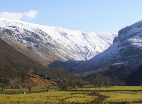
Wintry, unsettled conditions continue
Author: Press Office
15:54 (UTC) on Mon 24 Feb 2020
Wintry conditions remain in the forecast, with snow and ice warnings.
Paul Gundersen, Chief Meteorologist with the Met Office, said: “The flow of cold air over the UK will lead to heavy, wintry showers and icy conditions overnight. From 10pm Wednesday until 10am on Thursday there is a Met Office Yellow warning for snow & ice for most of the UK north of a line from the central Wales to the Wash, except north-east England and eastern Scotland.
“A low-pressure system moving in to the South West from the Atlantic overnight will bring a further period of rain to southern England. As this system encounters the cold air further north over the UK, there is a risk of snow along this boundary and we have issued a Yellow warning north of the M4 corridor from central Wales, parts of the Midlands and East Anglia. Snowfall up to 5cm is possible over higher ground in South Wales, with 1-3cm possible over the Cotswolds and the Chilterns. It is possible that rain may briefly turn to sleet or snow over lower ground across the Midlands, East Anglia and areas north of London, although accumulations here are likely to be small.”
Rain, sleet and snow will quickly clear eastwards by late morning and any snow at lower levels will soon thaw.
On Friday and Saturday the forecast remains distinctly unsettled with Yellow rain warnings in force for most of Wales and parts of northern England. Paul Gundersen added: “Within these warning areas 40-60mm of rain is possible on the highest ground with 15-30mm likely more widely. This could bring further flooding impacts to already-affected communities and catchments.”
Caroline Douglass, Director of Incident Management at the Environment Agency, said: “Flooding has a long lasting and devastating impact on people’s lives, and we offer our heartfelt sympathies to all who have been flooded and continue to be affected by the persistent wet weather.
“We have seen our third weekend of exceptional river levels and stormy weather, continuing into this week; with the effects of climate change, we need to prepare for more frequent periods of extreme weather like this. People need to be aware of their flood risk, sign up to flood warnings, make a flood plan and not to drive or walk through flood water.”
You can check your flood risk and stay up to date with flood warnings in your area with Natural Resources Wales, SEPA, NI Direct and the Environment Agency.”
You can check the latest weather warnings on our severe weather warnings pages and you can get the most accurate and up to date forecast for your area using our forecast pages and by following us on Twitter and Facebook, as well as using our mobile app which is available for iPhone from the App store and for Android from the Google Play store.