Amber warnings in force for Storms Dudley and Eunice
Author: Press Office
11:44 (UTC) on Wed 16 Feb 2022
Two storms named by the Met Office are expected to bring impacts from strong winds for much of the UK, with the potential for some snow later in the week across parts of Northern Ireland, northern England and southern Scotland.
Storm Dudley will impact the northern half of the UK from Wednesday afternoon, while Storm Eunice will bring strong winds to southern and central areas, as well as some snow for northern areas. Amber and yellow warnings have been issued for both storms.
Met Office Chief Meteorologist Frank Saunders said: “An active jet stream is helping to drive low-pressure systems across the country, with both storms set to cause some disruption and National Severe Weather Warnings have been issued.
“Significant disruption is possible from both Storm Dudley and Storm Eunice with strong winds one of the main themes of the current forecast. The most impactful winds from Dudley will be in the north on Wednesday afternoon, as shown in the amber warning area. Storm Eunice is expected to track eastwards from early on Friday, bringing the most significant winds to the central and southern areas of the UK, with some gusts possible in excess of 95mph in exposed coastal areas.”
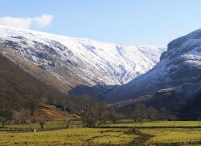
Storm Dudley
#StormDudley will bring a wet and windy afternoon today, particularly in the north with inland gusts of 60-70mph 💨⚠️ pic.twitter.com/rHsbegBJ8Z
— Met Office (@metoffice) February 16, 2022
Strong winds will cross western Scotland and Northern Ireland on Wednesday afternoon, pushing eastwards to northern England later in the day. Wind gusts could reach up to 80mph in exposed coastal areas, with 60-70mph gusts possible further inland. A yellow warning for wind has been issued for much of central and northern areas of the UK, including Northern Ireland. Embedded within that is an amber warning for southern and western Scotland, the north coast of Northern Ireland and northern England, where the strongest and most disruptive winds are expected.
For tracked impacts from Storm Dudley, follow @MetOffice on Twitter.
Storm Eunice
Weather warnings have been updated in association with #StormEunice
— Met Office (@metoffice) February 16, 2022
Stay #WeatherAware ⚠️ pic.twitter.com/0Dwyx5cevB
Yellow and amber warnings for wind have been issued for Storm Eunice, which is going to impact much of the UK on Friday. The most significant wind gusts are expected in the south and west of the UK, with an amber warning now in force here from the early hours of Friday morning. Exposed coastal areas could see wind gusts in excess of 95mph, while inland areas could still see gusts to around 80mph, bringing the potential for fallen trees, damage to buildings and travel disruption.
Although Storm Eunice’s strongest winds will be on its southern edge, the northern flank of the system brings the potential for some snow to northern areas. A yellow warning for wind and snow has been issued covering Northern Ireland, northern England and southern Scotland, where potentially up to 20cm of snow could accumulate over high ground, with up to 5cm possible in some lower areas. Brisk winds in this area could cause blizzard-like conditions and drifting of lying snow, reducing visibility, and making driving conditions difficult.
Katharine Smith, Environment Agency Flood Duty Manager, said: “Strong winds could bring coastal flooding to parts of the west, southwest and south coast of England, as well as the tidal River Severn, in the early hours of Friday morning. This is due to Storm Eunice resulting in high waves and potential storm surge coinciding with the start of a period of spring tides.
“Please remember to take extreme care on coastal paths and promenades. We urge people to stay safe on the coast and warn wave watchers against the unnecessary danger of taking ‘storm selfies’. Flooding of low-lying coastal roads is also possible and people should avoid driving through flood water as just 30cm of flowing water is enough to move your car.
“You can check your flood risk, sign up for free flood warnings and keep up to date with the latest situation at https://www.gov.uk/check-flood-risk, call Floodline on 0345 988 1188 or follow @EnvAgency on Twitter for the latest flood updates.”
Further ahead
After Storm Eunice the unsettled weather continues over the weekend with further strong winds, rain and sleet expected through Saturday and Sunday. The changeable conditions are then expected to continue into next week.