Christmas Forecast
Author: Press Office
13:46 (UTC) on Thu 22 Dec 2022
It will be a cloudy and wet Christmas for much of the UK, with any wintry showers confined to the far northwest.
Christmas Eve will be mostly dry for many southern and eastern parts of the UK. Further north and west, strong southwesterly winds will bring showers or some longer spells of rain, these heavy at times and falling as snow over the high ground of Scotland.
Christmas Day will see a continuation of unsettled weather with strong winds and spells of rain for many northern and western areas of the UK. A yellow National Severe Weather Warning has been issued for snow and ice for parts of northern and western Scotland valid from 9pm on Christmas Day to 6pm on Boxing Day. Whilst those further south won’t be immune to the occasional shower, the driest weather conditions are expected in central and eastern parts of England.
A white Christmas, which is defined as a single snowflake falling anywhere in the UK on Christmas Day, is most likely in northwest Scotland later on Sunday. Some snow could be seen here at low levels overnight and into Boxing Day.
A mild and green #Christmas is on the cards for many this year 🎄 but cold air will be pushing southwards late on Christmas Day into Boxing Day 👇 pic.twitter.com/xTCbp0wbfw
— Met Office (@metoffice) December 22, 2022
Met Office Deputy Chief Meteorologist David Oliver said: “An unsettled Christmas weekend is on the way for many, with those in the north and west seeing the most frequent and the heaviest showers. High winds will affect some coasts through the weekend with gales in places, especially the north and west.
“Christmas Day will be unsettled for many, with the most frequent showers in the northern half of the UK and some more sporadic and mostly lighter showers further south. There is some uncertainty about the timing of colder air from the northwest, but it looks like this will introduce some snow showers to the northwest of Scotland late on Christmas Day.”
How will the cold in North American influence the weather in the UK?
A large area of North America is experiencing extremely low temperatures with very cold northerly winds.
Although the event itself won’t directly impact on the UK’s weather, it does influence the medium-range outlook for the UK.
David Oliver explained: “As is often the case, the conditions across the Atlantic play an important role in dictating our weather in the UK. We won’t see any direct impacts from the event currently occurring across North America. Rather, the temperature contrasts that develop across the North Atlantic as a result of this will help strengthen the jet stream, which plays a big role in the weather we get in the UK.
“The jet stream will help to develop low pressure systems which are likely to affect the UK between Christmas and New Year. These will bring some wet and windy weather at times and the chance of some snow in the north of the UK, as is often the case at this time of year.”
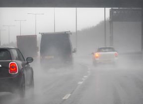
Stephen Basterfield, National Network Manager, at National Highways, said: “Even light or moderate rain can have an impact on visibility and vehicle performance, so it’s important to adjust your driving behaviour and take extra care.
“It is therefore always important to plan ahead for your journey. This advice is especially important during the winter season when weather conditions are traditionally more adverse.
“We have a section of our website dedicated to travelling when it is raining, as part of our guide to travelling in severe weather. It’s also a good idea for people to check their vehicles, such as tyres, coolant and oil levels, before heading out to reduce the risk of breakdowns.”
Keep up to date with the latest forecast on our website, by following us on Twitter and Facebook, as well as on our mobile app which is available for iPhone from the App store and for Android from the Google Play store. Keep track of current weather warnings on the weather warning page.
Updated at 14:00 (UTC) on Fri 23 Dec 2022