Amber warnings issued for snow and ice
Author: Press Office
12:06 (UTC) on Thu 9 Mar 2023
Amber warnings have been issued, highlighting further snowfall for central and northern England, northern Wales and eastern parts of Northern Ireland.
Temperatures dipped to -16°C last night at Altnaharra, which is the coldest March night in the UK since March 2010.
As milder air continues a transition north, snow on the leading edge is likely to cause further disruption for many. A number of National Severe Weather Warnings are in place across the UK as snow continues to cause disruption through the week.
Three Amber warnings have been issued by the Met Office, highlighting likely travel disruption, possible power cuts and a good chance that some rural communities could become cut off.
Thursday afternoon:
— Met Office (@metoffice) March 9, 2023
❄️ Risk of heavy snow and strengthening winds in central parts, with travel disruption likely
🌧️ Cloudy with rain in the south
🌤️ Cold but with some sunny spells in the north pic.twitter.com/9oYnDfSTu7
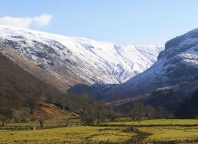
Northern and eastern areas of Wales have an Amber warning for snow and ice which comes into force from midday Thursday. Within this warning area many areas are likely to see 10-20cm of snow with a chance of up to 30cm falling, most likely over high ground.
An Amber warning for snow has also been issued covering an area from the south of the Peak District up to the North Pennines, valid from 1500 Thursday to 1200 Friday. 10-20cm of snow is likely to fall across much of the area, with 30-40cm in some places, and will be accompanied by strong winds.
Eastern areas of Northern Ireland have an Amber warning for snow and ice from 1500 Thursday to Friday morning, with 10-20cm of snow possible over high ground and 4-8cm of snow quite widely away from immediate coasts.
High winds will represent an additional hazard for those with heavy snow, with significantly deeper snowdrifts possible and very poor travel conditions.
Within the wider yellow warning areas through Thursday and Friday, 2-4cm of snow could accumulate quite widely, with 5-10cm possible in a few places.
Met Office Chief Meteorologist Jason Kelly said: “The boundary between milder and colder air is gradually moving north, with some heavy and persistent snow likely at times on the northern edge of this boundary. Snow has already settled quite widely in centrals parts of the UK and further accumulations are likely even to lower levels with disruption most likely for those within the amber warning areas.
“With some strong winds accompanying these snow showers, blizzard conditions are likely for a time in northern England and Wales, as well as parts of Northern Ireland. Ice will be a continuing hazard for many in the forecast period, with very low overnight temperatures likely to exacerbate continued likely travel disruption.”
The low pressure that’s leading to high winds for the UK late on Thursday and into Friday will also lead to some more significant gusts over northern France for a time, which has resulted in Météo-France naming the system Storm Larisa.
Further south in the milder air there will be continued rain showers and breezy conditions, there will be clearer skies and more sunshine by Friday afternoon.
Travel disruption
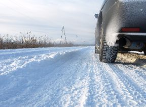
RAC Breakdown spokesperson Rod Dennis said: “We’re seeing up to 50% more breakdowns in the worst affected areas today compared to normal, with some drivers already stuck in the snow in some parts of South Yorkshire and Wales. Rural routes through central and northern England covered by the Met Office’s amber weather warning are also starting to get difficult to negotiate, and these are areas drivers should avoid if they can.
“Given the weather, we recommend thinking carefully before setting out today as, with more snow forecast, things are likely to get worse on the roads before they get better. These aren’t conditions anyone wants to be caught out in, so those who have to drive need to be confident on potentially slippery surfaces, have ensured their vehicles are up to the task, and are carrying an emergency breakdown kit so they can stay warm and communicate easily should they get stuck or break down.”
Further ahead
As we move towards the weekend, the area of low pressure that has brought the milder air will have moved out to the east, allowing colder air to spread south right across the UK, whilst wintry showers once again will become established across northern and eastern Scotland, as well as perhaps the east coast of England for a time.
It will be an exceptionally cold night on Friday, with a clear and frosty start to Saturday for the majority.
Another area of low pressure is expected to arrive from the west through Saturday, pushing milder air northeastwards. This will be preceded by snow, and possibly freezing rain, especially over the higher ground of Wales and further north. For many areas this is likely to turn to rain as the milder air arrives, but for some parts of northern Britain in particular the snow could become more persistent.
Further organised bands of snow showers may continue to affect northern Scotland with some rather large totals building up over the western Highlands and Grampians. Weather warnings are under constant review and will be issued as the detail of potential impacts becomes clearer.
By start of next week, low pressure from the west will drive strong winds and heavy rain across much of the UK. However, the colder air could hang on for longer in northern Scotland, with a chance of further significant snow should it do so.
Cold weather alert
The UK Health Security Agency has issued a Level 3 Cold Weather Alert for the whole of England which is likely to be reviewed in the coming days.
Dr Agostinho Sousa, Head of Extreme Events and Health Protection at the UK Health Security Agency, said: “During periods like this, it is important to check in on family, friends and relatives who may be more vulnerable to the cold weather, as it can have a serious impact on health.
“If you have a pre-existing medical condition or are over the age of 65, it is important to try and heat your home to at least 18°C if you can.’’
Keep up to date with the latest forecast on our website, by following us on Twitter and Facebook. Keep track of current weather warnings on the weather warning page.