Cold spells to come
Author: Press Office
13:06 (UTC) on Fri 24 Nov 2023
The first widespread frost of Autumn for much of England and Wales is expected tonight with a further cold spell forecast next week.
Temperatures have fallen across much of the UK and the first widespread frost across the majority of the UK is forecast tonight, with lows of -5°C possible even in rural parts of southern England. It will remain predominantly dry through Friday and Saturday with any showery rain confined to the east coast.
Wetter interludes will move in from the west and north on Sunday bringing rain for many through Sunday afternoon and Monday morning before clearing to the south and southeast on Monday afternoon.
Next week
It will turn colder again through Monday evening with a return to widespread overnight frosts. Conditions will also be largely dry, though some rain showers along the east coast could turn to sleet over higher ground.
Met Office Deputy Chief Meteorologist, Dan Harris, said: “Early next week, following a brief more unsettled interlude, we expect to see a return to widely cold but quiet conditions. Some rain, or showers, are likely to affect some parts of the east coast, and these could turn increasingly wintry over higher ground areas towards the middle of the week.
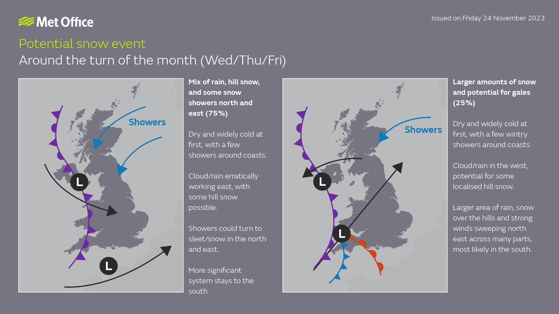
“Thereafter, confidence in the detailed forecast falls, which is typical when looking this far ahead. It does look as though there will be a trend towards something more unsettled, as areas of cloud and rain attempt to move across the UK.
“At present, the most likely outcome beyond mid-week is that rain from the west slowly moves east, with snow possible over higher ground, and a continued risk of showers over eastern parts. However, there is a chance that a more active weather system arrives from the southwest, which would bring more widespread rain, stronger winds, and the potential for more significant snowfall should the air over the UK become sufficiently cold ahead of it.
“Either way, a continuation of colder than average conditions seems most likely, more details will become clear over the coming days and, as you would expect, we will be monitoring developments in the forecast closely.”
You can keep up to date with the latest forecast on our website, by following us on Twitter and Facebook, as well as on our mobile app which is available for iPhone from the App store and for Android from the Google Play store.