A brief respite for some before cold returns
Author: Press Office
12:40 (UTC) on Fri 10 Mar 2023
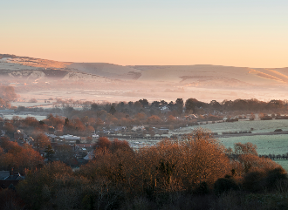
Wintry conditions will be slowly easing their grip on most parts of the UK over the weekend, but a return to colder conditions for many is likely in the early part of next week.
Over the next few days Met Office Chief Forecasters anticipate making changes to the pattern of National Severe Weather Warnings.
Friday outlook
The low-pressure system – named Storm Larisa by our French partner Météo-France - has moved across a swathe of England and has brought significant snowfall to some parts. Larisa is now gradually pulling away into northern Europe encouraging a feed of colder air and clearer conditions across many areas of the UK by late on Friday. However, these clear skies will bring further wintry hazards with widespread frost and ice occurring with sub-zero temperatures for many.
Jason Kelly is the Chief Forecaster. He said: “The worst of the snowfall in England is over for now, but further weather warnings will be in force to cover the further hazards brought by frost and ice.”
Northernmost parts of Scotland are likely to be subjected to further snow showers.
⚠️ Warning Update ⚠️
— Met Office (@metoffice) March 10, 2023
Here's an update of the current warnings in force for today and the weekend.
Latest info 👉 https://t.co/QwDLMfRBfs
Stay #WeatherAware⚠️ " pic.twitter.com/xLo41TaSLW
Weekend prospects
Jason continued: “During the early hours of Saturday a weather front will bring warmer air in from the South West to extend across most parts of the UK during Sunday. As we have seen over the last few days, the influence of this warm and moist air from the South West will bump into the cold air bringing a risk of further snowfall on the leading edge for a time. However, it will also bring heavy rainfall for many as it moves across the UK.
“This could bring transient snow for an hour or two to areas like Northern Ireland and North Wales before extending into the higher elevations of northern England and Scotland.”
Early next week
Early next week, a broad pattern is emerging which is likely to see a return to colder conditions during late Monday and early Tuesday, although with less certainty in the details.
Daniel Rudman is a Met Office Deputy Chief Forecaster. He said: “There is an increasingly strong signal for colder air to once again feed into the north of the UK during Monday. This flow is likely to extend southwards with much of the UK likely to be under the influence of colder conditions overnight into Tuesday.
“Tuesday is set to remain a cold day, but it is not expected to be as cold as conditions have been this week, and there will be brighter periods for most. There are likely to be some showers too, although any snow fall is expected be over higher elevations.”
Further out, a weather system is forecast to bring milder conditions in from the west. This system will bring further rain, especially to areas of higher ground in the west of the UK, although still with the risk of another period of snow for the north.
Travel disruption
RAC Breakdown spokesman Rod Dennis said: “Wintery conditions are far from over so drivers need to stay aware of the risks posed by a continuation of cold weather. Many roads are likely to be slippery as result of low overnight temperatures affecting surfaces that remain wet from either snow or rain this week, while fresh snowfall may affect isolated, upland routes. We urge drivers to keep a close eye on the weather forecast and heed any warnings, and to set out fully prepared – this means always having a winter coat and extra layers of clothing in the car, as well as food and drink, a mobile phone power bank and phone charging cable to hand.”
Cold weather alert
The UK Health Security Agency has in place a Level 3 Cold Weather Alert for the whole of England which is expected to remain in place until 9am on Monday.
Dr Agostinho Sousa, Head of Extreme Events and Health Protection at the UK Health Security Agency, said: “During periods like this, it is important to check in on family, friends and relatives who may be more vulnerable to the cold weather, as it can have a serious impact on health.
“If you have a pre-existing medical condition or are over the age of 65, it is important to try and heat your home to at least 18°C if you can.’’
Keep up to date with the latest forecast on our website, by following us on Twitter and Facebook. Keep track of current weather warnings on the weather warning page.