Storm Babet has been named
Author: Press Office
11:30 (UTC+1) on Mon 16 Oct 2023
Storm Babet will bring impactful rain across parts of the UK.
Heavy rain will move into the west of the UK on Tuesday evening as Storm Babet brings increasingly wet and windy weather. The rain will spread more widely across the UK on Wednesday bringing heavy downpours to most parts through the day.
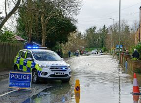
As the rain moves northwards it will stall across central and eastern parts of Scotland where the rain will become heavy and persistent from Thursday through to Saturday. There is a Severe Weather Warning for rain for this area where up to 150-200 mm of rain could accumulate in some areas of higher ground.
Further rain warnings have been issued for Northern Ireland and England and there is also a Yellow warning for wind over the northern half of Scotland through Thursday and into Friday.
Deputy Chief Meteorologist, Steven Keates said: “Storm Babet will bring impactful rain to many parts of the UK, but especially parts of eastern Scotland, Northern Ireland and northern England later this week. Heavy and persistent rain will fall onto already saturated ground bringing a risk of flooding. It is important to stay up to date with warnings from your local flood warning agency as well as the local authorities.
“As well as heavy rain, Storm Babet will bring some very strong winds and large waves near some eastern coasts too. Gusts in excess of 60mph are possible in eastern and northern Scotland from Thursday. It is likely Met Office warnings will be updated through the week.”
#StormBabet has been named by @metoffice and is forecast to bring impactful heavy rain to the UK from Wednesday this week
— Met Office (@metoffice) October 16, 2023
Strong winds will accompany the storm
Stay #WeatherAware pic.twitter.com/YJYB3haD4L
David Morgan, Flood Duty Manager for the Scottish Environment Protection Agency (SEPA), said: “Storm Babet will bring heavy rain and high winds across Scotland from Wednesday evening, starting in the South West before moving across to the North East through Thursday and into the weekend.
“Impacts from surface water and rivers are likely, and with catchments saturated from recent heavy rain and flooding, we’re urging people to be prepared for potential flooding. There is also concern that surface water flooding may be exacerbated by debris blocking drainage, culverts, etc. as a result of the high winds.
“Flood Alerts and Warnings will be issued as required, and we continue to work with the Met Office to monitor the situation 24/7. People can check our Flood Updates for all the latest information and the three-day Scottish Flood Forecast to see what conditions are expected further ahead.
“If you live or work in an area that could be affected, consider any steps you need to take now to be prepared and stay safe, and to take extra care if you need to travel.
“If you have not already signed up to Floodline, you can do so now to receive free updates for where you live, or travel through, directly to your phone. Follow SEPA’s social media, especially @SEPAflood on X for the latest information.”
Do you know your flood risk?
Could your property be at risk of flooding? Follow this three point plan to check and be prepared: 1. Check if your property is at risk here. If you are at risk take the next two steps to protect your property when you need to, 2. preparing a flood plan, 3. Prepare an emergency flood kit.
Further ahead
Low pressure is forecast to remain in charge of the UK’s weather into the start of next week, with potential for further spells of wet and windy weather.
You can keep up to date with the latest forecast on our website, by following us on Twitter and Facebook, as well as on our mobile app which is available for iPhone from the App store and for Android from the Google Play store.