

Observed and Forecast Tracks: Northern Hemisphere 2011
All tropical cyclones in the northern hemisphere season in 2011 are listed below including details of their start and end dates and maximum sustained wind (MSW). Qualitative comments are included on the performance of the Met Offi
Click on the name of the tropical cyclone to see a chart of the observed track and forecast tracks from the Met Office global model. Verification statistics on each tropical cyclone are available upon request from [email protected]. At the end of the season a verification report on the performance of the Met Office global model will be published.
| Name & ID | Start & end dates | 1-/10-minute MSW | Comments on Met Office global model forecasts |
|---|---|---|---|
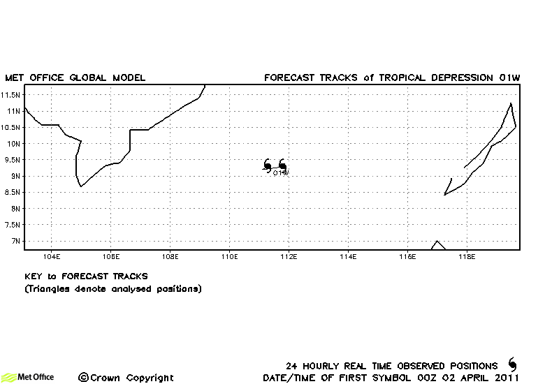
| 01W | 02-03 April | 30/- knots | 01W did not attain tropical storm status and no forecasts were verified. |
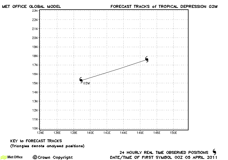
| 02W | 05-06 April | 30/- knots | 02W did not attain tropical storm status and no forecasts were verified. |
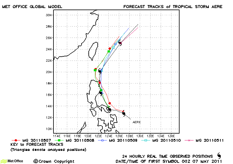
| Aere (03W) | 06-11 May | 50/45 knots | Track forecast errors were mixed compared to last season's values, but skill was high at longer lead times. The landfall on Luzon was fairly well predicted. |
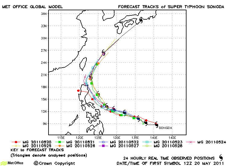
| Songda (04W) | 20-29 May | 140/105 knots | Track forecast errors were mostly below last season's average. There was a left of track and slow bias resulting a slightly late prediction of recurvature and extratropical transition. However, skill scores against CLIPER were high. |
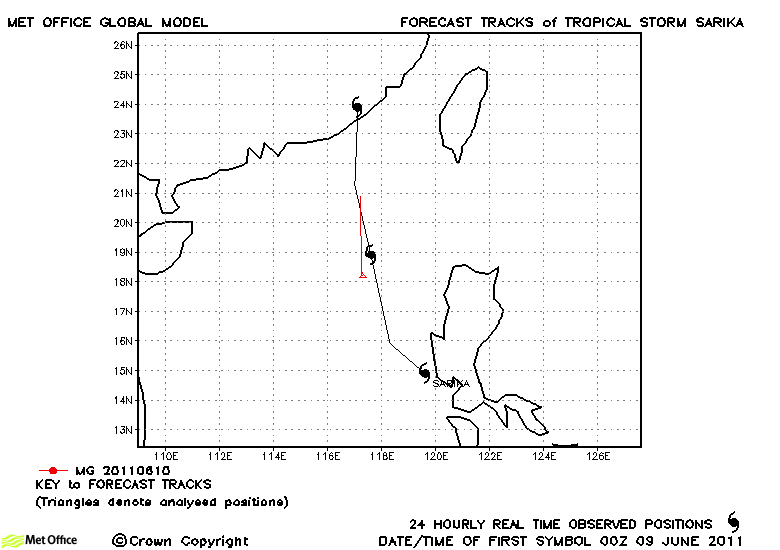
| Sarika (05W) | 09-11 June | 35/40 knots | Sarika was only briefly a tropical storm |
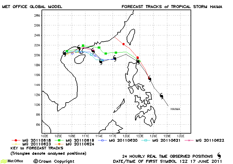
| Haima (06W) | 16-24 June | 35/40 knots | There was a slight right-of-track bias early on, but overall track forecast errors were below last season's average and skill scores were very high. |
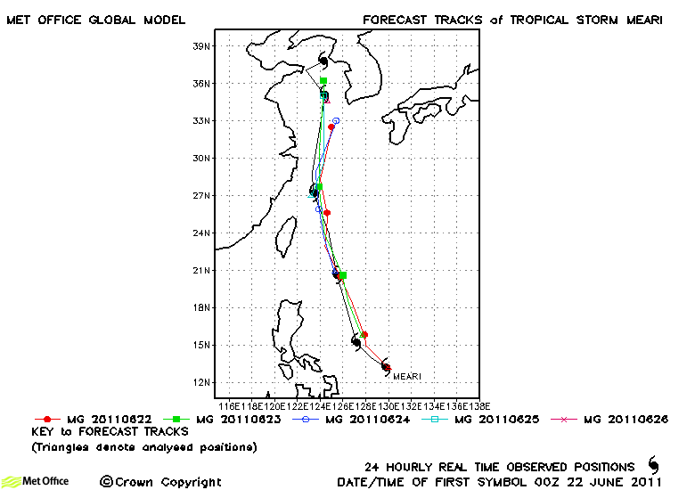
| Meari (07W) | 21-27 June | 60/60 knots | Track forecast errors were very low and skill scores high for this storm. There was a slight slow bias at longer lead times. |
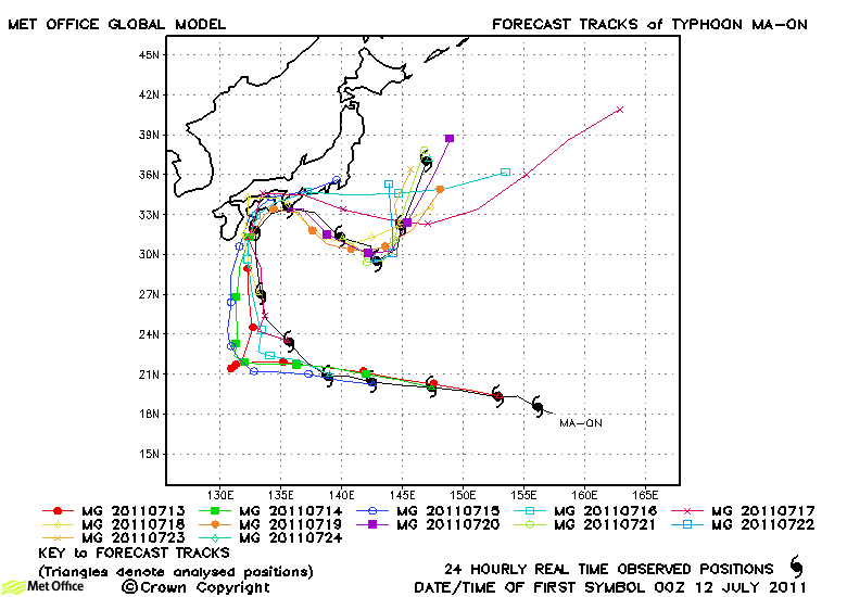
| Ma-on (08W) | 11-24 July | 115/95 knots | Ma-on was a long-lived typhoon with several changes in direction. On the whole these changes in direction were well predicted by the model. The track errors were near to last season's average. There was a slow and left-of-track bias overall, but skill scores against CLIPER were high. |
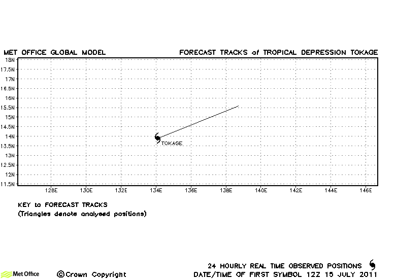
| Tokage (09W) | 15-16 July | 30/35 knots | Tokage was designated a tropical storm by JMA, but not JTWC. It was short-lived and no forecasts were verified. |
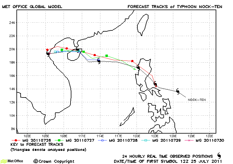
| Nock-ten (10W) | 24-30 July | 65/50 knots | The track of Nock-ten was very well predicted with low track forecast errors. Skill scores against CLIPER were also high. |
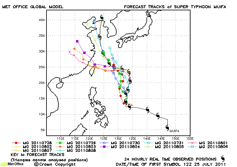
| Muifa (11W) | 24 July-08 August |
140/95 knots |
Forecast track errors were above last season's average, although skill scores were positive. The model turned Muifa too sharply westwards towards Taiwan. |
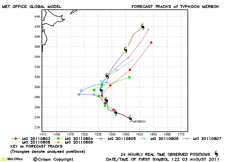
| Merbok (12W) | 03-09 August | 80/55 knots | The model erroneously stalled Merbok resulting in some large timing errors in the prediction of recurvature. Hence, track forecast errors were generally large. |
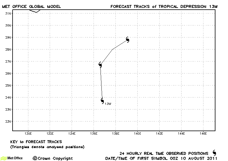
| 13W | 10-12 August | 30/30 knots | 13W did not reach tropical storm strength and no forecasts were verified. |
| Nanmadol (14W) | 22-31 August | 135/105 knots | Although the model had a right-of-track bias, its forecasts for Nanmadol were much better than some other models in predicting a track close to the Philippines and towards Taiwan. Hence, track errors were below last season's average. |
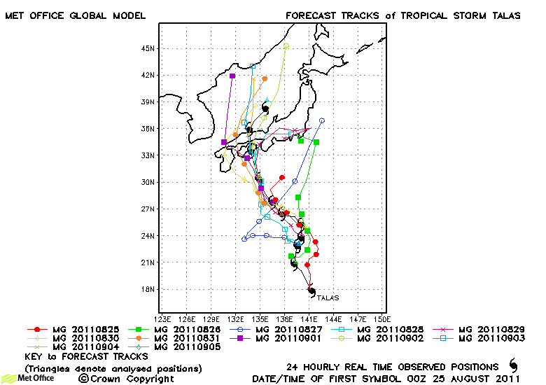
| Talas (15W) | 25 August-05 September | 55/65 knots | The majority of forecast tracks for Talas were good resulting in track forecast errors below last season's average. |
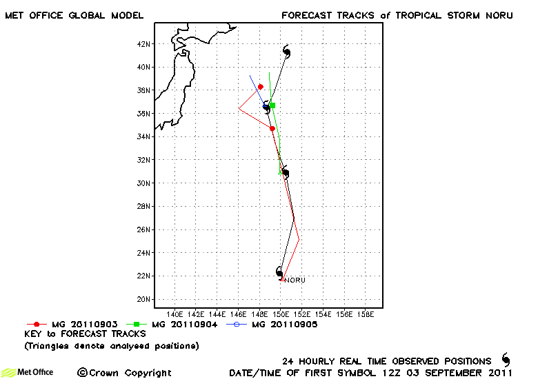
| Noru (16W) | 03-06 September | 45/40 knots | Track forecast errors were below average for this storm |
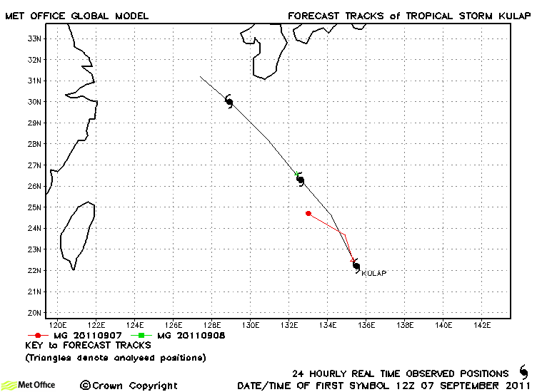
| Kulap (17W) | 07-10 September | 45/35 knots | Kulap was only briefly a tropical storm and few forecasts were verified. |
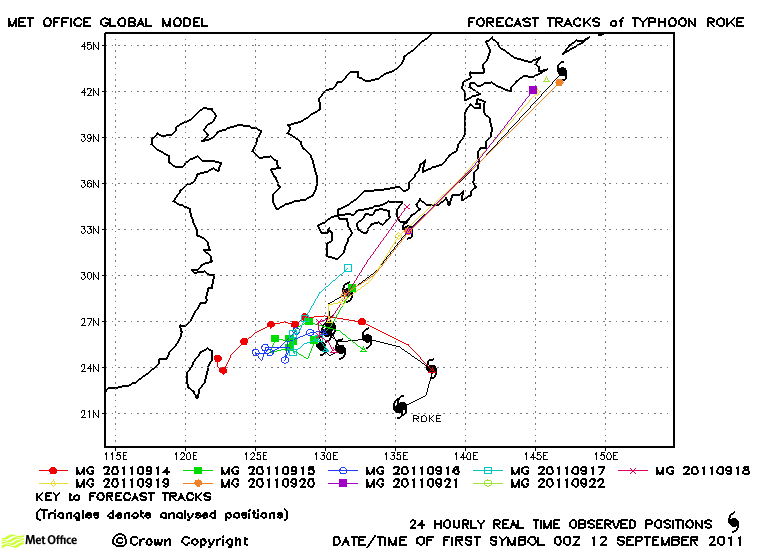
| Roke (18W) | 11-22 September | 115/95 knots | Roke's rapid acceleration across Japan was well predicted close to the event, but earlier forecasts kept the typhoon slow-moving south of Japan. Due to the large distance travelled by the typhoon as it raced across Japan, some of the forecast errors from earlier forecasts were very large. Overall, track forecast errors were above last season's average. |
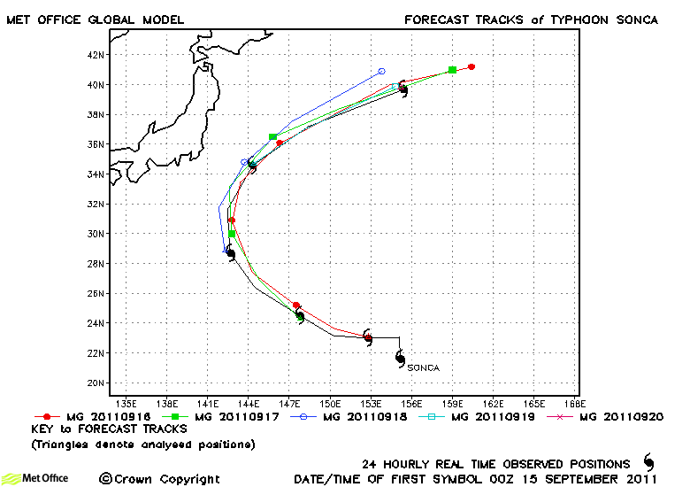
| Sonca (19W) | 14-20 September | 85/70 knots | Track forecasts for Sonca were mostly good and errors were below last season's average. |
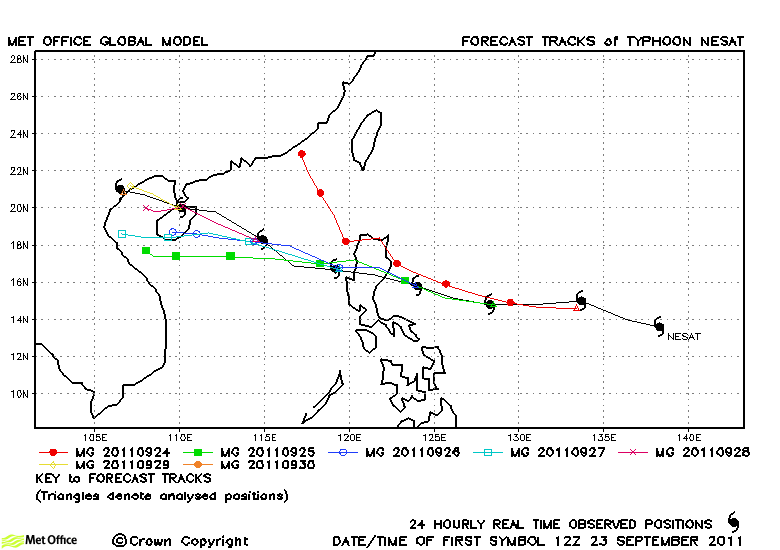
| Nesat (20W) | 23-30 September | 105/80 knots | A couple of early forecasts erroneously predicted a north-westward turn resulting in large longer lead time errors. However, track errors at shorter lead times were low. |
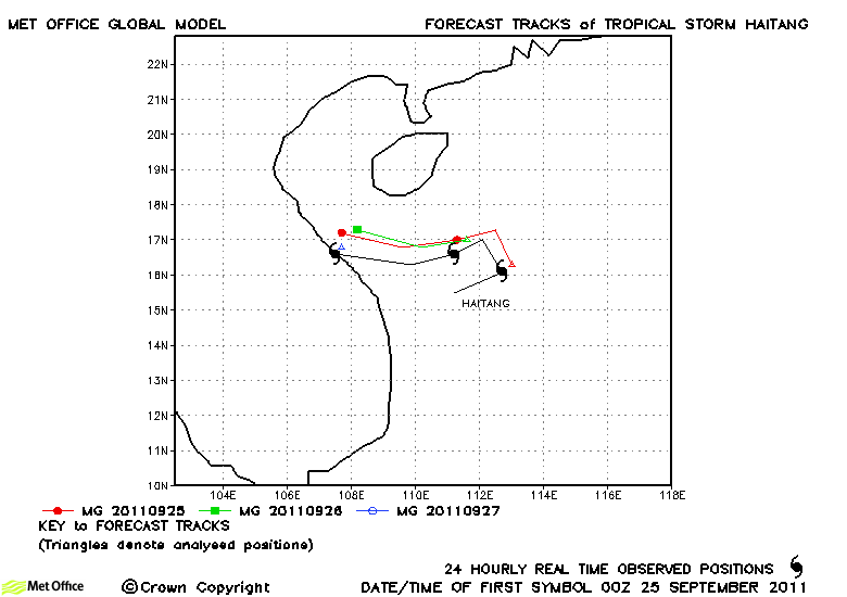
| Haitang (21W) | 24-27 September | 35/35 knots | Track forecast errors were low for Haitang. |
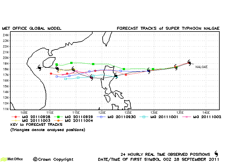
| Nalgae (22W) | 27 September-05 October | 130/95 knots | Forecast track errors were below average for this storm and skill scores against CLIPER were high. |
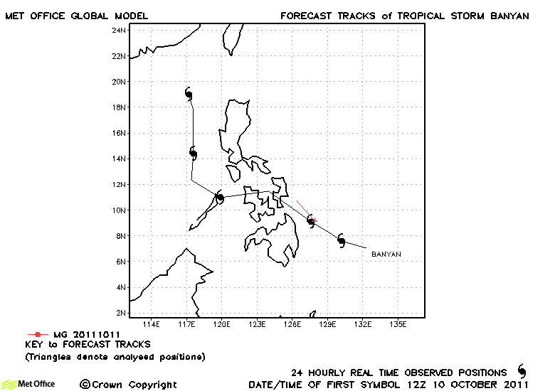
| Banyan (23W) | 10-14 October | 35/35 knots | Despite persisting for several days as a tropical depression, Banyan was only briefly a tropical storm and just one forecast was verified. |
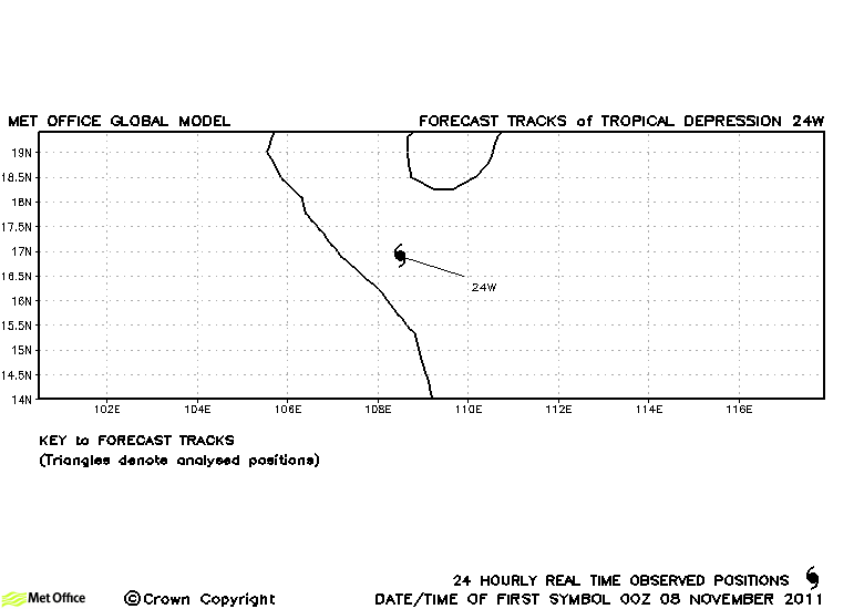
| 24W | 07-08 November | 30/- knots | 24W was a tropical depression and no forecasts were verified. |
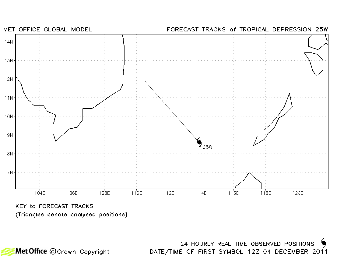
| 25W | 04-05 December | 30/- knots | 25W was a tropical depression and no forecasts were verified. |
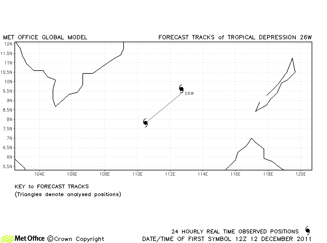
| 26W | 12-13 December | 30/30 knots | 26W was a tropical depression and no forecasts were verified. |
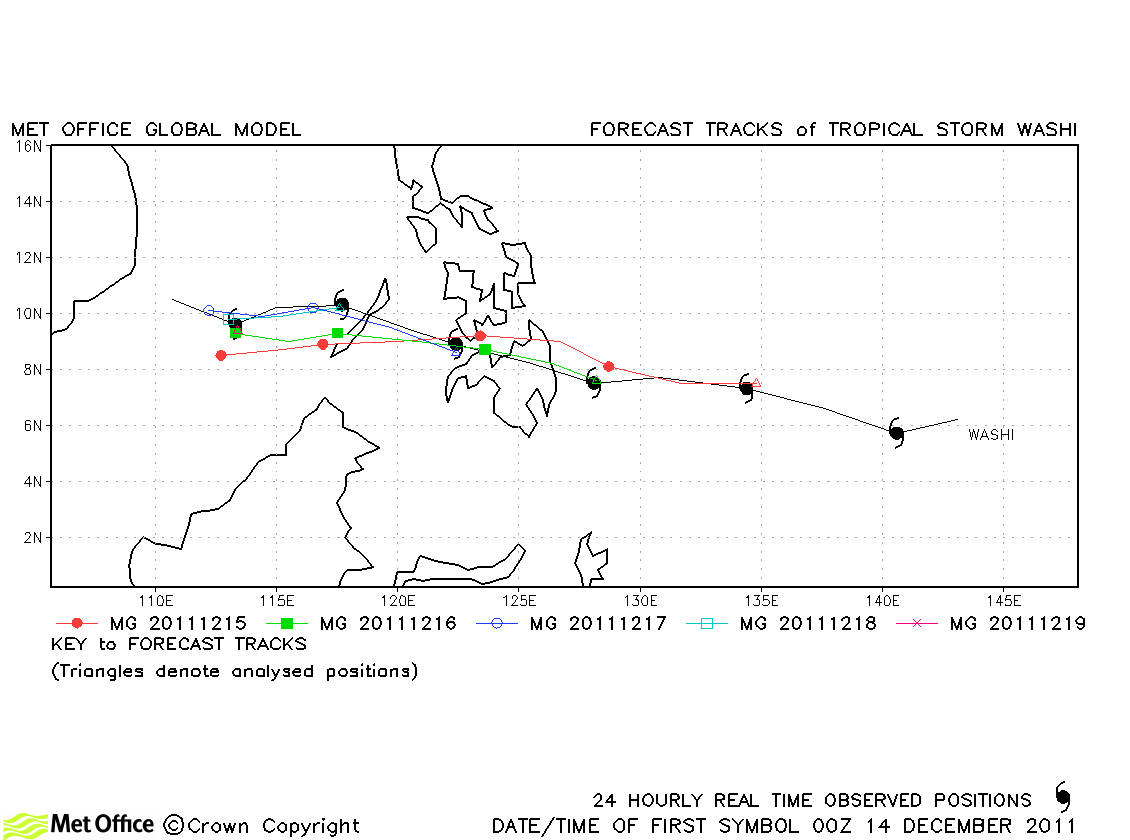
| Washi (27W) | 13-19 December | 55/40knots | Track forecast errors were below last season's average for this late season storm. |
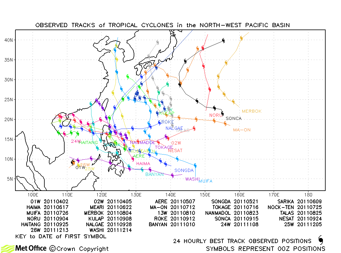
North-West Pacific observed tracks in 2011
Tropical cyclone names
| Name & ID | Start & end dates | 1-minute MSW | Comments on Met Office global model forecasts |
|---|---|---|---|
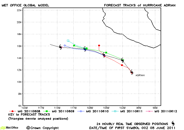
| Adrian (01E) | 07-12 June | 120/- knots | Track forecast errors were low and skill scores high with just a slight slow bias for this hurricane. |
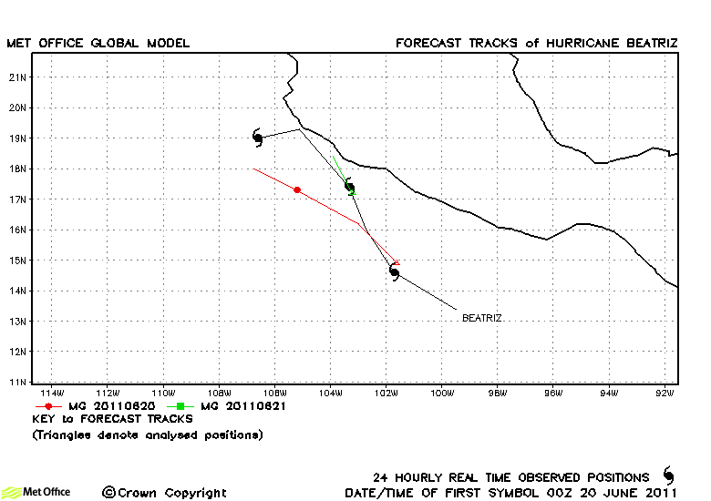
| Beatriz (02E) | 19-22 June | 75/- knots | Forecast tracks were too far to the left resulting in a failure to predict the proximity of the track to land. |
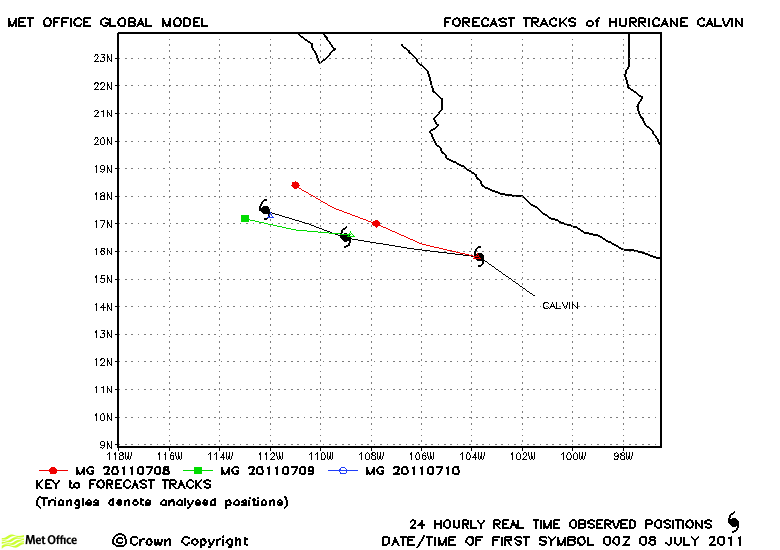
| Calvin (03E) | 07-10 July | 70 knots | Calvin was relatively short lived. Track forecast errors were low and skill scores high. |
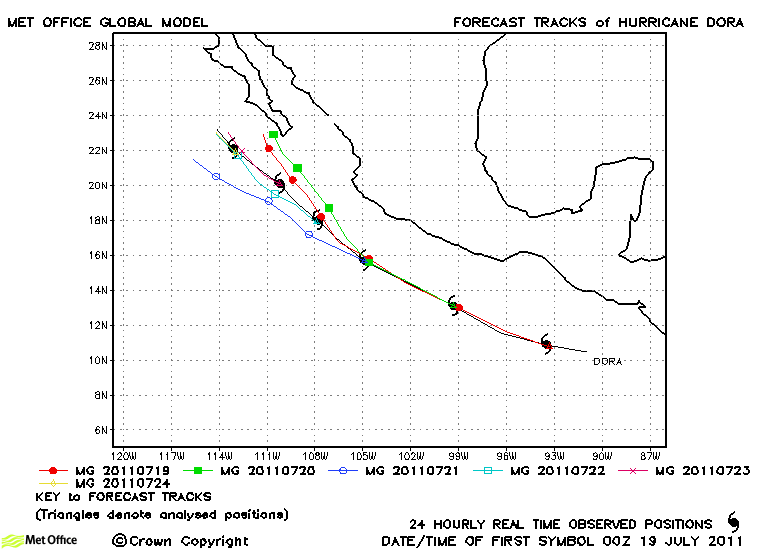
| Dora (04E) | 18-24 July | 135 knots | The direction and speed of motion of Dora were very well predicted with only slight deviations at longer lead times. Forecast errors were low and skill scores high. |
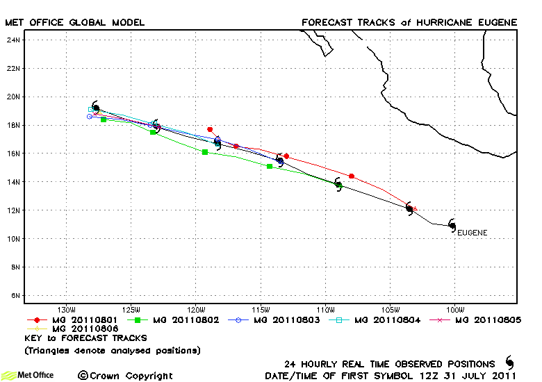
| Eugene (05E) | 31 July-06 August | 115 knots | Eugene was a straight-running storm which was well predicted in nearly all forecasts. Hence, track forecast errors were very low. |
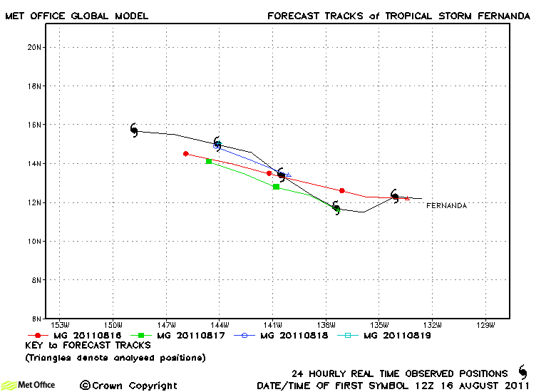
| Fernanda (06E) | 16-20 August | 55 knots | Track forecast errors were low and skill scores high for this storm. |
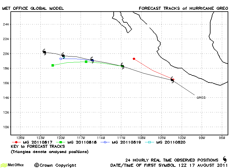
| Greg (07E) | 16-21 August | 75 knots | Track forecast errors were slightly above last season's average, but were still low. |
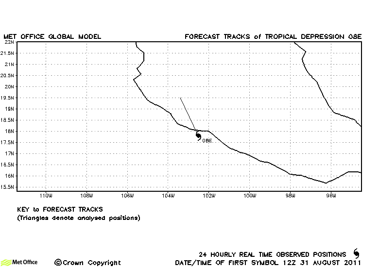
| 08E | 31 August-01 September | 30 knots | 08E did not reach tropical storm strength and no forecasts were verified. |
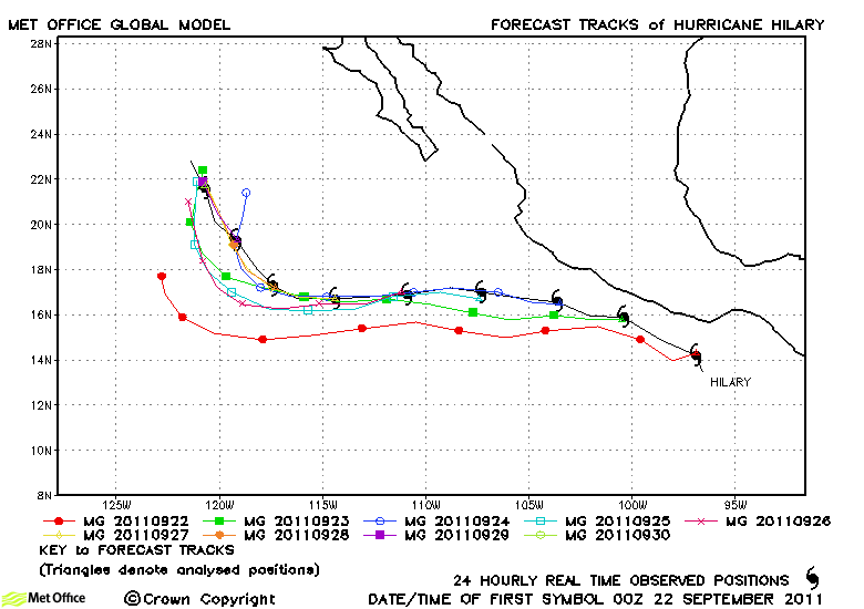
| Hilary (09E) | 21-30 September | 125 knots | Track forecasts for Hilary were generally good and forecast errors below last season's average. |
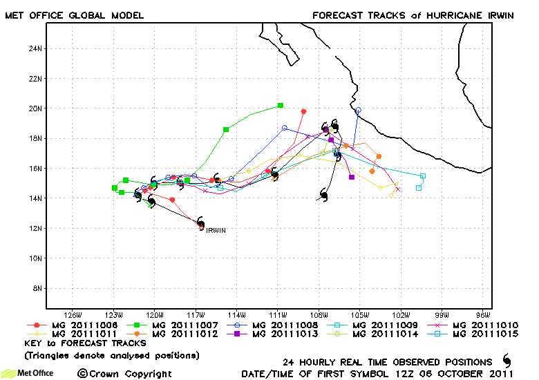
| Irwin (11E) | 06-17 October | 80 knots | Track forecast errors for Irwin were near to last season's average. The turn back eastwards early in its life was well predict |
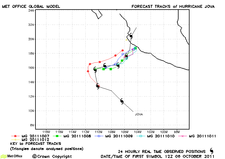
| Jova (10E) | 06-13 October | 110 knots | Track forecast errors were near to last season's average. The hurricane's changes in direction were generally well handled, although the final acceleration northwards near landfall was not. |
| 12E | 12-13 October | 30 knots | 12E did not reach tropical storm status and no forecasts were verified. |
| Kenneth (13E) | 19-25 November | 125 knots | Kenneth was the latest season major hurricane ever recorded in this region. Track forecasts were very good with low errors and high skill scores. The formation of the hurricane was also well predicted. |
| Name & ID | Start & end dates | 1-minute MSW | Comments on Met Office global model forecasts |
|---|
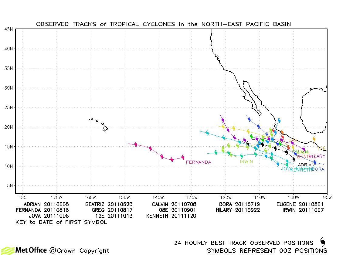
North-East and Central North Pacific observed tracks in 2011
| Name & ID | Start & end dates | 1-minute MSW | Comments on Met Office global model forecasts |
|---|---|---|---|
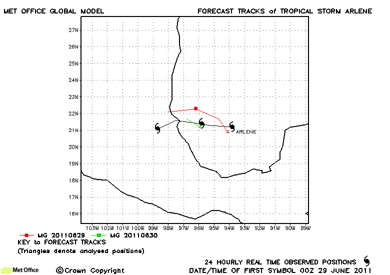
| Arlene (01L) | 28 June-01 July | 55/- knots | The few forecasts which were verified had track errors below last season's average. |
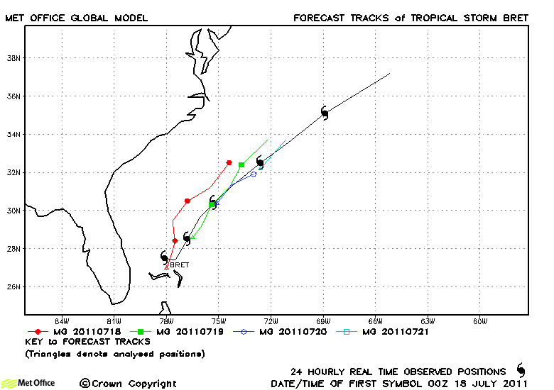
| Bret (02L) | 17-22 July | 55 knots | The track of Bret was well predicted. Track errors were low and skill scores high. |
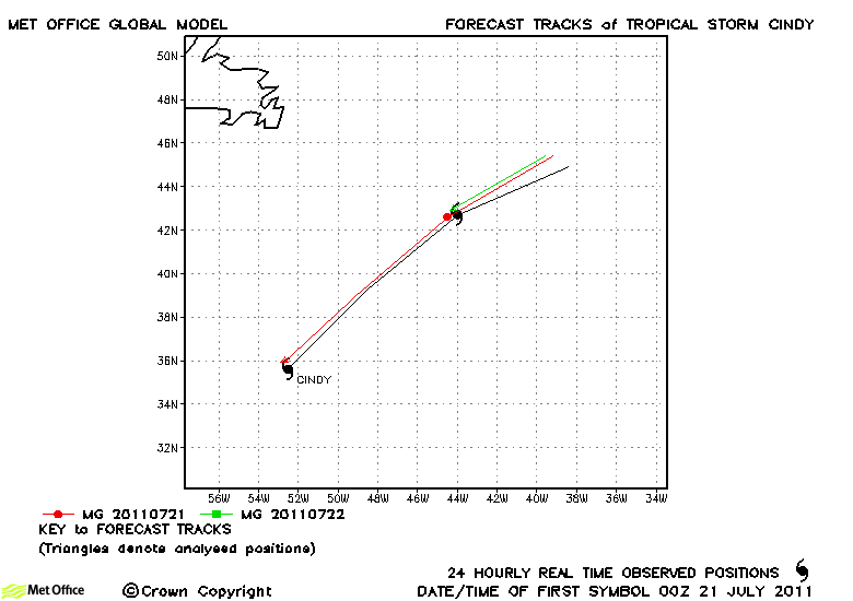
| Cindy (03L) | 20-22 July | 50 knots | Cindy was a tropical storm for less than two days, but in this time track forecasts were very good. |
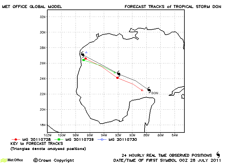
| Don (04L) | 27-30 July | 45 knots | Don was a tropical storm for a couple of days and in this time track forecasts and the location of landfall were very well predicted. |
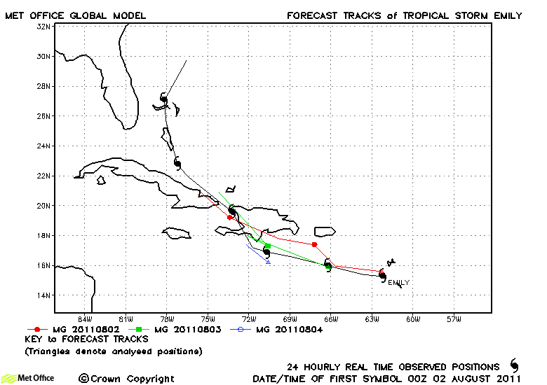
| Emily (05L) | 02-07 August | 45 knots | There was a fast bias in forecasts for Emily resulting in track forecast errors above last season's average. |
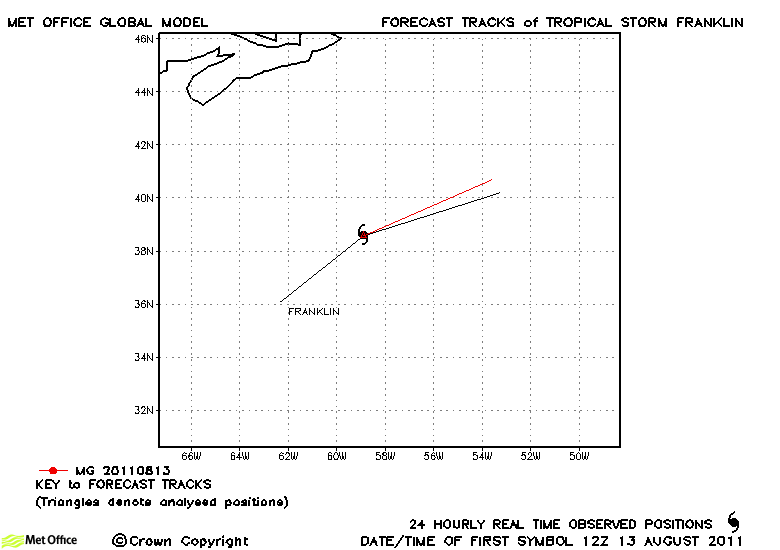
| Franklin (06L) | 12-14 August | 40 knots | Franklin was short-lived and only one forecast was verified. |
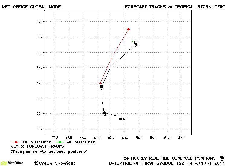
| Gert (07L) | 14-16 August | 50 knots | The few forecasts for this storm that could be verified had a left-of-track bias. |
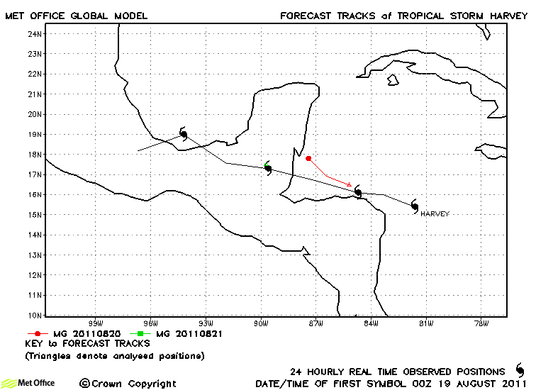
| Harvey (08L) | 19-22 August | 50 knots | Harvey was short-lived as a tropical storm and only a few forecasts were verified. |
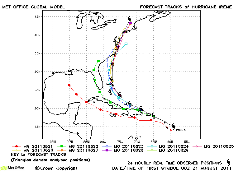
| Irene (09L) | 20-29 August | 105 knots | Early forecasts had a left-of-track bias and later forecasts a slow bias at longer lead times. Overall, this resulted in short lead time track forecast errors being near last season's average, but longer lead time errors being higher than average. Skill scores against CLIPER were positive, but not high. |
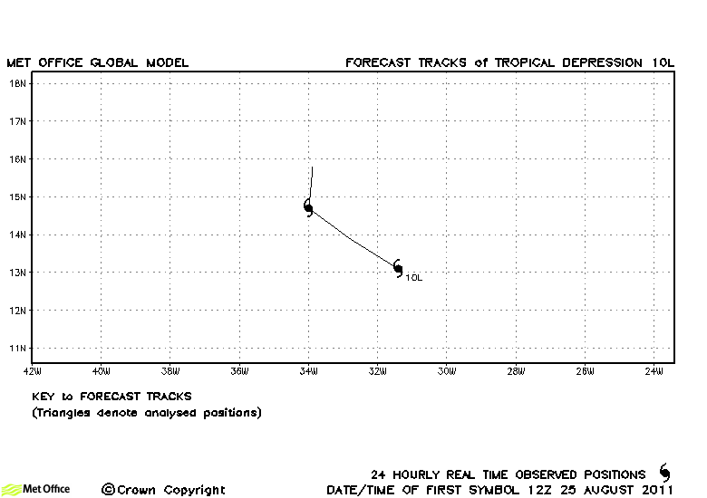
| 10L | 25-27 August | 30 knots | 10L did not reach tropical storm strength and no forecasts were verified. |
| Jose (11L) | 28-29 August | 40 knots | Jose was a short-lived storm and no forecasts were verified. |
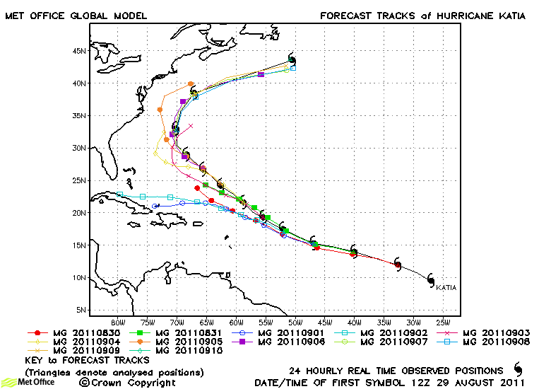
| Katia (12L) | 29 August-10 September | 115 knots | Track forecast errors were low and skill scores against CLIPER high for short lead times (up to 72 hours). However, longer lead time forecasts had a left-of-track and slow bias resulting in higher than average track forecast errors. The model handled the extra-tropical transition and subsequent impact on the UK well. |
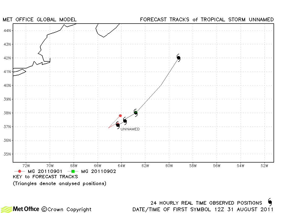
| Unnamed | 01-02 September | 40 knots | This short-lived storm was added to the list in post-season reanalysis |
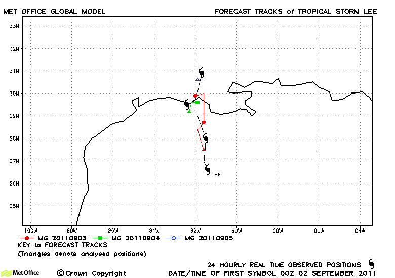
| Lee (13L) | 02-05 September | 50 knots | Lee was well predicted by the model - track forecast errors low and skill scores high. |
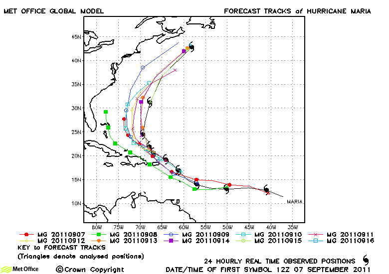
| Maria (14L) | 06-16 September | 70 knots | Track forecast errors were near to average at short lead times and above average at longer lead times due to a left-of-track bias. Skill scores against CLIPER were high. |
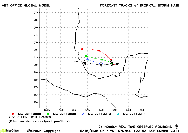
| Nate (15L) | 07-12 September | 60 knots | Track forecast errors were near to last season's average. Forecast tracks were a little too far north, but skill scores were high. |
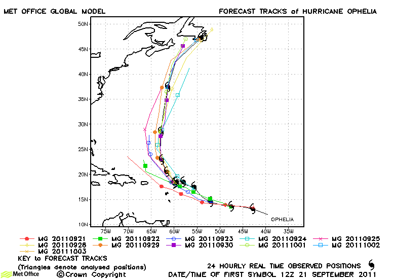
| Ophelia (16L) | 21 September-03 October | 120 knots | At short lead times track forecast errors were low, but at longer lead times they were high. This was primarily due to the failure to predict the period when Ophelia degenerated and was quasi-stationary midway through its life. The northward acceleration during extratropical transition was generally well handled. |
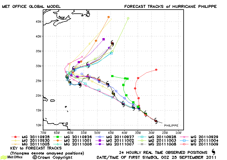
| Philippe (17L) | 24 September-09 October | 80 knots | Early forecasts turned Philippe northwards too quickly. Some later forecasts also predicted extratropical transition too soon. However, the main change from a westward to eastward track was fairly well handled. Track forecast errors were mostly above last season's average. |
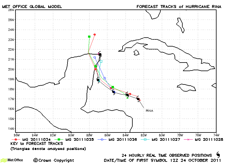
| Rina (18L) | 23-28 October | 95 knots | The track of Rina was well forecast and forecast errors were below last season's average. |
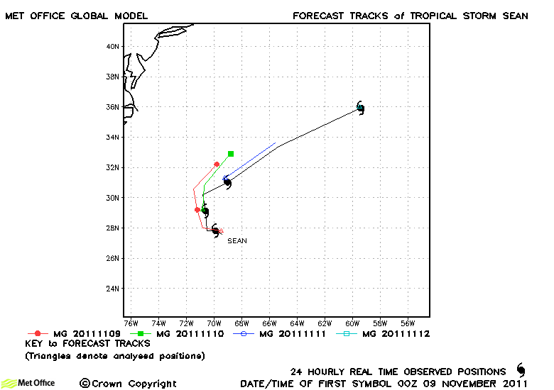
| Sean (19L) | 08-12 November | 55 knots | Track forecast errors were low and skill scores high for this storm |
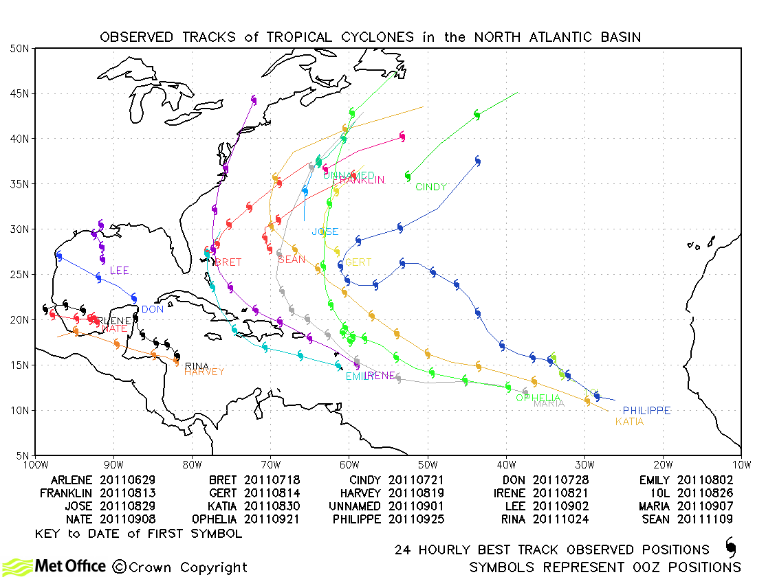
North Atlantic observed tracks in 2011
| Name & ID | Start & end dates | 1-/10-minute MSW | Comments on Met Office global model forecasts |
|---|---|---|---|
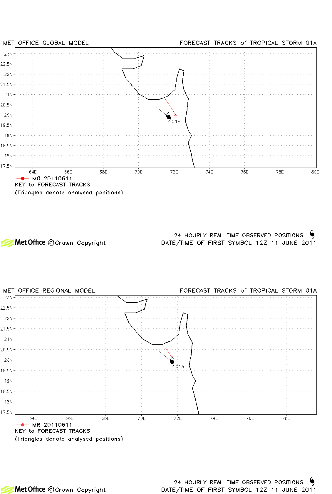
| 01A | 11-12 June | 35/30 knots | 01A only briefly reached tropical storm status according to JTWC. |
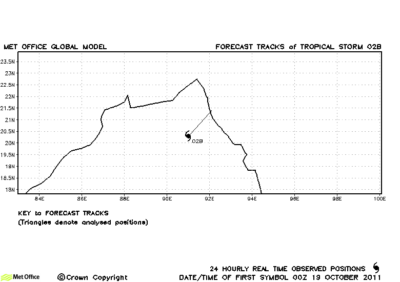
| 02B | 19 October | 35/30 knots | 02B only briefly reached tropical storm status according to JTWC. |
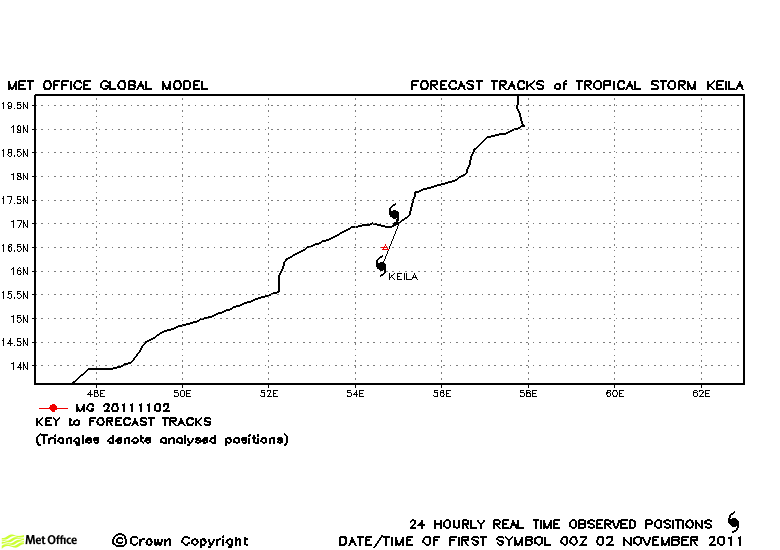
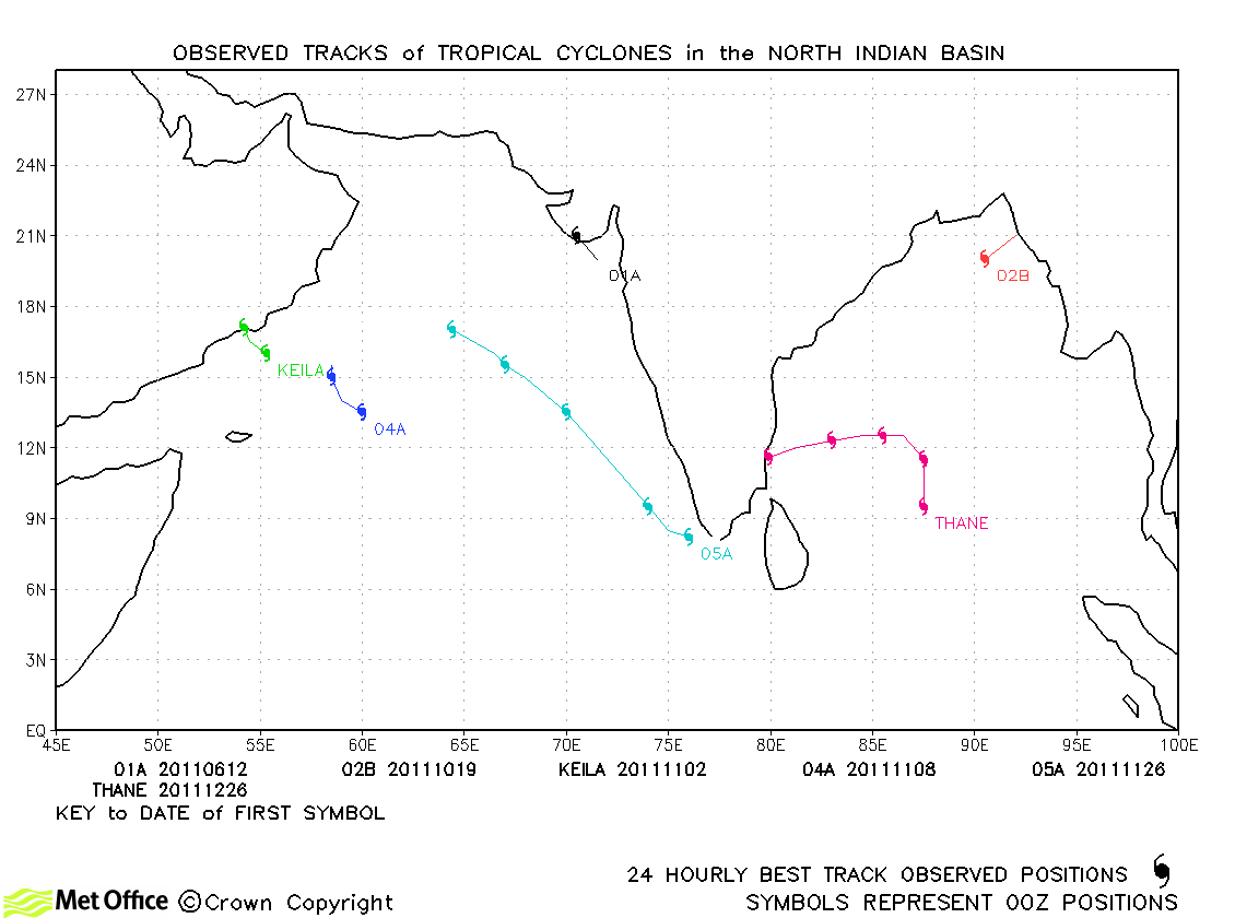
| Keila (03A) | 02-03 November | 35/35 knots | Keila was a short-lived storm and only one 12-hour forecast was verified. |
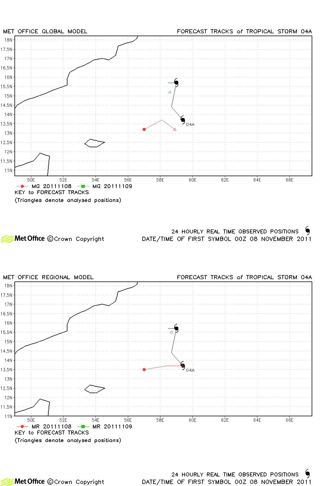
| 04A | 07-09 November | 35/- knots | 04A was short-lived as a storm and the few forecast verified had higher than average track forecast errors. |
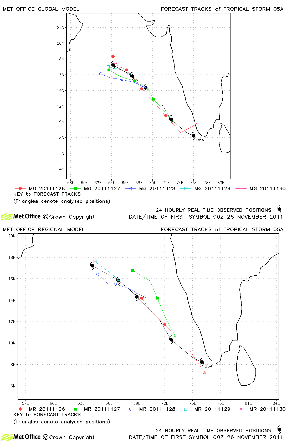
| 05A | 26-30 November | 35/30 knots | Track forecast errors were low for this storm and skill scores against CLIPER, particularly at longer lead times, were high. |
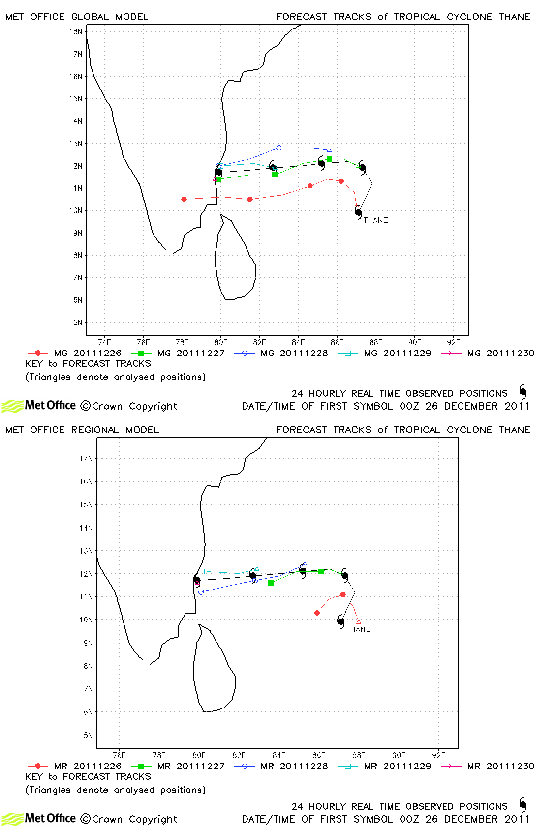
| Thane (06B) | 25-30 December | 80/65 knots | Track forecast errors were very low and skill scores very high for this storm. All but the first forecast predicted the landfall location and timing very well. |
North Indian observed tracks in 2011
Note on estimated wind speeds
1-minute MSW: Maximum sustained wind (knots) averaged over 1 minute (JTWC Hawaii, NHC Miami, CPHC Hawaii)
10-minute MSW: Maximum sustained wind (knots) averaged over 10 minutes (JMA Japan, IMD New Delhi)
Note: Although 1-minute average winds should be stronger than 10-minute average, this may not be the case here since estimates are obtained from different warning centres.

