

Observed and forecast tracks: northern hemisphere 2014
All tropical cyclones in the northern hemisphere season in 2014 are listed below including details of their start and end dates and maximum sustained wind (MSW). Qualitative comments are included on the performance of the Met Offi
Click on the name of the tropical cyclone to see a chart of the observed track and forecast tracks from the Met Office global model. Verification statistics on each tropical cyclone are available upon request from [email protected]. At the end of the season a verification report on the performance of the Met Office global model will be published.
| Name & ID | Start & end dates | 1-/10-minute MSW | Comments on Met Office global model forecasts |
|---|---|---|---|
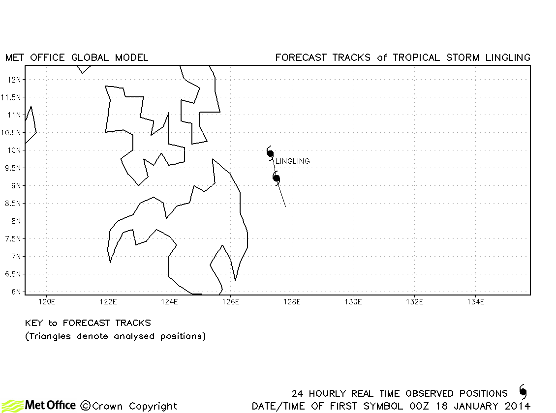
| Lingling (01W) | 18-19 January | 35/35 knots | Lingling was only briefly a tropical storm and no forecasts were verified. |
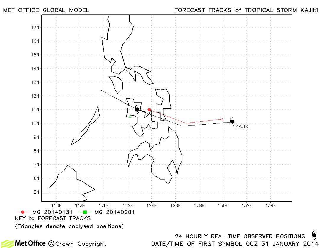
| Kajiki (02W) | 31 January-01 February | 35/35 knots | The formation of Kajiki was well signalled and the errors of forecasts verified were small. |
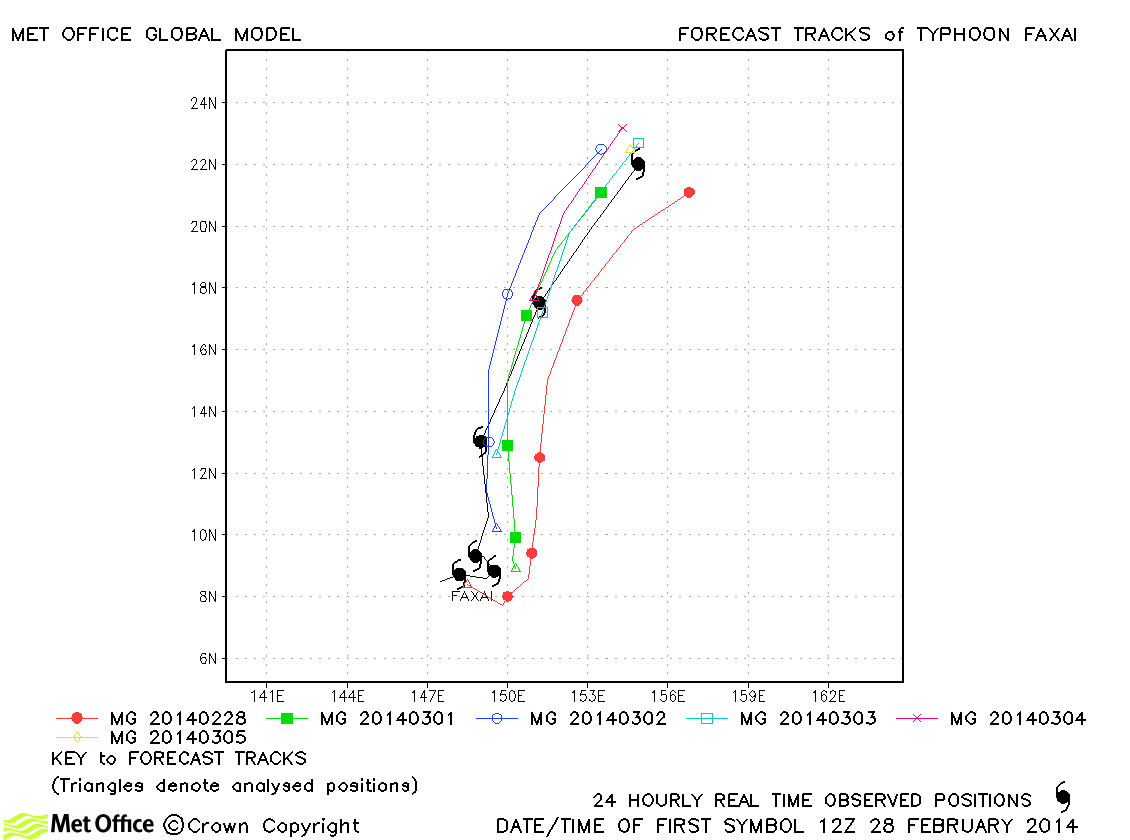
| Faxai (03W) | 27 February-05 March | 75/65 knots | The track of this storm was well predicted. Errors were below last season's average and skill scores against CLIPER were high. |
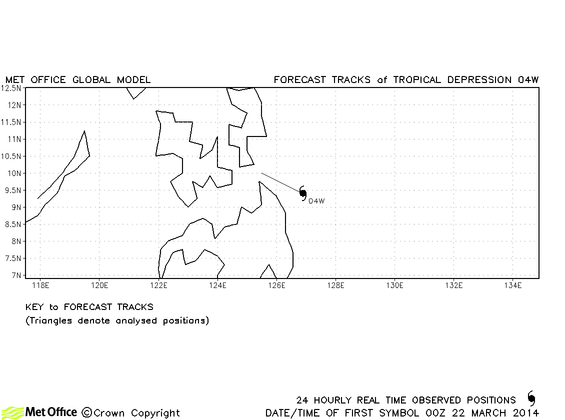
| 04W | 22 March | 30/- knots | 04W did not attain tropical storm status and no forecasts were verified. |
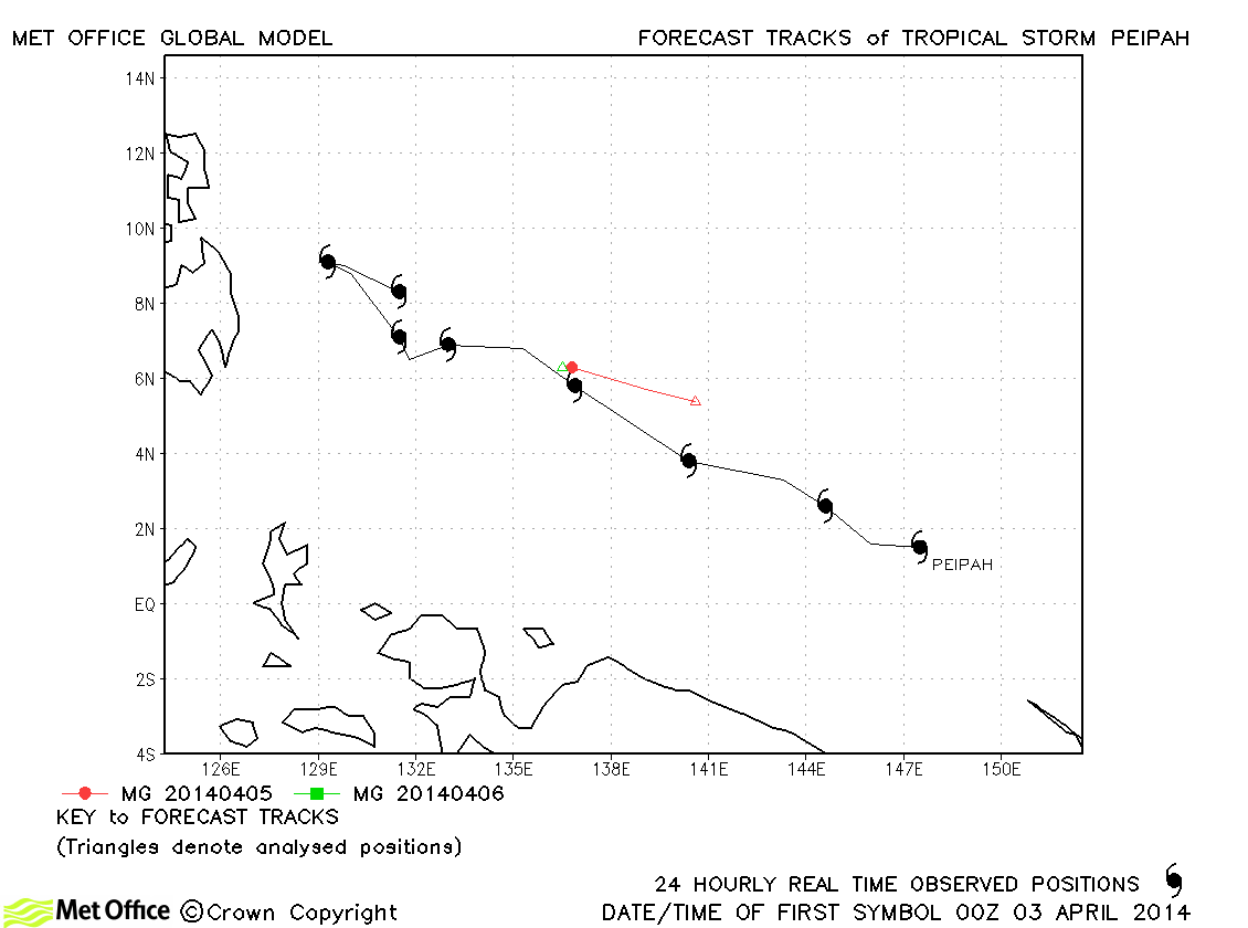
| Peipah (05W) | 03-10 April | 35/40 knots | Peipah only briefly reached tropical storm status. Track forecast errors were below last season's average. |
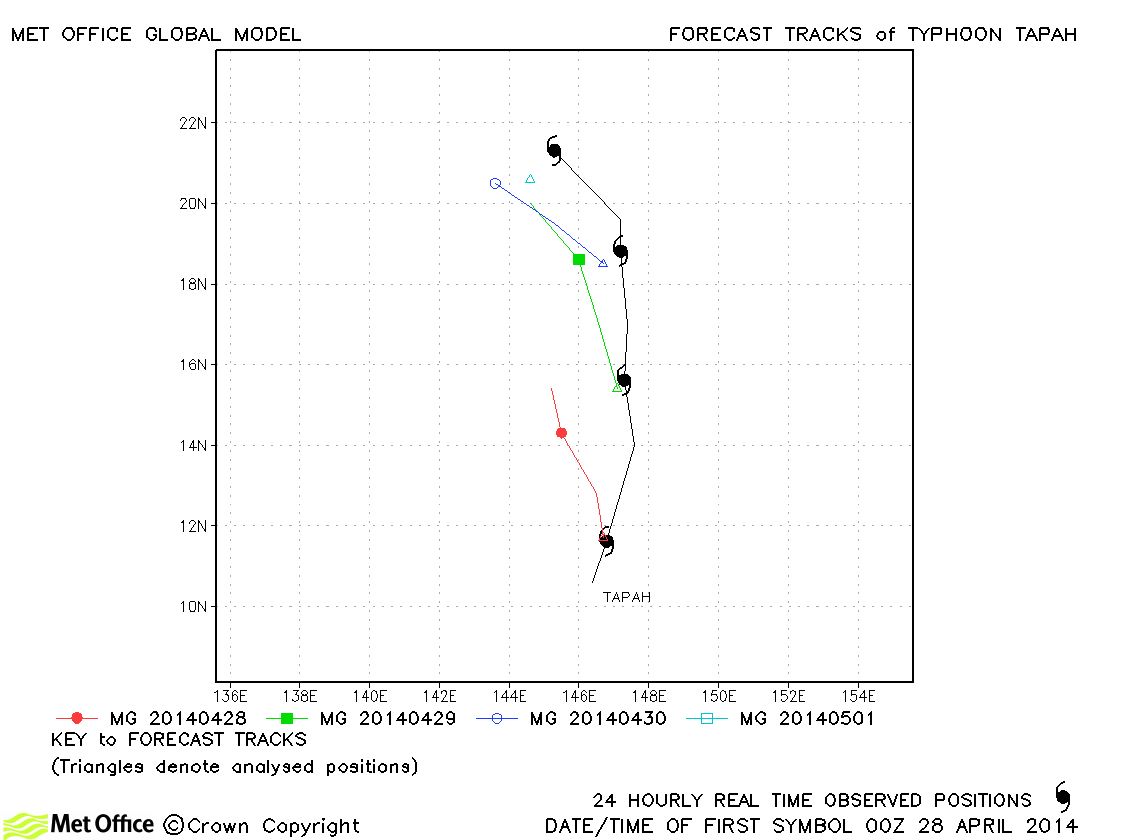
| Tapah (06W) | 27 April-01 May | 65/60 knots | Forecasts had a left-of-track bias resulting in errors above last season's average. |
| Mitag (-) | 11 June | -/40 knots | Mitag was named by JMA, but did not attain tropical storm status according to JTWC. No forecasts were verified. |
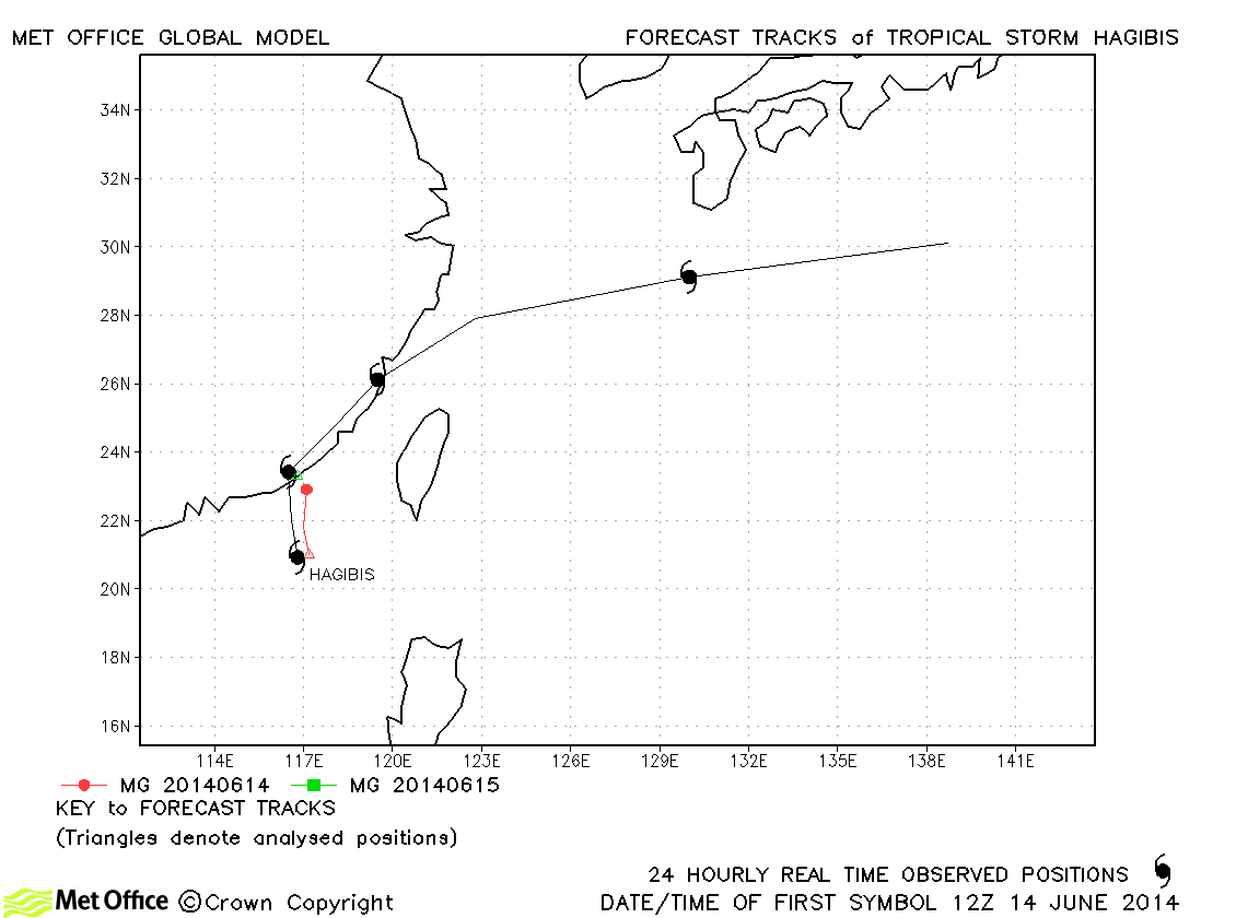
| Hagibis (07W) | 14-18 June | 45/40 knots | Hagibis was only briefly a tropical storm and track errors were close to average. |
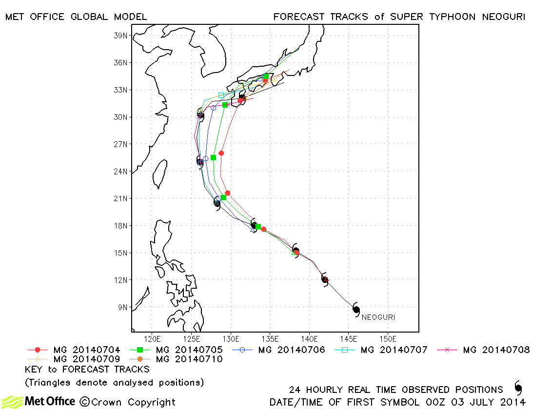
| Neoguri (08W) | 03-10 July | 135/95 knots | There was a slight right-of-track bias in forecasts, but track errors were below last serason's average and skill scores against CLIPER were high. |
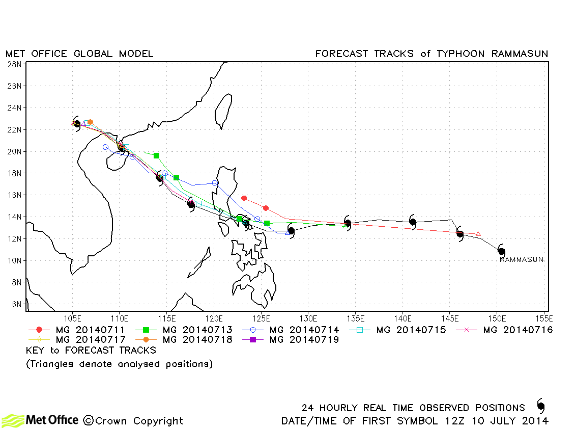
| Rammasun (09W) | 10-19 July | 135/90 knots | Track forecast errors were low - particularly at shorter lead times. Skill scores were high. There was a slow bias in forecasts. |
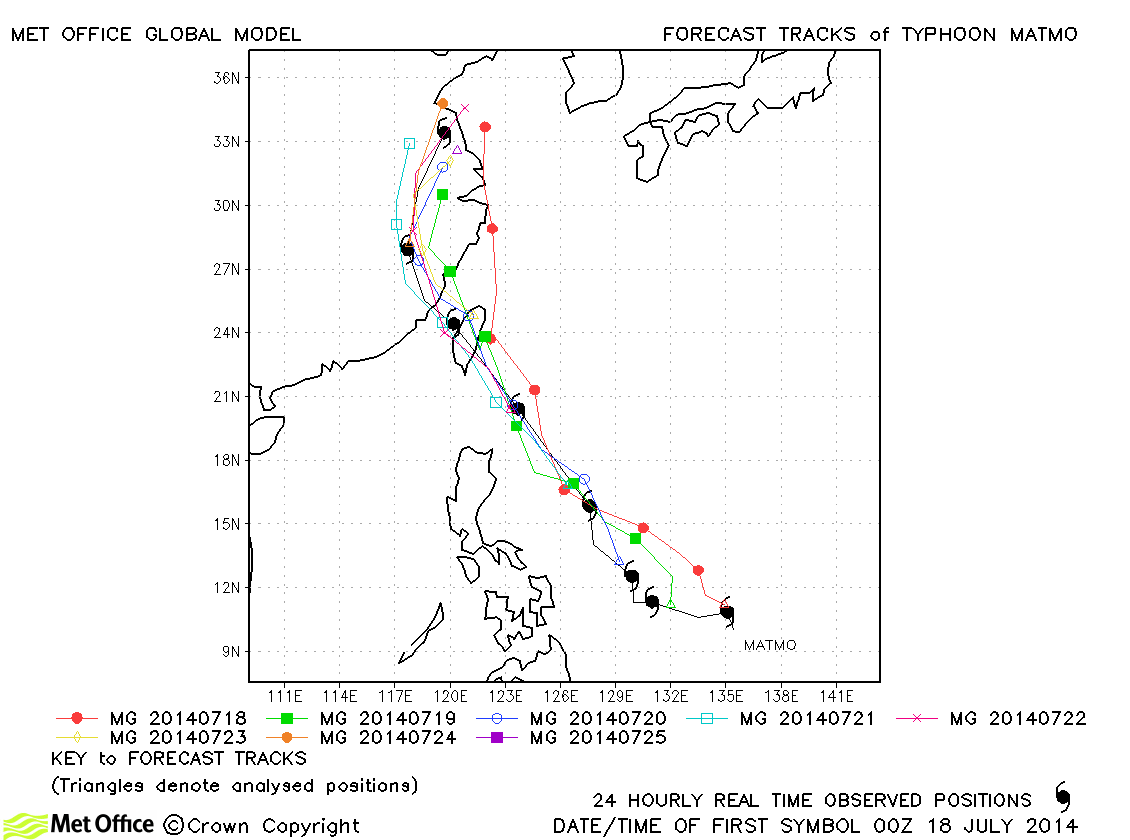
| Matmo (10W) | 17-25 July | 85/70 knots | Track forecast errors were low and skill scores high for this storm. |
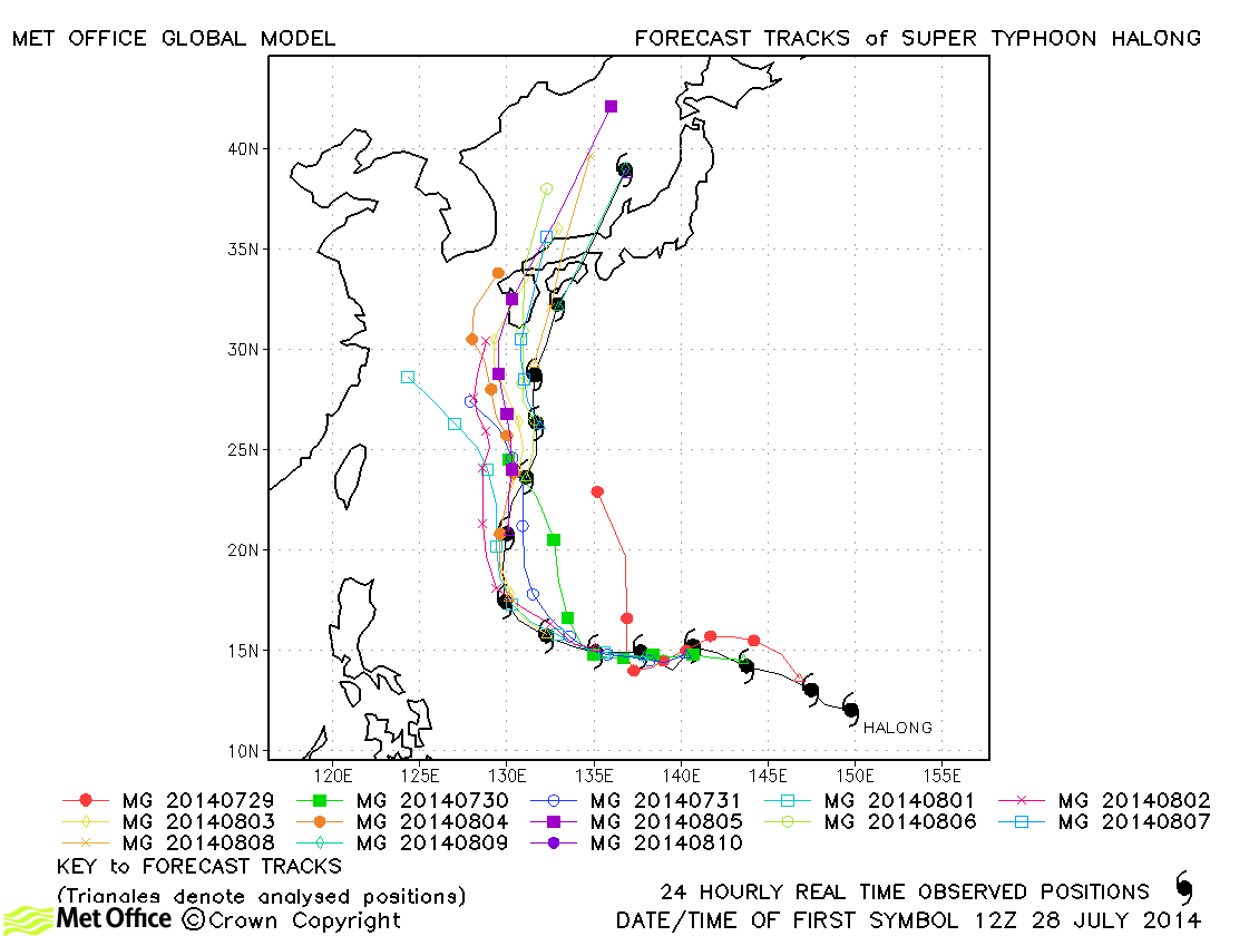
| Halong (11W) | 28 July-10 August | 140/105 knots | Track forecast errors were below last season's average and skill scores against CLIPER were high. There was a slow bias, but landfall over south-western Japan was mostly well predicted. |
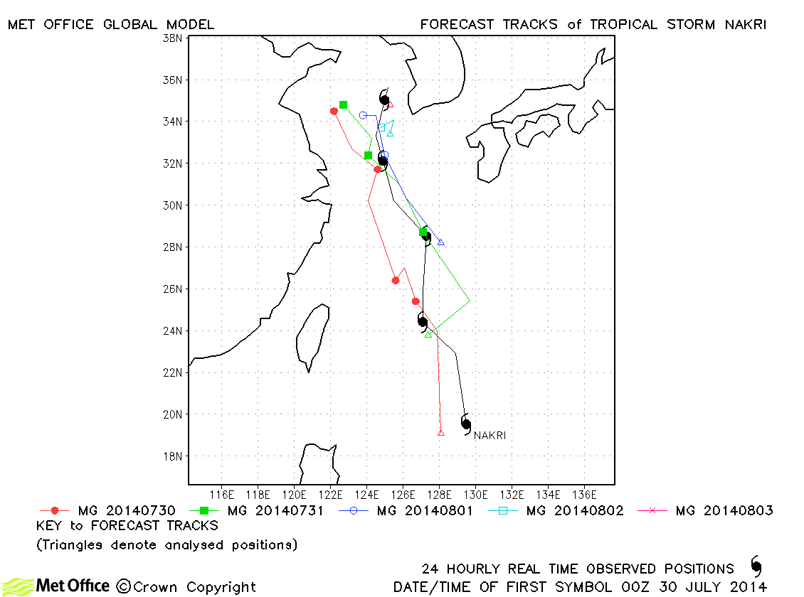
| Nakri (12W) | 29 July-03 August | 40/55 knots | Track forecast errors were below last season's average for this storm. |
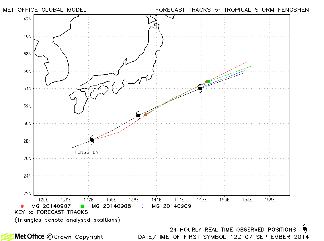
| Fengshen (13W) | 07-10 September | 60/55 knots | Fengshen was a straight-running storm with very low track forecast errors. |
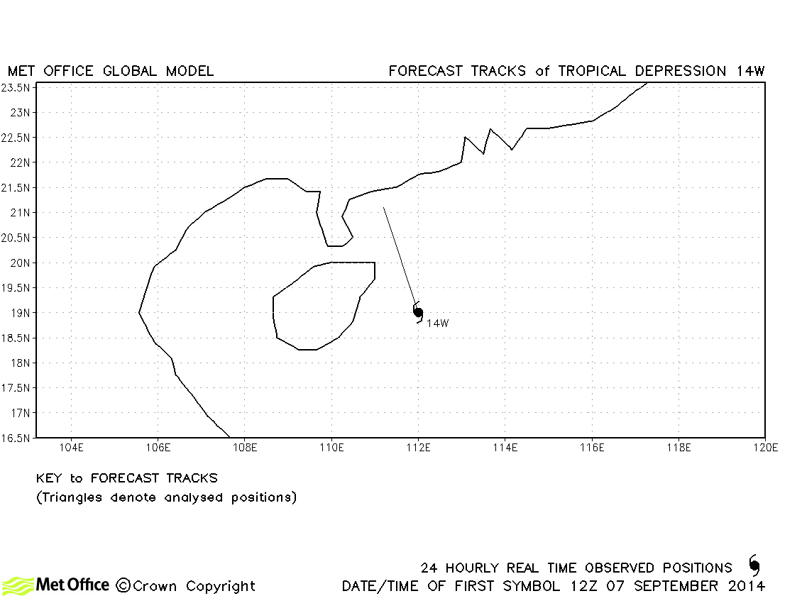
| 14W | 07-08 September | 25/30 knots | This depression did not achieve tropical storm status. |
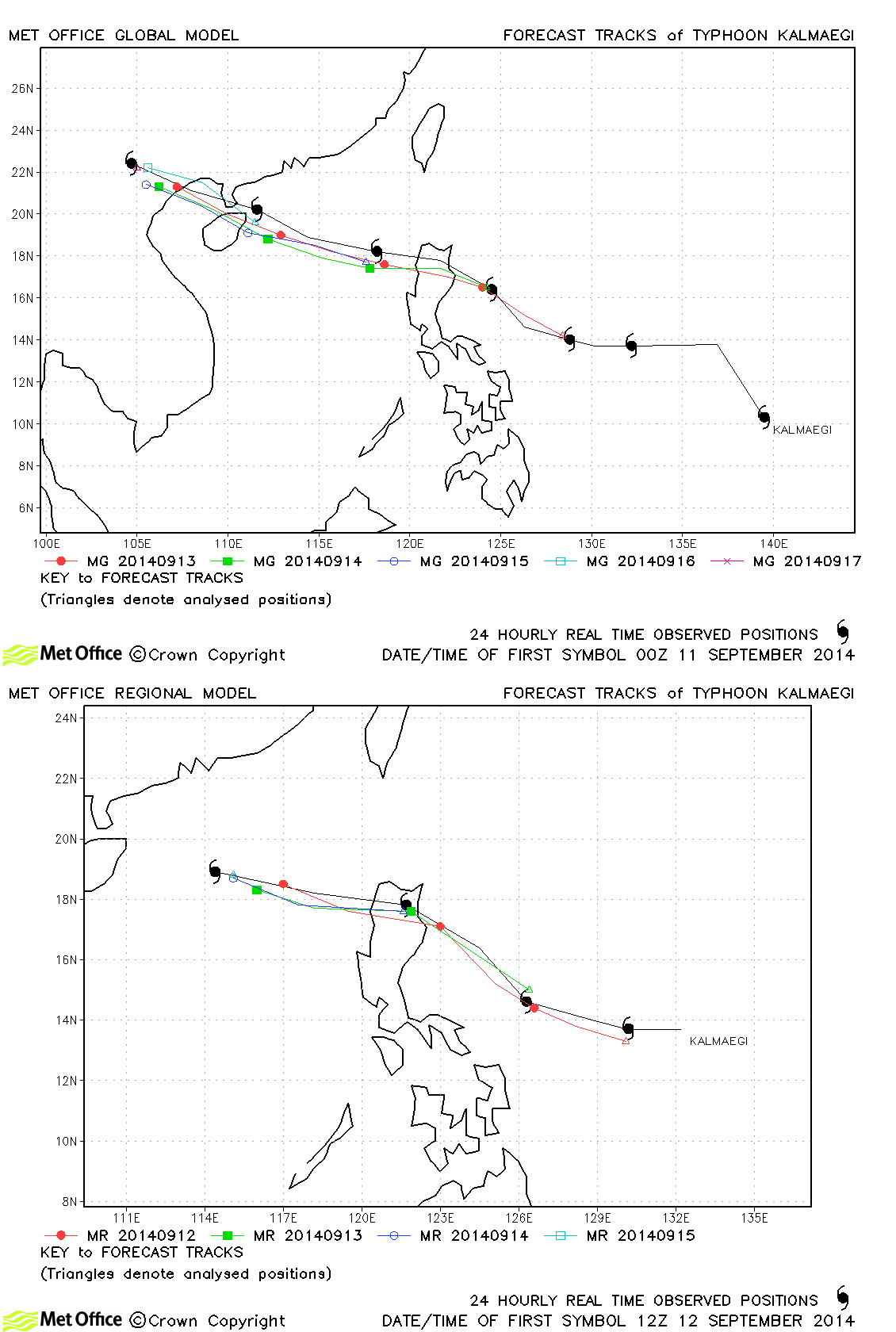
| Kalmaegi (15W) | 10-17 September | 70/75 knots | Track forecast errors were below last season's average and skill scores very high. Landfall over the Philippines was well predicted. |
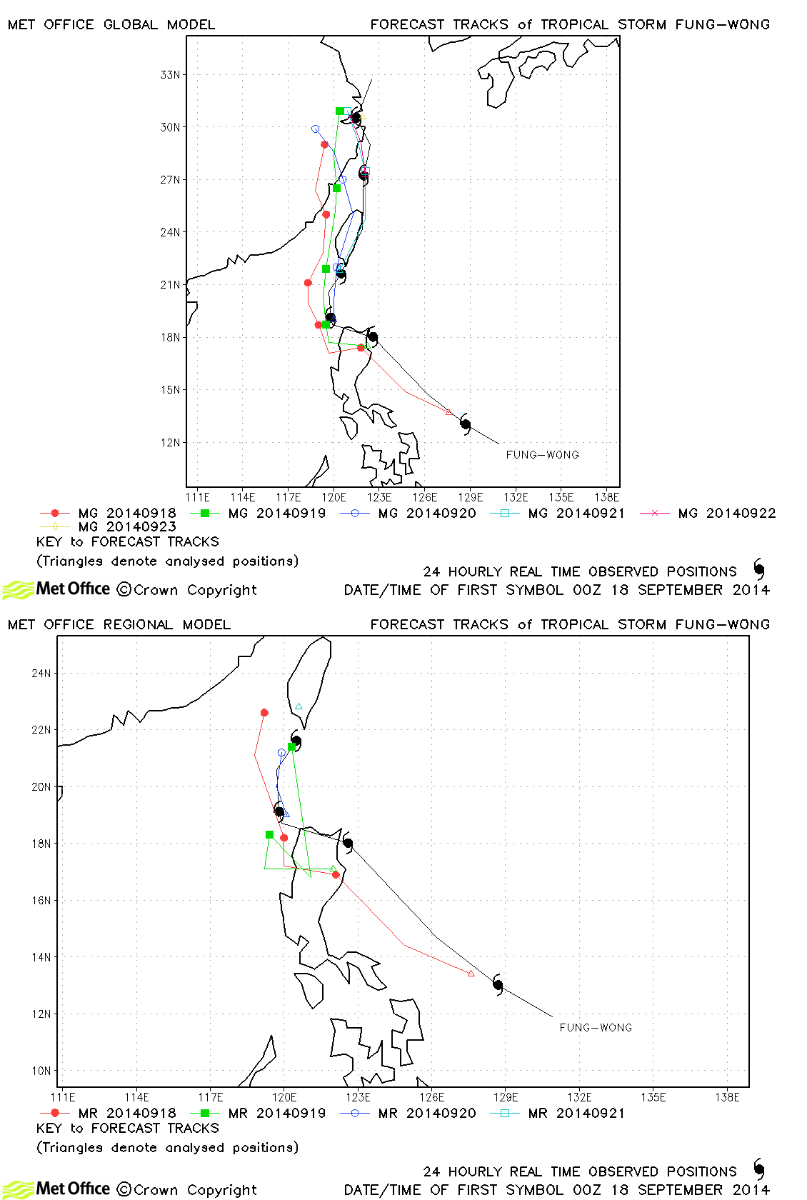
| Fung-wong (16W) | 17-23 September | 50/50 knots | Forecasts for Fung-wong were very good with the changes in direction well predicted. Track errors were low and skill scores high. |
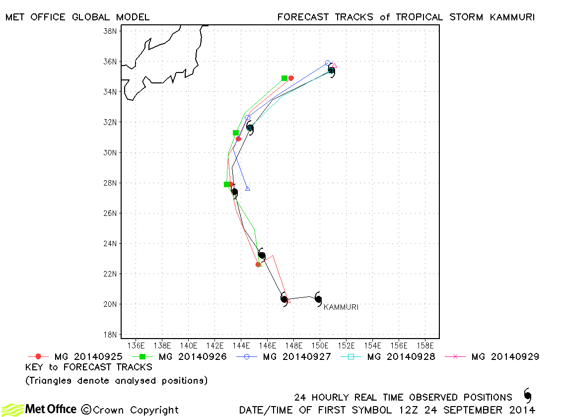
| Kammuri (17W) | 24-29 September | 55/50 knots | Kammuri was another storm with low track forecast errors and high skill scores. |
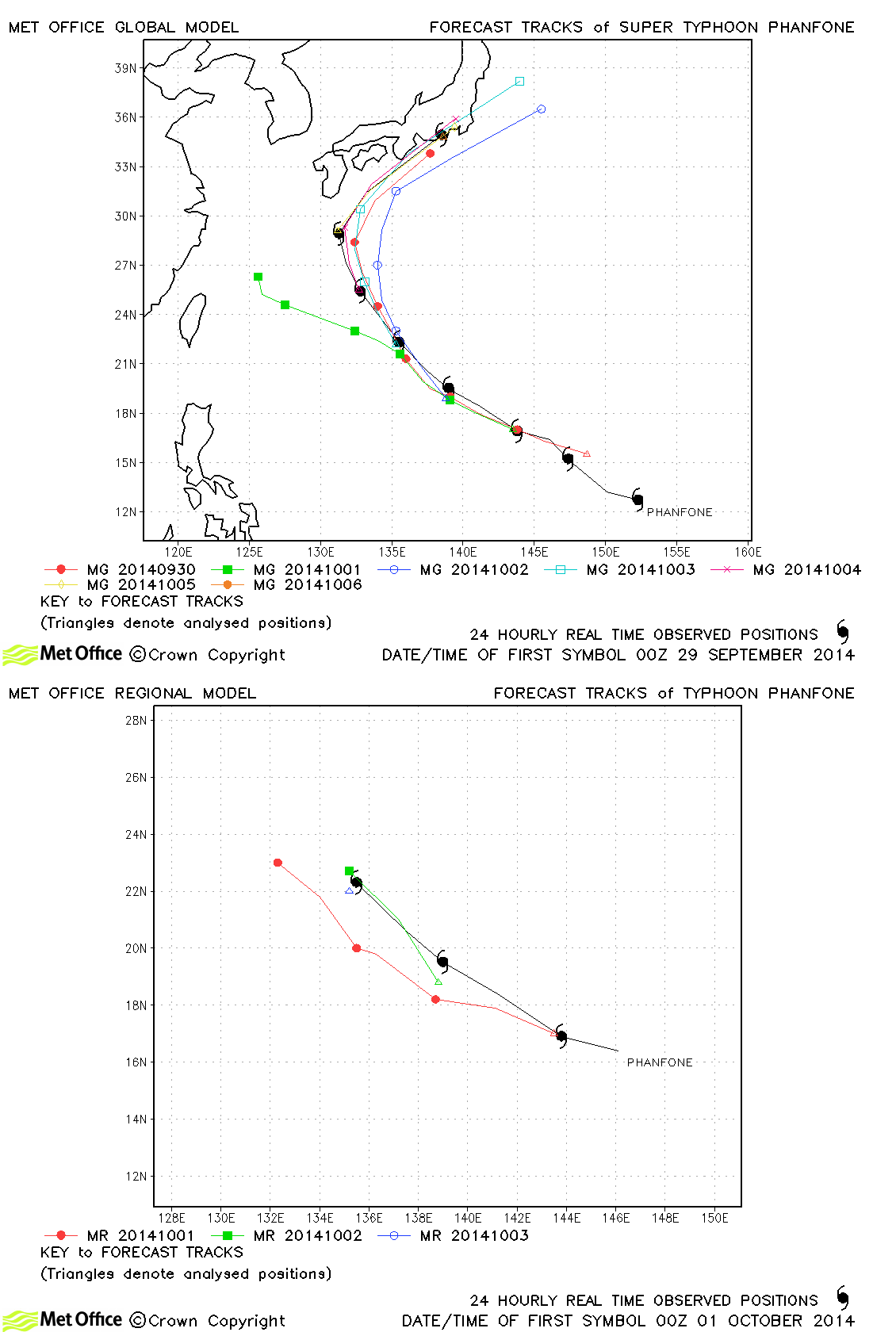
| Phanfone (18W) | 28 September-06 October | 130/95 knots | Apart from a couple of forecasts which tracked Phanfone too far east, forecasts were generally very good. Overall, track errors were mixed, but skill scores against CLIPER high. |
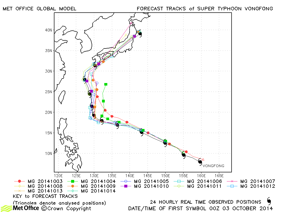
| Vongfong (19W) | 03-14 October | 155/115 knots | Track forecasts for Vongfong were excellent with very low errors. The landfall over Japan was generally well predicted. |
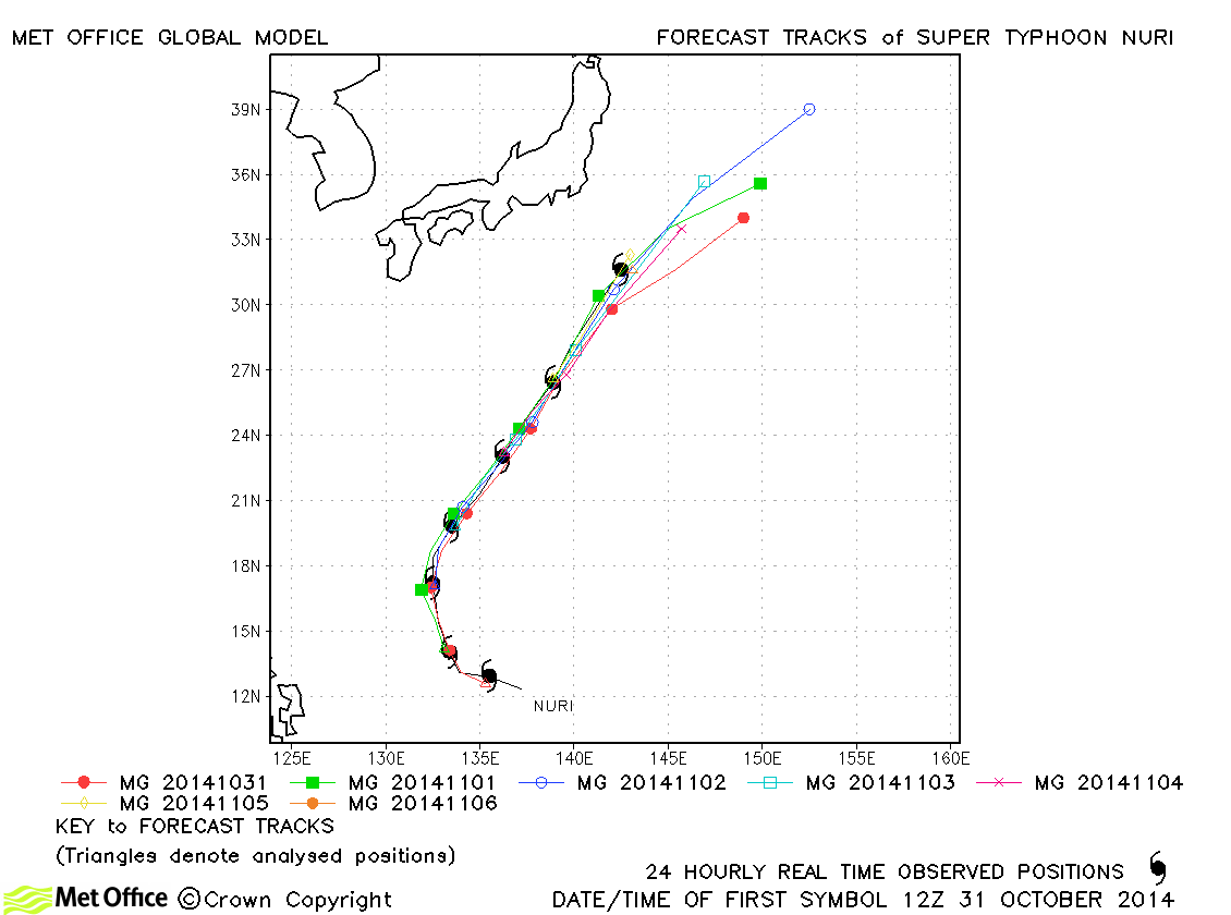
| Nuri (20W) | 31 October-06 November | 155/105 knots | Despite predicting an accurate track for Nuri the model had a fast bias which resulted in forecast errors being larger than last season's average. |
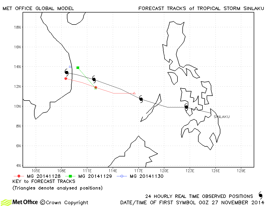
| Sinlaku (21W) | 26-30 November | 55/50 knots | The landfall of Sinlaku was predicted fairly well by the model. |
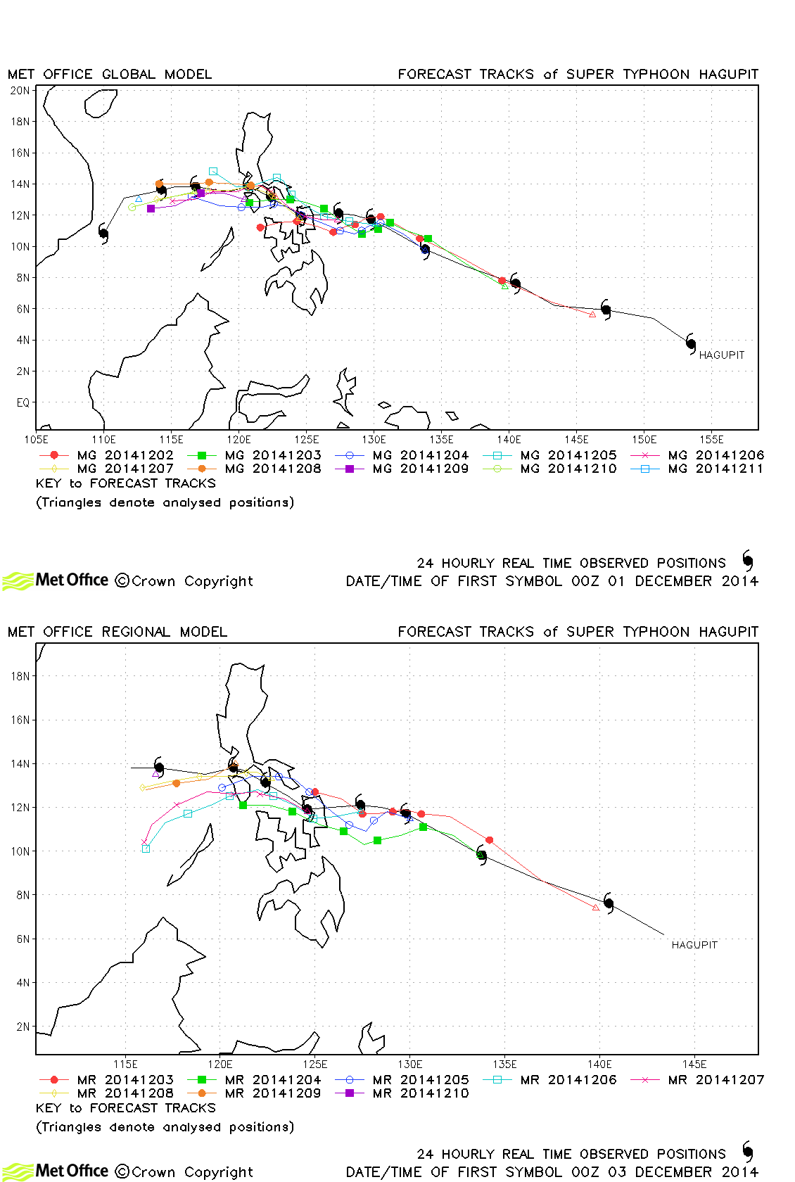
| Hagupit (22W) | 01-12 December | 155/115 knots | Early forecasts had a slow bias resulting in an incorrect timing of landfall over the Philippines. However, the turn north-westwards and subsequent movement after landfall were well predicted. Overall, track forecast errors were below last season's average. |
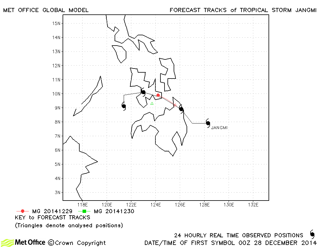
| Jangmi (23W) | 28-31 December | 45/35 knots | Jangmi was short-lived as a storm and only one 24-hour forecast was verified. |
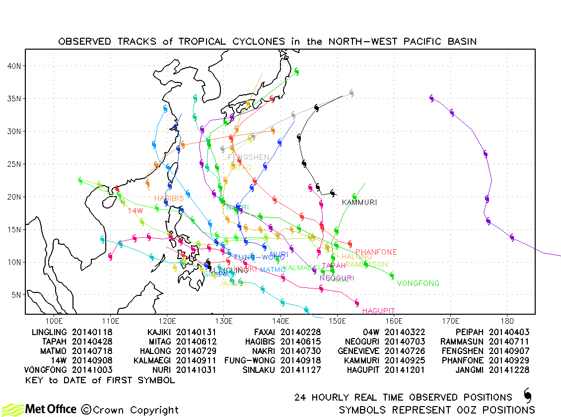
North-west Pacific observed tracks in 2014
North-west Pacific tropical cyclone names
| Name & ID | Start & end dates | 1-minute MSW | Comments on Met Office global model forecasts |
|---|---|---|---|
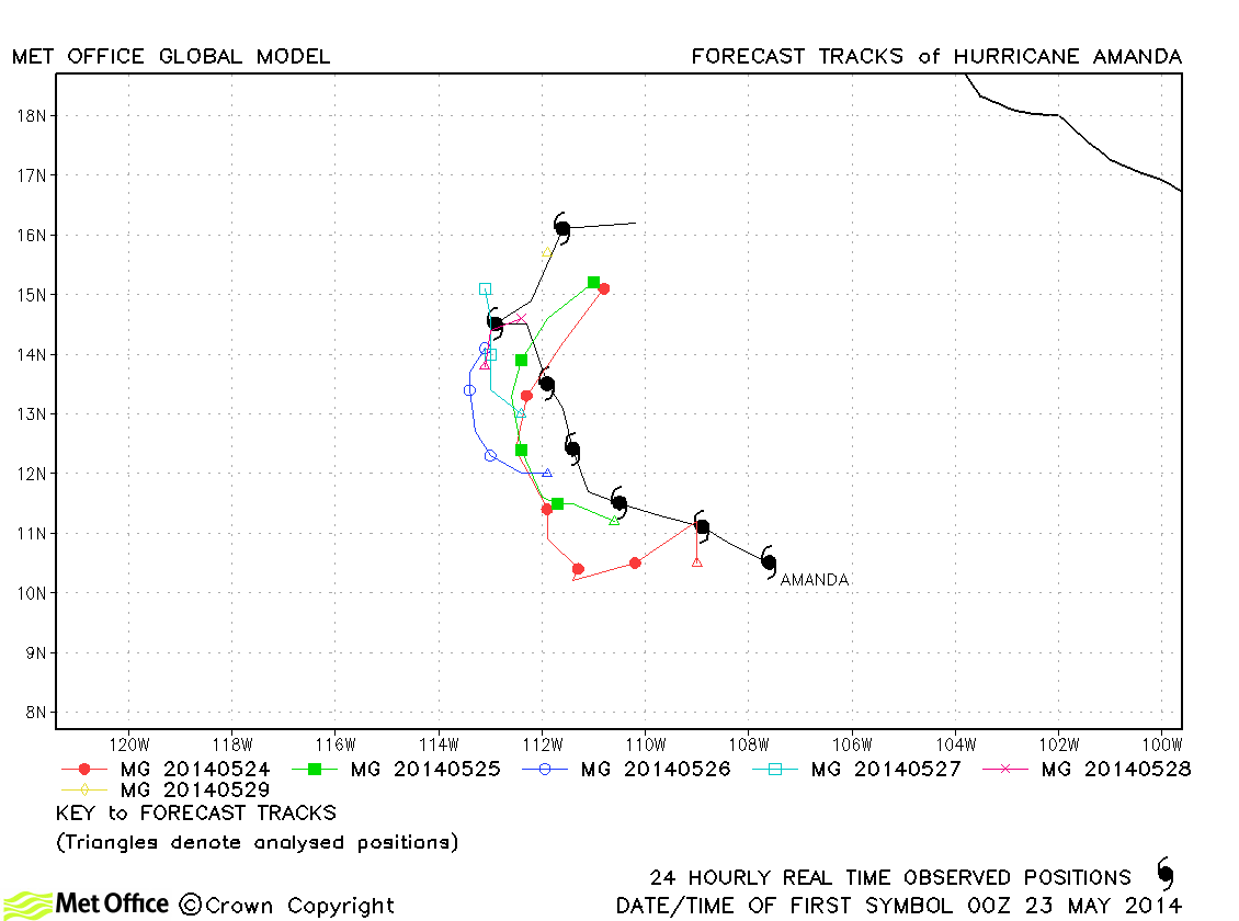
| Amanda (01E) | 22-29 May | 135 knots | Track forecast errors were below last season's average, although there was no skill against CLIPER. |
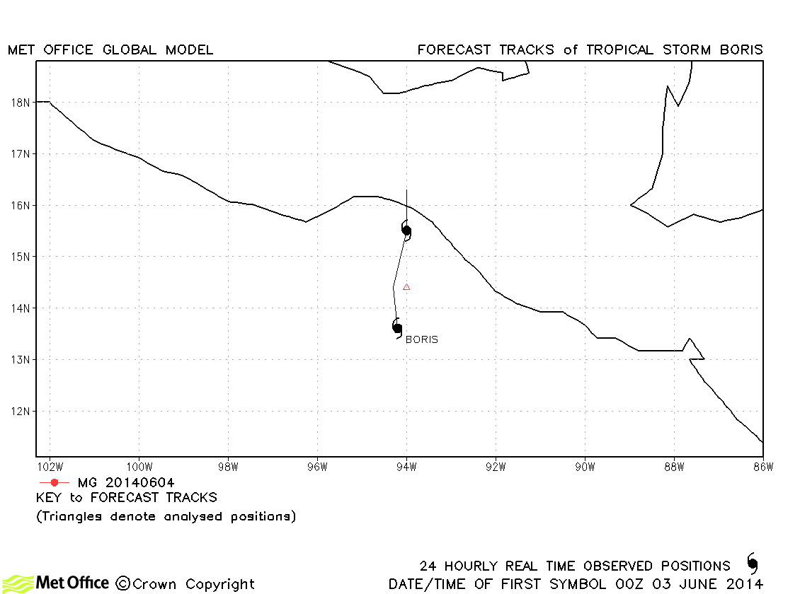
| Boris (02E) | 02-04 June | 35 knots | Boris only briefly attained tropical storm status and no forecasts were verified. |
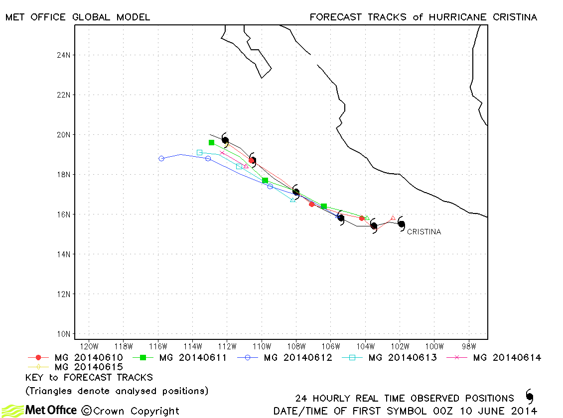
| Cristina (03E) | 09-15 June | 125 knots | There was a fast and left-of-track bias in forecasts resulting in track forecast errors above last season's average. |
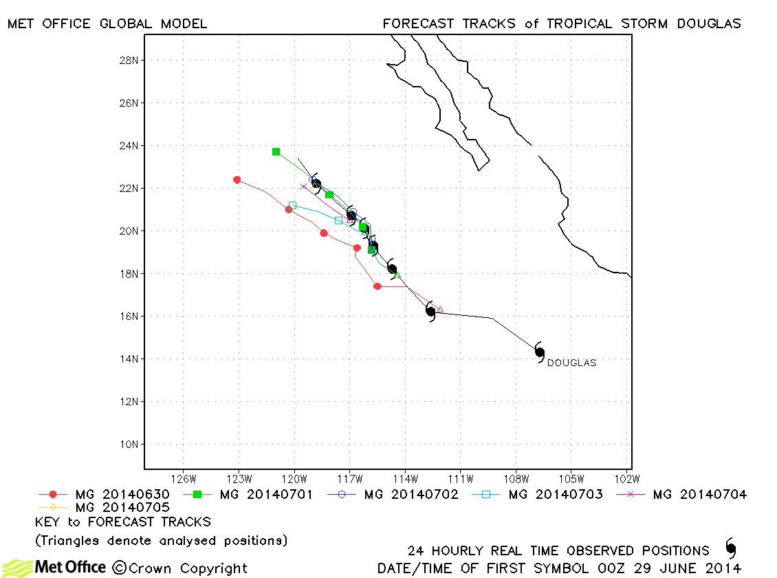
| Douglas (04E) | 28 June-05 July | 40 knots | At short lead times track forecast errors were low for this storm. There was a slight left-of-track bias. |
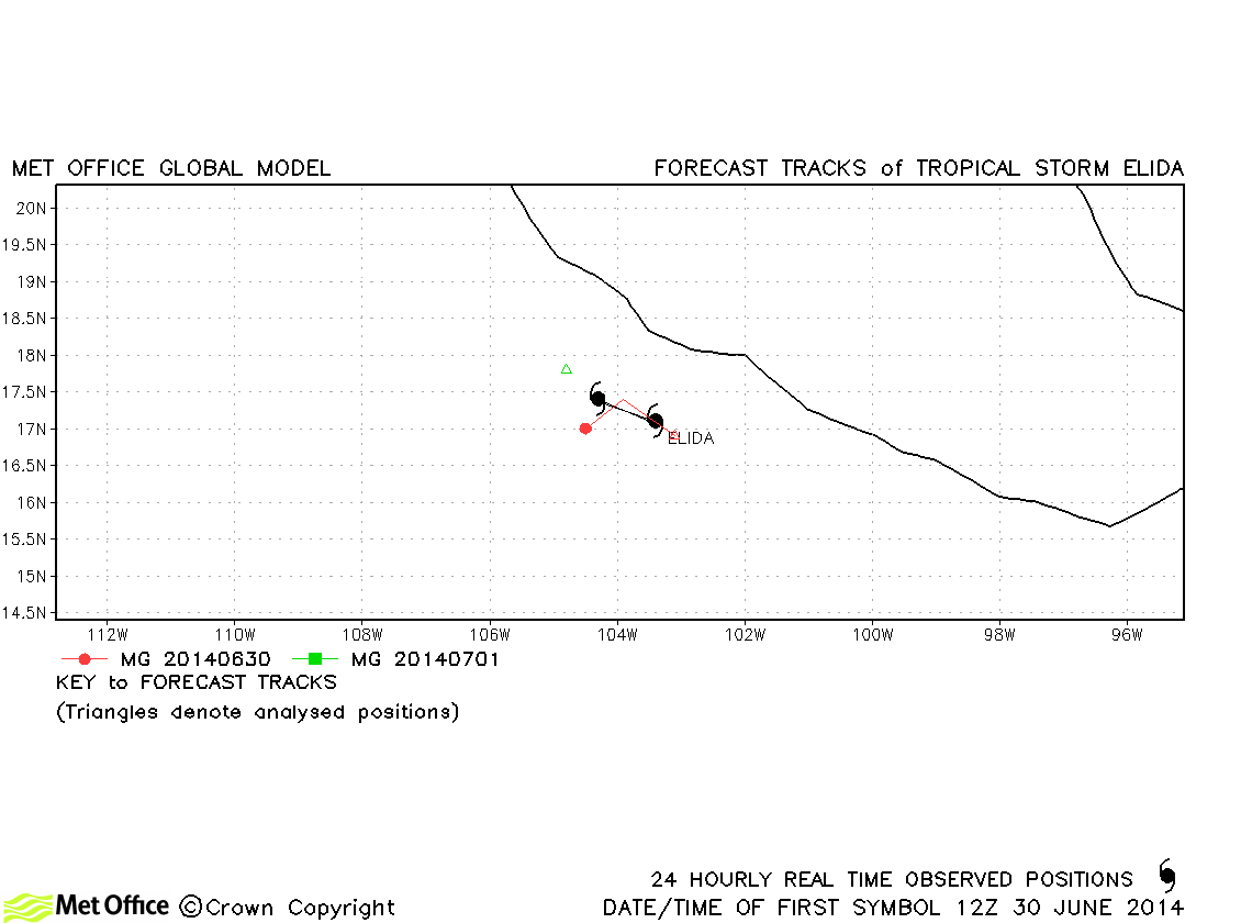
| Elida (05E) | 30 June-02 July | 45 knots | Elida was a short-lived storm and track forecast errors were low. |
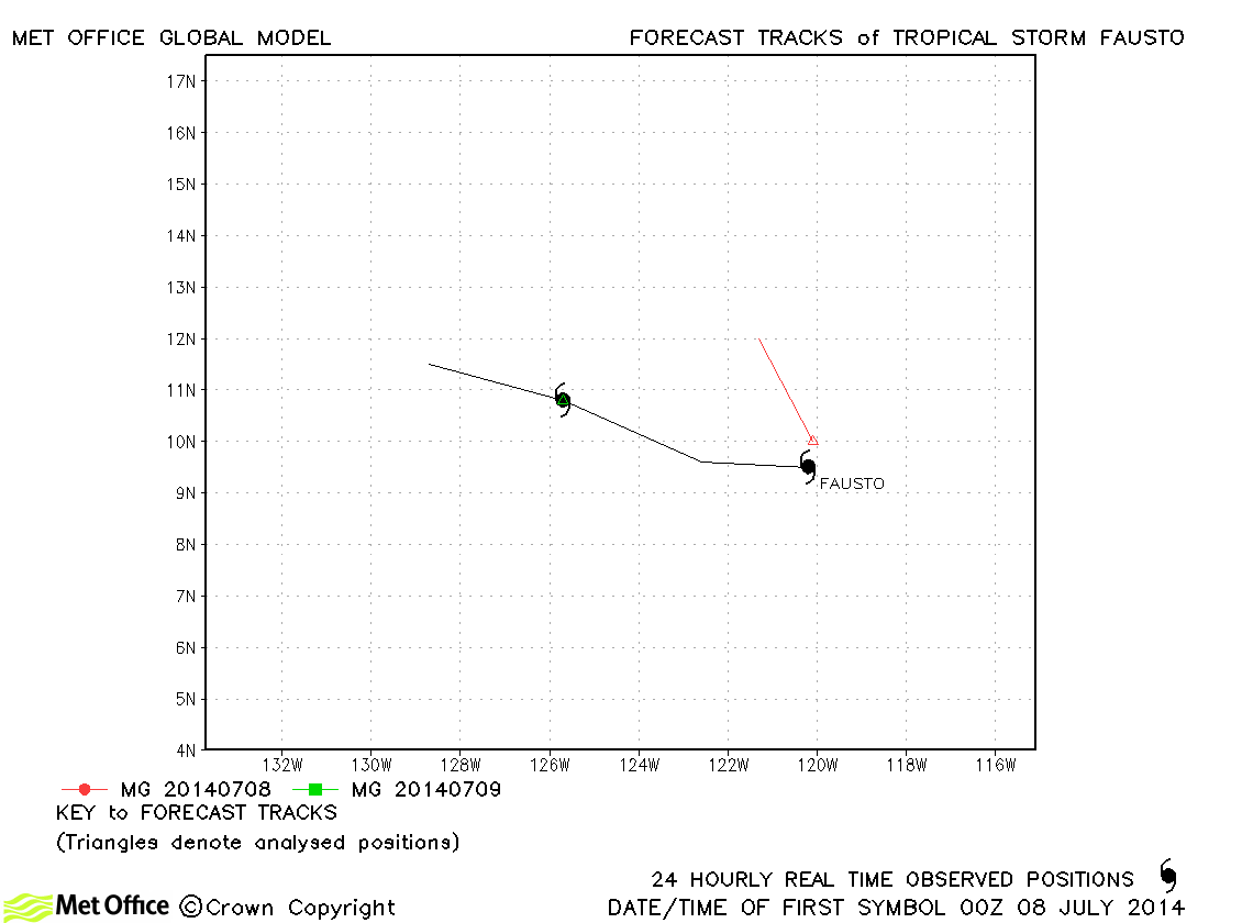
| Fausto (06E) | 07-09 July | 40 knots | Fausto was short-lived and few forecasts were verified. |
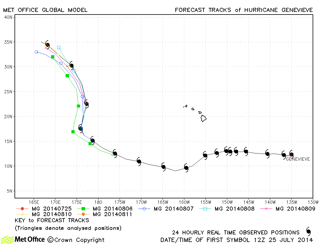
| Genevieve (07E) | 25 July-12 August | 140 knots | Genevieve was short-lived as a storm in the east Pacific, but developed into a strong Hurricane as it neared and crossed the Dateline into the western Pacific. Track forecast errors were near to or below last season's average and skill scores against CLIPER were high. |
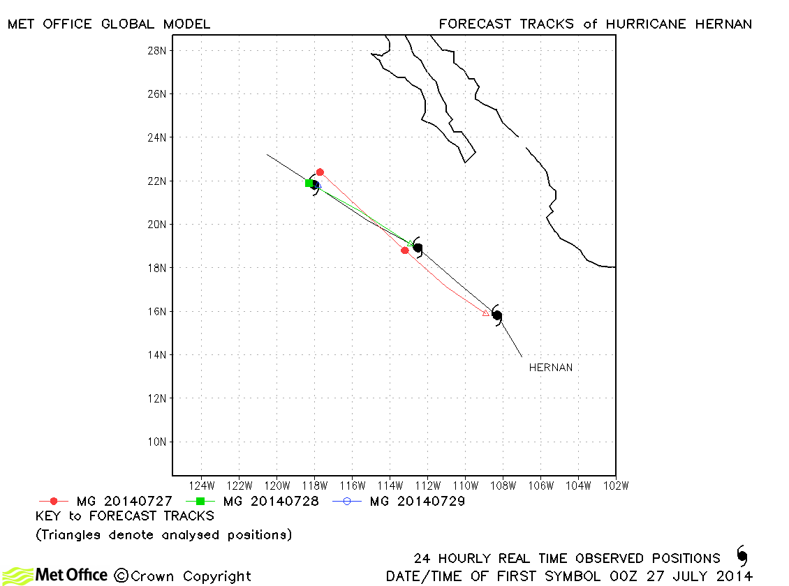
| Hernan (08E) | 26-29 July | 65 knots | Track forecast errors were very low for Hernan. |
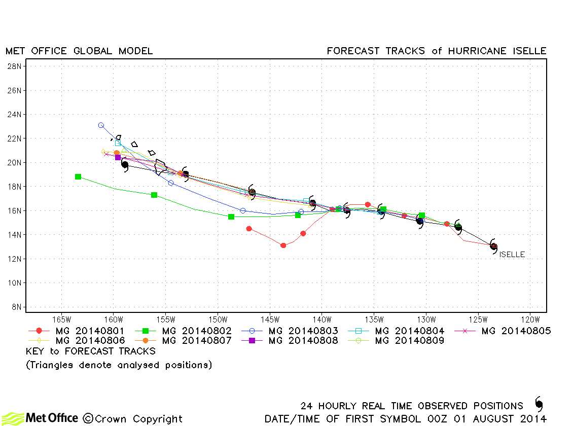
| Iselle (09E) | 31 July-09 August | 120 knots | Track forecast errors were below last season's average and skill scores against CLIPER were high. |
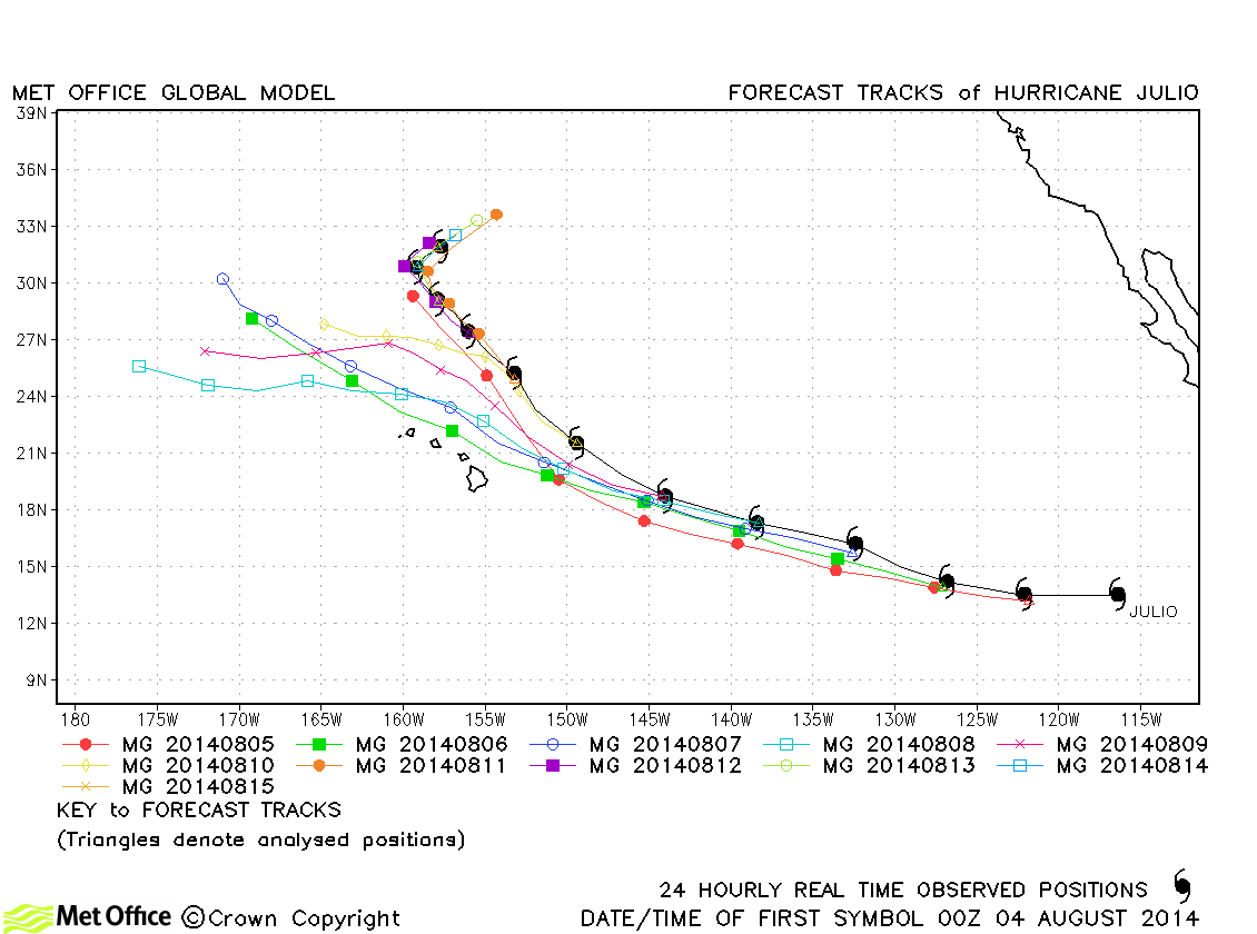
| Julio (10E) | 04-15 August | 105 knots | Track forecast errors were low and skill scores high at short lead times, but errors were high at long lead times due to a marked left-of-track bias in forecasts. |
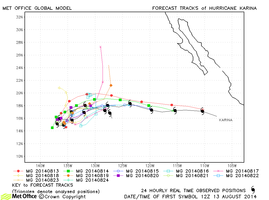
| Karina (11E) | 13-27 August | 70 knots | Track forecast errors were near to or below last season's average. The reversal in direction of Karina was well predicted. |
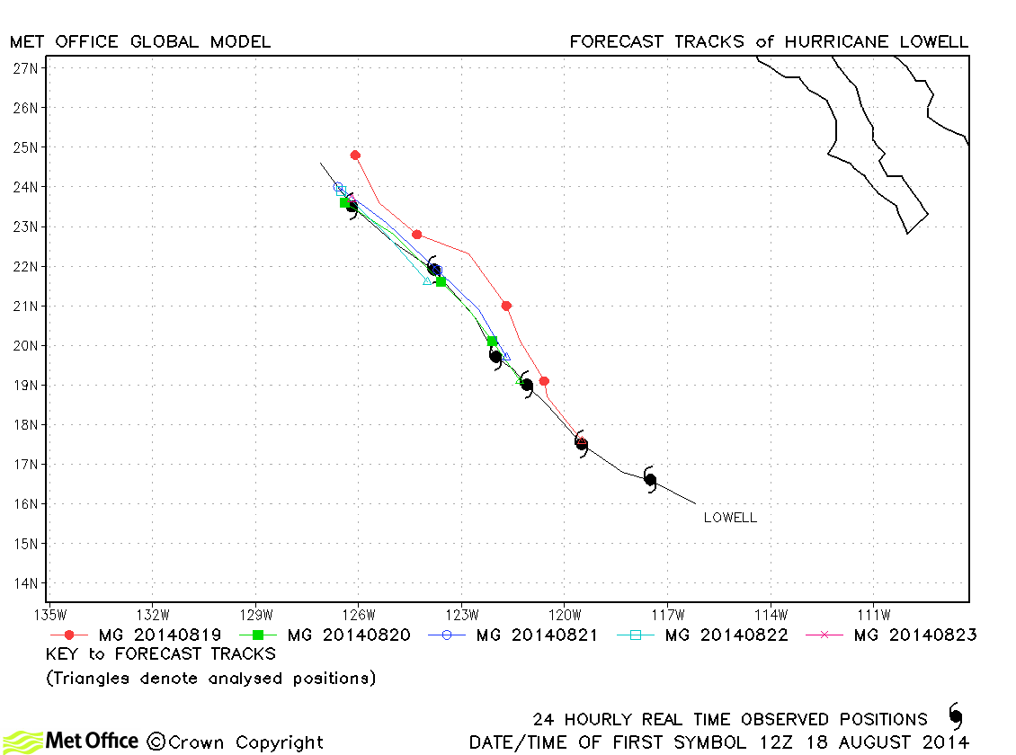
| Lowell (12E) | 18-24 August | 65 knots | Track forecast errors were below last season's average and skill scores against CLIPER were high. |
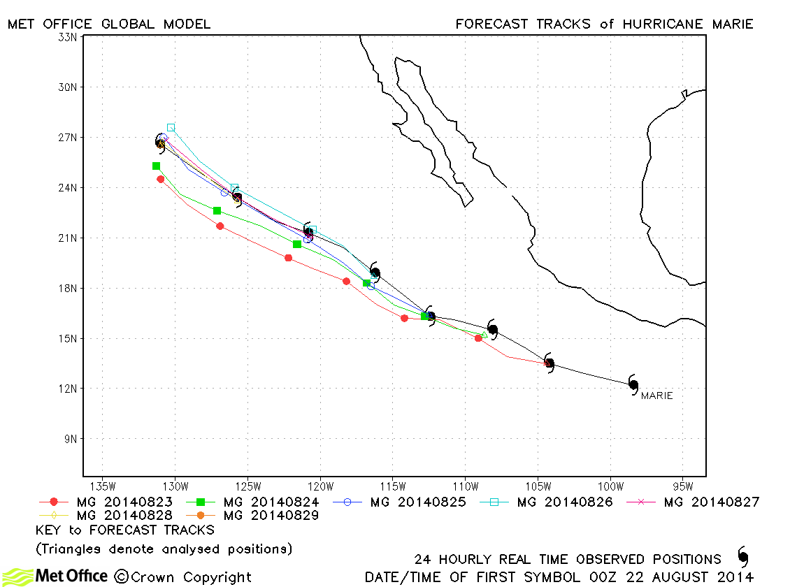
| Marie (13E) | 22-29 August | 140 knots | Track forecast errors were well below last season's average and skill scores against CLIPER were high. |
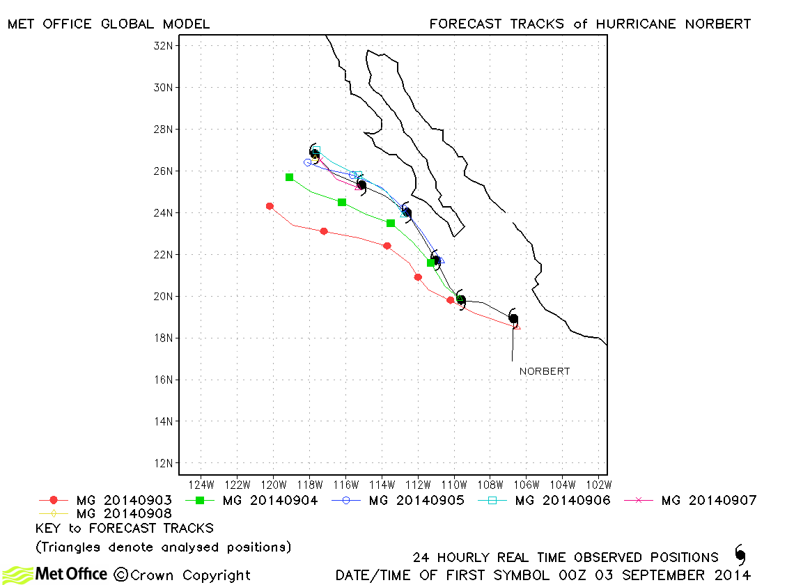
| Norbert (14E) | 02-08 September | 105 knots | Track errors were below last season's average at nearly all lead times, but there was a left-of-track bias in forecasts. |
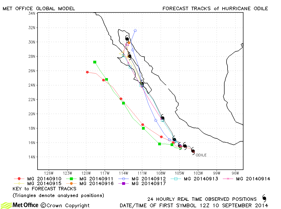
| Odile (15E) | 10-17 September | 115 knots | A couple of early forecasts had a left-of-track bias, but after this track forecasts were very good. Track forecast errors were below last season's average at most lead times. |
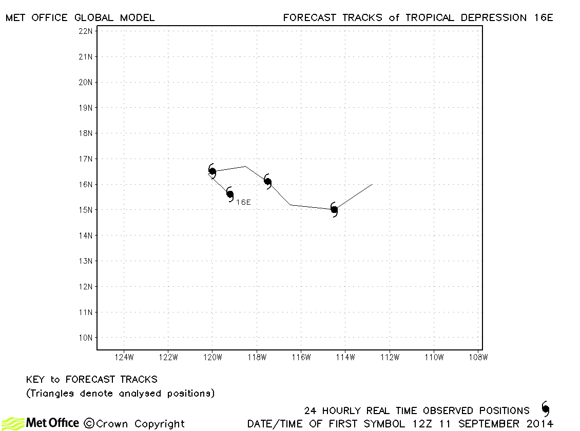
| 16E | 11-15 September | 30 knots | No forecasts verified as this depression did not achieve tropical storm status. |
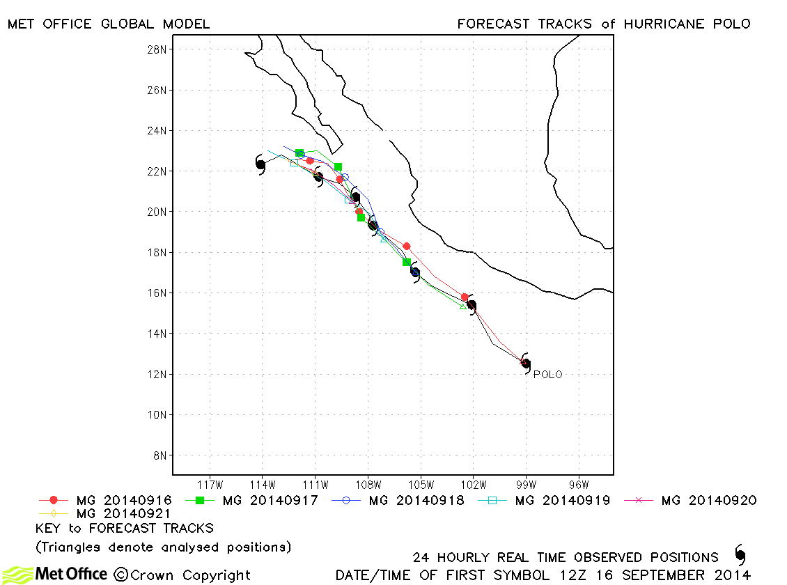
| Polo (17E) | 16-22 September | 65 knots | Track forecast errors for this storm were particularly low. |
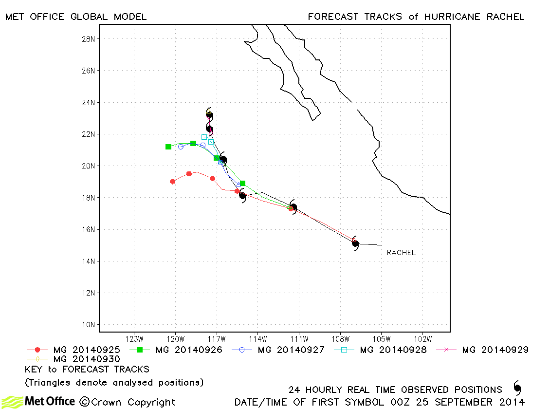
| Rachel (18E) | 24-30 September | 75 knots | There was a left-of-track bias in some forecasts resulting in long lead times errors above last season's average, but errors at shorter lead times were low. |
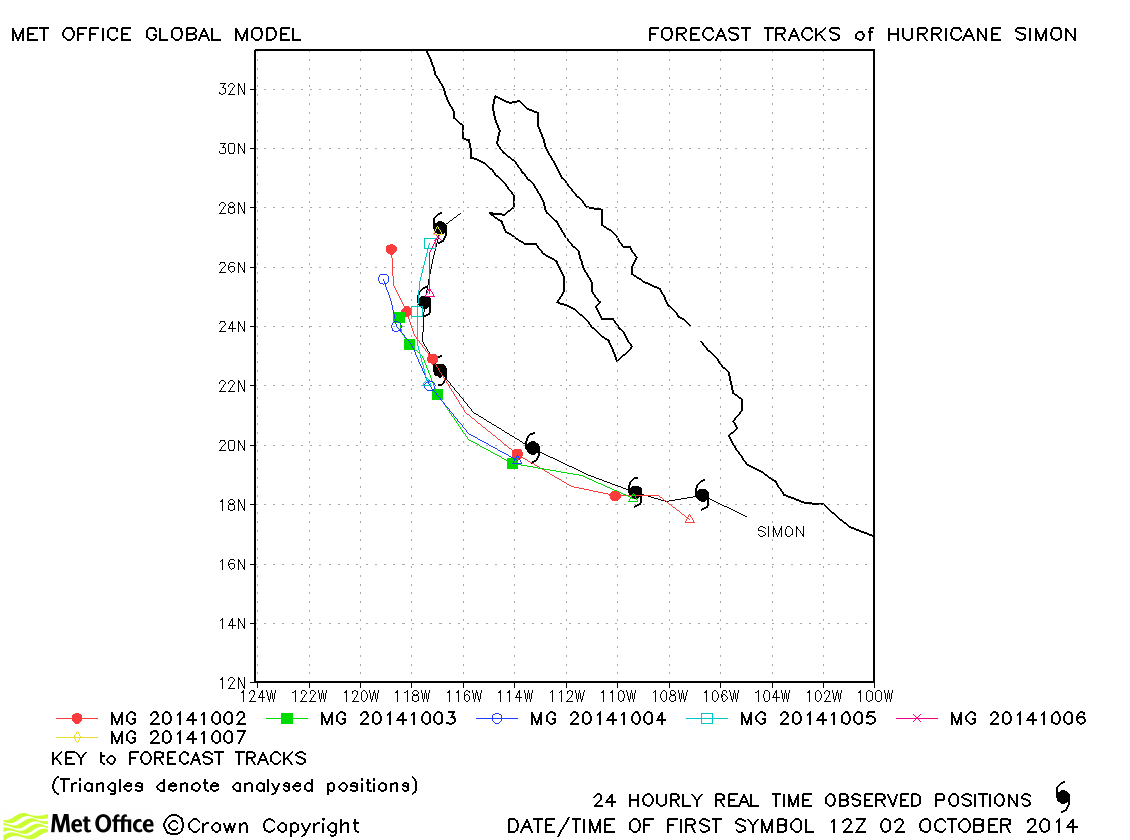
| Simon (19E) | 02-08 October | 115 knots | Track errors were below last season's average. There was a slight left-of-track bias. |
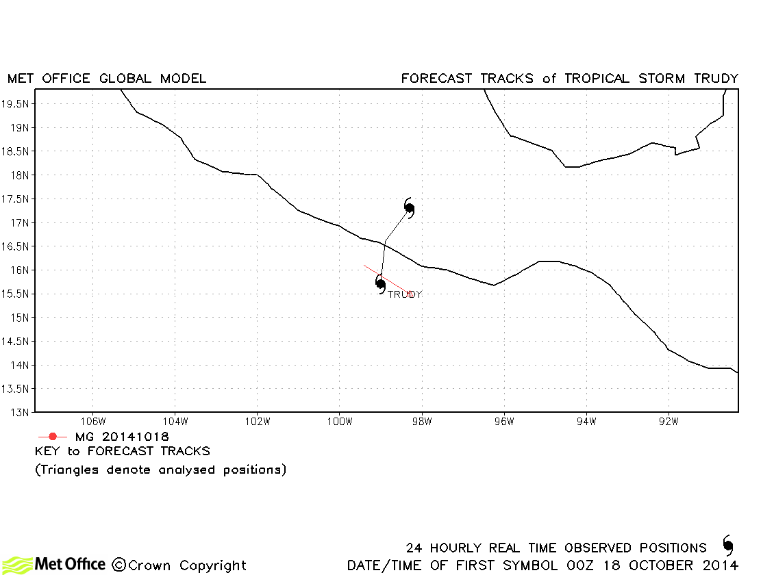
| Trudy (20E) | 17-19 October | 45 knots | Trudy was only briefly a tropical storm. |
| Vance (21E) | 30 October-05 November | 95 knots | Track forecast errors were near to last season's average. There was a left-of-track bias in forecasts. |
| Name & ID | Start & end dates | 1-minute MSW | Comments on Met Office global model forecasts |
|---|---|---|---|
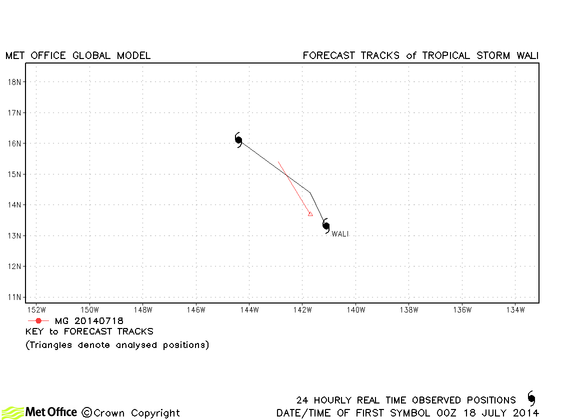
| Wali (01C) | 17-19 July | 40 knots | Wali was a short-lived storm and few forecasts were verified. |
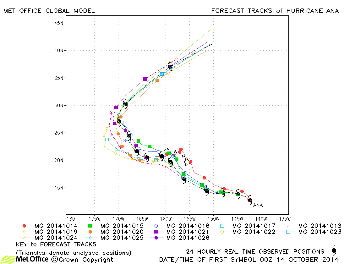
| Ana (02C) | 13-26 October | 75 knots | Track forecast errors were below last season's average for this hurricane. |
North-east and Central North Pacific observed tracks in 2014
North-east Pacific tropical cyclone names
Central North Pacific tropical cyclone names
| Name & ID | Start & end dates | 1-minute MSW | Comments on Met Office global model forecasts |
|---|---|---|---|
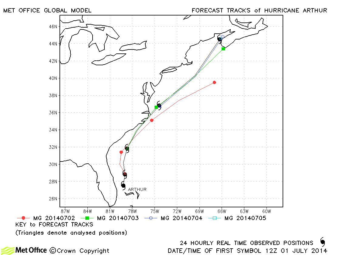
| Arthur (01L) | 01-05 July | 85 knots | Track errors at short lead times were very low. At longer lead times there was a slow bias in forecasts. |
| 02L | 21-23 July | 30 knots | 02L did not achieve tropical storm status and no forecasts were verified. |
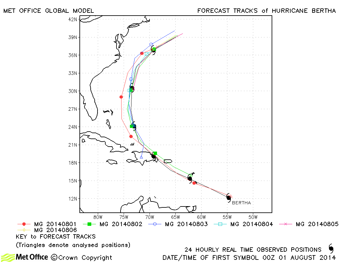
| Bertha (03L) | 01-06 August | 65 knots | Track forecast errors were mostly below last season's average and skill scores against CLIPER were high. |
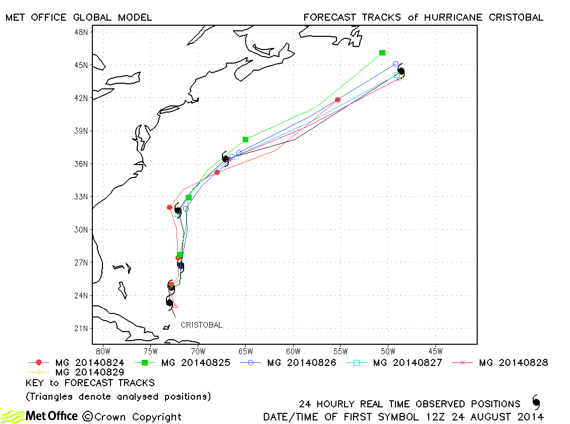
| Cristobal (04L) | 23-29 August | 70 knots | Track forecast errors were near to last season's average and skill scores against CLIPER were high. |
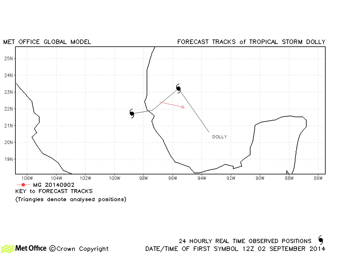
| Dolly (05L) | 01-03 September | 45 knots | Dolly was a short-lived storm and few forecasts were verified. |
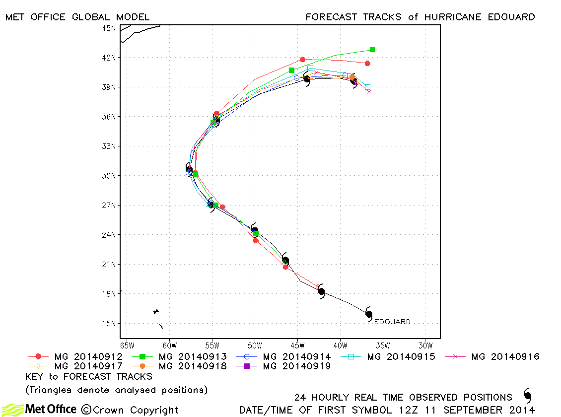
| Edouard (06L) | 11-19 September | 100 knots | Forecasts for the track of Edouard were excellent with exceptionally low track errors and high skill scores. |
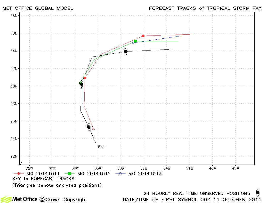
| Fay (07L) | 10-13 October | 65 knots | Track errors were slightly above last season's average due to a fast bias. |
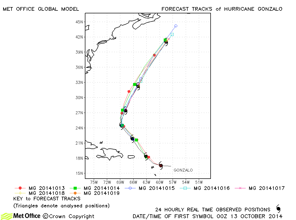
| Gonzalo (08L) | 12-19 October | 125 knots | Track forecasts for Gonzalo were excellent with a very precise track and timing of turns. Errors at all lead times except the longest were below last season's average and skill scores were very high. The landfall over Bermuda was very well predicted. |
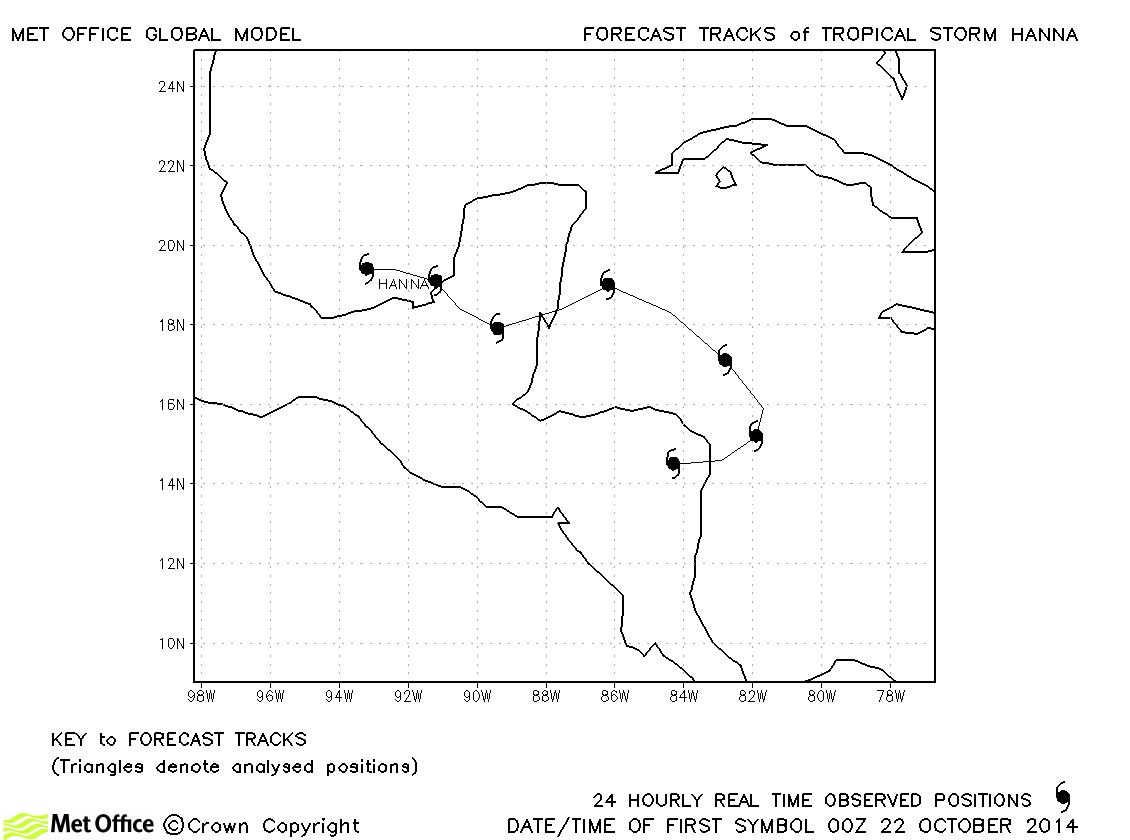
| Hanna (09L) | 22-28 October | 35 knots | Hanna only briefly reached tropical storm status and no forecasts were verified. |
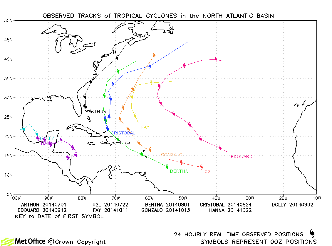
North Atlantic observed tracks in 2014
North Atlantic tropical cyclone names
| Name & ID | Start & end dates | 1-/10-minute MSW | Comments on Met Office global model forecasts |
|---|---|---|---|
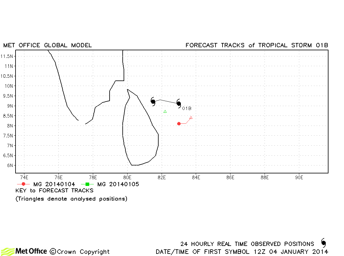
| 01B | 04-05 January | 40/30 knots | This was a short-lived storm. It's initial and forecast positions were to the south of its actual location. |
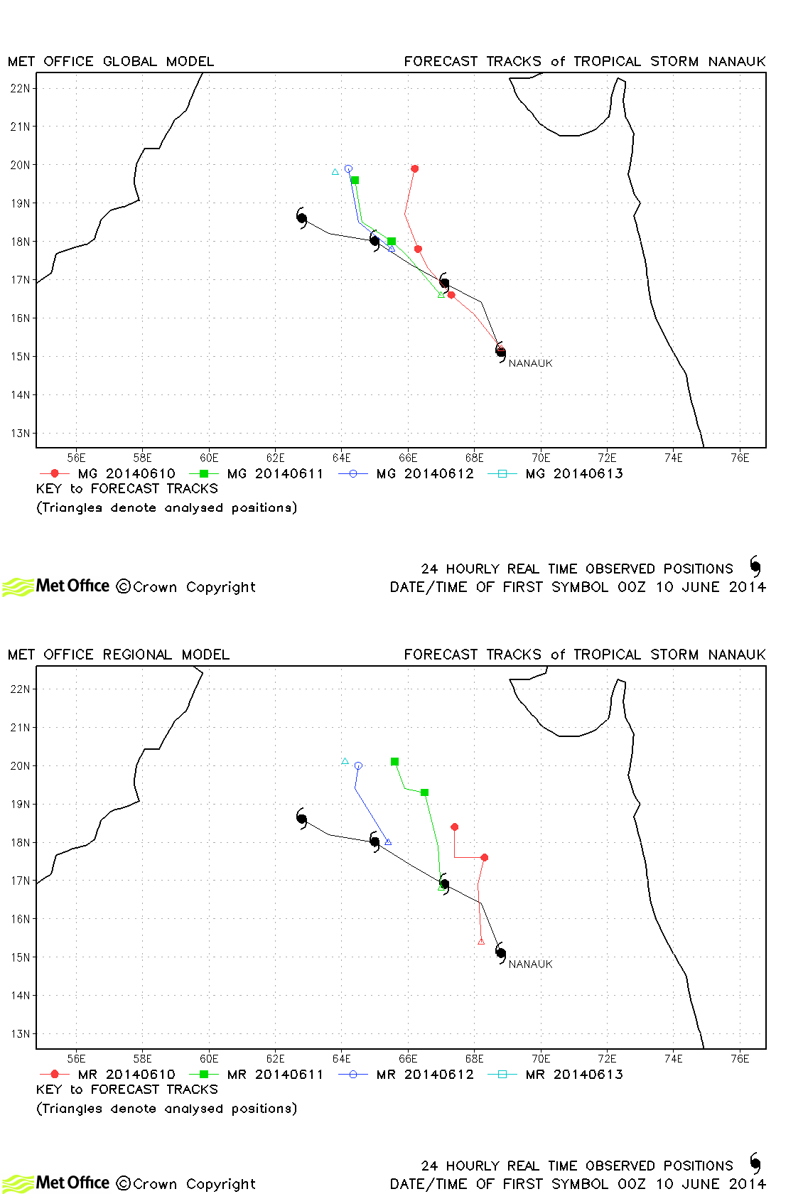
| Nanauk (02A) | 10-13 June | 55/45 knots | Track forecast errors were below last season's average, although skill scores against CLIPER were poor. |
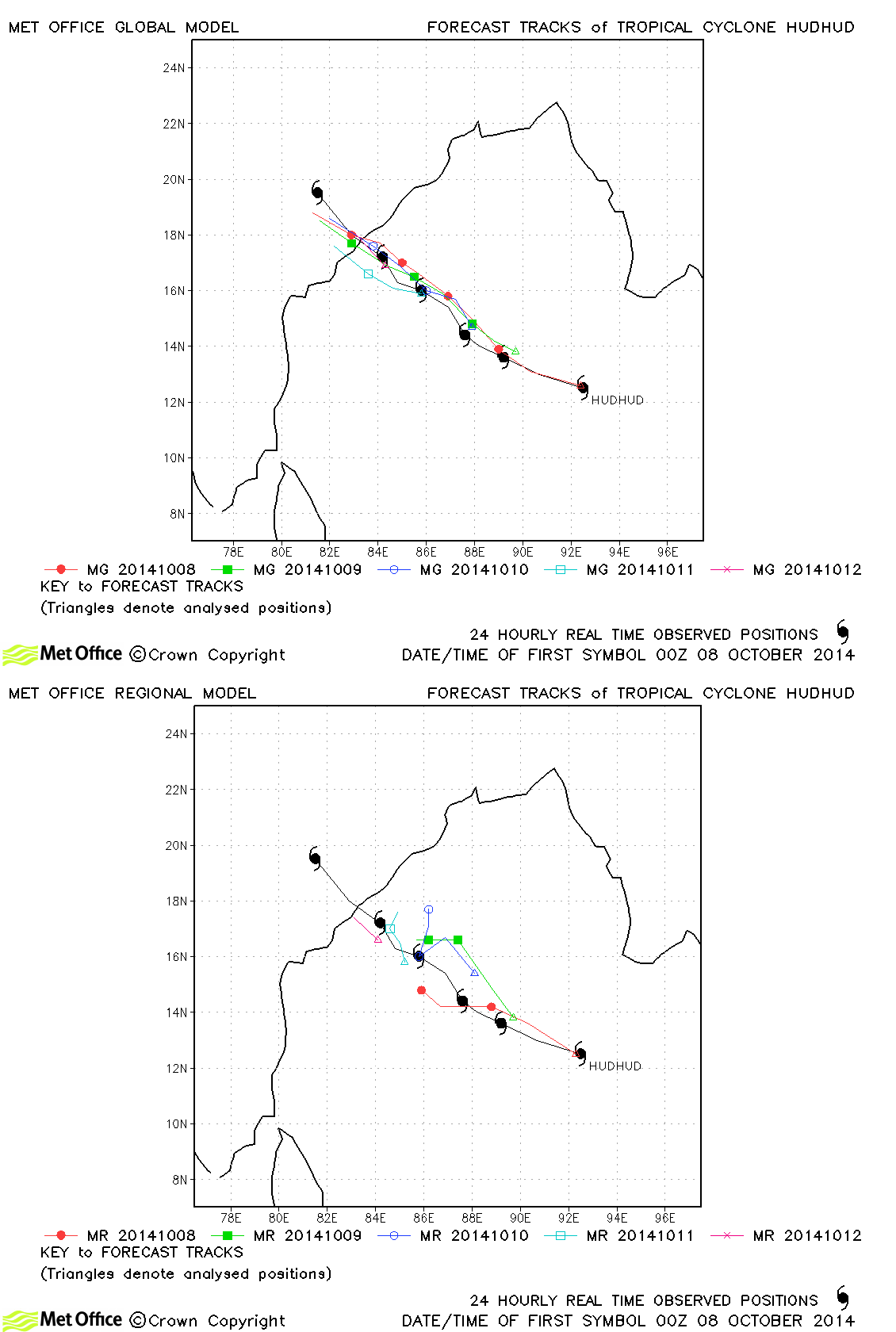
| Hudhud (03B) | 07-13 October | 115/95 knots | Track forecast errors were low compared to last season's average. The location of landfall was well predicted. |
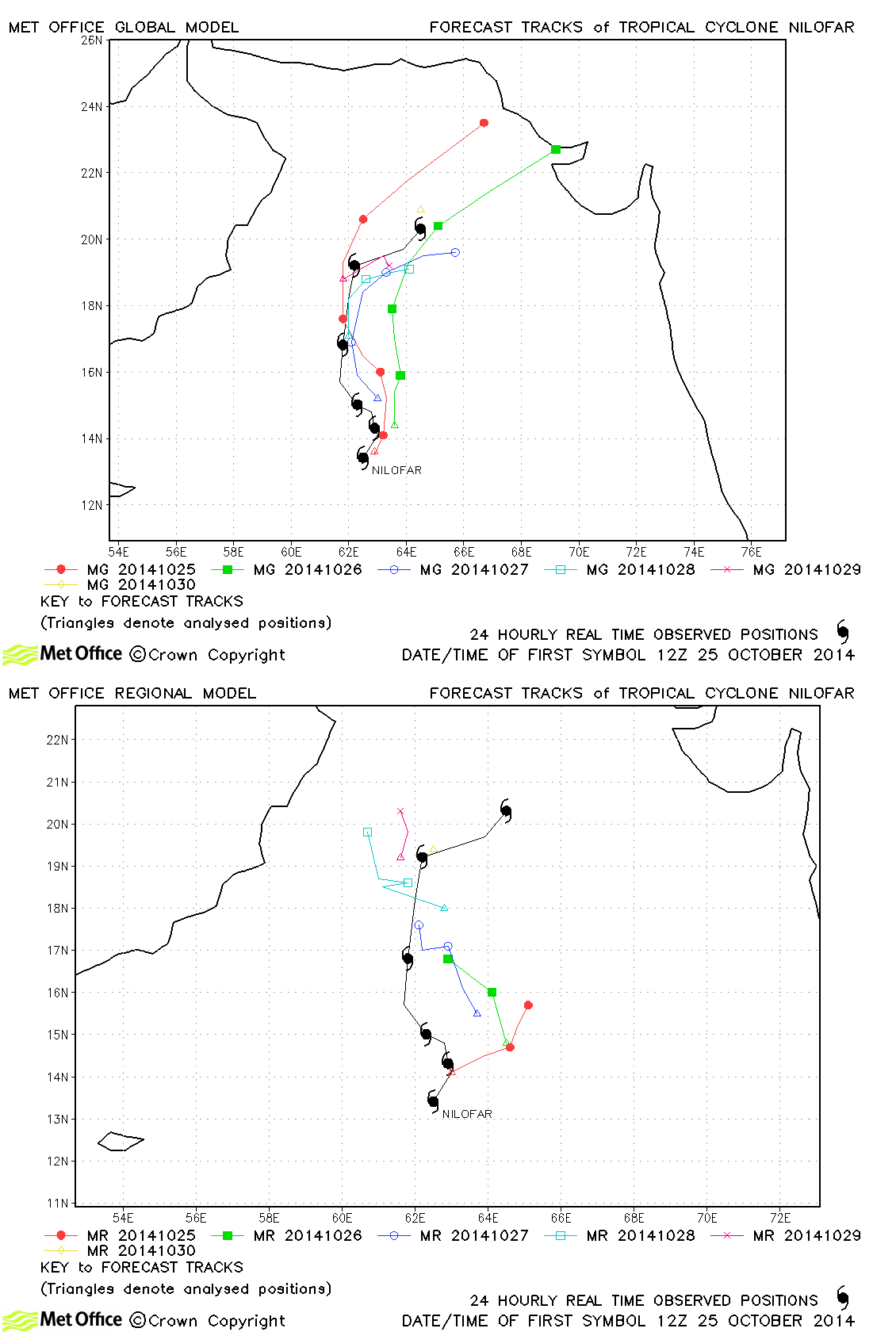
| Nilofar (04A) | 25-30 October | 115/100 knots | Track forecast errors were mostly below last season's average for this storm. Although some early forecasts predicted landfall, the Met Office model was the first to indicate that Nilofar would weaken and dissipate at sea. |
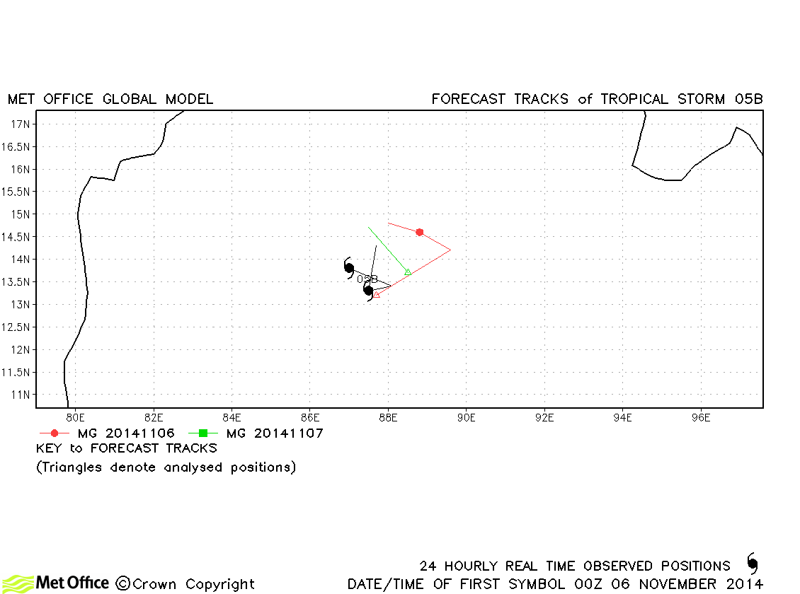
| 05B | 05-07 November | 35/30 knots | 05B was only designated as a tropical storm by JTWC. Forecasts had track errors close to last season's average. |
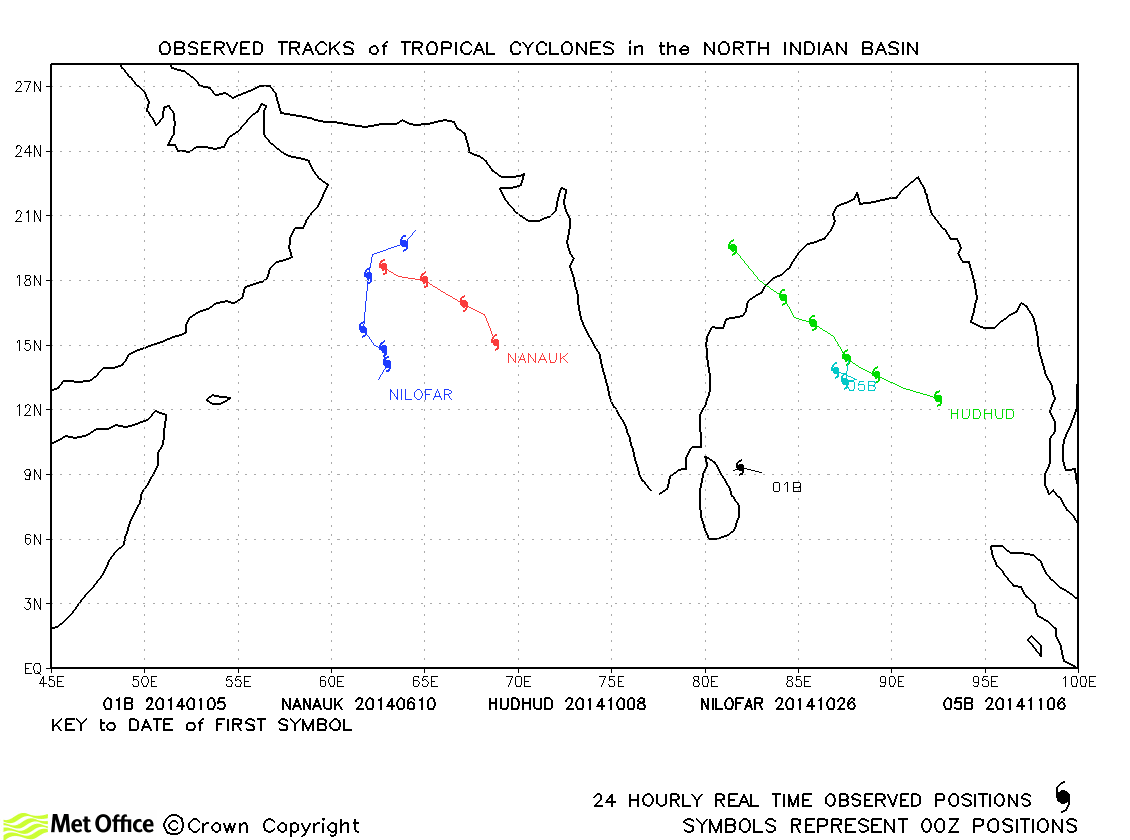
North Indian observed tracks in 2014
North Indian tropical cyclone names
Note on estimated wind speeds
1-minute MSW: Maximum sustained wind (knots) averaged over 1 minute (JTWC Hawaii, NHC Miami, CPHC Hawaii)
10-minute MSW: Maximum sustained wind (knots) averaged over 10 minutes (JMA Japan, IMD New Delhi)
Note: Although 1-minute average winds should be stronger than 10-minute average, this may not be the case here since estimates are obtained from different warning centres.

